
New River Gorge National Park is packed with short hiking trails that lead to cliff-top viewpoints, waterfalls, sandstone walls, and remnants of the area’s coal-mining history. One of the best things about this park is that all the hikes are short and sweet (the longest hike on this list is just 3 miles).
Whether you want an iconic view of the New River Gorge Bridge, an easy walk to a waterfall, or a steep stair-climbing workout, here are the best hikes in New River Gorge National Park.
Our New River Gorge Hiking Experience: We spent four days in New River Gorge in late October, giving us enough time to explore the park from north to south and hike more trails than are included in this guide. We’re avid hikers and have now visited 56 of the 63 U.S. national parks, so hiking is usually a big part of our national park trips. The recommendations and ratings in this guide are based on our firsthand experience, and all of the photos are our own.
Which New River Gorge Hike Should You Choose?
With most of these trails taking just one or two hours, you can hike several of them in a single visit. But if you are short on time, these are our recommendations based on what you want to see and do.
| If you want… | We recommend… |
| Best overall hike | Castle Rock + Grandview Rim Trail |
| Best view of the New River Gorge Bridge | Long Point Trail |
| Best cliff & gorge views | Endless Wall Trail |
| Best challenging hike | Kaymoor Miners Trail |
| Best easy hike | Sandstone Falls |
| Best hike with kids | Tunnel Trail |
Our Top Picks
If you only have time for one hike: We recommend the Castle Rock + Grandview Rim Trail loop. It’s short, unique, and one of our favorite hikes in the park. The trail runs beneath enormous sandstone cliffs before looping back along the rim of the gorge.
If this is your first visit: Hike Long Point Trail for the classic view of the New River Gorge Bridge. It’s an easy-to-moderate hike, and the viewpoint at the end is one of the most iconic views in the park.
If you want something easy: Choose Sandstone Falls. This short, mostly flat walk takes you past multiple viewpoints of the waterfalls and it was one of our favorite experiences in New River Gorge.
If you want a challenge: Hike the Kaymoor Miners Trail. You’ll descend deep into the gorge to a historic mining site and then climb hundreds of steps back to the rim. It’s short, steep, and much tougher than its mileage suggests.
If you are hiking with kids: The Tunnel Trail is short, easy, and a little more adventurous than a typical nature walk, with huge sandstone walls and rock formations along the way.
Map of the New River Gorge Hiking Trails
Below is a map of the best hikes in New River Gorge. Each hike is a different color.
How to Use This Map: Click the icons on the map to get more information about each point of interest. To take this map with you, click the star next to the title of the map which adds it to your Google account. Next, within your Google Maps app, select ‘Saved’ and then select ‘Maps’. This map title will now appear in your list.
Best Hikes in New River Gorge National Park
About our ratings: Our ratings reflect the overall hiking experience, including scenery, wildlife, trail variety, and whether we think the hike is worth the time and effort. Difficulty does not affect the rating. A strenuous hike can earn five stars if we think the experience is worth it.
⭐️⭐️⭐️⭐️⭐️ Exceptional: One of the best hikes in New River Gorge; worth planning your day around.
⭐️⭐️⭐️⭐️ Very good: Highly recommended, especially for the right type of hiker.
⭐️⭐️⭐️ Good: Enjoyable, but we’d prioritize other trails if time is limited.
Endless Wall Trail
Our Rating: ⭐️⭐️⭐️ Endless Wall is one of the most popular hikes in New River Gorge, with beautiful cliff-top views over the gorge. We enjoyed it, but we preferred Long Point for the view and Castle Rock for the hiking experience. If we did this again, we’d hike out-and-back to Diamond Point rather than completing the loop and walking along the road.
Distance: 2.8 mile (4.5 km) loop
Difficulty: Easy to moderate
Total Ascent: 400 feet (120 m)
Lowest Elevation: 1,800 feet (550 m)
Highest Elevation: 2,030 feet (620 m)
Time: 1 to 2 hours
Location: Canyon Rim
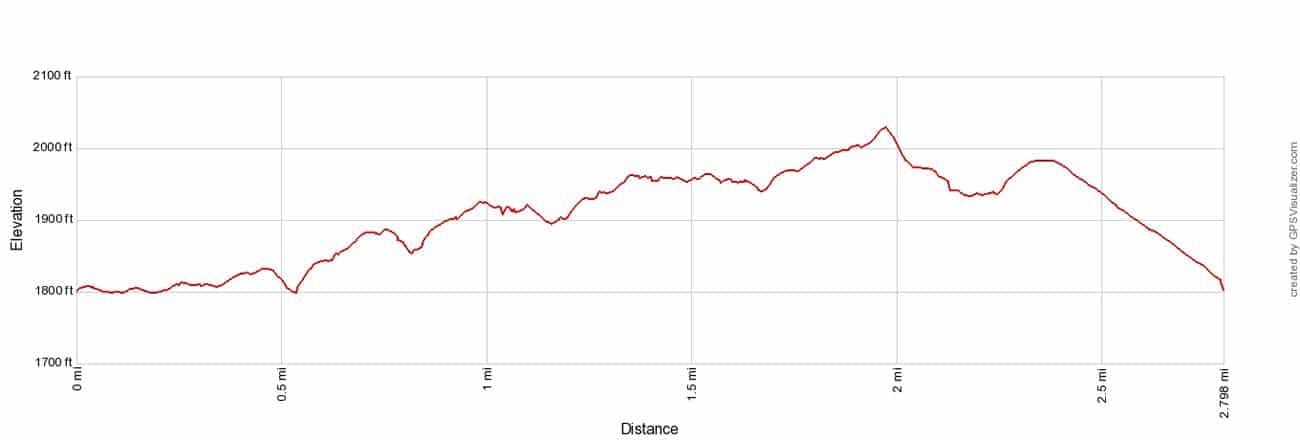
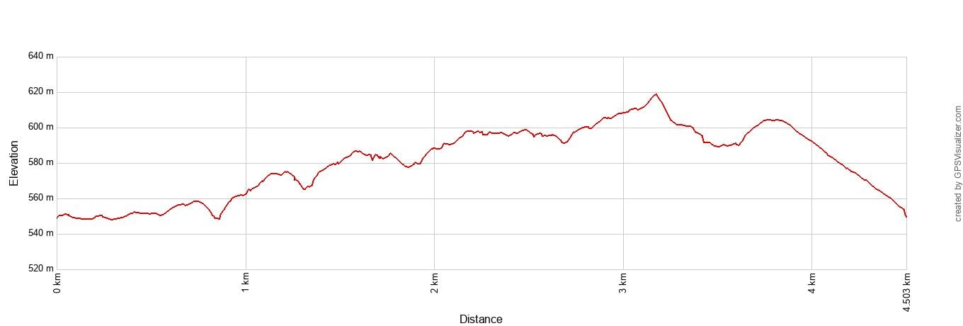
Endless Wall Trail elevation profile as a loop, starting at the Endless Wall Trailhead.
The Endless Wall trail is one of the best hikes in New River Gorge National Park. It’s a relatively easy hike and the trail leads out to overlooks along the “Endless Wall,” a long line of Nuttall sandstone ridges high above the gorge.
There are two ways to do this hike: as a loop or out-and-back.
Endless Wall Trail as a Loop
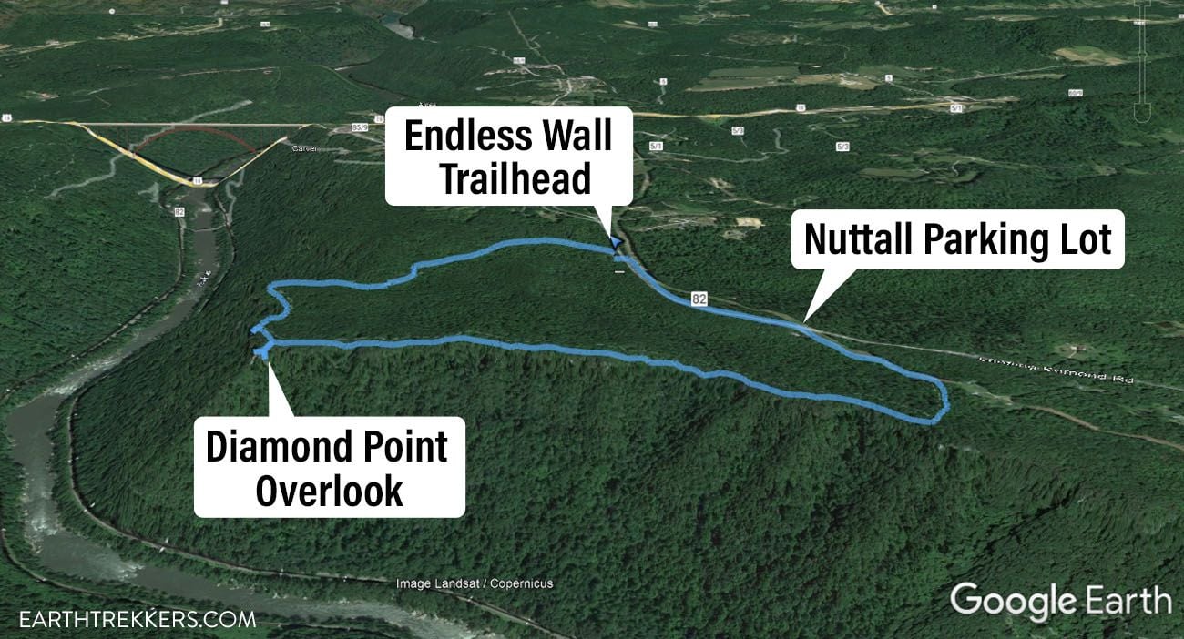
There are two trailheads for this hike: the Endless Wall Trail trailhead and the Nuttall Parking Lot. If you do this hike as a loop, you start and end at one of these trailheads. The hiking stats above, and the elevation profile, are for the full loop starting and ending at the Endless Wall Trail trailhead.
If you start at the Endless Wall Trail trailhead, you will first walk through a forest of trees and enormous rhododendrons. It’s very pretty. Once you get out to the “wall,” you can take the short spur trails that lead to the viewpoints. Diamond Point is the main overlook on the Endless Wall Trail. Then, it’s another walk through the forest and a 0.5-mile boring walk on Lansing-Edmond Road to get back to your car.
If you start at the Nuttall Parking lot and want to do this as a loop, you can walk the road first to get this part over with.
Endless Wall Trail Out-and-Back
If we did it again, this is how we would do it.
Park at either parking lot and hike out to Diamond Point and the other overlooks. It’s the same distance both ways if you turn around at Diamond Point.
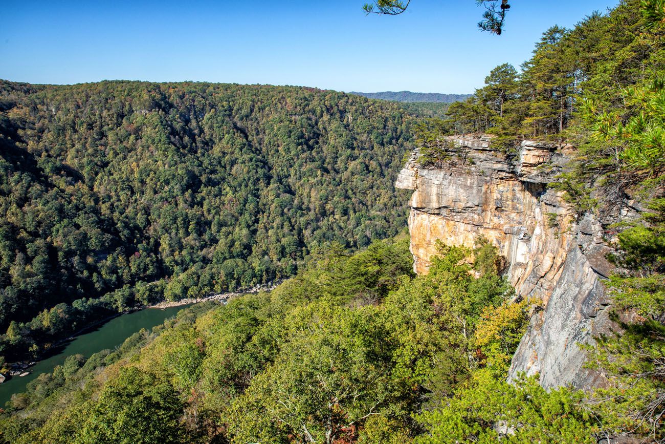
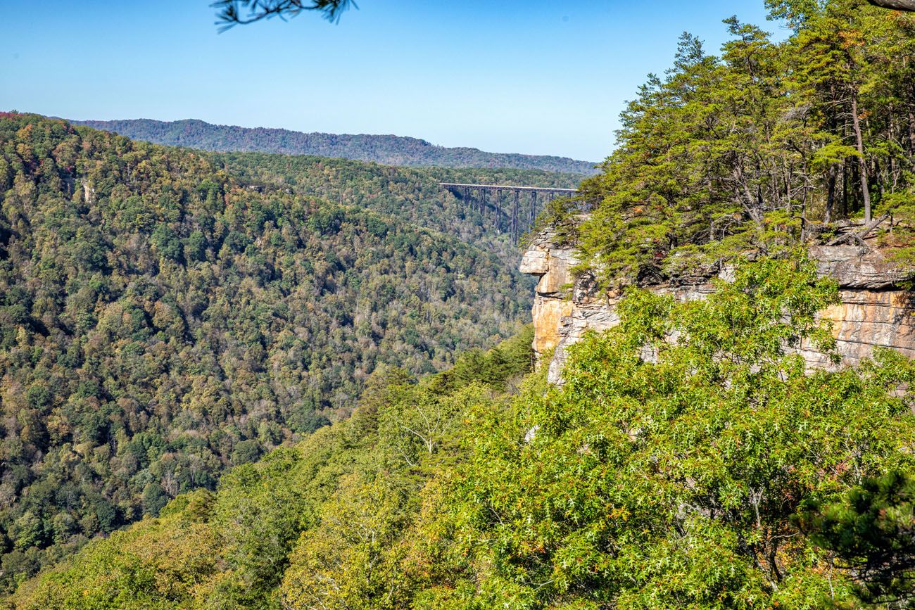
The view from Diamond Point.
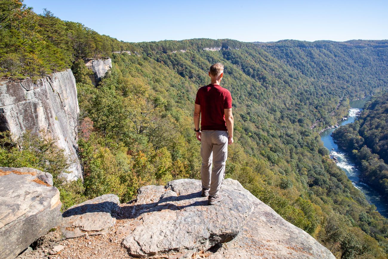
Another view from Diamond Point.
PRO TRAVEL TIP: The Endless Wall Trail parking lot was much more crowded than the Nuttall Parking Lot when we were here, so there might be a better chance getting a parking space at the Nuttall Parking Lot when the park is busy.
Long Point Trail
Our Rating: ⭐️⭐️⭐️⭐️ The trail itself is fairly easy and uneventful, but the payoff is fantastic: one of the best views of the New River Gorge Bridge. If this is your first visit to the park, Long Point is one of the hikes we’d prioritize.
Distance: 3 miles (4.8 km) round trip (out-and-back)
Difficulty: Easy to moderate
Total Ascent: 400 feet (120 m)
Highest Elevation: 2,000 feet (610 m)
Lowest Elevation: 1,740 feet (530 m)
Time: 1 to 2 hours
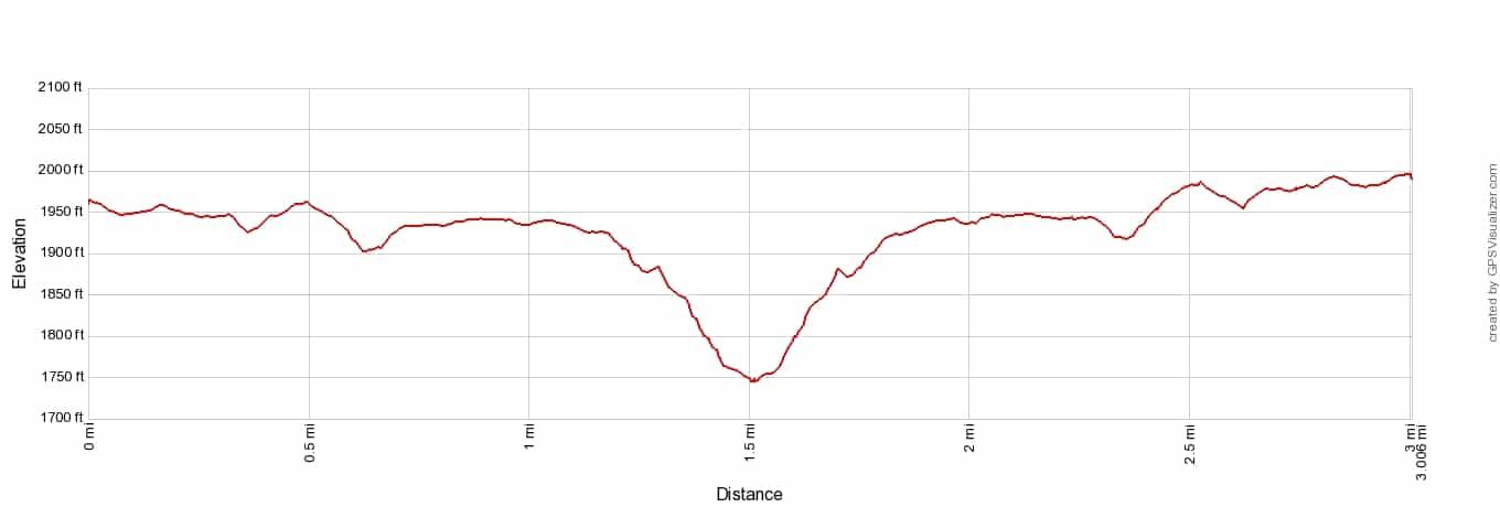
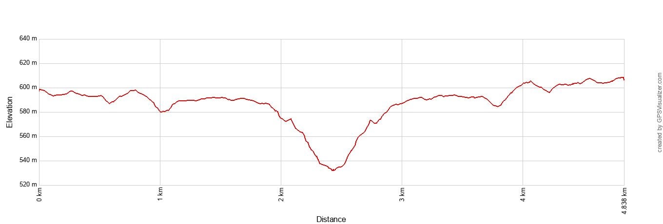
Long Point Trail Elevation Profile
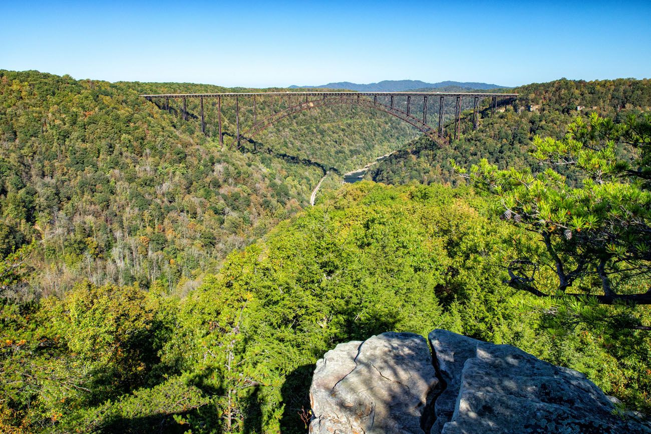
For one of the best views of New River Gorge Bridge, put this hike on your list.
To do this hike, park at the Long Point Trailhead on Newton Road. This is a large parking lot and there is a pit toilet.
The trail ever so slightly descends as you hike out to the rim. 0.2 miles from Long Point, the trail makes a steep descent.
At Long Point, enjoy the awesome view.
To finish the hike, retrace your steps. You will first have a short, steep climb but beyond this, the trail is mostly flat.
Note: This is also a mountain biking trail, so keep an eye out for mountain bikers. Bikers have to lock up there bike 0.2 miles from Long Point (there is a metal bar here to lock your bike).
Kaymoor Miners Trail
Our Rating: ⭐️⭐️⭐️⭐️ Hike this one for the challenge and the history rather than big panoramic views. Descending to the old mining site and then climbing roughly 900 steps back up makes this one of the toughest and most memorable short hikes in New River Gorge.
Distance: 1.6 miles (2.5 km) round trip (out-and-back)
Difficulty: Strenuous
Total Ascent: 1,000 feet (300 m)
Highest Elevation (trailhead): 2,010 feet (610 m)
Lowest Elevation (mining site): 1,060 feet (325 m)
Time: 1.5 to 2.5 hours
Location: Canyon Rim
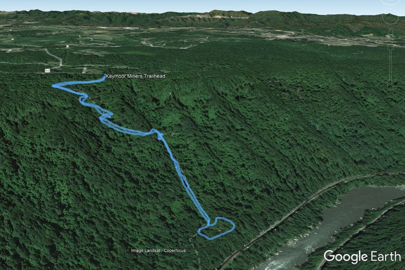
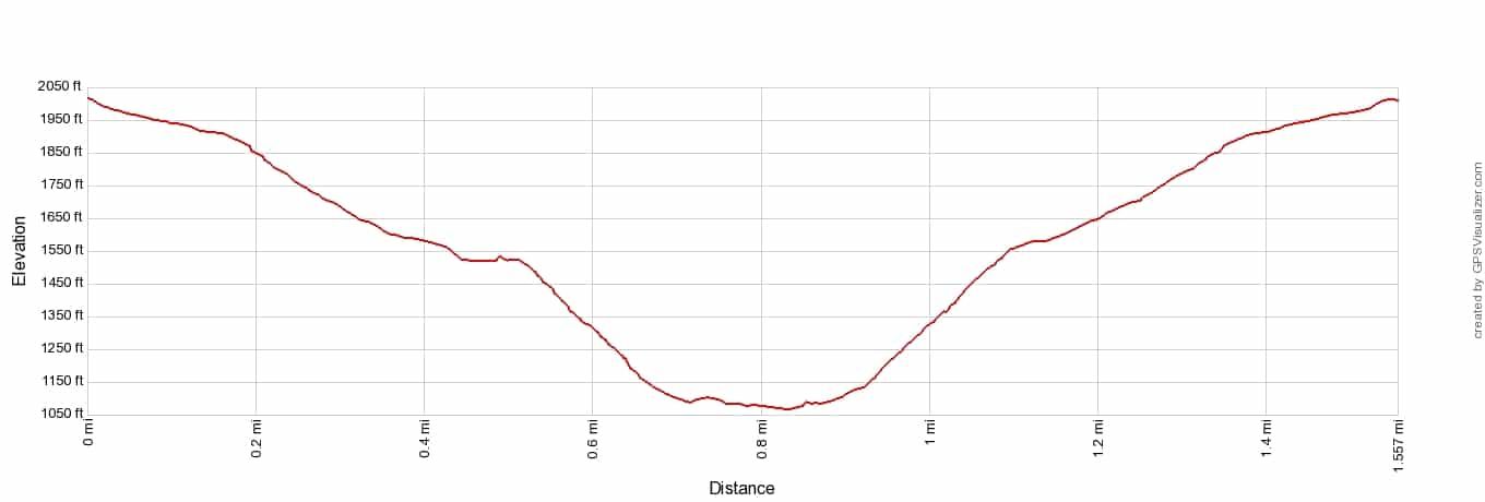
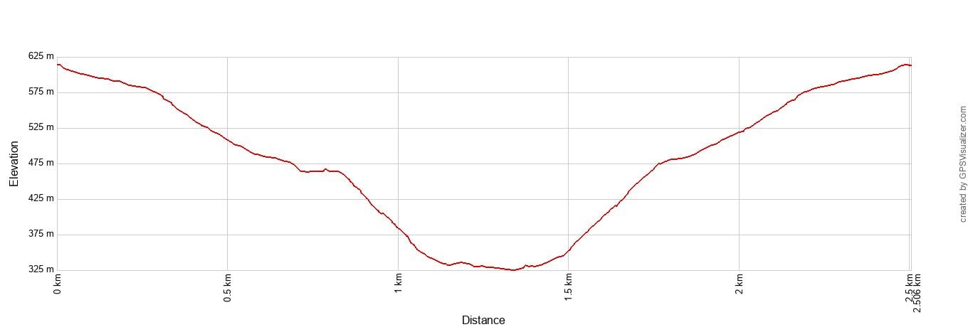
Kaymoor Miners Trail Elevation Profile
This is one of the toughest hikes in New River Gorge National Park. It’s also one of our favorites.
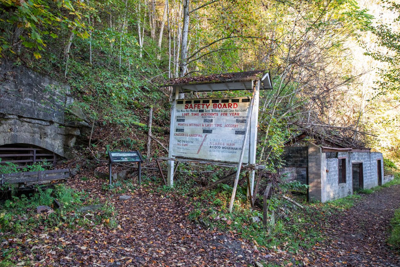
This trail starts on the upper rim of the gorge and rapidly descends towards the river. It takes you to a historic coal mine, the Kaymoor One Mining Complex.
Park at Kaymoor Top (aka “Kaymoor Parking Lot” on Google Maps). You will pass the trailhead just before you reach the parking lot.
First, you hike down a steep, dirt trail to the top of the mining site.
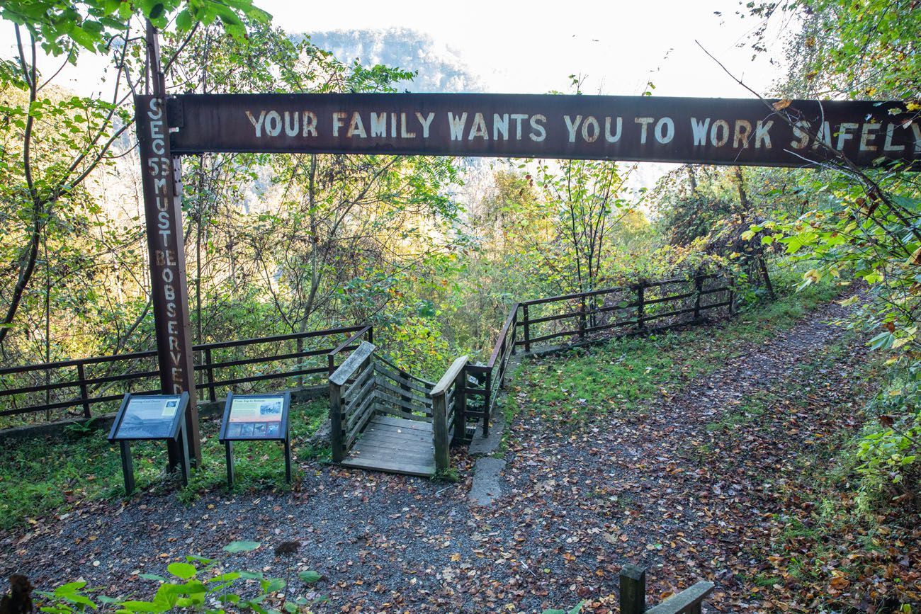
The steps are where the real fun begins. To get to the coal processing plant, you will walk down 819 steps. By the time we got to the bottom, our legs were shaky and we were left wondering how we’d climb back up all of those steps.
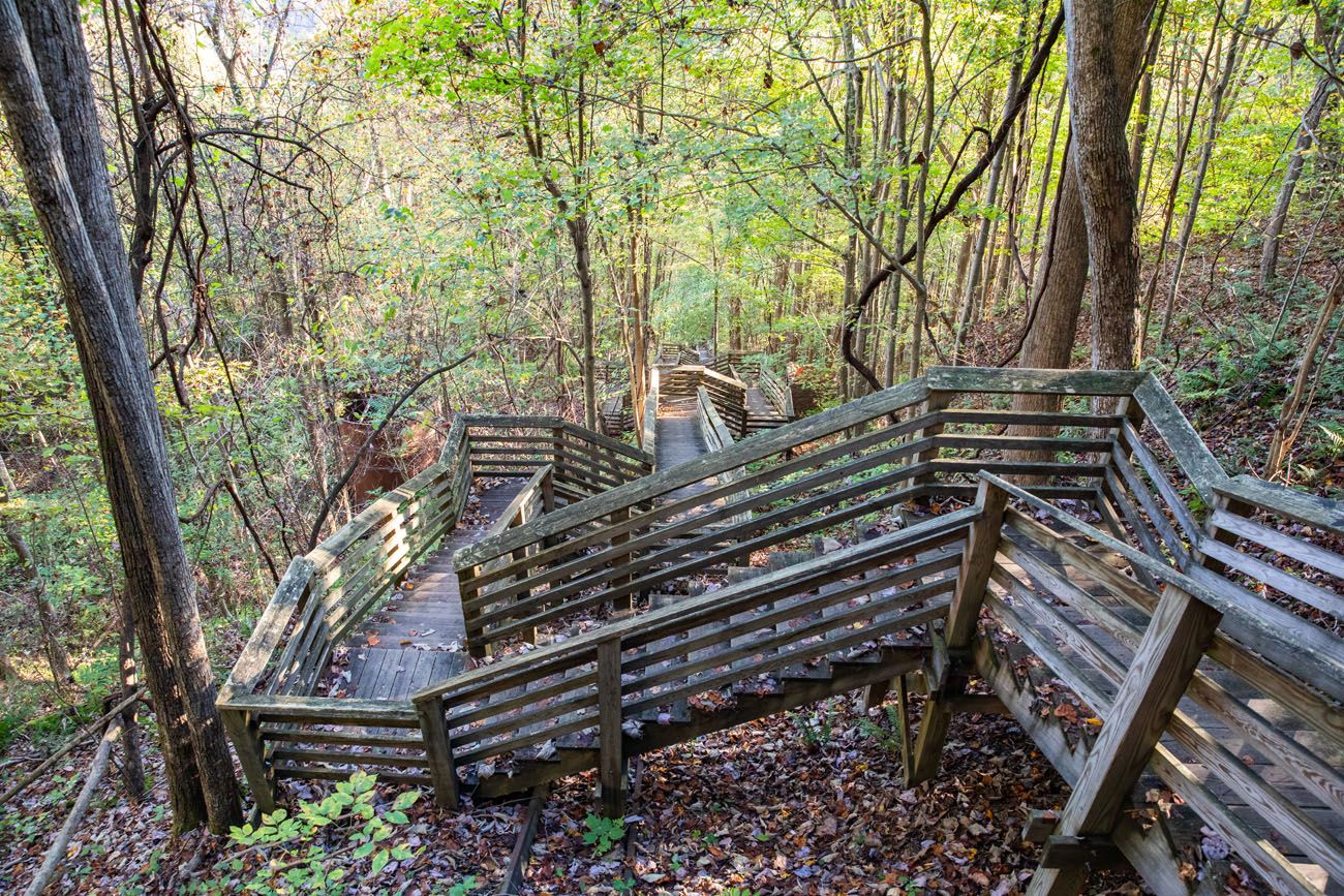
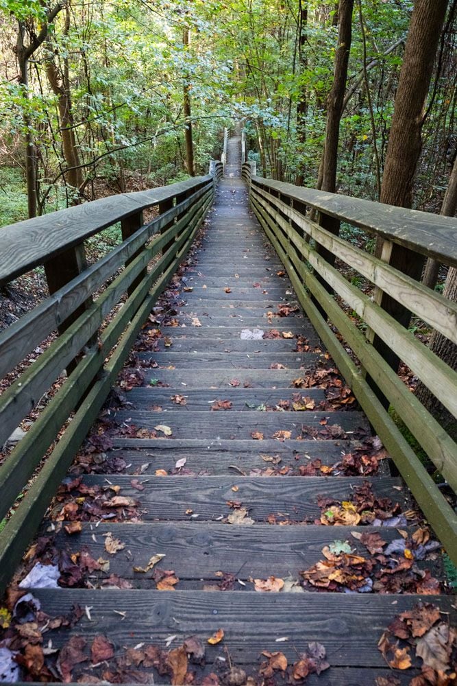
The old mining structures at the bottom are surrounded by a fence but you can walk around the this fence to see the buildings.
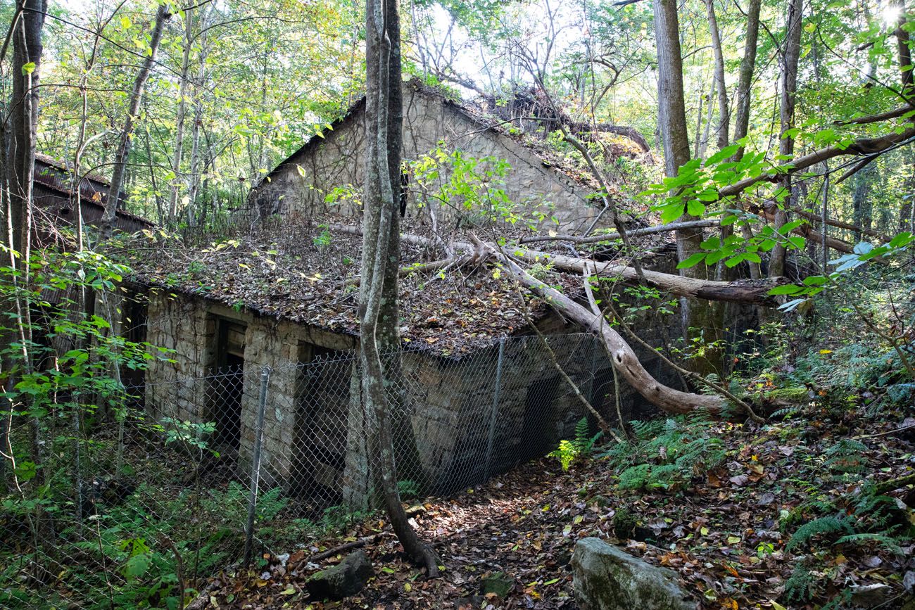
Note: The buildings at the coal processing plant are located behind a fence. Please don’t cross the fence to visit the buildings. Not only is it dangerous but it also weakens these historic buildings.
To return to your car, it’s time to climb back up all of those stairs. Maybe this hike should be renamed the Endless Stairs Trail.
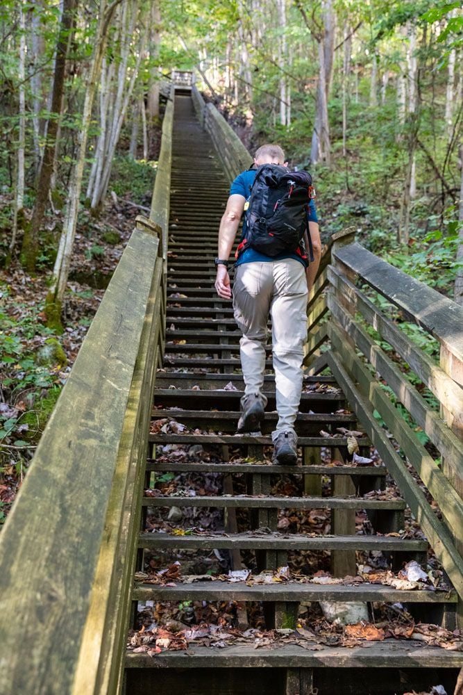
To keep ourselves entertained on the long climb back up, we decided to count the number of steps.
Tim and I counted 819 steps. The National Park Service says its 821. Either way, it is a LOT of steps, but counting them somehow made it feel easier.
From the top of the stairs, it’s just a half mile to go, now on a steep dirt trail. And guess what, there are stairs here, too! 121 to be exact (for a grand total of 940).
Enjoy!
Castle Rock Trail + Grandview Rim Trail Loop
Our Rating: ⭐️⭐️⭐️⭐️⭐️ This was one of our favorite hikes in New River Gorge. It’s short, but the trail beneath the enormous sandstone cliffs feels much more adventurous than its one-mile length suggests. If we could only hike one trail in the park, this would be our pick.
Distance: 1 mile (1.5 km) loop
Difficulty: Moderate
Total Ascent: 210 feet (64 m)
Highest Elevation: 2,530 feet (770 m)
Lowest Elevation: 2,440 feet (745 m)
Time: 1 hour
Location: Grandview
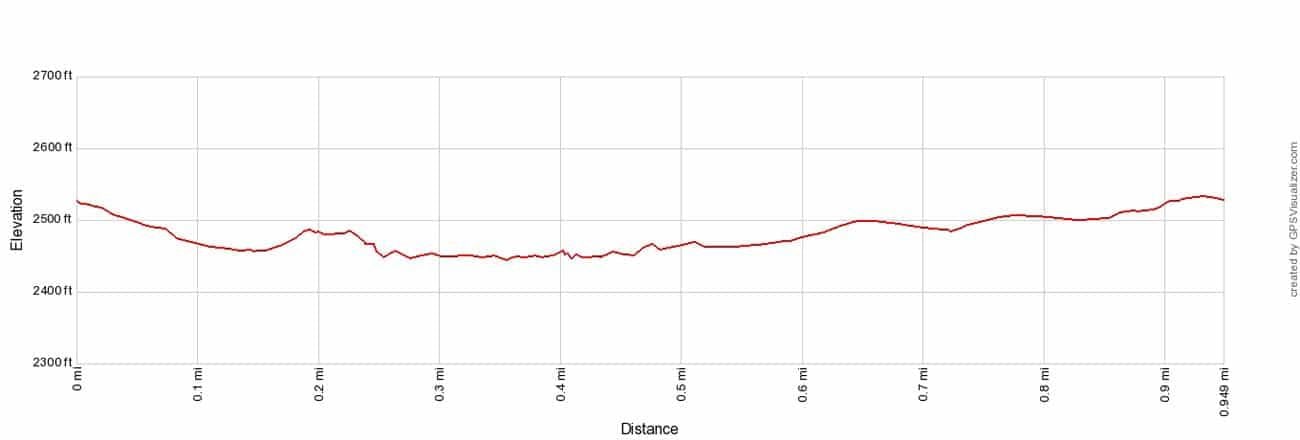
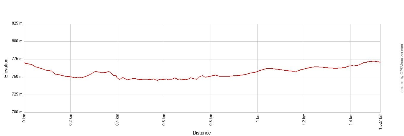
Castle Rock Trail + Grandview Trail Loop Elevation Profile
Tim and I loved this hike. It’s short, it’s sweet, and hiking along the sandstone walls is tons of fun.
The National Park Service labels this as a strenuous hike but I think that’s a bit of a stretch. There are a few steep climbs and descents but overall it is doable for most people.
Park at the Grandview Visitor Center. The Castle Rock Trailhead is located next to the Grandview Overlook (aka Main Overlook).
Follow the Castle Trail until it connects with the Grandview Rim Trail. The trail has a bunch of short ups and downs, and at times you will have to hike across rocks and rough terrain, but that’s all part of the fun.
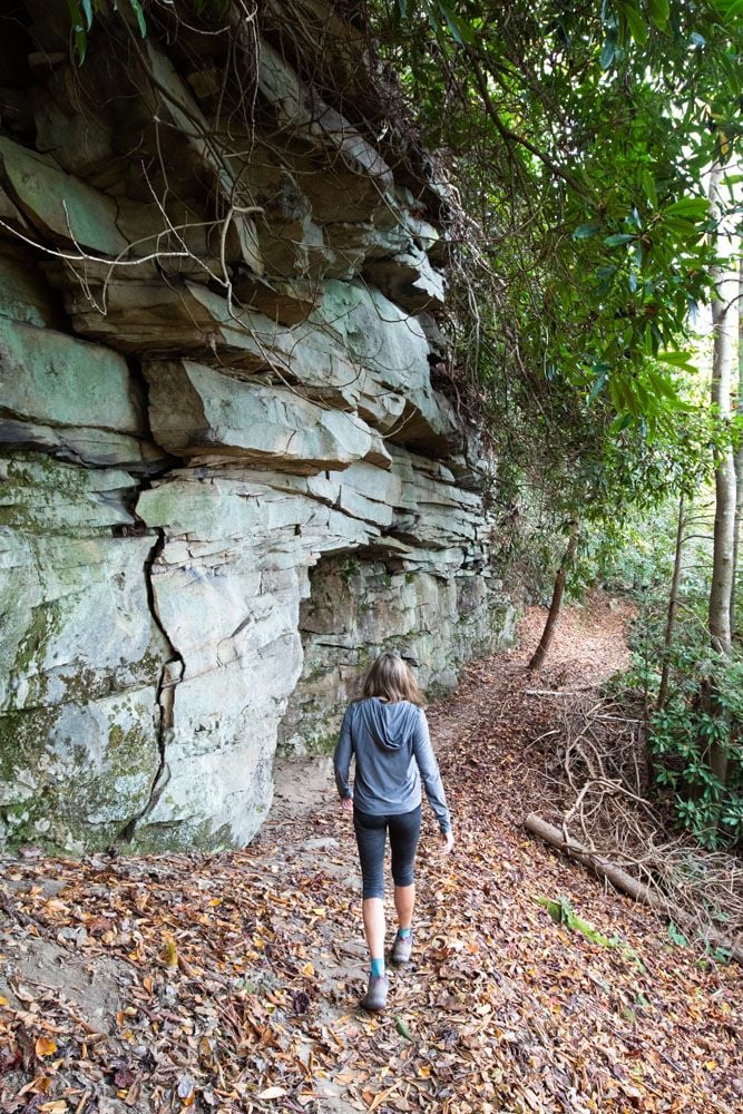
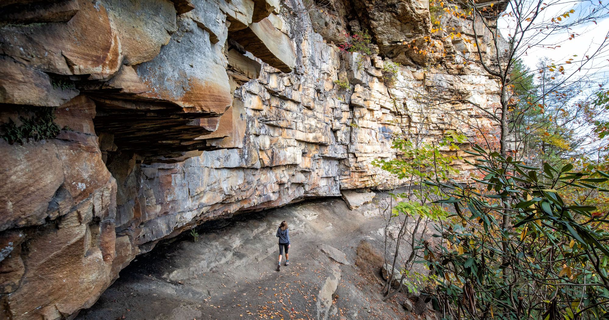
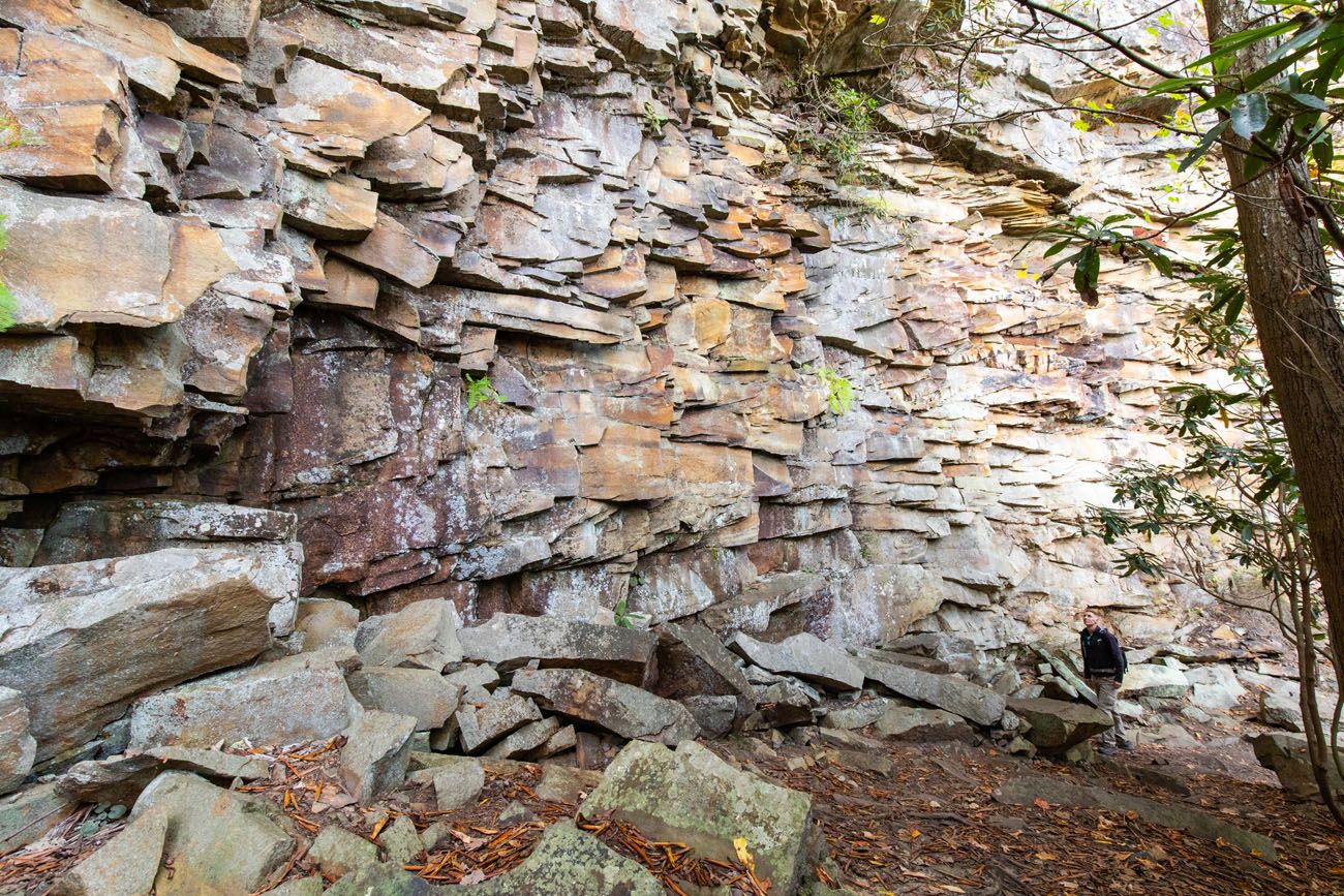
It takes about five minutes to get to the sandstone walls and this is where the trail gets really interesting. These walls are immense and lots of fun to photograph (we spent a lot of time here). I think it’s one of the most beautiful places in New River Gorge National Park. The cover photo for this guide was also taken on this trail.
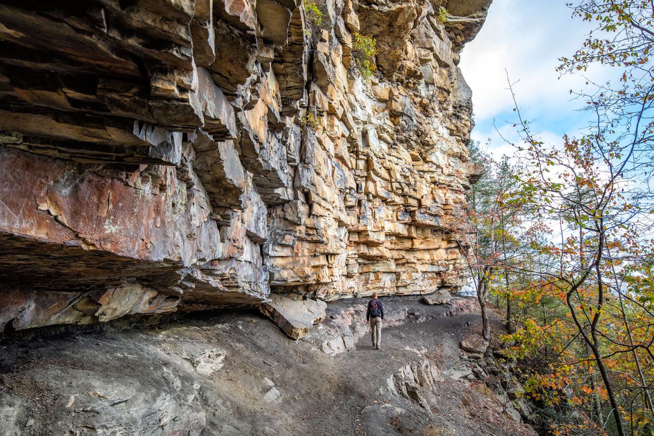
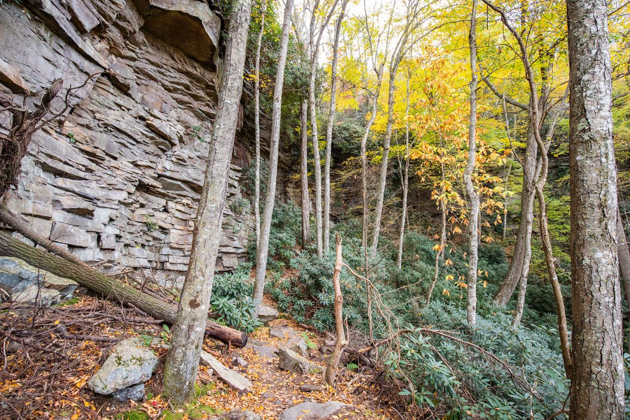
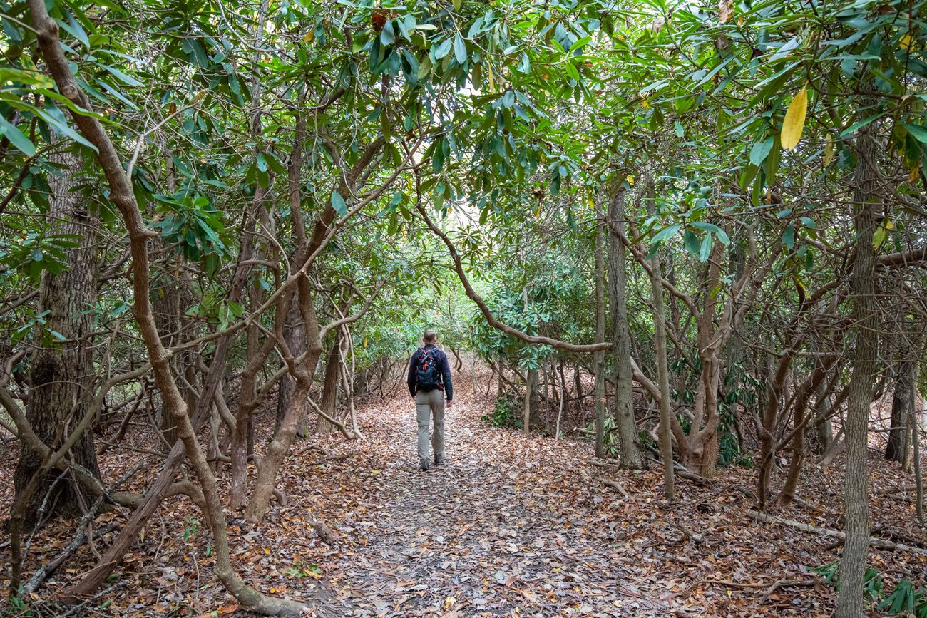
Once you reach the Grandview Rim Trail, turn left to complete the loop. You will walk through tunnels of rhododendrons and there are a few viewpoints over the New River Gorge.
Note: You can hike the Grandview Rim Trail to Turkey Spur Overlook (turn right at the trail intersection). We did this. It’s a very nice walk, and it’s relatively easy, but it runs parallel with Turkey Spur Road. The views from the trail are not much different than those you get from the road. I think your time is better spent hiking the Castle Rock Trail and Grandview Rim Trail loop and then driving out to Turkey Spur, rather than hiking the full trail.
Tunnel Trail
Our Rating: ⭐️⭐️⭐️⭐️ Short, easy, and more interesting than its mileage suggests, Tunnel Trail follows massive sandstone cliffs and passes the entrance to its namesake tunnel. It’s a fun add-on while visiting Grandview and one of our top picks for families with kids.
Distance: 0.6 miles (1 km) round trip (out-and-back)
Difficulty: Easy
Total Ascent: 150 feet (45 m)
Time: 30 to 45 minutes
Location: Grandview
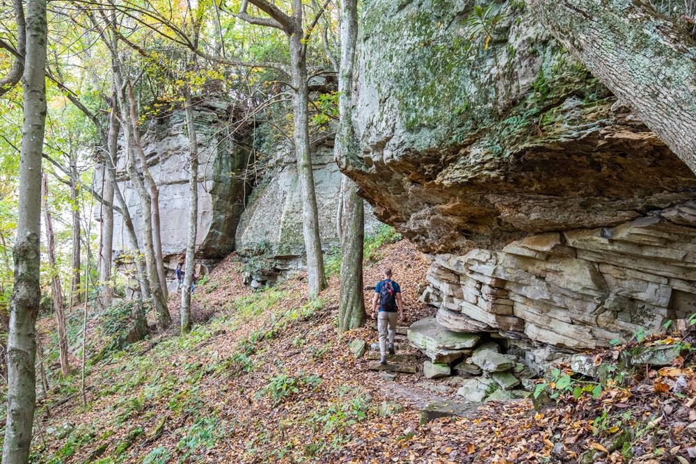
This is another fun hiking trail that takes you along massive sandstone cliffs. It starts at the Main Overlook and then winds along the cliffs.
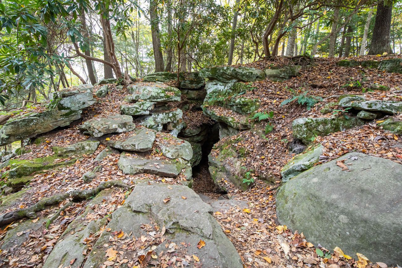
From the trail, look for entrances into the tunnel…a narrow cave that cuts through the cliffs. The tunnel is closed for safety concerns, so you can’t hike all of the way through, but you can walk a short distance into the tunnel.
Sandstone Falls
Our Rating: ⭐️⭐️⭐️⭐️⭐️ Sandstone Falls is more of a scenic walk than a traditional hike, but it was one of our favorite experiences in the park. Boardwalks and short trails lead to multiple views of the falls, and for very little effort, you get some of the most beautiful scenery in New River Gorge.
Distance: 1 mile (1.6 km) round trip
Difficulty: Easy
Total Ascent: 50 feet (15 m)
Time: 1 hour
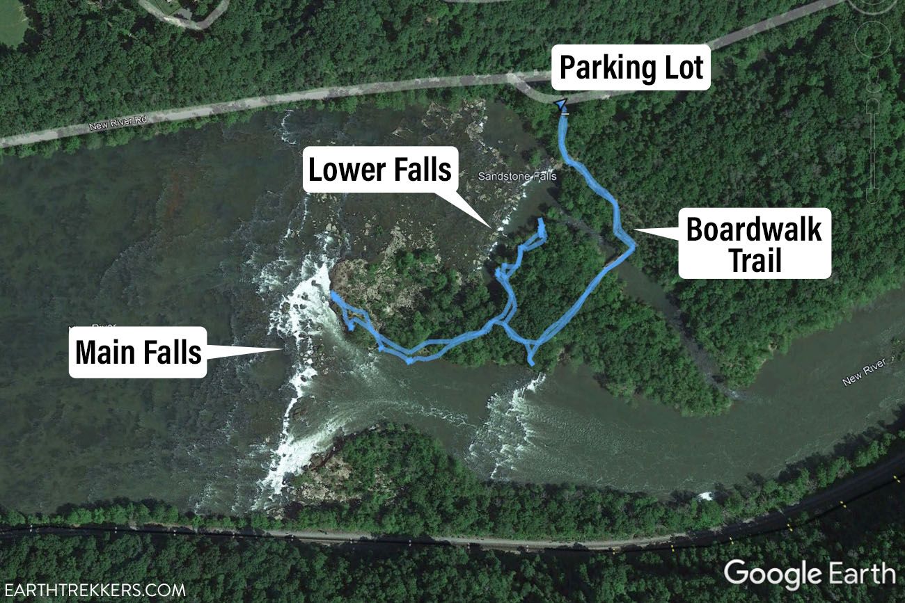
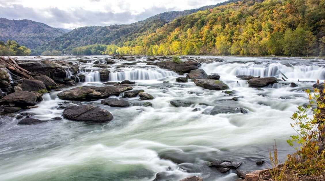
Sandstone Falls is the largest waterfall on the New River. From a series of boardwalk trails and bridges, you get views of both the upper and lower falls. If you want a closer view, you can hike the network of trails to other viewpoints of the falls.
From the parking lot, follow the boardwalk trail to the very end. There are several viewpoints from the boardwalk that are very nice.
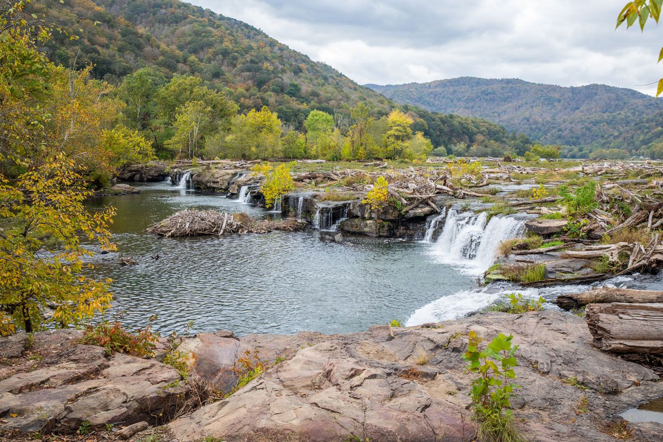
Lower Falls from Boardwalk
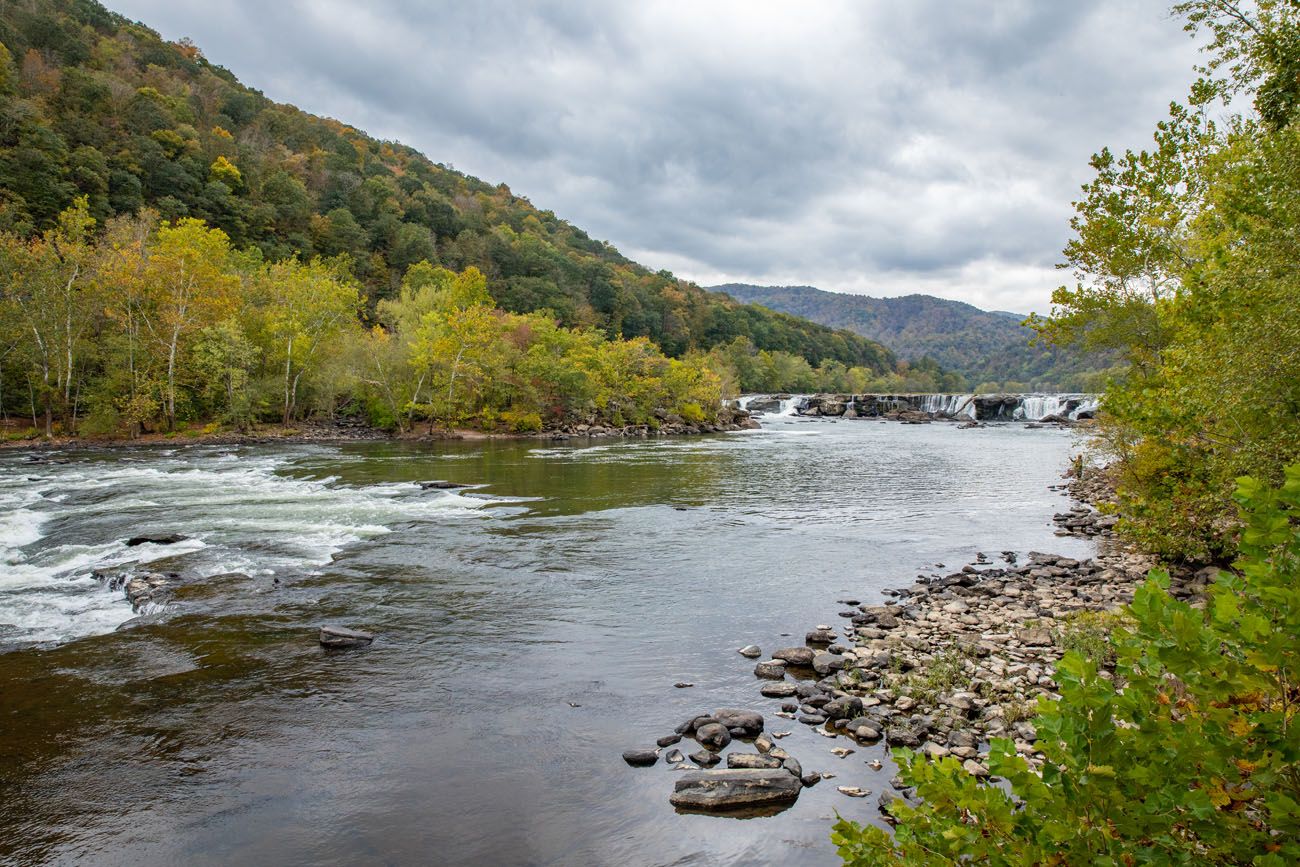
View of the main falls from the end of the boardwalk.
Just before you reach the end of the boardwalk, there will be steps that lead off of the boardwalk to the right. This connects you to the trails.
The trail splits almost right away. Taking the split to the right takes you out to the lower falls. Here is the view.
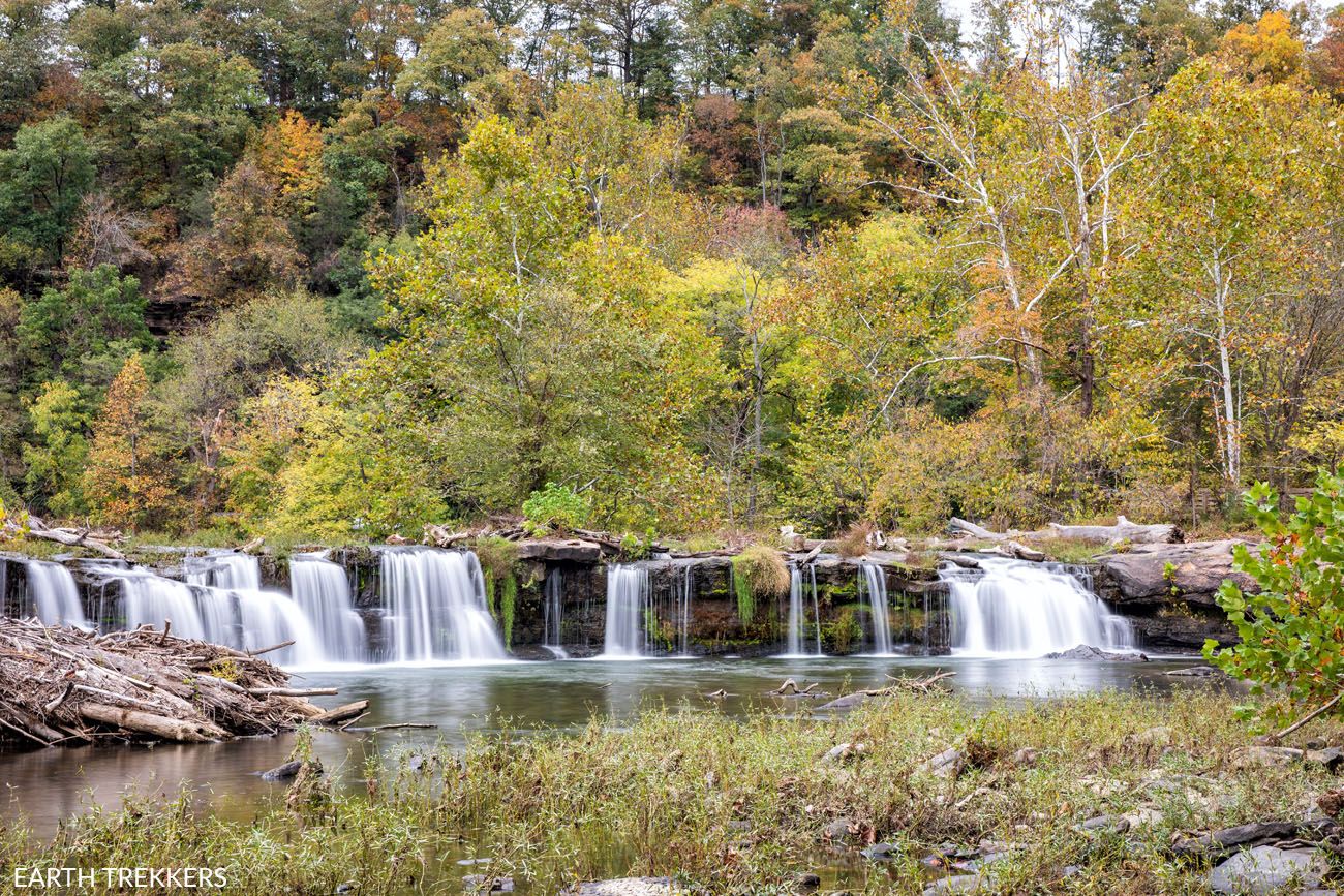
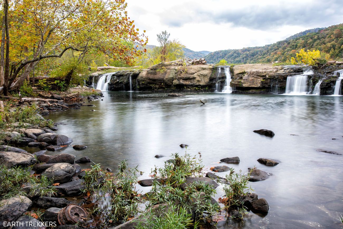
If you take the split to the left, you get closer to the main falls (the upper falls). Here is a view from the “beach:”
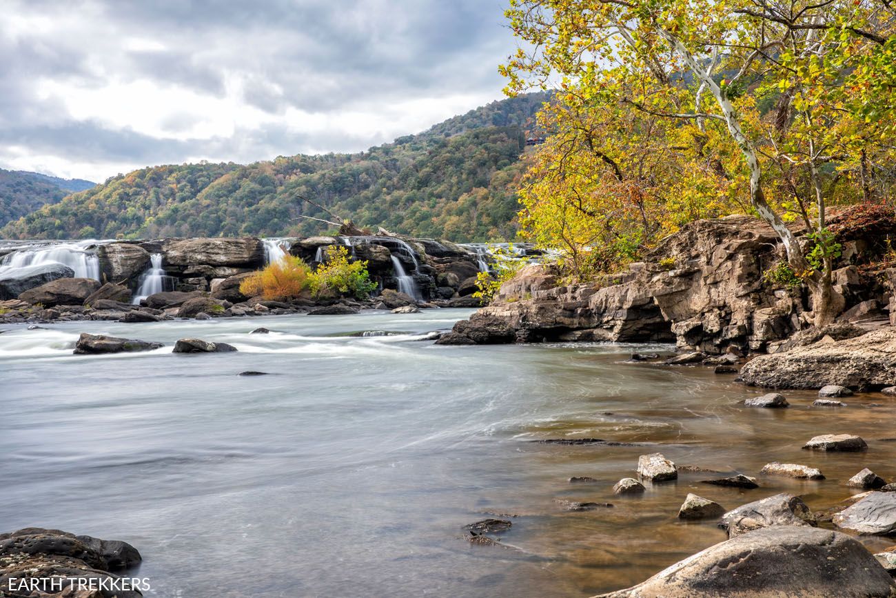
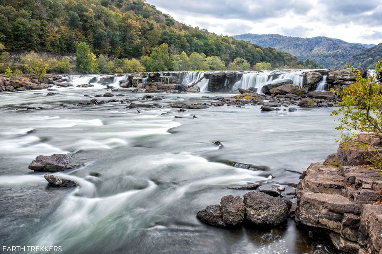
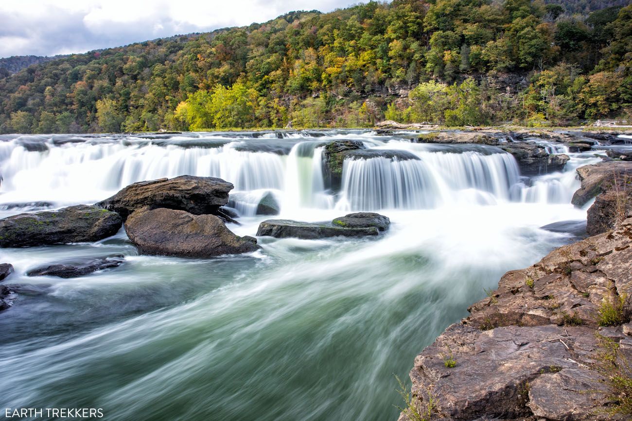
From the beach, you can scramble up onto the rocks for an even better view of the main falls. Just be careful here. There are numerous warnings about drownings, should you fall in.
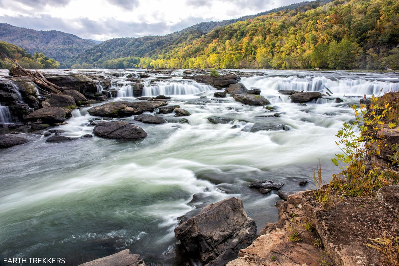
There is another trail in this area, the Island Loop Trail, which we did not hike, since it leads away from the falls and looks like it just winds through a forest.
Bonus: The Cliff Side Trail
The Cliff Side Trail is not located in New River Gorge National Park. It is located in Hawks Nest State Park, which sits just to the north of the national park. With views of the New River Gorge, this fun hike is worth adding to your to do list if you plan to spend several days in the area.
This hike takes you along sandstone cliffs, similar to the Castle Rock Trail, and offers views over the New River and Hawks Nest Dam.
Our Rating: ⭐️⭐️⭐️ A fun, uncrowded hike along sandstone cliffs with views over the New River, but not one we’d prioritize on a first visit to New River Gorge. If you hike it, we recommend turning around after the sandstone walls rather than completing the loop and walking along Highway 60.
Distance: 1.8 mile (2.8 km) loop
Difficulty: Moderate
Total Ascent: 430 feet (130 m)
Highest Elevation: 1,315 feet (400 m)
Lowest Elevation: 1,040 feet (315 m)
Time: 1 to 1.5 hours
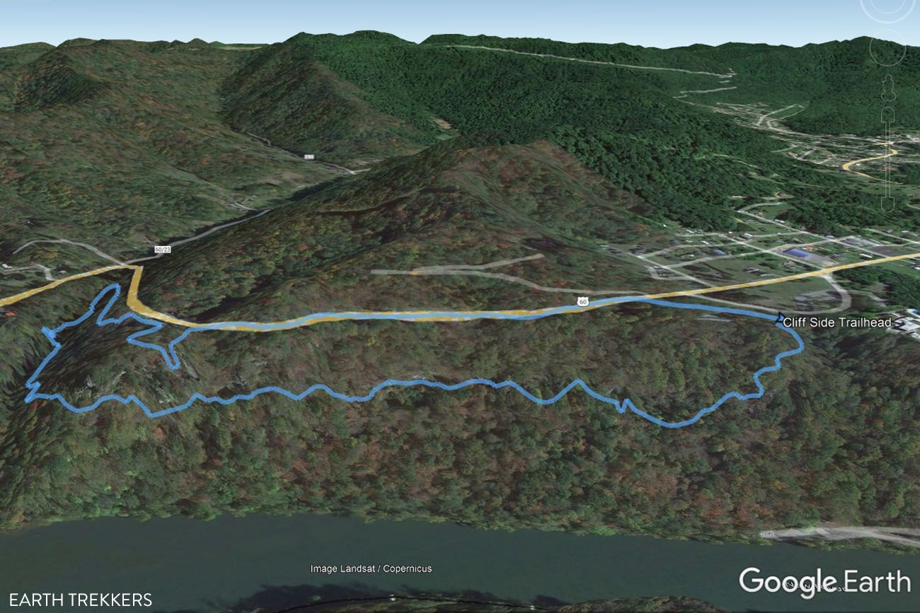
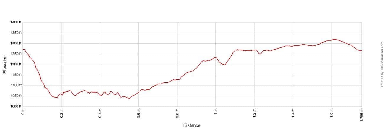
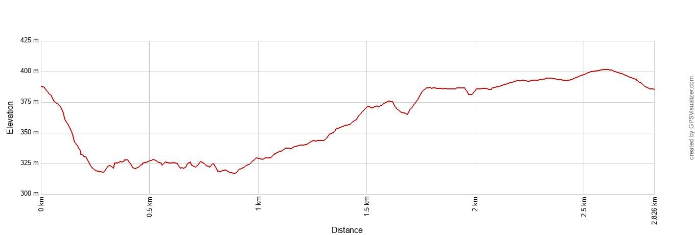
Cliff Side Trail Elevation Profile as a loop
Park in the Hawks Nest State Park parking lot just off of Highway 60. The trail starts at the Midland Trail Shelter which is next to the parking lot.
Follow the white blazes on the trees. It’s a steep descent on the first part of the trail. At the trail split, turn right and continue to follow the white blazes. Now, you will be hiking along the sandstone walls. This is the best part of the hike.
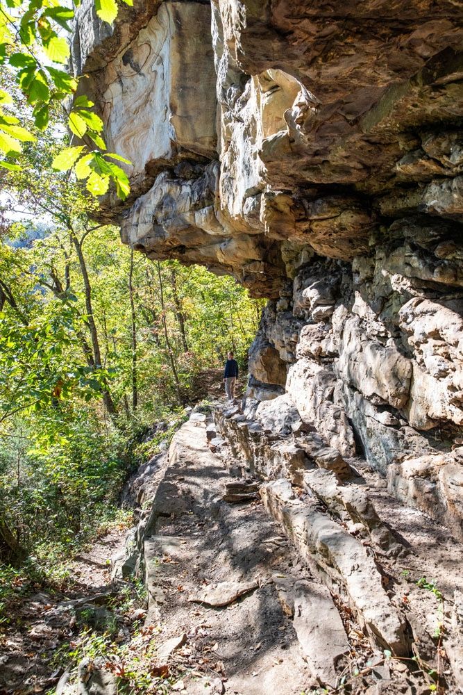
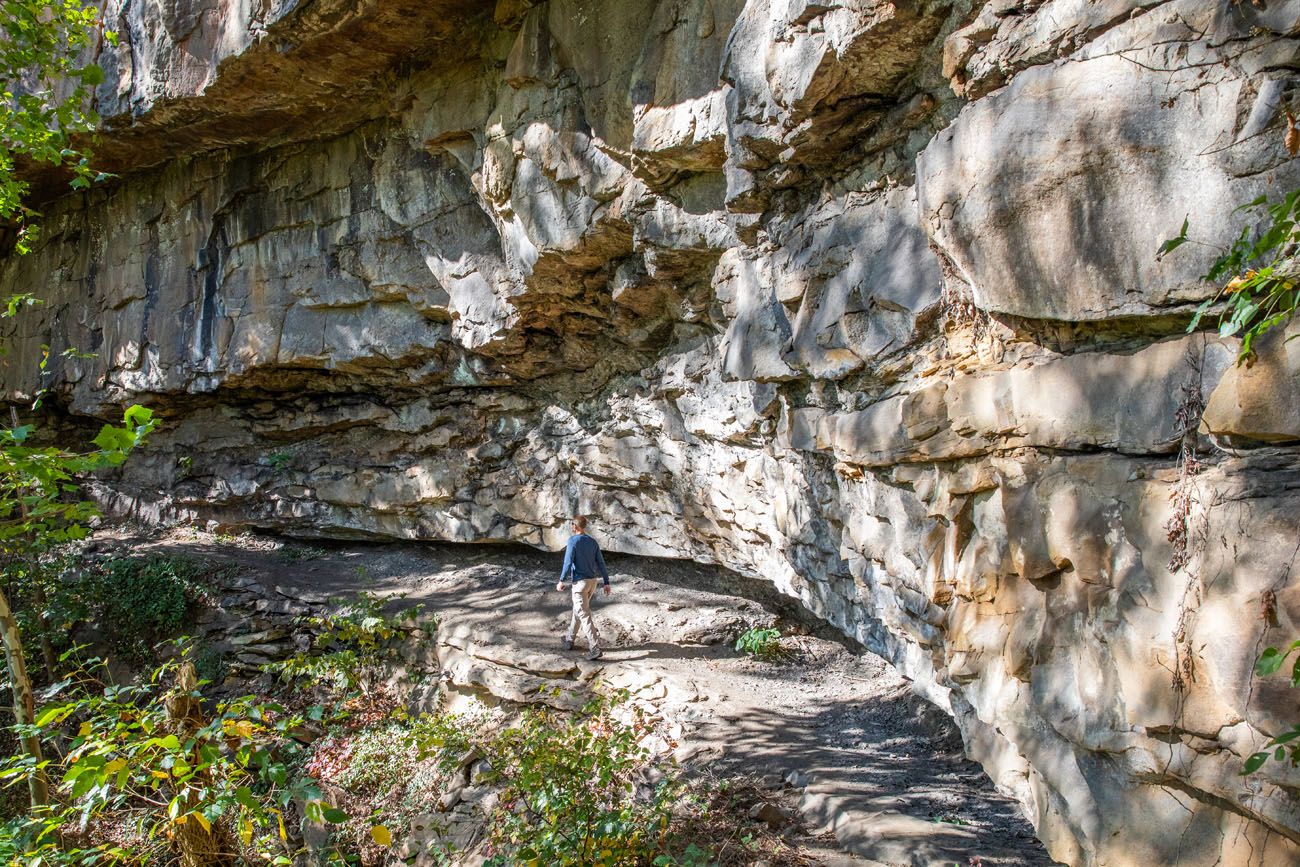
Beyond the sandstone walls, the trail climbs back up and you reach the parking lot for the Hawks Nest Overlook. Take in the view. Then, return to your car by walking on the shoulder of Highway 60, which is boring and dangerous.
Alternatively, start at the Midland Shelter, hike out to the end of the sandstone walls, turn around, and hike back to your car. Drive to the Hawks Nest Overlook. This makes the hike shorter and saves you a dangerous walk along the road.
Prior to this hike, we read reviews that said we should be prepared for dangerous cliff edges and rock scrambling. There were a few edges but nothing that felt dangerous and we never encountered any rock scrambling.
When is the Best Time to Hike in New River Gorge?
The best times to hike in New River Gorge National Park are spring and fall, when temperatures are generally more comfortable and the forest is at its most colorful.
Spring is a beautiful time to hike, especially from April into May, when wildflowers bloom throughout the gorge. Rhododendrons typically bloom around May in the Grandview area. Trails can be wet and muddy after spring rains, so waterproof hiking shoes are helpful.
Fall is our favorite time to hike in New River Gorge. We visited in late October and had cool hiking weather and the beginning of fall colors. October into November is especially scenic as the forests covering the gorge change color, although weekends during peak foliage can be busy.
Summer is also a good time to hike, but expect warmer, more humid conditions. Many trails are shaded by the forest, which helps, but starting early in the day makes for a more comfortable hike. Thunderstorms can occur, so check the forecast before setting out.
Winter hiking is possible, and the park is open year-round, but snow and ice can make trails, stairs, and overlooks slippery. Some seasonal facilities are also closed during the winter months.
Important Tips for Hiking in New River Gorge
Have a backup hike. Many trailhead parking lots in New River Gorge are small, and the most popular lots can fill quickly. If a trailhead is full, move on to another hike rather than parking along the road.
Download your maps before you start. New River Gorge is a large, spread-out park, and driving between hiking areas can take longer than expected. Download the NPS app or an offline trail map before your trip, and don’t rely entirely on turn-by-turn directions. Some roads in and around the park are narrow and winding.
Use extra caution near cliff edges. Several hikes on this list, particularly Endless Wall and Long Point, end at or run near to unprotected cliffs. Stay on established trails and keep children close near overlooks.
Check the weather before hiking. Rain and thunderstorms can develop quickly, and wet rocks, roots, stairs, and boardwalks can become slippery. We recommend wearing hiking shoes with good traction.
Watch for ticks, poison ivy, and snakes. Ticks are common during the warmer months, and copperheads and timber rattlesnakes live in the park. Stay on the trail and watch where you place your hands and feet.
Know that hunting is permitted in parts of the park. New River Gorge is both a national park and a national preserve, and hunting is allowed in designated preserve areas. If you are hiking during hunting season, the National Park Service recommends wearing blaze orange.
Check for trail closures before your visit. Construction projects, storm damage, and other issues can temporarily close trails or sections of trails. Check the National Park Service website for current alerts before heading out.
Essential Hiking Gear: What Should You Bring on a Day Hike?
If you are new to hiking or are curious about what you should bring on a hike, check out our Hiking Gear Guide. Find out what we carry in our day packs and what we wear on the trails.Plan Your Trip to New River Gorge
- Planning your first visit? → Our New River Gorge National Park Travel Guide covers when to go, how many days you need, where to stay, and how to plan your time in the park.
- Want more ideas for your visit? → Our Best Things to Do in New River Gorge includes scenic drives, viewpoints, historic sites, rafting, and more.
- Love short, rewarding hikes? → Take a look at our 20 Fun, Short Hikes in the US National Parks for more trails with big payoffs without a full day of hiking.
- Visiting more parks in the region? → Our 10 Best Hikes in Shenandoah National Park includes everything from easy summit walks to Old Rag.
- Planning more national park trips? → Our Guide to the US National Parks is a great place to start, with trip-planning advice, itineraries, and ideas for choosing which parks to visit next.
If you have any questions about the best hikes in New River Gorge National Park, or if you want to share your experience, let us know in the comment section below.
More Places to Visit in and around New River Gorge
New River Gorge National Park Itinerary for 1 to 3 Days
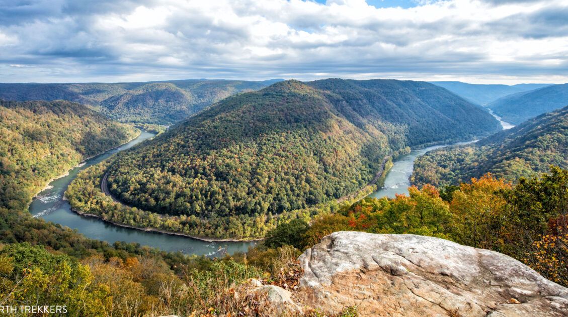
Pinterest Facebook Flipboard If you are planning your New River Gorge National Park itinerary, this is a great place to start. There are many different ways to plan the “perfect New River Gorge itinerary,” depending on your interests and how much time you have. The things to do in New River Gorge National Park are […]
14 Wonderful Things to Do in Cuyahoga Valley National Park
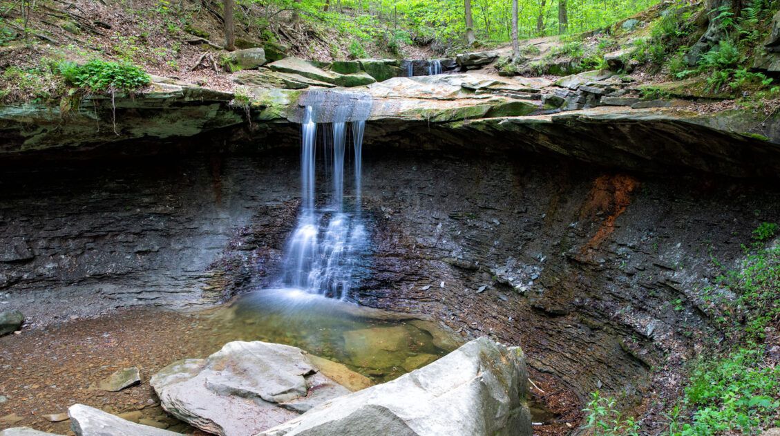
Cuyahoga Valley National Park preserves a lush river valley that is home to both natural and historical sites. Among the thousands of acres of forests and wetlands are a network of hiking and biking trails. Visit a covered bridge, ride a train through the heart of the park, learn about the Ohio and Erie Canal, […]
9 Amazing Things to Do in Shenandoah National Park
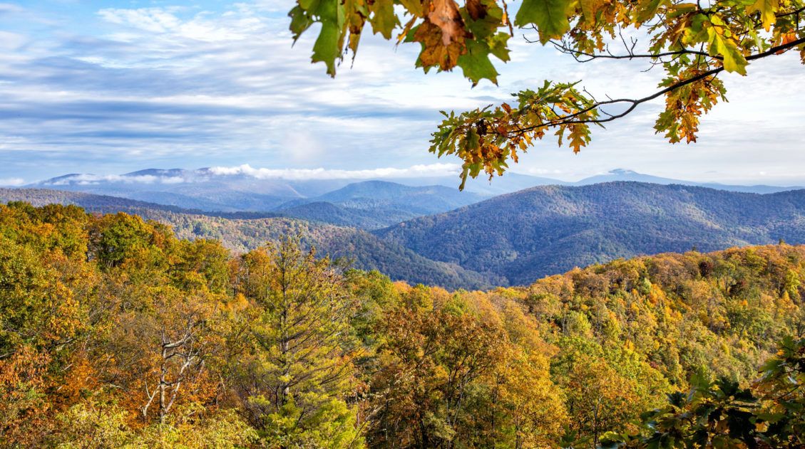
This guide covers the best things to do in Shenandoah National Park, nearby attractions, and essential tips to help you plan your trip, including where to stay, how many days you’ll need, and the best time of year to visit. Shenandoah National Park preserves a section of the Blue Ridge Mountains in Virginia. Skyline Drive […]

Best Distilleries to Visit on the Kentucky Bourbon Trail
The Kentucky Bourbon Trail is hot right now! With the increasing popularity of bourbon, tourism is up in Kentucky. What better way to learn about and sample bourbon than on the Kentucky Bourbon Trail? The Kentucky Bourbon Trail is a collection of 60 whiskey distilleries. All of these distilleries offer tours and tastings. On the […]
A Weekend in Gatlinburg and Great Smoky Mountains National Park
In an attempt to catch the last of the autumn colors, Tim and I went a road trip to the Great Smoky Mountains in early November. We spent a weekend exploring Great Smoky Mountains National Park, using Gatlinburg, Tennessee as our home base. Great Smoky Mountains National Park is the United States’ most visited national […]

12 Best Things to Do in Louisville, Kentucky
Louisville, Kentucky…the home of the Kentucky Derby, Kentucky Fried Chicken, and Louisville Slugger bats. Named after King Louis XVI of France, the city was founded in 1778 by George Rogers Clark. Muhammad Ali and Jennifer Lawrence were born and raised here. One third of all bourbon comes from Louisville. It’s home to several stops on […]

A Weekend Getaway to Asheville, North Carolina
Nestled in the Blue Ridge Mountains, Asheville makes the perfect weekend getaway. There is something here for everyone, whether you are a foodie, a family, a beer aficionado, or an outdoor adventurer. In this guide, we cover the best things to do in Asheville, organized by travel style. Best Things to Do in Asheville The […]
One Perfect Day in Congaree National Park
With its compact size and short list of things to do, one day is all you really need to visit Congaree National Park. With one day in Congaree National Park, walk the boardwalk trail, go canoeing or kayaking on Cedar Creek, and venture farther into the wilderness on one of several other hiking trails in […]
Our 15 Favorite US National Parks: A Few May Surprise You
Stretching from the South Pacific, across the United States and into the Caribbean, are 63 national parks. These national treasures are filled with scenic drives, hundreds of miles of hiking trails, wildlife, historic sites, and endless opportunities for adventure. In this guide, we cover 15 of the best national parks in the USA and what […]

Watkins Glen Gorge Trail in Photos & Tips for Your Visit
Watkins Glen State Park is a breathtaking natural wonder located just outside the town of Watkins Glen in the Finger Lakes region of New York. The highlight of the park is the Watkins Glen Gorge Trail, a stunning path leading through the heart of the gorge, passing 19 waterfalls and climbing over 800 stone steps. […]
United States Travel Guide: Places to Visit in the USA
Plan your visit to the United States. Learn about the best things to do, how to plan your time, road trip ideas, and sample itineraries.
Ultimate Hiking Guide: Europe, Asia, Africa, Americas & Oceania
Are you looking for the perfect hike? With hikes on six continents ranging from a few miles to multi-day adventures, explore some of the best hikes from around the world.
West Virginia Travel Guide: Places to Visit in West Virginia
Plan your visit to West Virginia. Learn about the best things to do, how to plan your time, where to stay, and more.


Comments 5