Hawai’i Volcanoes National Park is home to two of the world’s most active volcanoes, Mauna Loa and Kīlauea. If you get lucky with your timing, you can catch Kīlauea in action, as molten lava oozes up from below the Earth’s crust, creating brand new land.
But there is more to Hawai’i Volcanoes National Park than volcanic eruptions. You can hike through a lush rainforest and learn about the history and culture of this dynamic place.
The lava is not always flowing in Hawai’i Volcanoes National Park. We have visited this park twice, 22 years apart. Our first visit was in 1999. The lava was flowing, and we saw it, but it was through a telescope, so it was not the most thrilling experience. On our more recent visit in summer 2021, there were no active lava flows in the park.
This park has the unique ability to change dramatically in just a short period of time. In the past few decades, lava flows have covered roads and beaches, and earthquakes have disrupted the landscape. The conditions are constantly changing, so I recommend checking the National Park Service website for updates as you plan your trip.
In this guide, we cover the best things to do in Hawai’i Volcanoes National Park, with tips to help you have the best experience.
Please practice the seven principles of Leave No Trace: plan ahead, stay on the trail, pack out what you bring to the hiking trail, leave areas as you found them, minimize campfire impacts, be considerate of other hikers, and do not approach or feed wildlife.
Interesting Facts about Hawai’i Volcanoes National Park
Five volcanoes formed the Big Island of Hawai’i. Two of these volcanoes, Kīlauea and Mauna Loa, are located in Hawai’i Volcanoes National Park. The other three volcanoes, Mauna Kea, Kohala, and Hualalai, are located outside of the park.
Kīlauea is the most active of the five volcanoes on the Big Island. It has erupted multiple times in the past five years so check the National Park Service website for updates before your trip…it could be erupting while you are here.
Kīlauea erupted continuously from 1983 to 2018. During this time, it destroyed two towns and covered Chain of Craters Road. In May 2018, a series of earthquakes and eruptions destroyed nearby homes. A section of Crater Rim Road remains closed because of damage sustained during this eruption.
One of the best things to do in Hawai’i Volcanoes National Park is to drive Chain of Craters Road, where you can see the trails of recent lava flows and the brand new land that Kīlauea has formed.
Mauna Loa is considered to be the largest volcano on Earth, in terms of surface area and volume. The summit of Mauna Loa is 13,680 feet (4,170 meters) above sea level. If you take into account its height from its base on the sea floor to summit, it is 30,085 feet (9,169 meters) tall, just slightly taller than Mount Everest (29,029 feet, 8,848 meters). It erupted in December 2022 but is no longer active.
Hawai’i Volcanoes National Park officially became a national park on August 1, 1916, in order to protect and study these two volcanoes. It is also one of the few US National Parks that is an International Biosphere Reserve and a World Heritage.
In 2023, Hawai’i Volcanoes National Park had 1.6 million visitors, making it the 19th most visited park in the USA.
Best Things to Do in Hawai’i Volcanoes National Park
1. See the Lava Flow
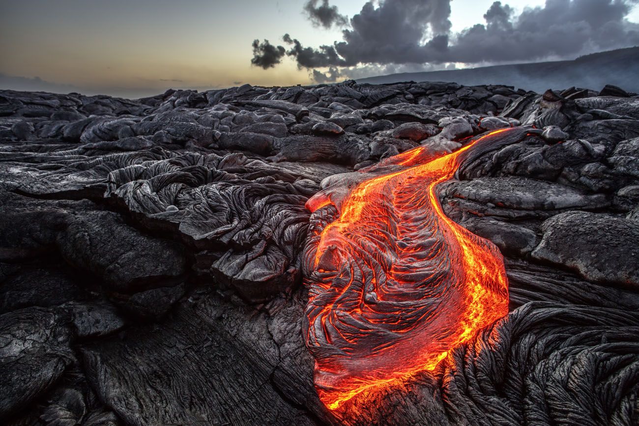
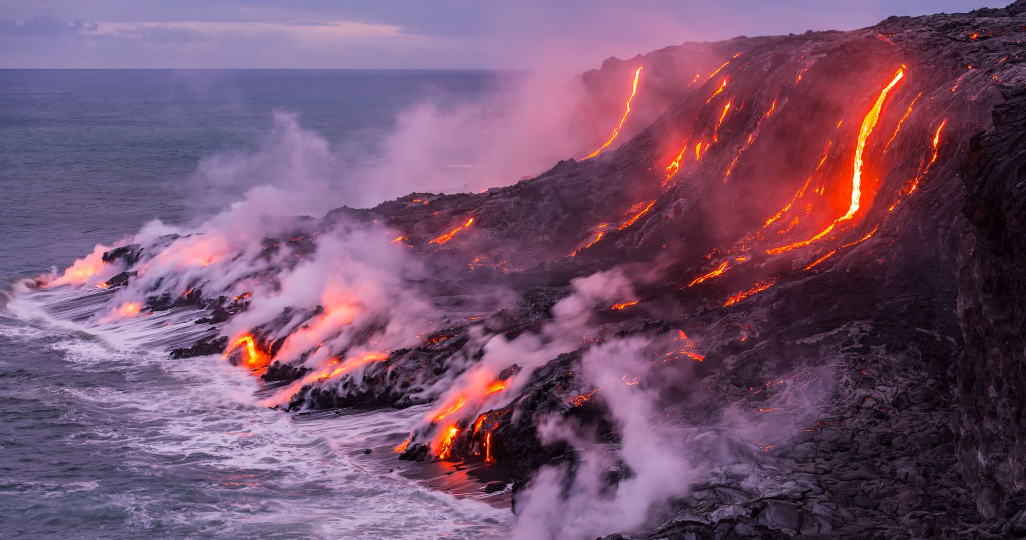
If you are here when Kīlauea is actively erupting, one of the best things to do in Hawai’i Volcanoes National Park is to see the lava flow. As you plan your trip and just before your visit, get updates on the National Park Service website. These eruptions are awesome to see, but there is also the chance that there will be road closures as well.
Willyam Bradberry/shutterstock.com
There are several ways to do this and it really depends on where the eruption is occurring. In the past two decades, you could see active lava flows along Chain of Craters Road, along the coastline, and at Halema’uma’u Crater.
During our visit in 1999, lava was actively flowing near Chain of Craters Road. Tim and I were able to see the lava flow way off in the distance using a telescope set up by park rangers.
In recent years, it was possible to hike out to the lava flow. The National Park Service offered ranger guided hikes or you could do this on your own.
One of the best ways to see the lava flow is on a helicopter tour. Seeing the flow from the sky is an awesome way to get the full view, not only of the molten lava but also the crater.
If the lava is flowing, plan on sticking around past sunset. The glow of the lava against the dark sky creates a magical scene.
For updates on the activity of Kīlauea and Mauna Loa, visit the National Park Service website. These two volcanoes are constantly monitored for new activity and this is the best way to find out if an eruption is imminent.
2. Hike the Kīlauea Iki Trail
Distance: 4 miles | Difficulty: Moderate | Time: 2 to 3 hours
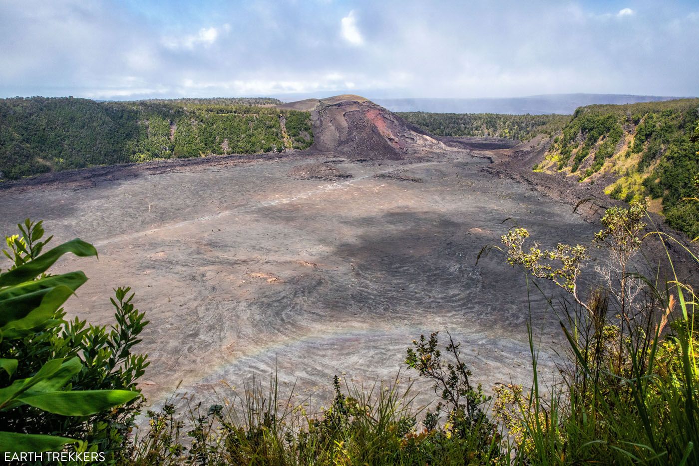
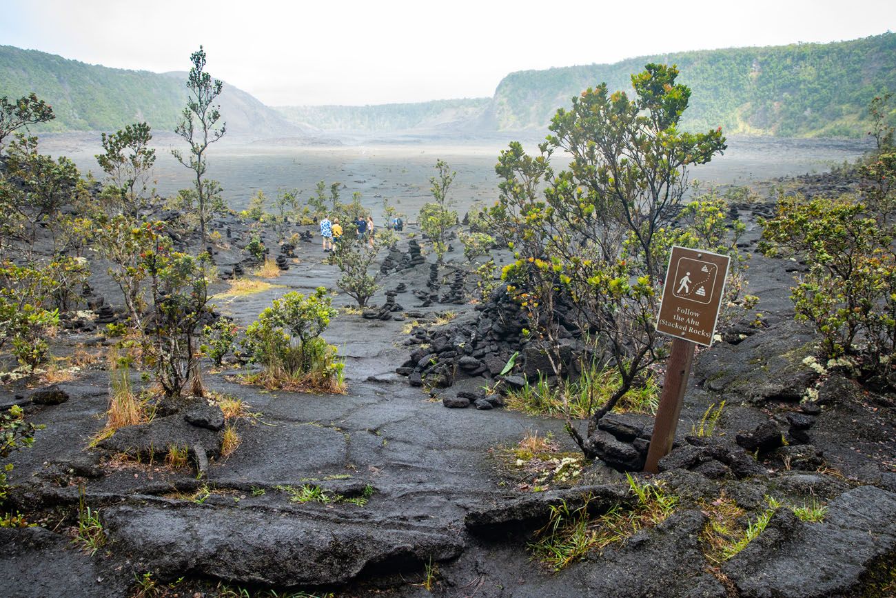
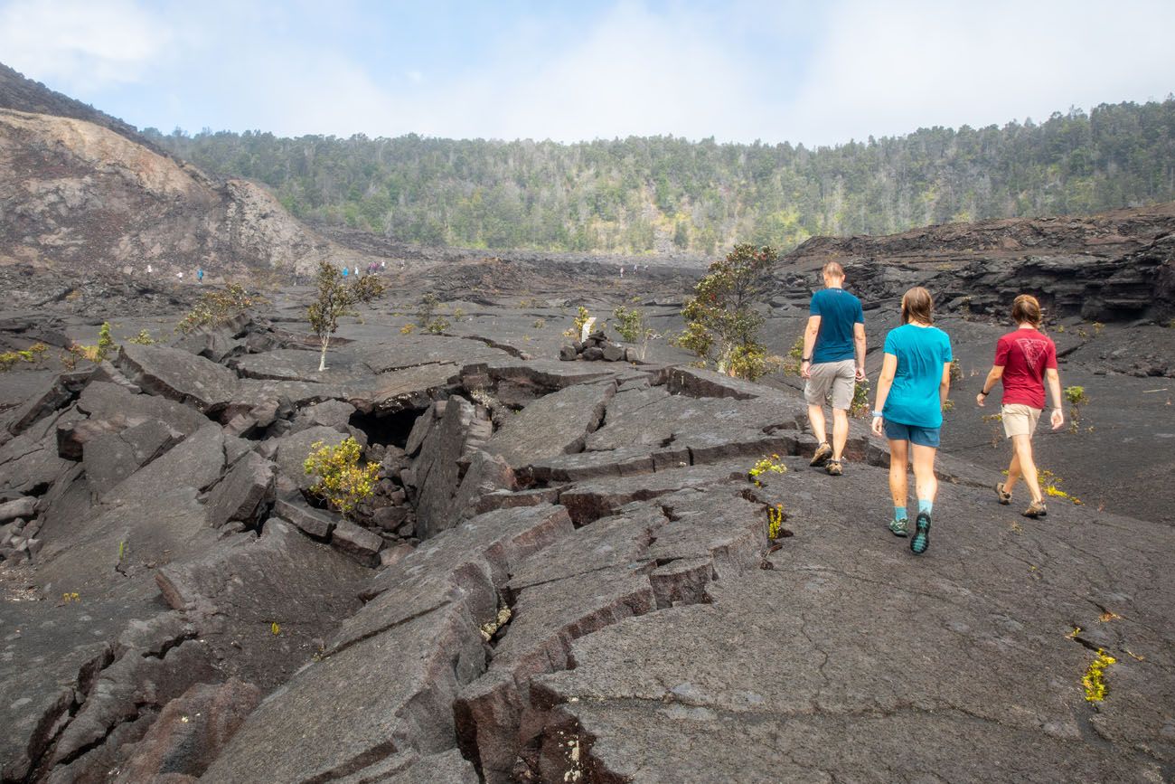
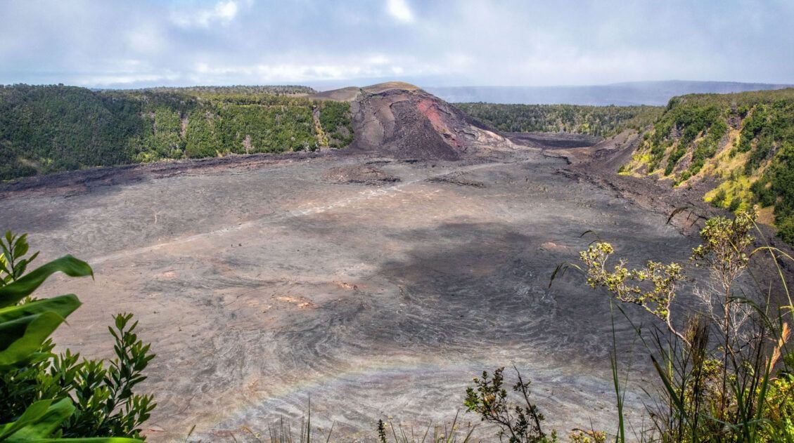
This fun hike is a must do! On this hike, you get to walk across a solidified lava lake on the floor of the Kīlauea Iki crater.
Kīlauea Iki Crater
On November 14, 1959, Kīlauea erupted, sending molten rock into the sky. It flowed into Kīlauea Iki crater, dramatically changing this landscape.
The best place to park for this hike is at the Kīlauea Iki Trailhead parking lot (it’s also called the Kīlauea Iki Overlook on the national park map). From here, you can hike the Kīlauea Iki Trail as a loop and combine this with the Thurston Lava Tube.
Entering Kīlauea Iki Crater
Crossing Kīlauea Iki Crater
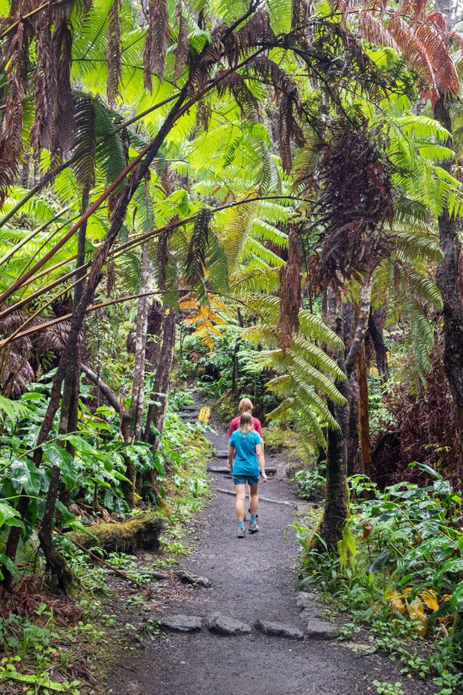
Crater Rim Trail
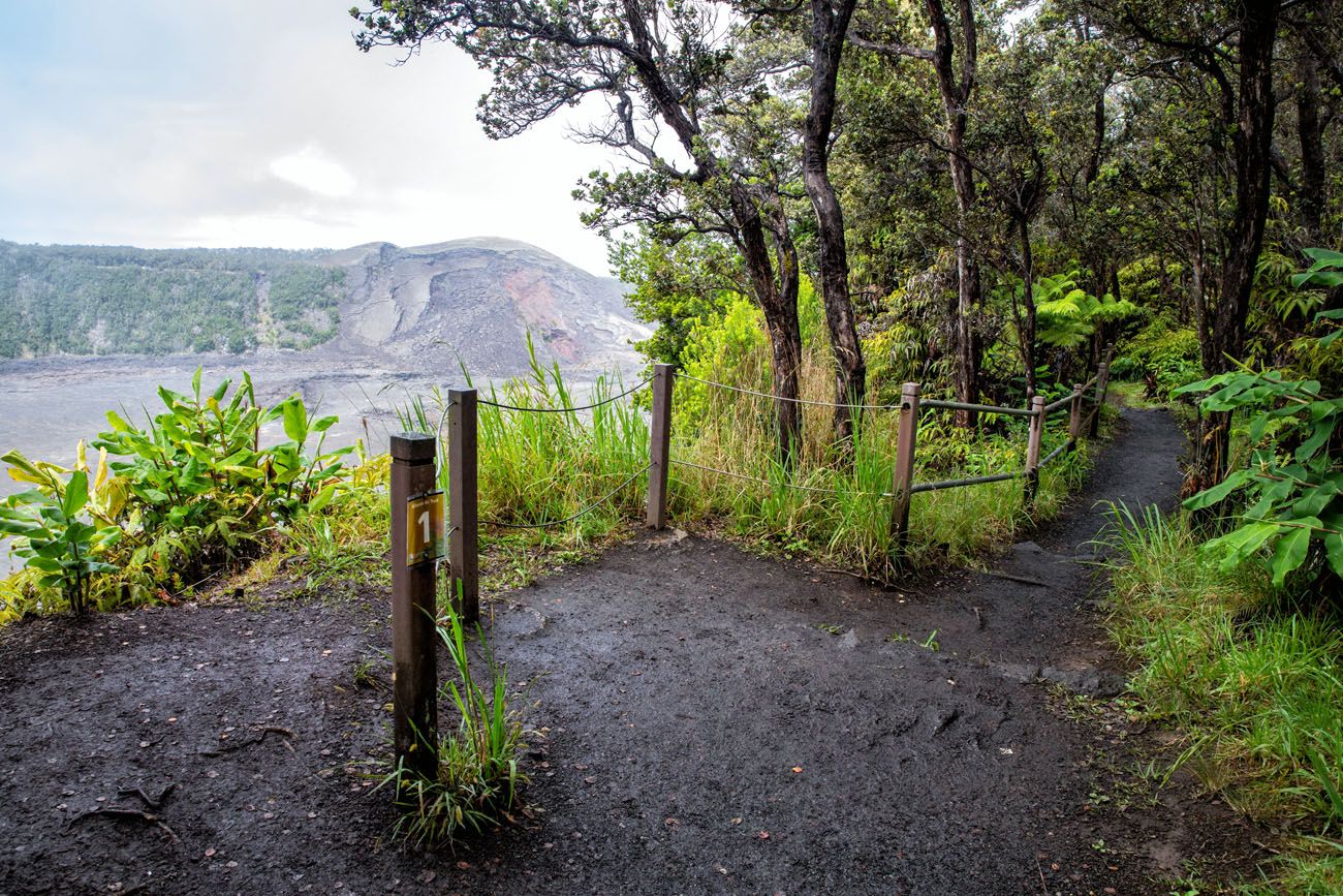
Crater Rim Trail and a viewpoint of Kīlauea Iki Crater
The National Park Service has an excellent trail guide for this hike (download it before your visit because cellular service is limited inside of the park). Along the trail are numbered markers which correspond to information provided in the guide. If you follow this guide, you will hike the loop in a counter-clockwise direction, starting on Crater Rim Trail and then crossing the crater on the return walk to your car. Once you hike up the rim, you can cross the street and visit the Thurston Lava Tube. I recommend doing this as part of the loop hike because parking can be limited at the Lava Tube. Then take the trail back to the parking lot.
What We Did: We did this in a reverse order because I did not know about the hiking guide until I wrote this post. From the Kīlauea Iki Trailhead parking lot, we did this loop in a clockwise direction. The first part of the trail heads south along the crater rim. We visited the Thurston Lava Tube and then hiked across Kīlauea Iki crater, returning to the parking lot on the Crater Rim Trail. For more information on how to do this hike, with maps, elevation profile, and lots more photos, check out our Guide to the Kīlauea Iki Trail.
Both directions work great, but if you want to follow the NPS Trail Guide, you will do this hike in a counter-clockwise direction.
PRO TRAVEL TIP: Parking at this trailhead fills up early in the day. I recommend doing this first thing to make sure you get a parking space.
3. Thurston Lava Tube (Nahuku)
Lava tubes form when a lava flow forms a roof and walls, a hard crust that cools around the still-flowing lava. This resulting tube serves as a conduit for the continuing flow of lava.
The Thurston Lava Tube is one of these tubes. The lava is no longer flowing, so what was left behind is a tube, which is open on either end, that you can walk through. It’s about 600 feet long and the ceiling reaches a height of 20 feet, so no stooping or crouching is necessary to walk through the tube.
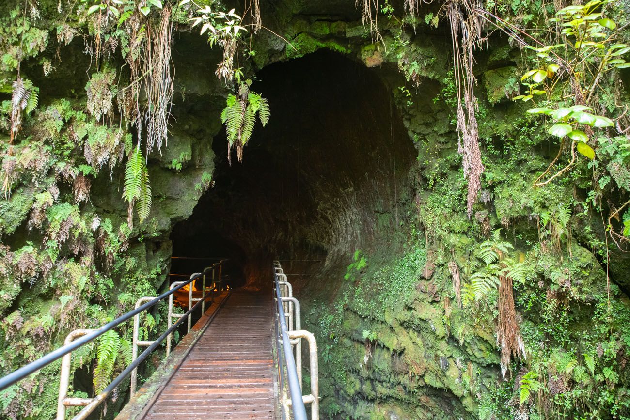
To get to the lava tube, you will walk on a short trail through a rainforest. It is a slightly downhill walk to get to the Thurston Lava Tube and a slightly uphill walk back to the end of the trail.
Where to Park
The best place to park is right across the street from the Thurston Lava Tube. However, this is a very small parking lot and you need to be extremely early, or lucky, to get a space here.
The next closest parking lot is at the Kīlauea Iki Trailhead parking lot. It is a 1.6 mile out-and-back walk to the Thurston Lava Tube and you can also add on the Kīlauea Iki crater walk (highly recommended!).
If you can’t get a space at either of these lots, you can park at the trailhead for the Devastation Trail. From here, it is 6 mile out-and-back walk to the Thurston Lava Tube.
4. Crater Rim Drive
Crater Rim Drive once circled around Kīlauea Crater. In 2018 eruption, part of the road was damaged, along with the Jaggar Museum, so you can no longer drive the full loop around the crater.
The north and east sections of this road remain open. Along this drive, there are several viewpoints, hiking trails, and places to visit.
In order from west to east, here are notable stops along the drive.
From Kīlauea Overlook, you get a sweeping view of the Kīlauea Caldera. We didn’t have the best weather on our most recent visit, with frequent rain showers and low lying clouds over the course of the day (but one of the most brilliant rainbows we have ever seen). But having seen this on a clear day on a different visit, the view is worthwhile.
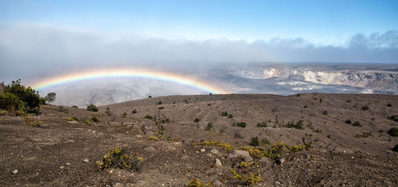
Kīlauea Overlook
On the drive, you can see the Steam Vents and walk the short Sulphur Banks Trail (1.4 miles round trip).
Another hike to consider is the Halem’uma’u Trail. This moderate, 1.6 mile out-and-back-hike takes you from the crater rim to the floor of the Kīlauea caldera.
Stop inside the Kīlauea Visitor Center to learn more about the park and get updated conditions from park rangers.
We loved the Volcano Art Center Gallery, which has for sale paintings and sculptures from local artists.
The Volcano House is a great place to stay or have a bite to eat. Both Mark Twain and President Franklin D. Roosevelt were guests here.
On the east side of the rim, you can hike the Kīlauea Iki Trail and visit the Thurston Lava tube, mentioned earlier. You can also hike the Devastation Trail or walk part of Crater Rim Drive to the the Keanakako’i Overlook, for another view of the Kīlauea Caldera.
5. Devastation Trail
Distance: 1 mile out-and-back | Difficulty: Easy | Time: 30 to 60 minutes
This paved, mostly flat trail goes through an almost barren landscape. Located next to the Kīlauea Iki crater, cinders from the 1959 eruption buried this area. Since this time, life has been gradually making a comeback.
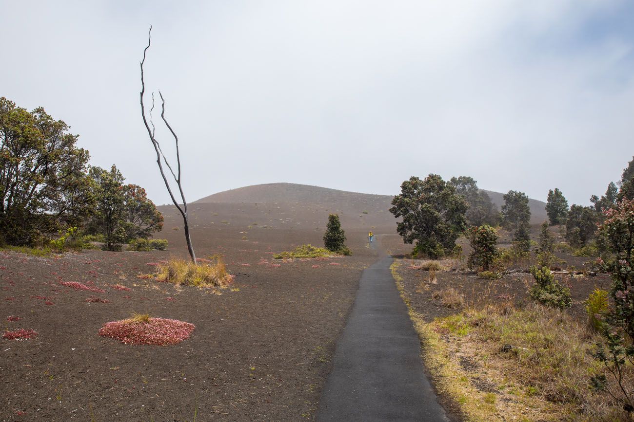
Along the walk, you will see brown, barren ground, a few charred trees, and small shrubs and trees which grow near the trail. Near the end of the trail is the Pu’u Pua’i Overlook where you will have a view of the Kīlauea Iki Crater.
Note: We thought this was just OK. If you only have one day in Hawai’i Volcanoes National Park, I think there are better places to put your time and energy.
6. Chain of Craters Road
Currently, Chain of Craters Road is 18.8 miles long. When it was constructed, it was 9 miles longer, but several lava flows in recent decades have covered not only the road, but also picnic areas, the Waha’ula Visitor Center, a black sand beach, and a heiau (an ancient Hawaiian sacred site).
Without stops, it takes roughly one hour to drive this road out-and-back. But it will take longer, since there are few key places to visit along the drive. There are no gas stations or restaurants along this road, although there are toilets at the turn-around at the end of Chain of Craters Road.
Starting near the Kīlauea Caldera, Chain of Craters Road heads south towards the coast. For the first part of the drive, you will wind through forests and past craters left behind from prior eruptions.
Once you emerge from the trees, this drive really begins to get interesting. Now you are crossing fields of lava. Much of what you are looking at really isn’t all that old, dating back to just a few decades ago.
From the Mau Loa o Maunaulu pull out you will look out over massive lava flows that crossed this road between 1969 and 1974.
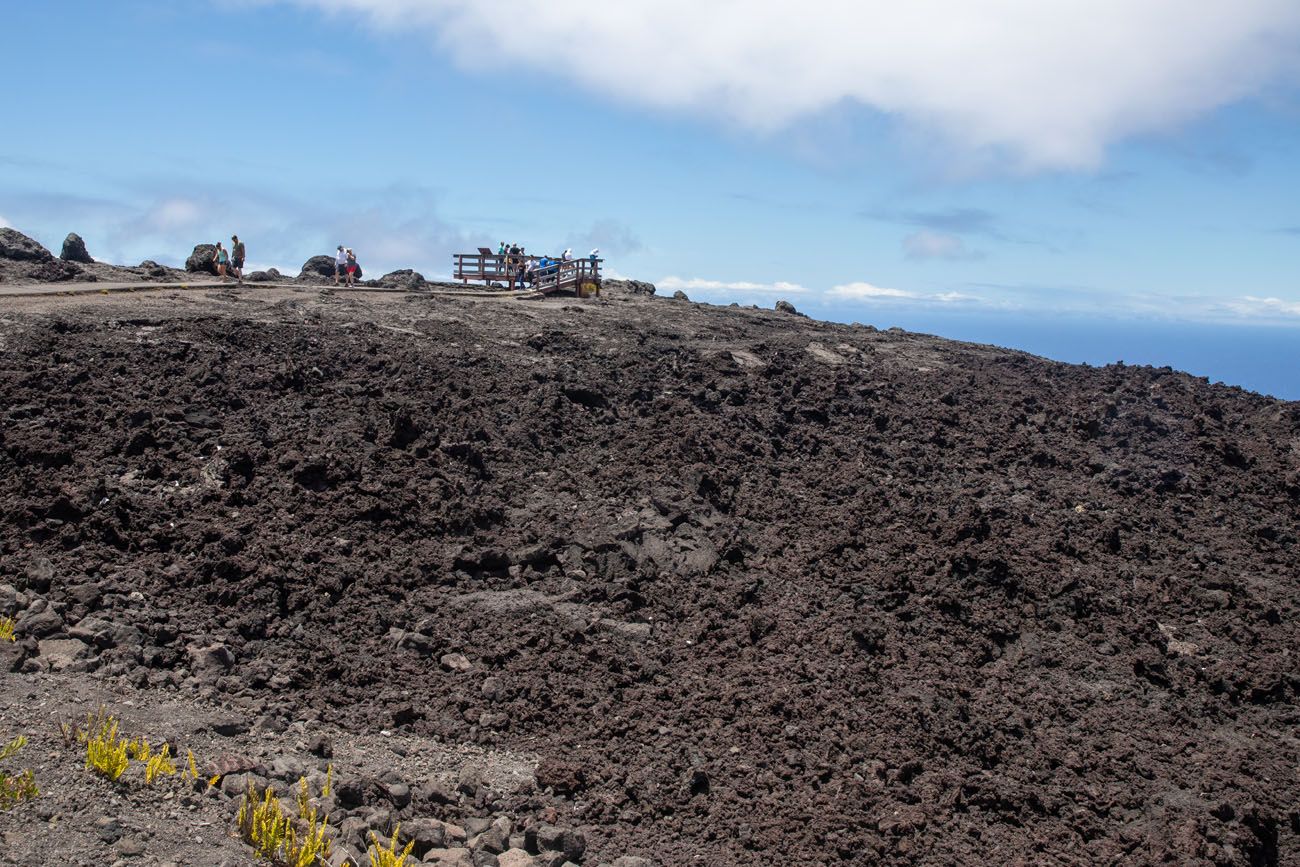
Mau Loa o Maunaulu pull out
Once you go around a tight curve, you will drop down to sea level and the views really open up. Now you are looking along the coastline and the dark remnants of past lava flows.
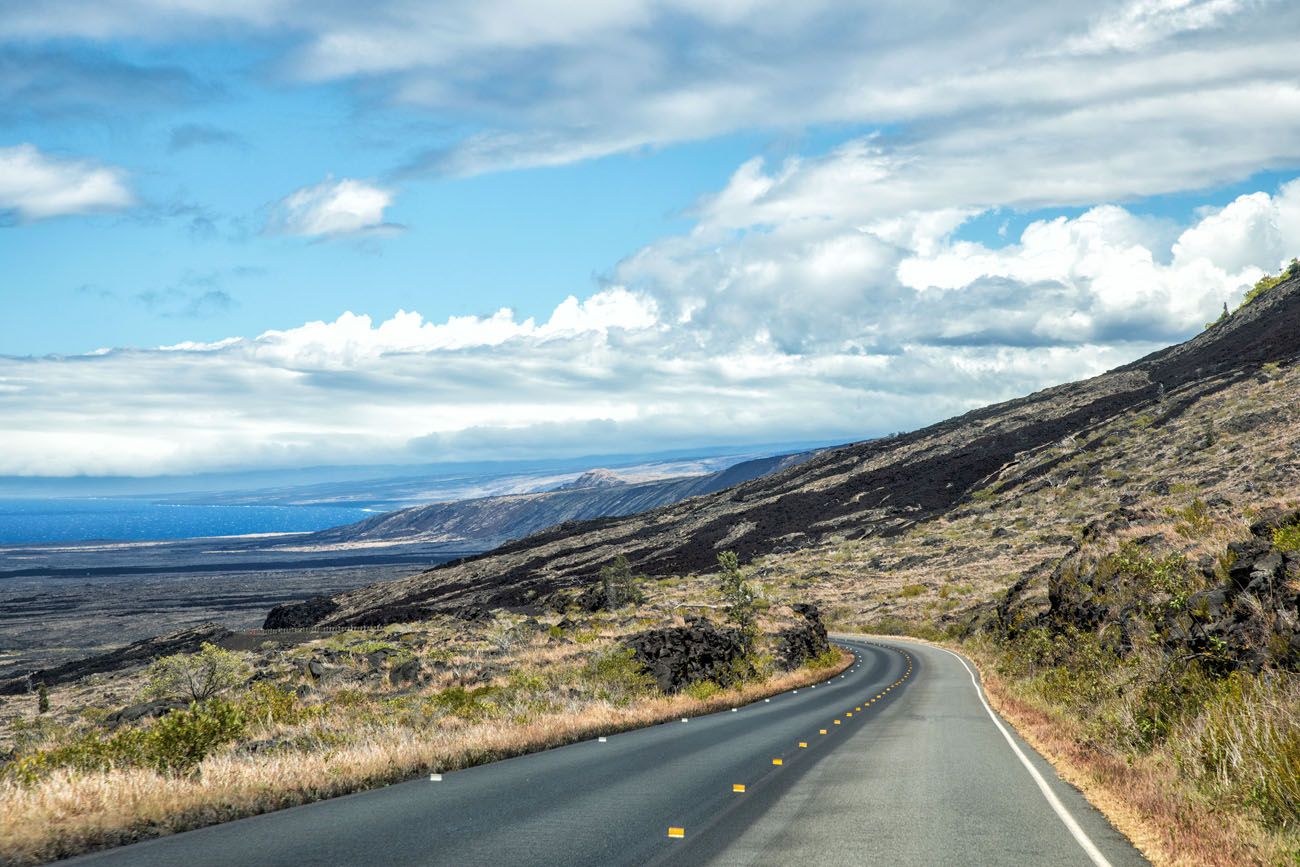
As you drive down Chain of Craters Road, this is one of the first views of the coastline.
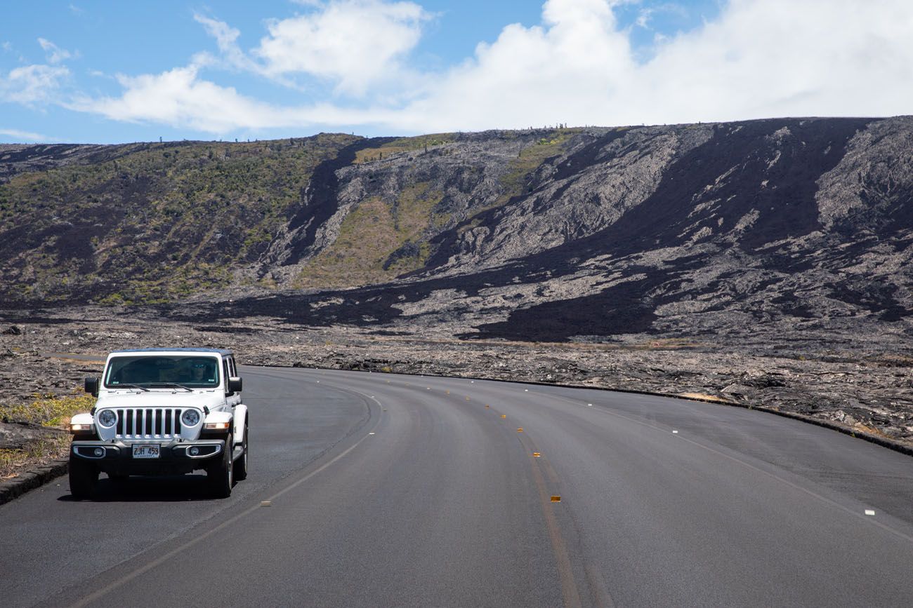
Another view of Chain of Craters Road.
Once on the coastline, you are driving through jet black lava. We stopped at a pull out and walked out to the coast for this awesome view.
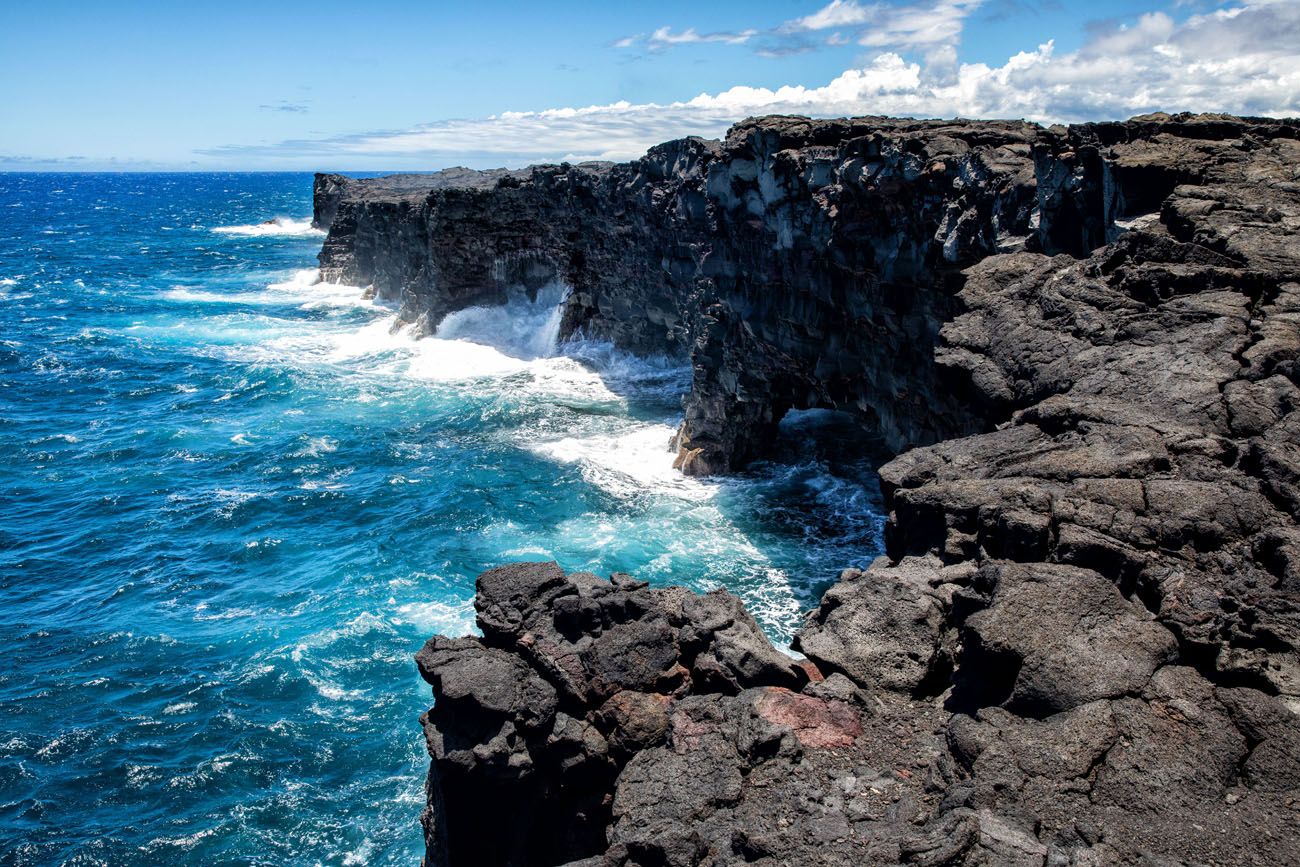
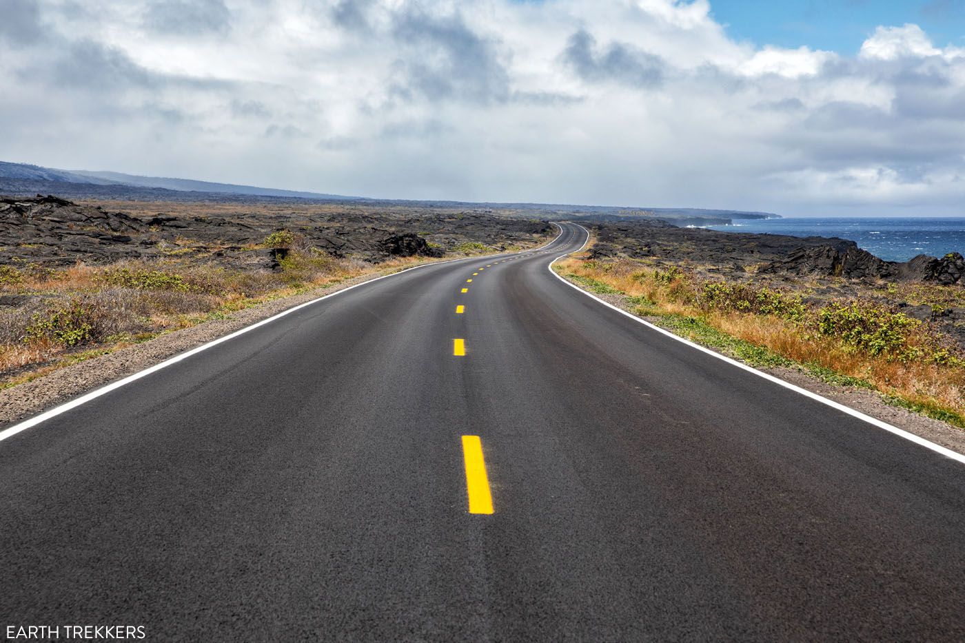
Chain of Craters Road as it heads east along the coast.
Before coming to the end of the road, you also have the opportunity to see the Pu’uloa Petroglyphs and see the Holei Sea Arch (both are mentioned next).
The road ends at a turn-around point. There are toilets here. Beyond this turn-around, the road once continued much farther. Lava flows in the late 20th century covered the road and added hundreds of acres to the park. You can walk to where the lava flow covered the road.
7. Hike out to the Pu’uloa Petroglyphs
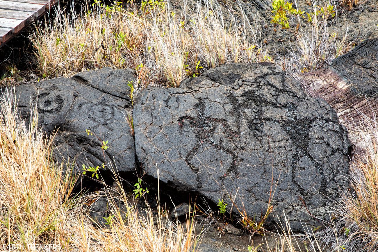
This is the best place in Hawai’i Volcanoes National Park to see petroglyphs.
Pu’uloa means “long hill” in Hawaiian. This sacred site contains over 23,000 petroglyph images that have been carved out on the hardened lava.
To get here, you will have to hike across the lava field. It’s 1.4 miles round-trip, easy to moderately difficult, and takes about an hour. For most of the hike, you will be on a dirt trail through the lava field. To see the petroglyphs, a boardwalk trail circles around some of the best images. As part of Leave No Trace, stay on the boardwalk to avoid damaging the petroglyphs.
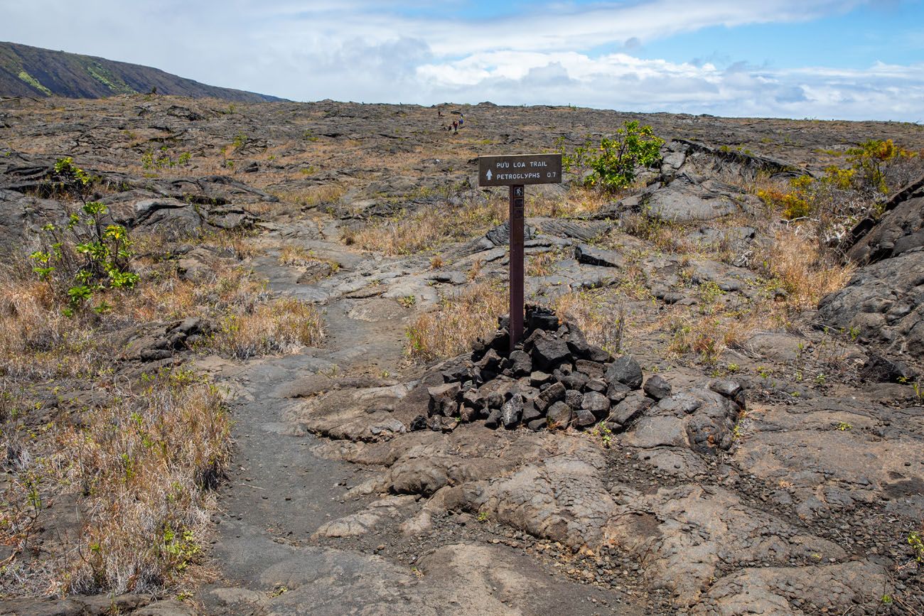
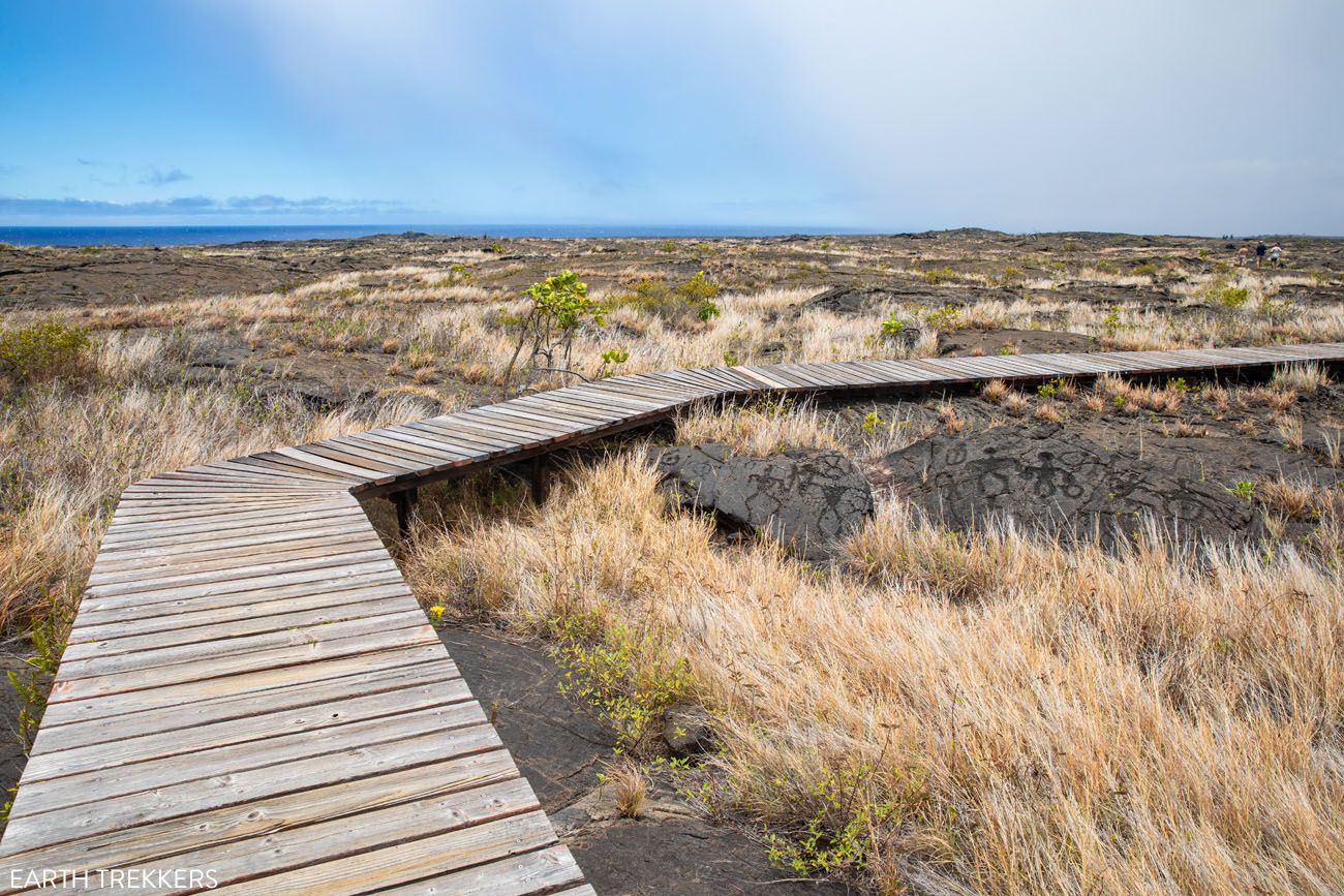
8. See the Holei Sea Arch
The Holei Sea Arch is a 550 year old arch located on the coastline. It is located at the end of Chain of Craters Road.
Until 2020, you could get a lot closer to the arch. There is a viewpoint very close to the arch, but this is now closed indefinitely, because of cracking on the coastal cliffs. To see the arch, you will walk across a lava field to a new viewpoint. If you have a telephoto lens, bring this with you for the best photo.
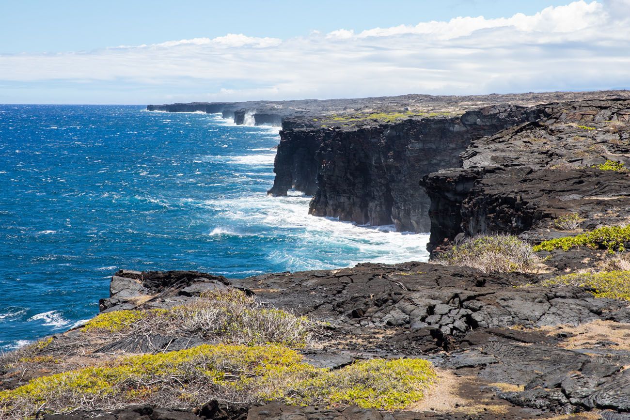
The view from the new viewpoint
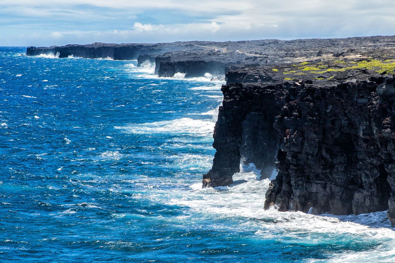
If you have a zoom lens you can get a better photo of the arch.
9. Visit Mauna Loa
For most visitors, seeing the sights around Kīlauea is enough to keep you busy for a solid day. But for those with more time, you can also visit Mauna Loa.
Mauna Loa is the massive volcano in the northeastern section of the park. It also dominates the skyline of the Big Island due to its sheer size.
Mauna Loa Lookout
The easiest way to visit Mauna Loa is to drive Mauna Loa Road to the Mauna Loa Lookout. From Mauna Loa Lookout, you are at almost 7,000 feet (over 2,000 meters) and you will have a decent view of Kīlauea Caldera and the coast. We did not do this, since clouds covered Mauna Loa on our visit, and from what I have read, this happens quite frequently.
You can see the view on the NPS website and determine if you think it is worth the drive (you should also check the website to see if Mauna Loa is erupting).
To get here, Mauna Loa Road is 11.2 miles long (one-way), unpaved, narrow, and very windy.
Note: This lookout is located part of the way up Mauna Loa. From this side of the volcano, you cannot drive to the summit.
Hiking to the Summit
The 11 mile road gets you to a viewpoint located on the side of Mauna Loa, but it doesn’t get you to the summit.
To get to the summit, you are going to need a pair of hiking shoes and a high level of fitness. From the Mauna Loa Overlook, it is a very strenuous 19 mile hike one-way to the summit. To do this, you will need a backcountry permit.
10. Visit the Kahuku Unit
The Kahuku Unit is a separate area of Hawai’i Volcanoes National Park. Located to the west of Kīlauea Caldera, on the slopes of Mauna Loa, is a cattle ranch. The Kahuku Ranch was once one of the largest cattle ranches in Hawaii.
Prior to the late 1700’s, this area was used by Hawaiians to gather resources and to visit religious sites. In 1793, cattle were brought to the island as a gift for King Kamehameha. The cattle were allowed to roam freely, which damaged the ecosystem. In the 1830’s, Mexican vaqueros were brought to the island to control the cattle. Kahuku became a cattle ranch which operated into the 1900’s.
In 2003, the Nature Conservancy helped the National Park Service purchase this land. It was added to Hawai’i Volcanoes National Park to conserve this area.
There are a handful of day hikes that you can do in the Kahuku Unit. Most of these are relatively short, ranging from a half-mile to 7 miles long.
Currently, the Kahuku Unit is only open from Thursday through Sunday from 8 am to 4 pm. Get updates on the National Park Service website.
Optional: Hike the Pu’u Huluhulu Trail
Distance: 2.5 miles out-and-back | Difficulty: Easy to Moderate | Time: 1 to 2 hours
On this hike, you walk through a landscape that has been dramatically altered by the 1969 to 1974 Maunaulu lava flow. Most of the hike is flat but near the end, it’s a short, steep climb up the Pu’uhuluhulu cone. Your reward is a rather unexciting view of a small, tree covered cinder cone.
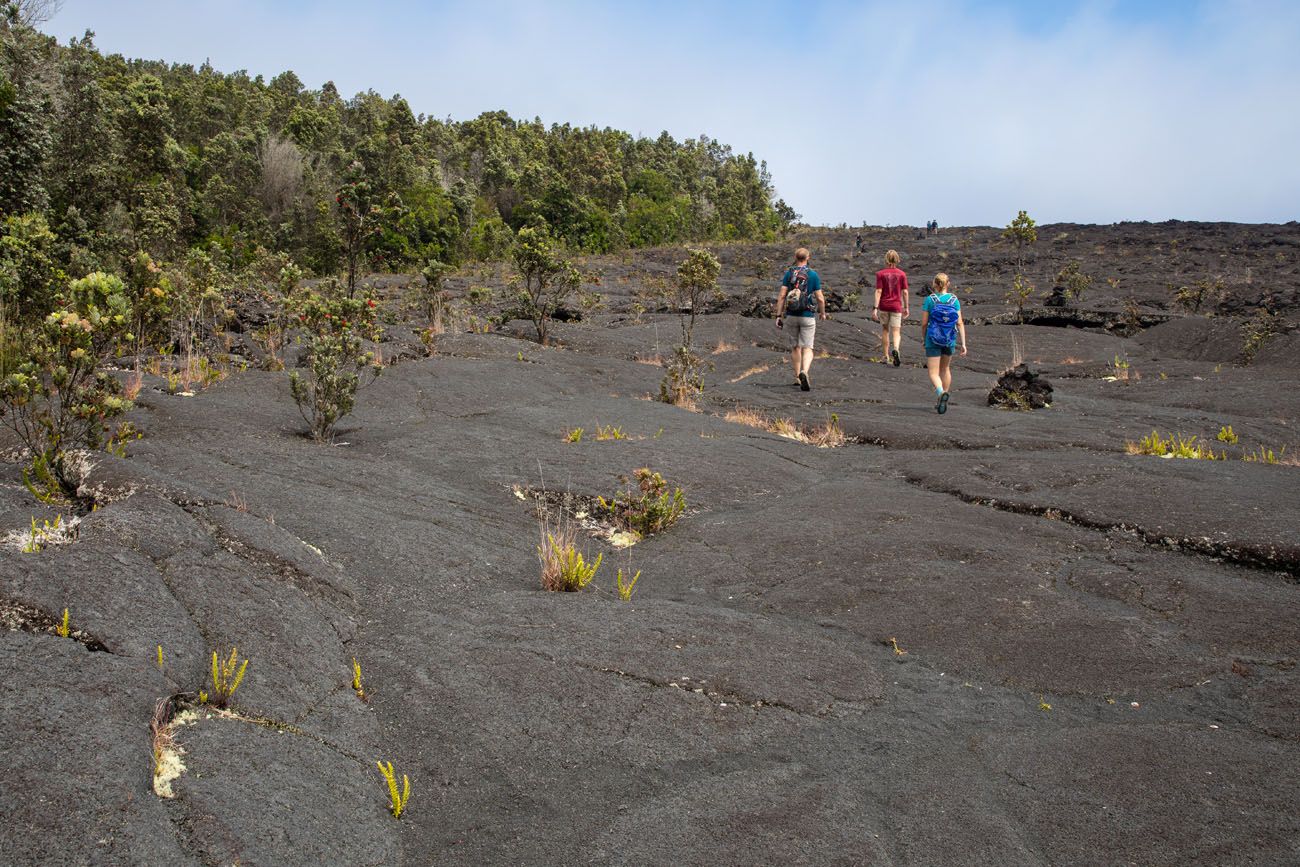
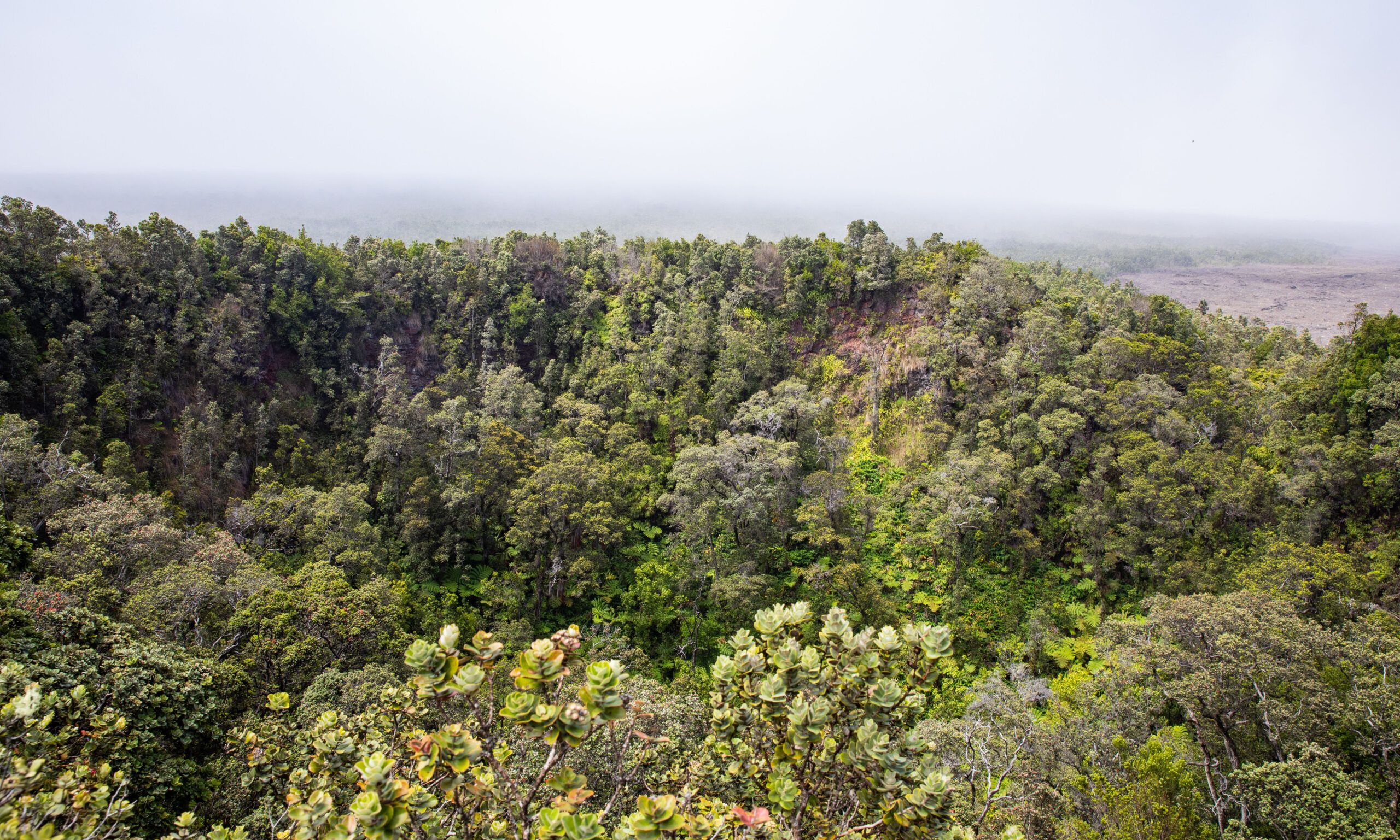
Pu’uhuluhulu Cinder Cone
I am including this hike in this post to be complete. We did this hike because we read on other sources that it’s a great hike. We did not feel the same way. But I still think that it is worth mentioning, so you know that it exists.
If you plan to do this hike, the National Park Service has a trail guide that you can download before your visit. The trail numbers correspond with information in the guide.
If you have more than one day in the park, it might be worth including this hike on your itinerary. But if you only have one day, I recommend putting your time and energy to the sights already mentioned.
Best Things to Do in Hawai’i Volcanoes National Park with Limited Time
Here is a list of the best things to do in Hawai’i Volcanoes National Park. All of these can be done in one day.
- See the Lava Flow (if Kīlauea is erupting)
- Drive Crater Rim Drive and visit the viewpoints
- Hike the Kīlauea Iki Trail
- Walk through the Thurston Lava Tube
- Drive Chain of Craters Road
- Hike to the Pu’uloa Petroglyphs
- See the Holei Sea Arch
Things to Do in Hawai’i Volcanoes National Park: On a Map
How to Use This Map: Click the icons on the map to get more information about each point of interest. To take this map with you, click the star next to the title of the map which adds it to your Google account. Next, within your Google Maps app, select ‘Saved’ and then select ‘Maps’. This map title will now appear in your list.
How Much Time Do You Need in Hawai’i Volcanoes National Park?
With one day in Hawai’i Volcanoes National Park, you have enough time to see the top sights in and around Kīlauea Caldera. This includes the above list of 7 things to do.
With two days in Hawai’i Volcanoes National Park, you can add on the Kahuku Unit and/or Mauna Loa.
If you plan to do backcountry camping or hike to the summit of Mauna Loa, plan on spending at least three days in Hawai’i Volcanoes National Park.
Best Time to Visit Hawai’i Volcanoes National Park
The best time to visit the park is when the lava is flowing. 😉
But even without an active volcanic eruption, this is still a great park to visit. If you are planning to visit Hawaii, it’s still worth visiting Hawai’i Volcanoes National Park, even without an active lava flow.
Hawai’i Volcanoes National Park can be visited all year. November through March is the wet season, so expect more rainfall during these months. The weather is drier from April through October. Crowds are their largest during the summer months.
For drier weather and lower crowds, the best time to visit Hawai’i Volcanoes National Park is in April, May, September, and October.
Hawai’i Volcanoes National Park appears in our Best US National Parks in January and Best US National Parks in April articles. For more information about the best times to visit the national parks, check out our Best National Parks Month-by-Month Guide.
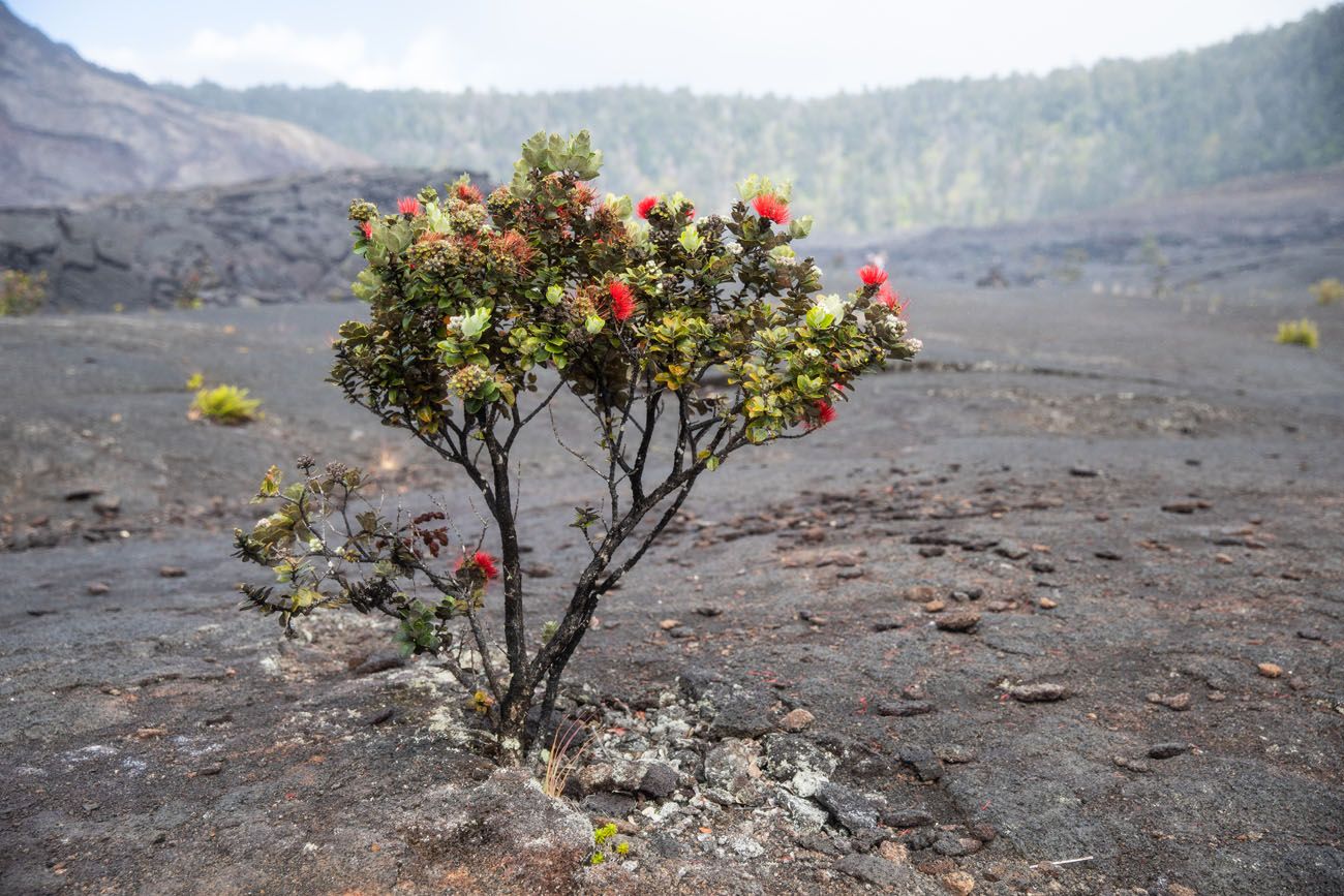
ʻŌhiʻa trees are beautiful trees that are endemic to Hawaii. They are one of the first plants to colonize lava beds so they are essential in starting the growth of new forests. In recent years, a fungus is infecting these trees, killing them. Called Rapid ʻŌhiʻa Death (ROD), there are things you can do as a visitor to Hawaii to help prevent the spread of this fungus. Don’t touch the trees, clean your hiking boots and clothes after hiking in areas with ʻŌhiʻa trees, and report diseased trees to the National Park Service. Learn more here.
How to Get Here
Hawai’i Volcanoes National Park is located in the southeast corner of the Big Island.
To get to the Big Island, there are two major airports.
Hilo is the closest city and airport to Hawai’i Volcanoes National Park. From Hilo, it is a 30 mile drive to the park which takes about 45 minutes.
Kailua-Kona is farther away but has a larger airport, so you might find more convenient flights into Kailua-Kona. To get to the park, it is about a 100 mile drive that takes between 2 and 3 hours.
To drive between Kīlauea Visitor Center and the Kahuku Unit, it is a 43 mile drive that takes about one hour.
Where to Stay
Inside the Park
The only lodging inside of the park is the Volcano House. Dating back to 1846, this lodge offers views of the Kīlauea caldera. There are 33 guest rooms as well as a dining room and gift shop. Both Mark Twain and President Franklin D. Roosevelt have stayed here.
There are also two campgrounds in the park: Namakanipaio Campground (which is operated by the Volcano House) and Kulanaokuaiki Campground. Learn more here.
Outside of the Park
Hilo is the closest city to the national park. From Hilo, it is a 45 minute drive to get to the Kīlauea Visitor Center. Orchid Tree B&B, Old Hawaiian Bed and Breakfast, and Howzit Hostels all get rave reviews.
Kailua-Kona is farther away, but more convenient for many travelers, due to its easier accessibility by plane. It’s a long drive to get to the park (2 hours and 105 miles if you take Highway 200 to Hilo and drive south from here) but it is doable, even if you only have one day in Hawai’i Volcanoes National Park.
We stayed in Kailua-Kona for both of our visits. In the morning, I recommend driving right to the park. If you still have time at the end of the day, you can add Punalu’u Beach and the southernmost point onto the drive back to Kailua-Kona.
In Kailua-Kona, we stayed at the Courtyard by Marriott King Kamehameha’s Kona Beach Hotel. It is conveniently located within walking distance of the shops and restaurants on Ali’i Drive in town. It is also the host hotel for the Ironman World Championship. Also in and around Kailua-Kona, Holua Resort, Beach Villas Kahaluu on Kona Coast, and the Kona Coast Resort all get great reviews.
Important Note: If you plan to visit in Hawai’i during October, take note of the date of the Ironman World Championship. Hotels in and around Kailua-Kona will sell out months, if not a year, in advance, and at race time, roads around town will close. Typically, this event takes place the second weekend in October.
Tips to Have the Best Experience
If you want to visit the Thurston Lava Tube and/or hike the Kīlauea Iki Trail, do this first thing, since parking is limited. We got to the Kīlauea Iki trailhead parking lot a little bit before 9:30 am and had no trouble finding a parking space. By the time we finished the hike, just before 11 am, the parking lot was completely full.
Leave No Trace. Practice the seven principles of Leave No Trace. This includes packing out what you bring to the hiking trail, be considerate of other hikers, and leaving archaeological artifacts as you found them.
Pack a Picnic Lunch. Dining options are limited inside of the park. You can get food at the Volcano House and at the Kilauea Military Camp. Once you head out towards the coast, there are no facilities, so pack some snacks at a minimum, but lunch is even better, especially if you will be here midday.
Cellular Service. We use Verizon and we had limited cellular service near the Kīlauea Visitor Center. Once on Chain of Craters Road, we had no cellular service. Do not expect to text, email, or access the internet from your phone while inside the park, unless you are near the Kīlauea Visitor Center.
Plan Your Visit
Park Hours: With the exception of the Kahuku Unit, Hawai’i Volcanoes National Park is open 24 hours a day, 365 days per year. The Kahuku Unit is open Thursday through Sunday from 9 am to 4 pm.
Entrance Fee: $30 per non-commercial vehicle, valid for 7 days
Get updates on road conditions and trail closures, as you plan your trip and just before your visit, on the National Park Service website.
If you have any questions about the best things to do in Hawai’i Volcanoes National Park, or if you would like to share your experience, let us know in the comment section below.
More Information about Hawaii
Read all of our articles about Hawaii in our Hawaii Travel Guide and the United States in our United States Travel Guide.
Header photo credit: Yvonne Baur/shutterstock.com



Comments 10