With enormous sand dunes, cinder cones, lava beds, and the densest population of Joshua Trees in the world, Mojave National Preserve is home to a wide variety of landscapes. This is a fun place to explore and makes a great addition to a southern California road trip. In this guide, we cover the best things to do in Mojave National Preserve with helpful tips to plan your visit.
What is Mojave National Preserve?
Mojave National Preserve, with a size of more than 1.5 million acres, is the third largest unit in the US National Park System within the contiguous United States. In the contiguous United States, Death Valley National Park is the largest (3.4 million acres), Yellowstone National Park comes in second (2.2 million acres), and Everglades National Park comes in 4th.
Mojave National Preserve is not a national park. It is a national preserve, which means that the land is protected by an act of Congress but hunting and mining are still permitted. National Preserves are managed by the National Park Service and some preserves have maintained hiking trails and even a visitor center.
Mojave National Preserve is home to the largest and densest population of Joshua Trees in the world (even more so that its nearby neighbor, Joshua Tree National Park).
The preserve sits at a high elevation so temperatures are cooler here than what you might expect for southern California. Average highs in the summer are in the low 90’s, sometimes getting above 110°F on unusually hot days. In the winter, a dusting of snow is a possibility. On our visit in February, we were here on one of the rare days that it snows.
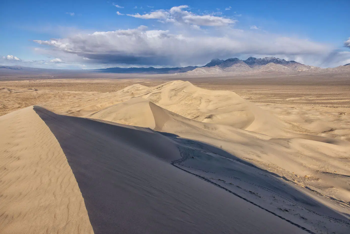
Kelso Dunes | Best Things to Do in Mojave National Preserve
Geography and Maps of the Park
Mojave National Preserve covers a large area of land. There are numerous roads the run through the park, some of which are paved, some are gravel, and some are remote, sandy roads. The main highlights of the park (Teutonia Peak Trail, Kelso Dunes, and Hole in the Wall) can all be accessed on paved roads.
The area around Cima Dome and Cima Road is the best place to see the Joshua Trees. However, a fire in 2020 and 2023 wiped out a large portion of this forest. We could see the burnt remains of these trees during our visit in 2022 but since the second fire, less of these trees stand. Learn more on the National Park website.
There are numerous entrances into the preserve. Since this is not a national park, there are no entrance booths or national park fees.
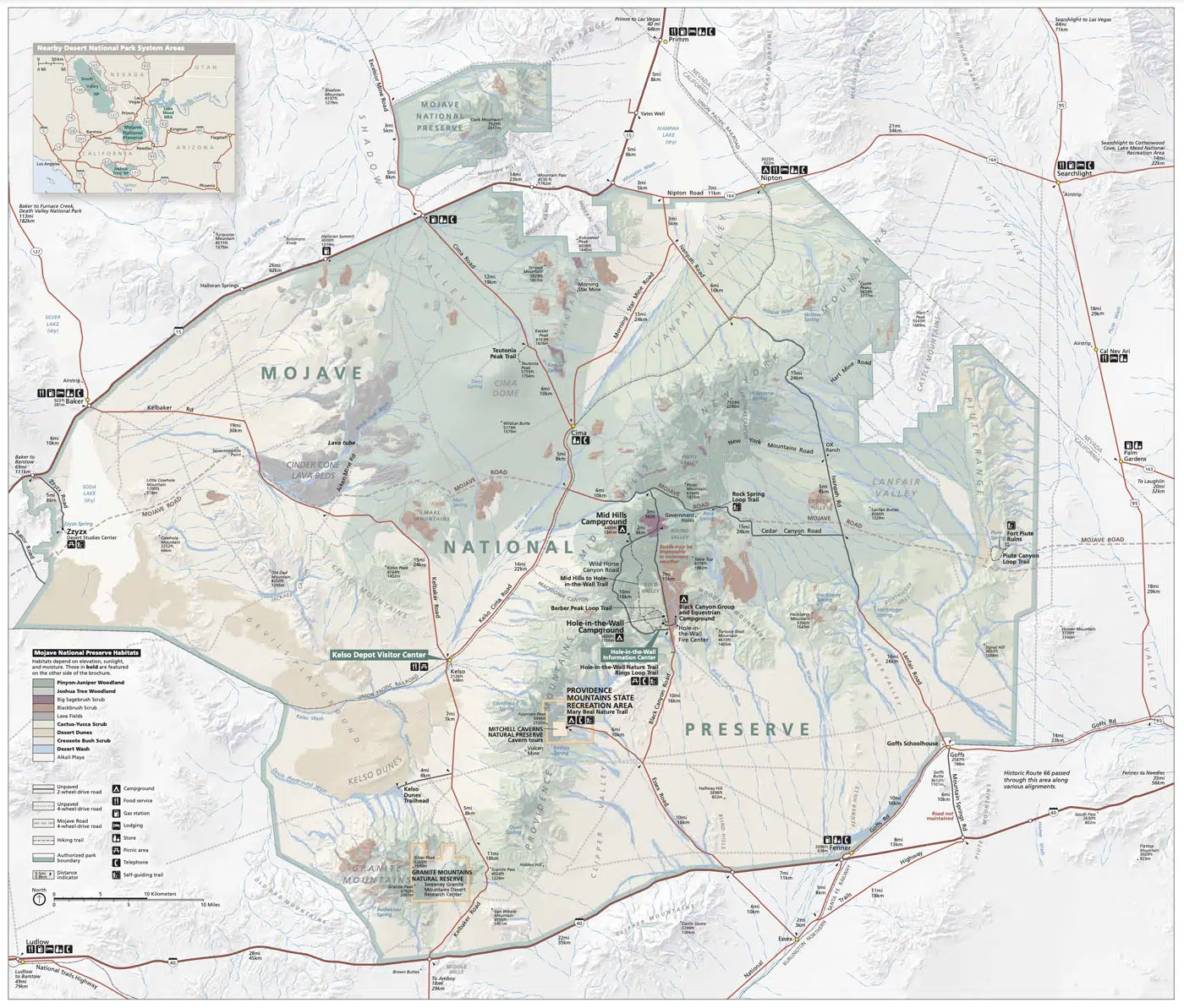
National Park Service map of Mojave National Preserve
Here is our map of the things to do in Mojave National Preserve with a driving route that connects the top sights in the preserve.
How to Use This Map: Click the tab in the top left corner of the map to see a list of the points of interest and to turn layers on/off. Click the icons on the map to get more information about each point of interest.
To take this map with you, click the star next to the title of the map which adds it to your Google account. Next, within your Google Maps app, select ‘Saved’ and then select ‘Maps’. This map title will now appear in your list.
Top 10 Things to Do in Mojave National Preserve
We spent two days exploring the Mojave National Preserve. Below I list our top 10 experiences in the preserve, a good starting point for planning your visit. After this section, I list a few more things to do in the Mojave National Preserve, if you have more time.
1. See the Joshua Trees
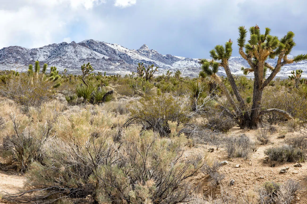
The Mojave National Preserve is home to more Joshua Trees than any other place on Earth. There are more Joshua Trees here than at nearby Joshua Tree National Park.
The best place to see the Joshua Trees are along Cima Road, near the Teutonia Peak hiking trail. The forest on Cima Dome and Shadow Valley is the largest in the world. Note: our photos were taken in 2022 before the August 2023 fire at Cima Dome.
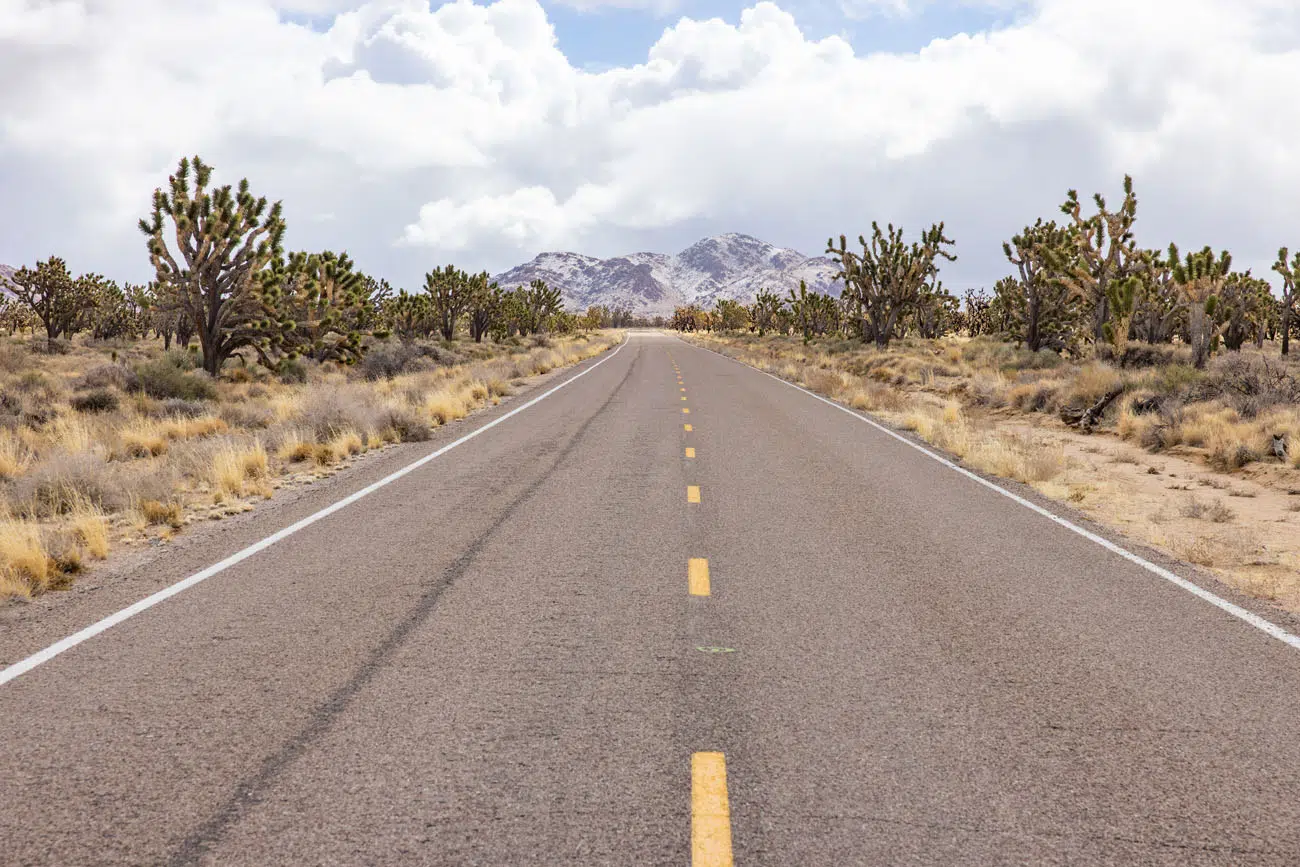
Cima Road | Best Things to Do in Mojave National Preserve
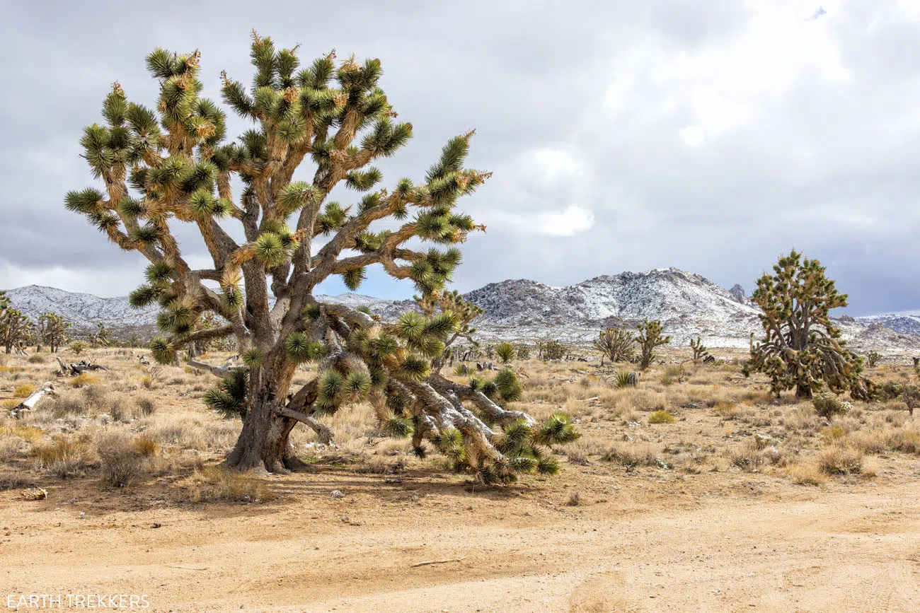
Joshua Trees (and snow in February)
In August 2020, a lightning strike started a fire that ripped through the area, killing 25% of the Joshua Trees. The burned trees were still standing on our visit in 2022. You can see them along Cima Road and on the Teutonia Peak Trail. Read more about the fire here. And since our visit, a second fire occurred at Cima Dome.
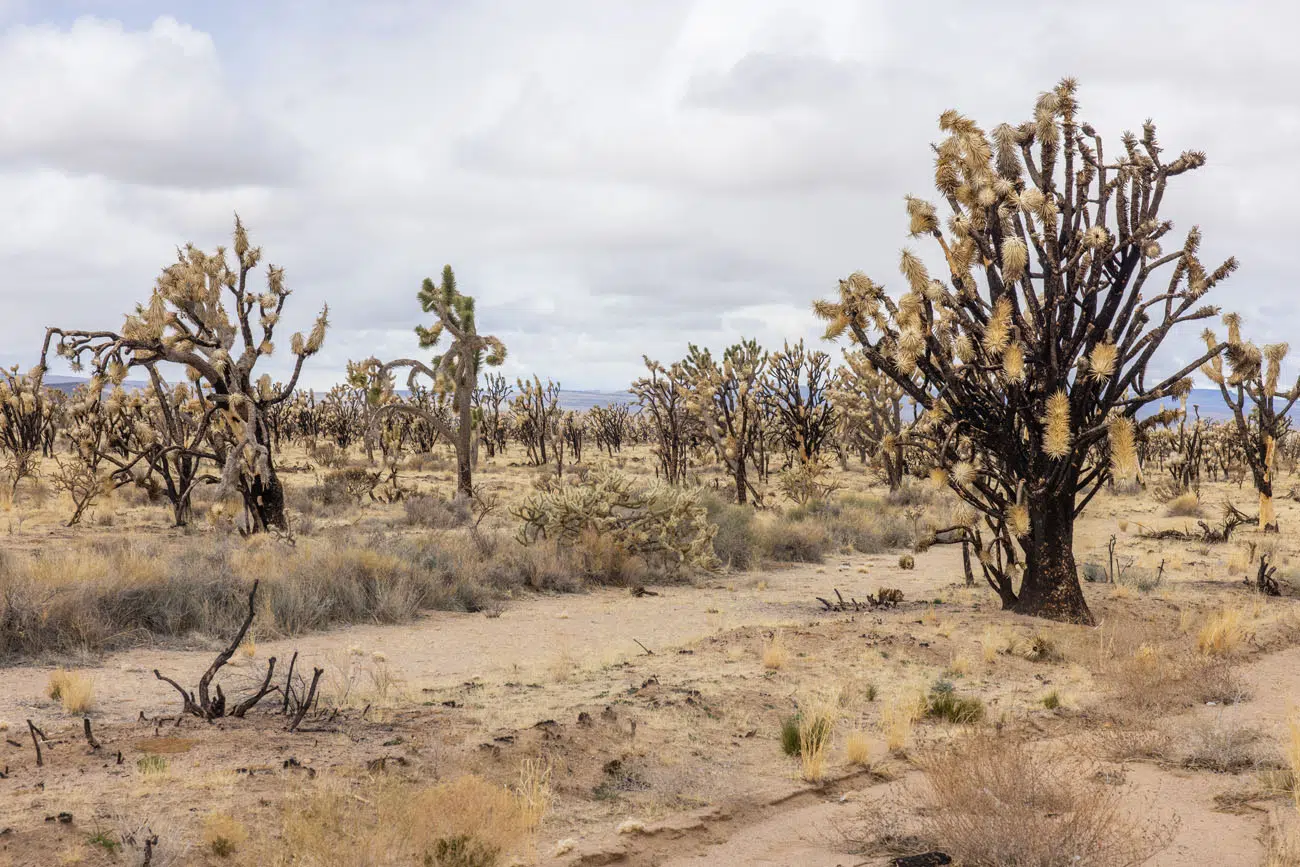
Burned Joshua Trees from the 2020 fire, photo taken in 2022
What is a Joshua Tree? The Joshua Tree, Yucca brevifolia, is a member of the agave family. These spiky trees may have served as inspiration for Dr. Seuss’ Truffula trees, mentioned in The Lorax. Joshua Trees only grow in the Mojave Desert, usually between 2,500 and 5,000 feet of elevation.
2. Teutonia Peak Trail
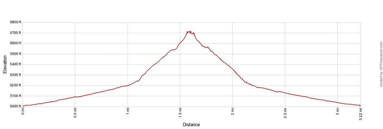
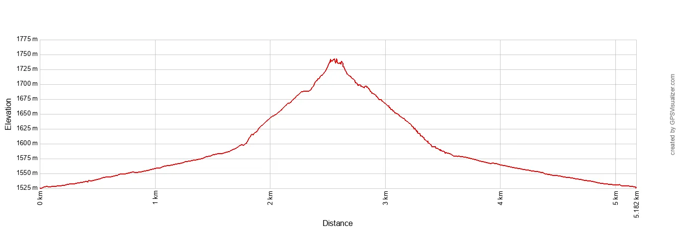
Distance: 3.25 miles (5.2 km) round trip (out-and-back)
Difficulty: Moderate
Total Ascent: 750 feet (230 m)
Starting Elevation: 5,000 feet (1,525 m)
Highest Elevation: 5,720 feet (1,743 m)
Time: 1.5 to 3 hours
Location: Cima Road
Teutonia Peak Trail Elevation Profile
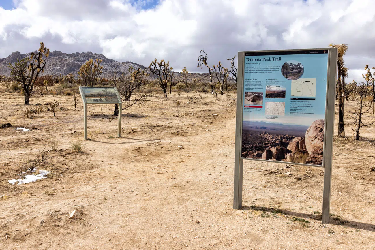
Teutonia Peak Trailhead | Best Things to Do in Mojave National Preserve
This trail starts off flat and easy, as you walk through a forest of Joshua Trees. Some of these trees were burned in the 2020 fire but many are still very green and healthy.
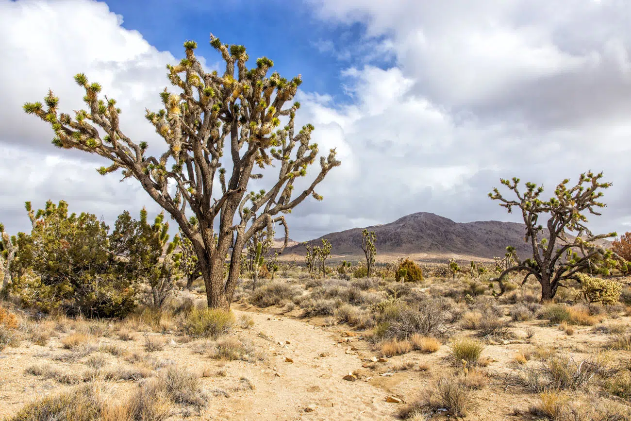
Teutonia Peak Trail | Best Things to Do in Mojave National Preserve
Teutonia Peak is a small mountain that is covered with boulders. The trail weaves its way up this peak, ending on top of the mountain, where you have panoramic views over the preserve.
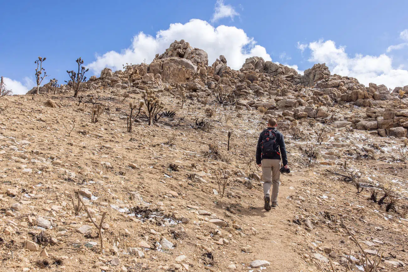
Trail to Teutonia Peak | Best Things to Do in Mojave National Preserve
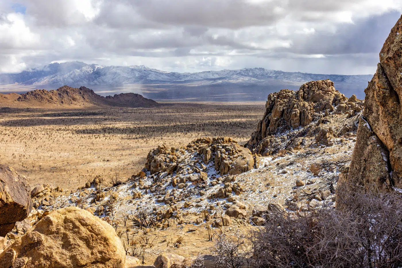
View from Teutonia Peak | Best Things to Do in Mojave National Preserve
The trail is well marked with trail signs and rock cairns. It’s a great hike to do if you want close-up views of the Joshua Trees and for the views over Mojave National Preserve.
3. See the Mojave Memorial Cross
Not far from Teutonia Peak Trail is the Mojave Memorial Cross, which was erected in 1934 to commemorate American war veterans. It stands on Sunrise Rock, which is officially on private property. This cross was the subject of a legal battle and is officially known as the White Cross World War I Memorial.
Location: Cima Road near Teutonia Peak Trail
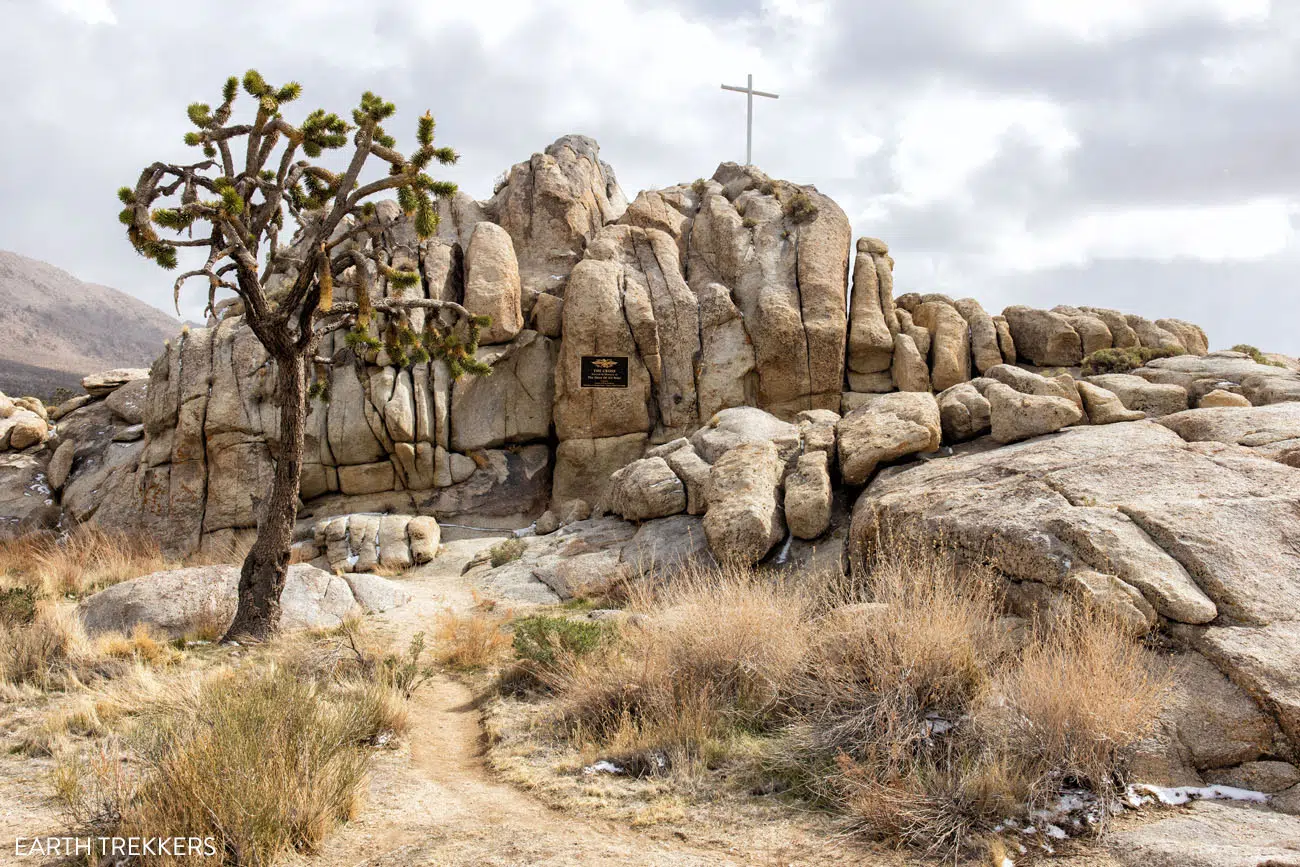
Mojave Memorial Cross | Best Things to Do in Mojave National Preserve
4. Hole-in-the-Wall Rings Trail
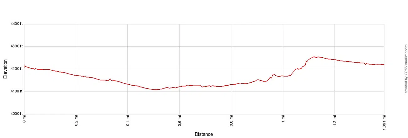
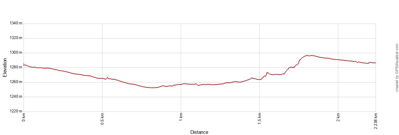
Distance: 1.4-mile (2.2 km) loop
Difficulty: Easy
Total Ascent: 175 feet (53 m)
Lowest Elevation: 4,110 feet (1,253 m)
Highest Elevation: 3,080 feet (940 m)
Time: 30 to 60 minutes
Location: Hole-in-the-Wall
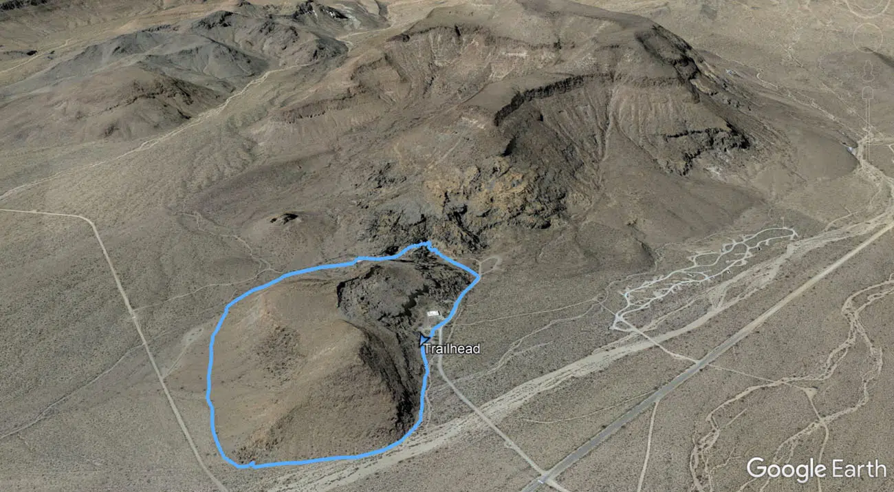
Hole in the Wall Rings Trail Map
Hole in the Wall Rings Trail Elevation Profile
This short hike is one of our favorite experiences in Mojave National Preserve. The scenery is much different than other areas of the preserve, and with the added bonus of rock scrambling up the rings, this hike is fun to do.
The trail makes a loop, starting at the Hole-in-the-Wall Information Center. You can go in either direction. We did the hike in a clockwise direction, which saves the rings for the very end of the hike. If you do this hike in a clockwise direction, you also get to climb up the rings, rather than down them, which I think is easier.
About five minutes into the hike, you come to a pile of boulders. Look closely for petroglyphs on these boulders. The area is marked with an informational sign like the one in the photo below.
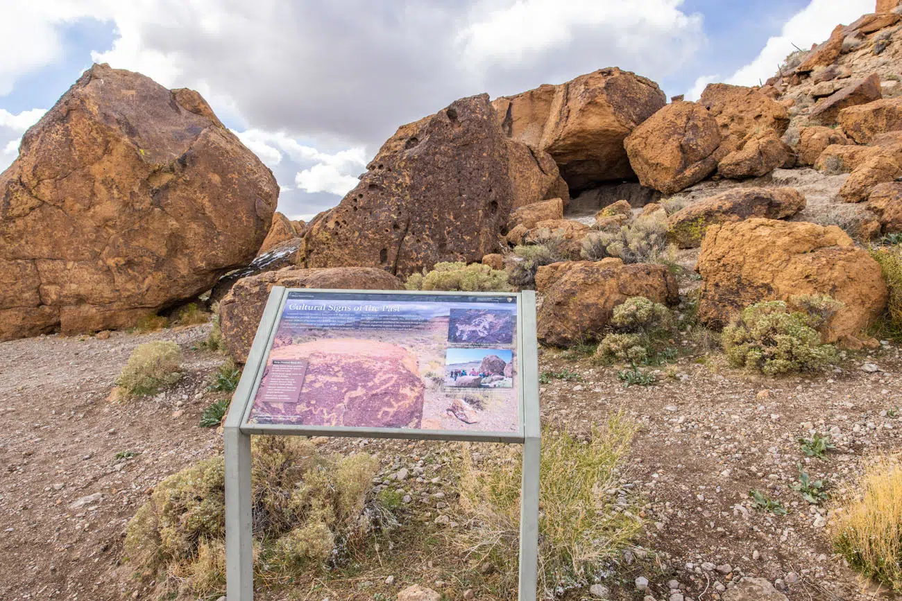
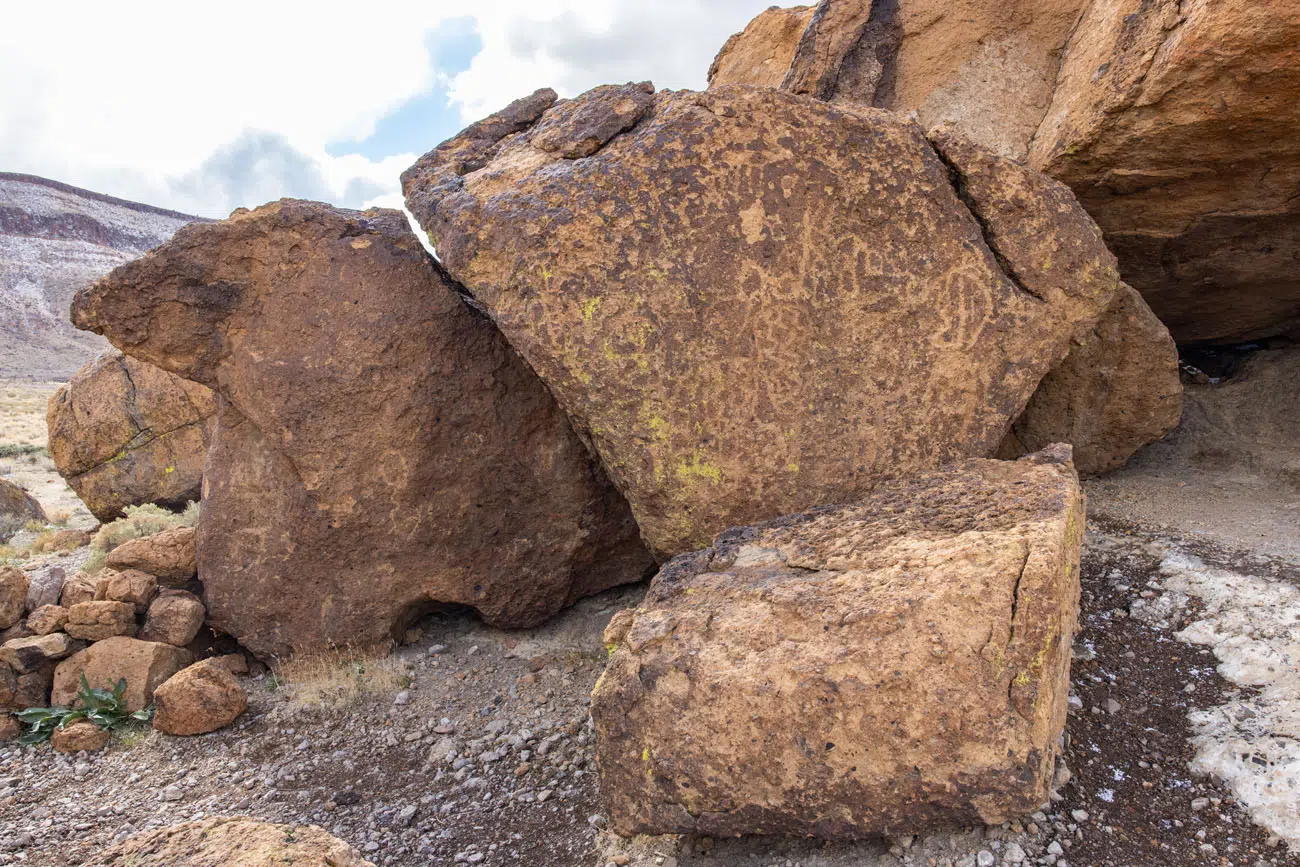
Petroglyphs on the Rings Trail | Best Things to Do in Mojave National Preserve
Beyond the petroglyphs, you walk through a valley with views of mountains off in the distance.
The best part of the hike is Banshee Canyon. Here, the rock walls have giant pock marks, giving this area a very unique appearance. In the canyon, you will do some rock scrambling, sometimes with the aid of metal rings that are bolted onto the rocks.
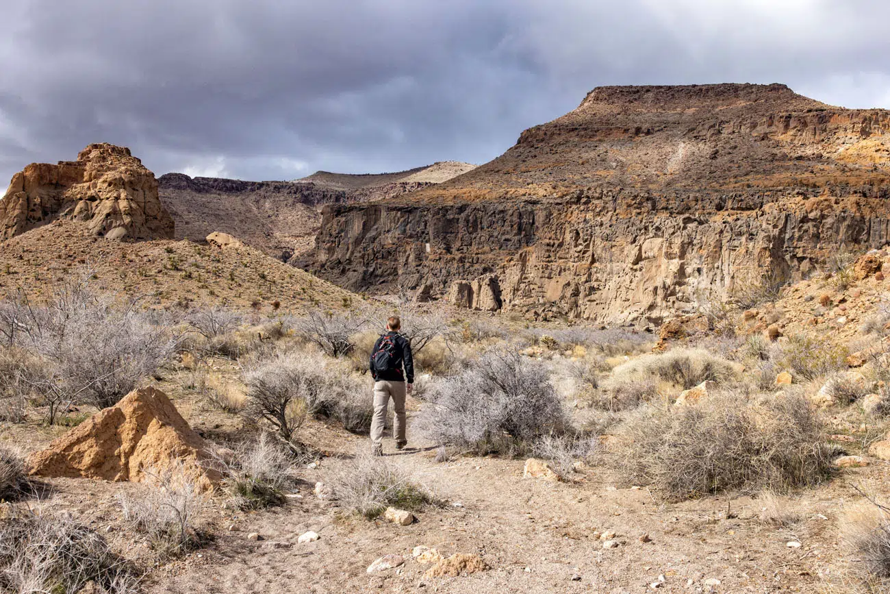
Heading into Banshee Canyon
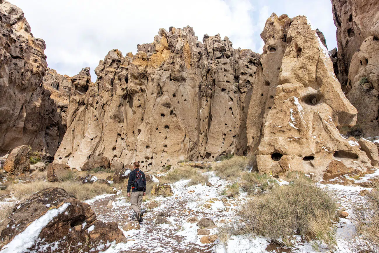
Banshee Canyon | Best Things to Do in Mojave National Preserve
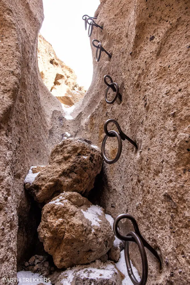
There are two sections with metal rings. This is the first and the longest of the two sections.
The trail ends at a road near the campground. Follow the road back to the parking lot to complete the loop.
GETTING HERE: The Hole-in-the-Wall Information Center and Rings Trail Trailhead is located on Black Canyon Road, 28 miles north of I-40. From I-40, take Essex Road north to Black Canyon Road and the Hole-in-the-Wall Information Center will be on the left hand side of the road. These roads are paved the entire way. You can also get here by driving south on Black Canyon Road. Black Canyon Road north of Hole-in-the-Wall is unpaved but is suitable for standard vehicles as long as it is not wet or raining. We hiked Teutonia Peak, saw the Mojave Memorial Cross, and then drove Kelso-Cima Road to Cedar Canyon Road to Black Canyon Road to Hole-in-the-Wall. Most of these roads are unpaved but they were well graded during our visit and suitable for standard vehicles.
5. Boulders Viewpoint
From the Boulders Viewpoint, you get a view of giant piles of boulders. These stacks of boulders look very similar to the scenery in Joshua Tree National Park. You can simply take in the view from the parking lot or walk the short trail for a closer view.
Location: Kelbaker Road near I-40
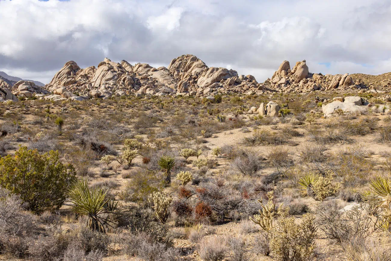
Boulders Viewpoint | Best Things to Do in Mojave National Preserve
6. Kelso Dunes
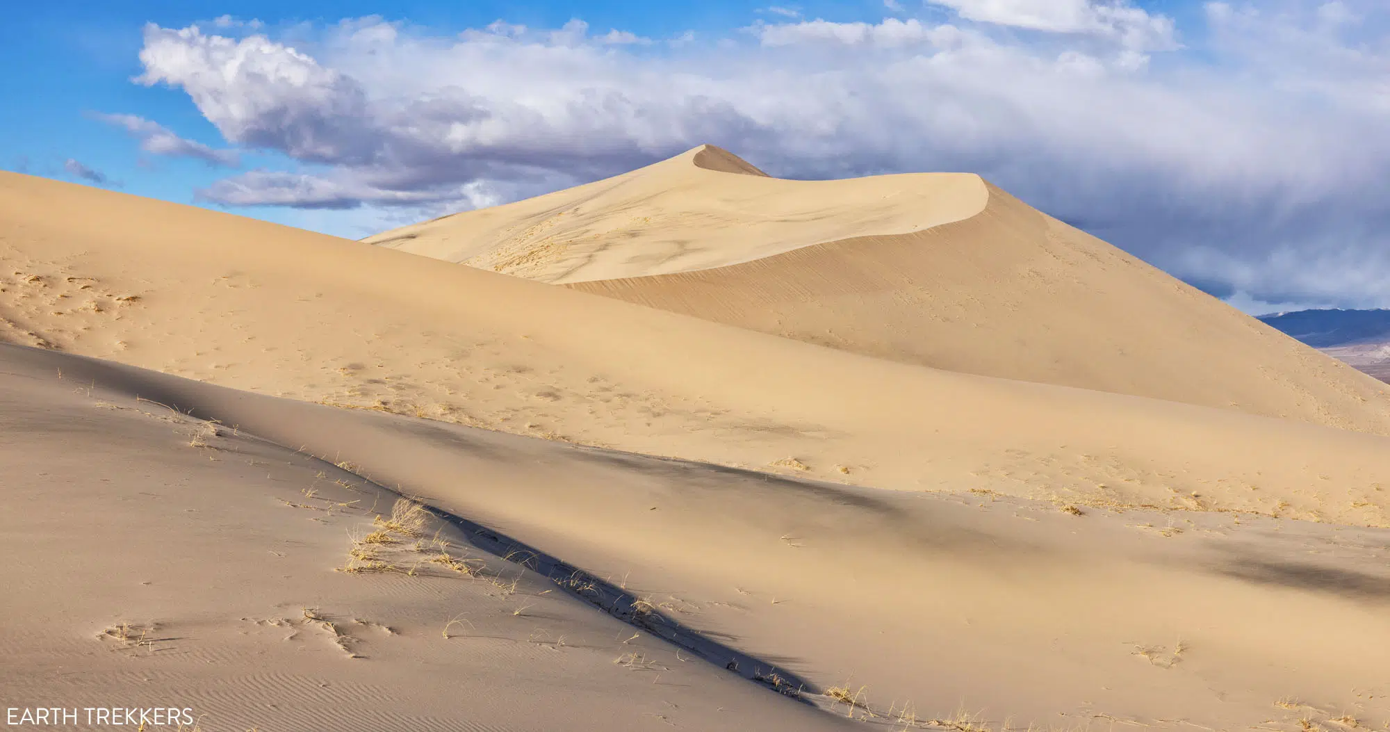
The Kelso Dunes is the most popular hiking destination in the Mojave National Preserve. To get to the top, it is a short but tough hike. Hiking uphill in the sand is a lot more challenging than it looks.
For those who don’t want to go that far, you can hike a short distance into the dunes and explore the lower dunes. But if you want to stand on the highest dune, here are the hiking stats.
Kelso Dunes Hiking Stats
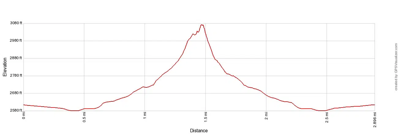
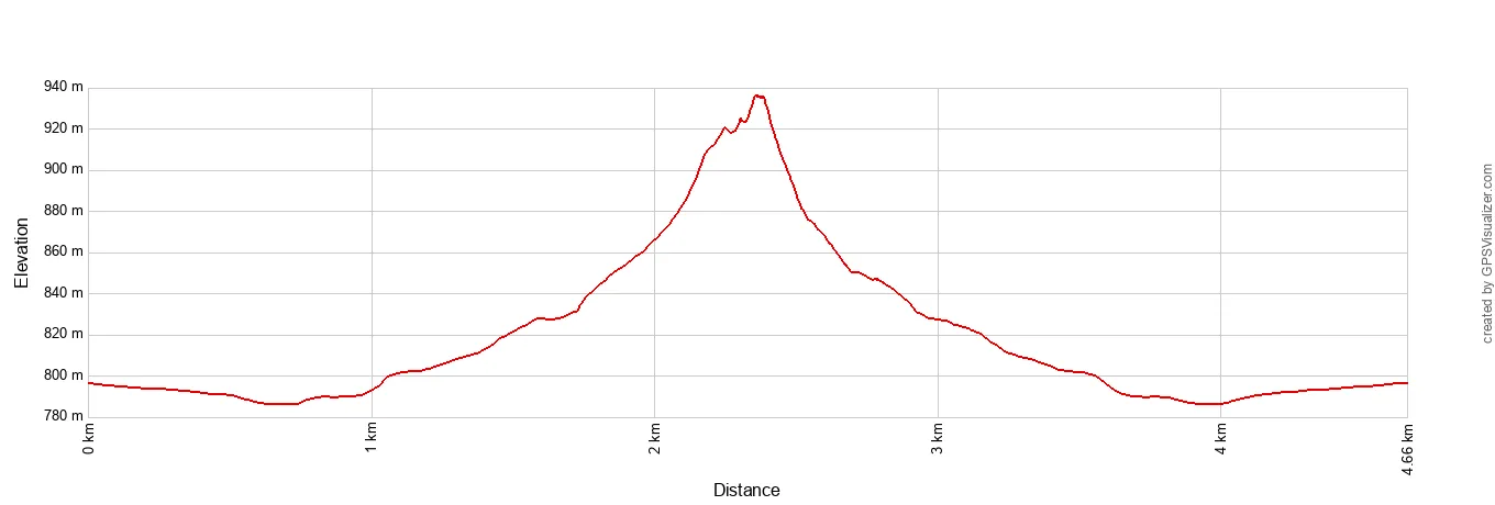
Distance: 2.9 miles (4.66 km) round trip (out-and-back)
Difficulty: Strenuous
Total Ascent: 650 feet (198 m)
Starting Elevation: 2,580 feet (786 m)
Highest Elevation: 3,080 feet (940 m)
Time: 1.5 to 3 hours
Kelso Dunes Elevation Profile
The parking area is located on Kelso-Dunes Road. From Kelbaker Road, turn onto Kelso-Dunes Road, which is a rough, gravel road that is suitable for standard vehicles.
From the parking lot, the trail starts off flat and gravelly. Enjoy it. Before long, the trail changes to thick sand and you start the uphill walk into the dunes.
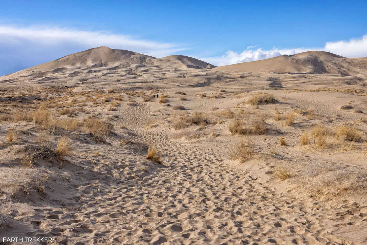
At the beginning of the Kelso Dunes Trail
Once in the dunes, there are multiple trails that lead in the same general direction. These break off and then rejoin again later, but basically you want to be heading up to the highest dune.
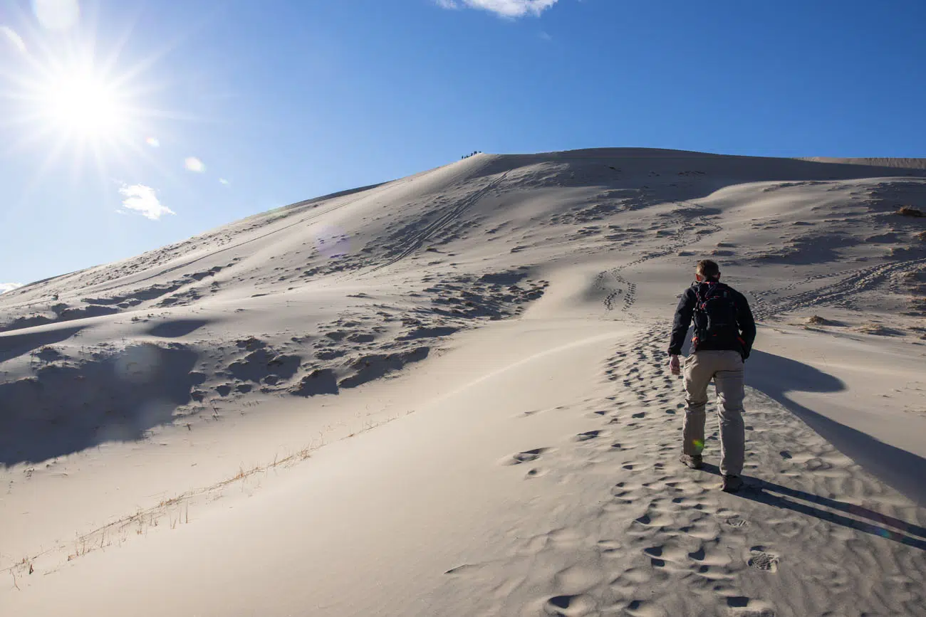
The last half of a mile is the toughest. The dunes are steep and the shifting sand makes it even more difficult. You take one step forward and then sink backwards half a step. It’s slow, it’s a bit frustrating, but it’s worth it. The view from the top is the best view in Mojave National Preserve.
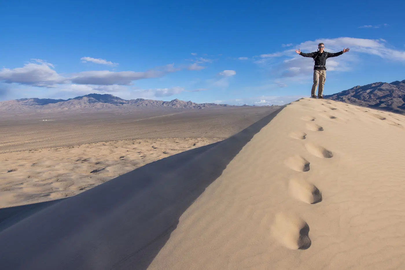
Tim on top of the tallest dune
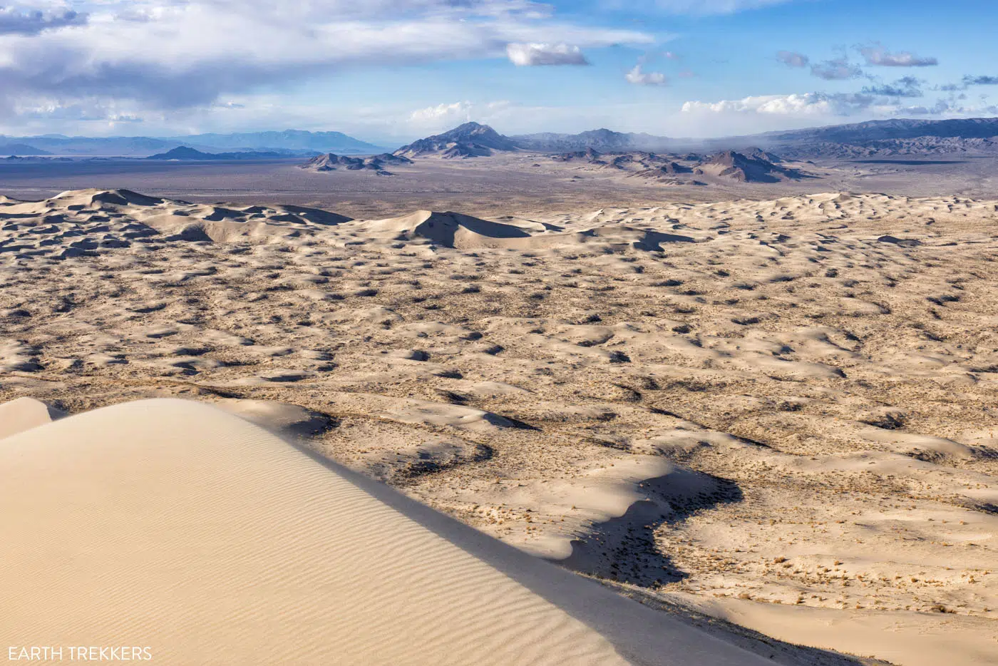
View from the Kelso Dunes | Best Things to Do in Mojave National Preserve
Getting back to your car is much easier and tons of fun. We ran down the steep slope of the highest dune and then it was a downhill walk. It’s much easier to enjoy the views of the dunes on the walk back to the parking lot.
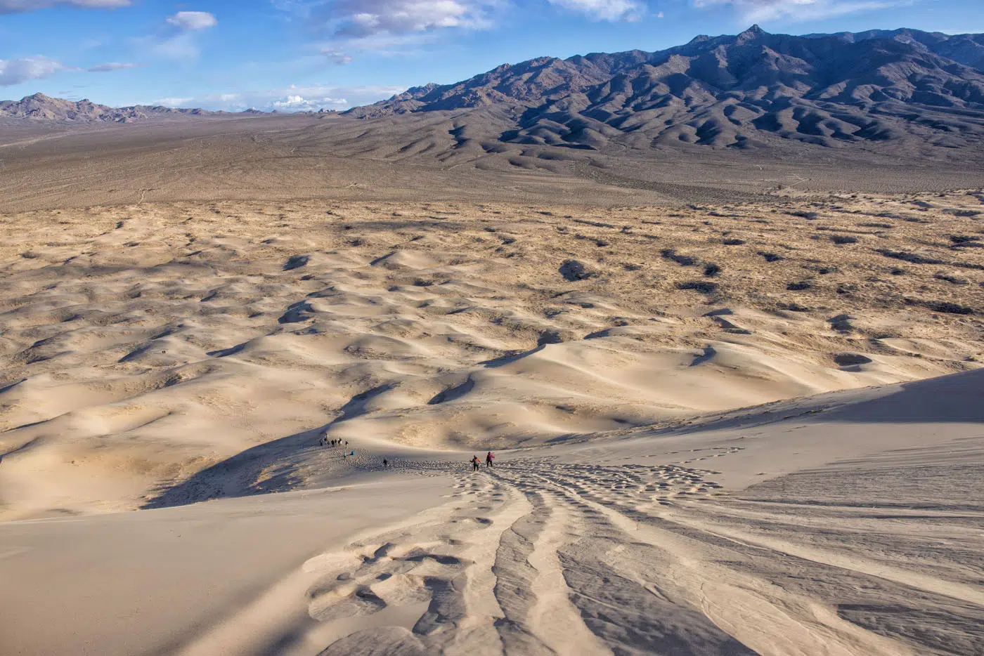
The “trail” down the highest dune
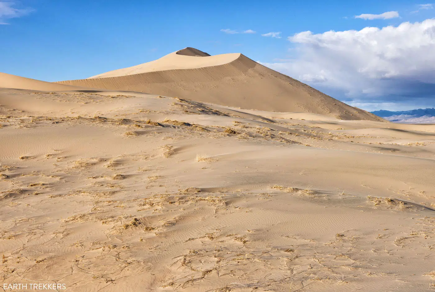
Kelso Dunes | Best Things to Do in Mojave National Preserve
7. Lava Tubes Trail
Distance: 0.5 miles (0.8 km) round trip (out-and-back)
Difficulty: Easy
Total Ascent: 120 feet (37 m)
Time: 30 minutes
Location: Aiken Mine Road
This very short and mostly flat “hike” takes you to a lava tube.
From the parking lot, you walk along a gravel road for most of the distance. There is a short trail that leads to the lava tube from this road. The trail is well marked with a sign.
Once at the lava tube, you have the option to enter it by climbing down the ladder. It is possible to hike through the lava tube to the other side, but you need a good light source, like a head lamp or flashlight. The light on a smartphone is not bright enough. Also, keep an eye out for snakes because they can be found inside the lava tube.
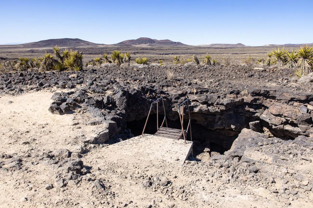
Entrance into the Lava Tubes
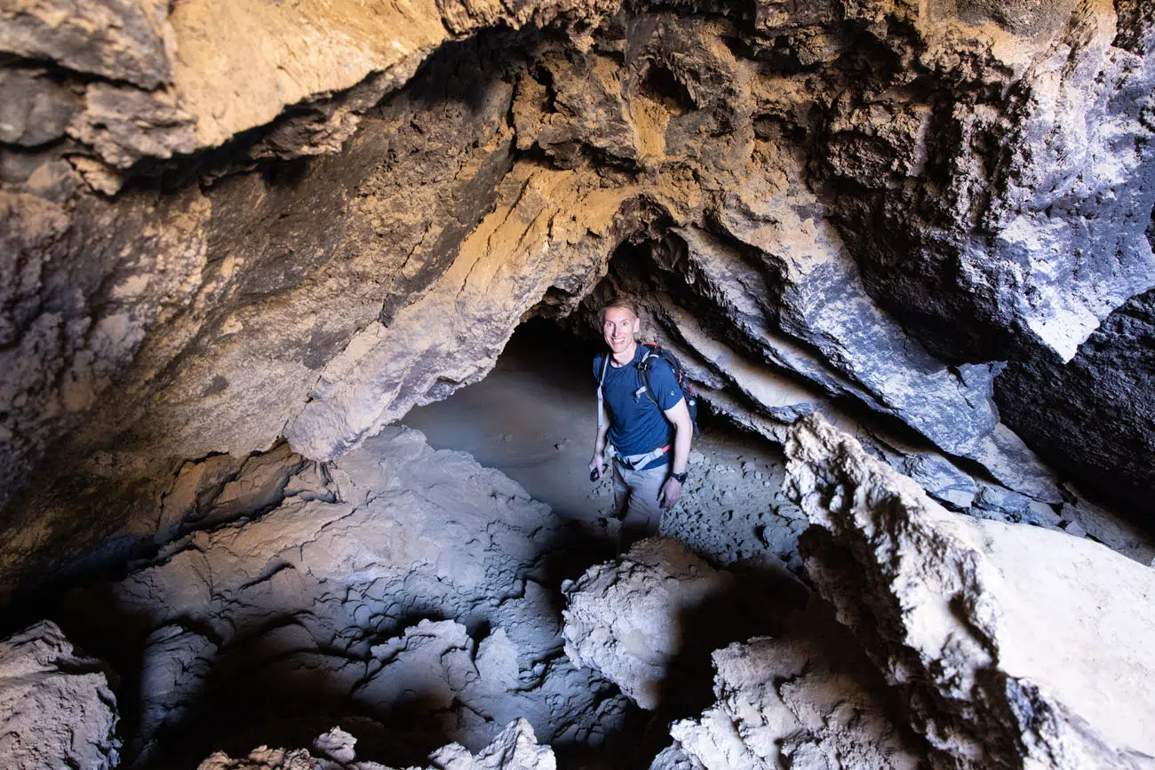
Tim inside the lava tube
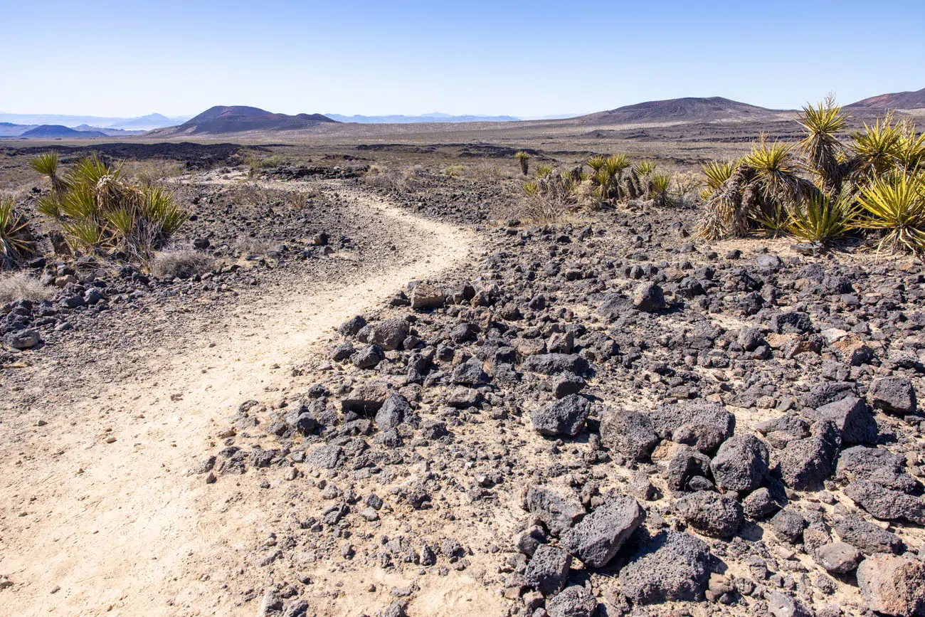
The trail from the lava tube to the parking lot
To get here, you will drive Aiken Mine Road, a rough, sandy road that can be washboarded. The National Park Service recommends a high-clearance vehicle for this road.
8. See the Cinder Cones
Along Aiken Mine Road, you can see cinder cones. Cinder cones are the volcanic ash and other sediments that remain around a volcanic vent. Most cinder cones have a crater at the summit.
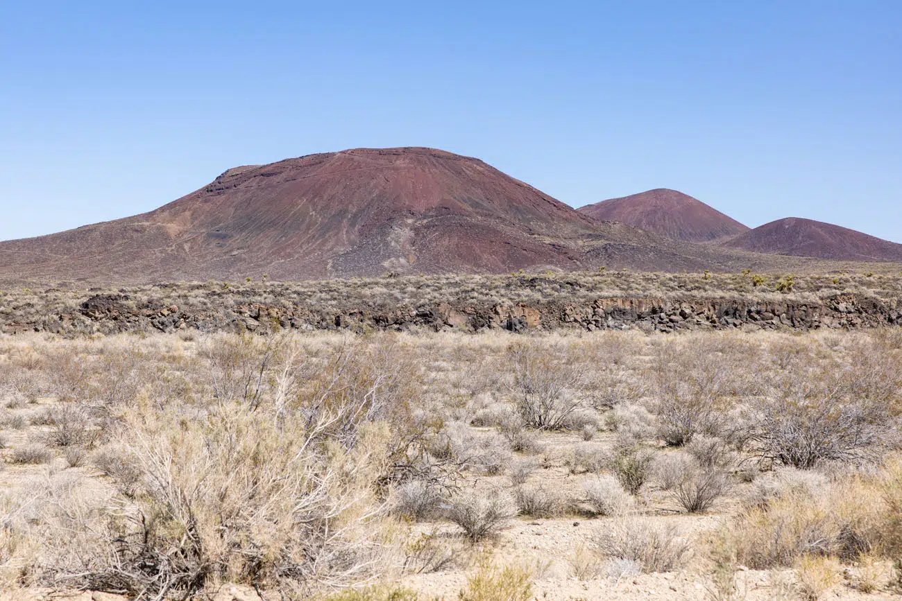
Cinder cones | Best Things to Do in Mojave National Preserve
This area, with its cinder cones and charcoal and dark red colored terrain, looks dramatically different than the Kelso Sand Dunes and the Joshua Tree forest along Cima Road. One of the things that makes Mojave National Preserve so special is the variety of landscapes it contains.
9. Visit Zzyzx
We added Zzyzx to our to-do list simply because of the name. And it turned out to be a cool spot to visit.
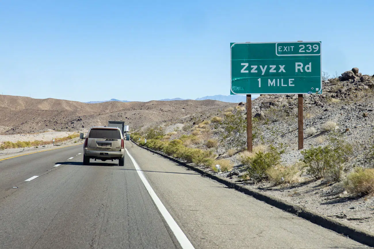
Zzyzx, formerly known as Soda Springs, was the site of the Zzyzx Mineral Springs and Health Spa. The spa is no longer open and the area is now the site of the Desert Studies Center.
To get here, turn onto Zzyzx Road from I-15. It takes about 10 minutes to drive Zzyzx Road to the very end. As you near the end of the road, you get a great view of Soda Lake, which is a dry lake bed that looks a lot like Badwater Basin in Death Valley National Park.
The views are great and this place was deserted during our visit, other than a fox roaming around the dry lake bed. If you have plans to drive on I-15, this 30-minute detour is worth it, if you want to see another unique landscape in the Mojave National Preserve.
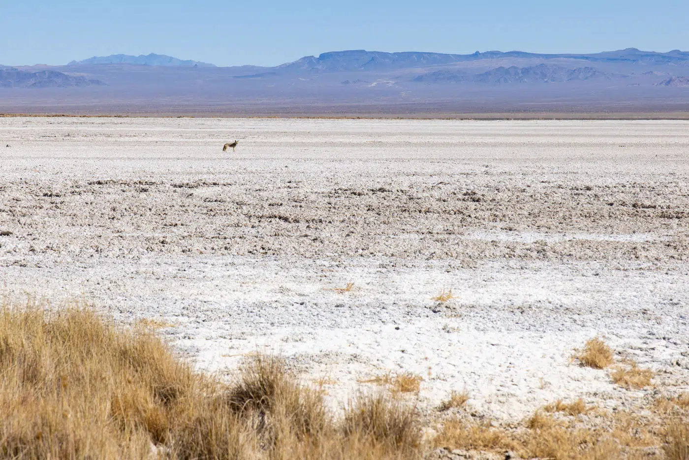
Fox on Soda Lake | Best Things to Do in Mojave National Preserve
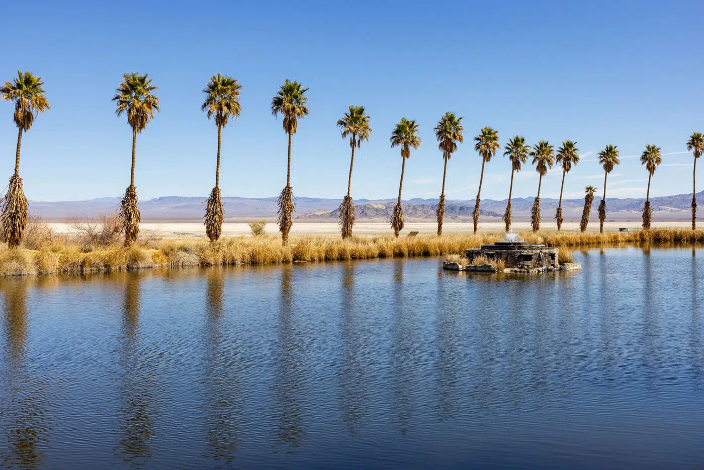
Lake Tuendae | Best Things to Do in Mojave National Preserve
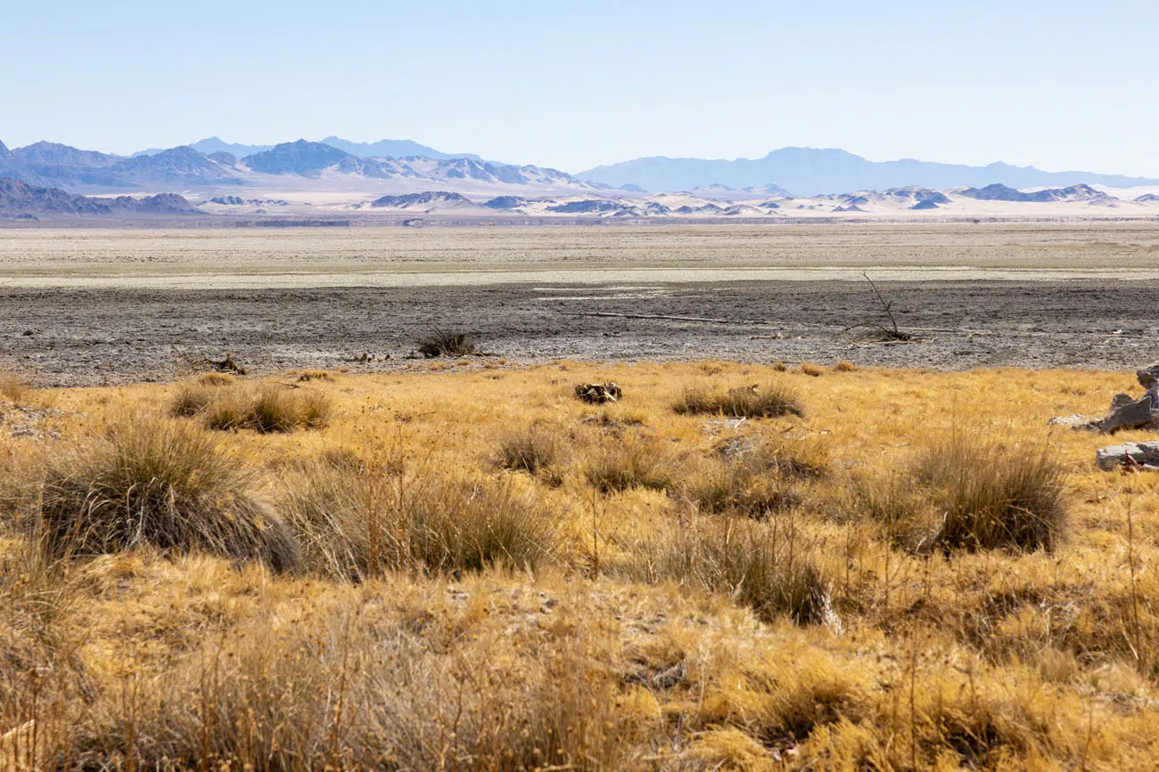
View of the dunes from Zzyzx | Best Things to Do in Mojave National Preserve
10. See the World’s Tallest Thermometer
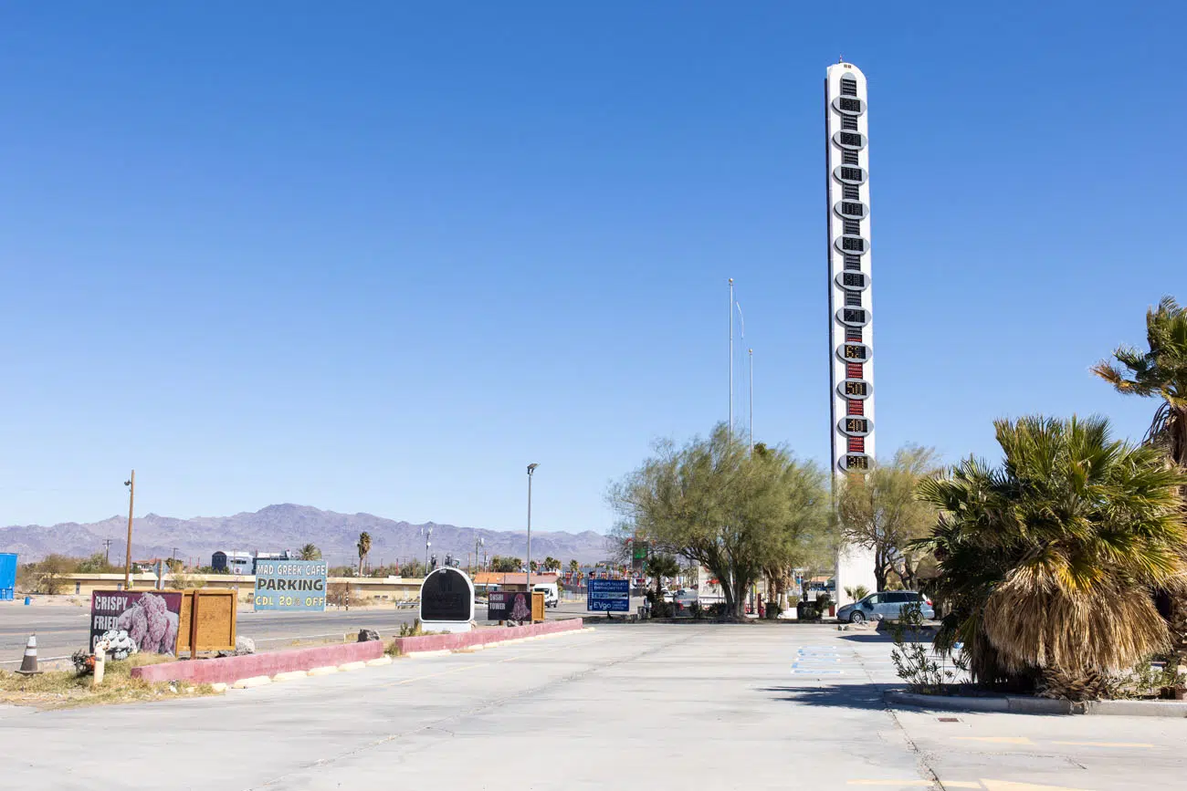
Even though it is not officially located in Mojave National Preserve, I’m including the World’s Tallest Thermometer, since it’s one of those cheesy yet interesting sights to see on a road trip through the American Southwest.
The thermometer is located on I-15 in Baker, not far from Zzyzx. There are also some fast food restaurants, several gas stations, and a Tesla recharging station.
Things to Do with More Time
Here are four more things to do in Mojave National Preserve, if you have more time.
Kelso Depot
The Kelso Depot is an old railroad depot that dates back to the early 20th century. It was placed on the National Register of Historic Places and in 2005 it became the visitor center for Mojave National Preserve. The area is also home to the Kelso ghost town.
We visited the area in 2022. The visitor center was closed with no plans to reopen until 2025 at the earliest. All that remains of the ghost town are a few abandoned buildings so it’s nothing to go out of your way to see. Frankly, in this area, my favorite thing was the view of the Providence Mountains.
Lava Beds Trail
The Lava Beds Trail is a 1-mile loop hike to the top of a cinder cone. It’s a challenging hike on a gravelly trail and those who do it say that it looks like you are walking on another planet.
Directions to get here are sketchy. The hike is located on Indian Springs Trail, which is a sandy road that is only suitable for high-clearance vehicles. We drove this road in a high-clearance 4WD SUV and could only make it a short distance. The road quickly becomes impassable and it is roughly a 1 mile walk to the trailhead, turning this hike into a 3-mile hike. We chose not to do it, since we had other more important things we wanted to do later in the day (Vegas, baby!).
See the Mojave Desert Mailbox
The Mojave Desert Mailbox is located on Mojave Road. Mojave Road is a narrow, sandy, rough road that runs through the center of Mojave National Park.
The Mojave Desert Mailbox is covered with graffiti and stickers. Inside is a book where you can sign your name and leave a comment (and read the comments of past travelers).
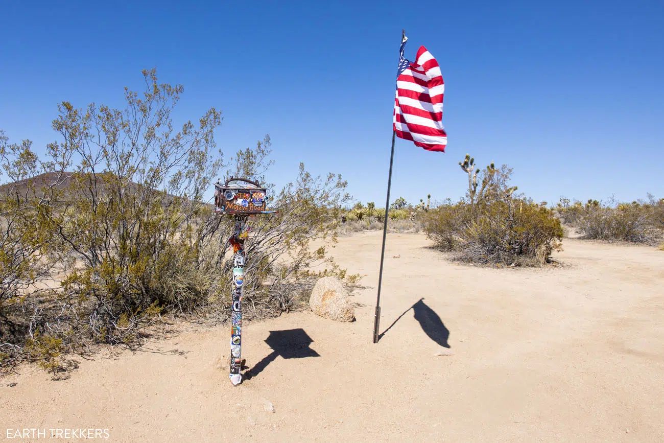
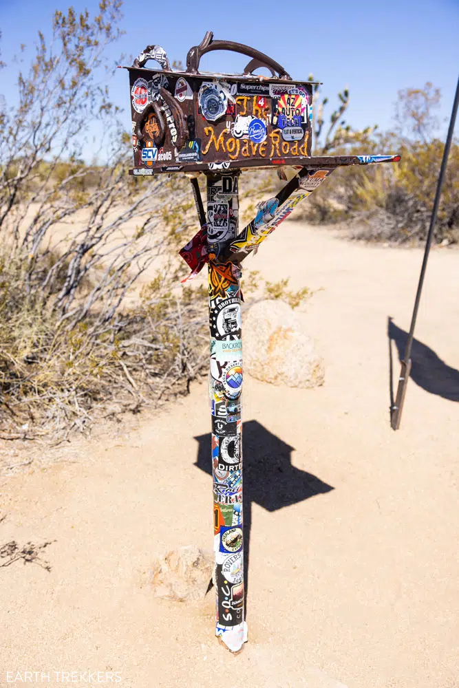
To get here, you must have a high-clearance 4WD vehicle. The road is narrow, bumpy, and covered with thick sand. From Aiken Mine Road, turn onto Mojave Road. It is only 5 miles to get to the mailbox but it took us about 45 minutes to drive out and back to the mailbox. Along the drive, you get to see a lot of Joshua Trees and the cinder cones off in the distance.
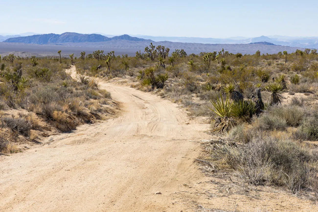
Mojave Road | Best Things to Do in Mojave National Preserve
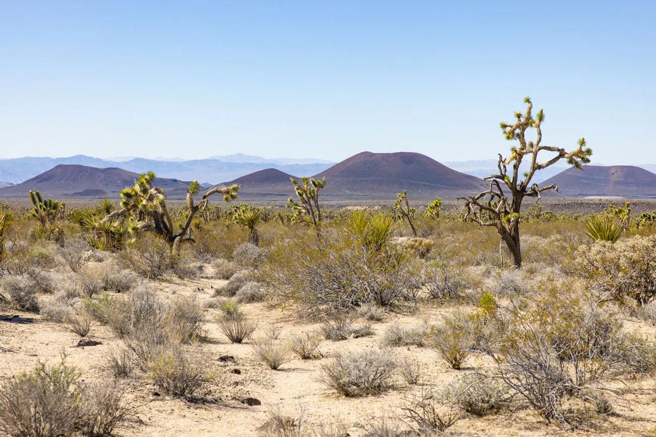
View from Mojave Road
If you have a high-clearance 4X4 and like the idea of traveling to a remote area of the Mojave National Preserve, this could be worth it for you. But for most people, I think your time is better spent at Kelso Dunes and Hole-in-the-Wall.
Cow’s Cove
This is another hike that came up a few times in our research but we skipped it since we were short on time. The Cow Cove Trail is a 3-mile round-trip hike that takes you to some petroglyphs. This hike is located on Aiken Mine Road near the Lava Tube Trail.
Planning Your Time
To visit Mojave National Preserve, you need one to two days. With one day, you can visit most of the top highlights but it’s not quite enough time to visit everything on our top 10 list. Since everything is so spread out, it takes a lot of time to drive to each place.
We spent two days in Mojave National Preserve. This was part of a one week road trip that started and ended in Las Vegas. From Las Vegas, we visited Mojave National Preserve on the drive to Twentynine Palms (where we stayed for part of our visit Joshua Tree National Park). After Joshua Tree, we visited Palm Desert and Anza-Borrego Desert State Park. On the return drive to Las Vegas, we spent our second day in Mojave National Preserve.
Here is our two-day Mojave National Preserve itinerary:
Day 1: Leave Las Vegas in the morning and drive to Mojave National Preserve. Teutonia Peak Trail, Mojave Memorial Cross, Hole-in-the-Wall Rings Trail, Boulders Viewpoint, Kelso Depot, Kelso Dunes, drive to Twentynine Palms.
Day 2: Drive from Palm Desert to Mojave National Preserve. Visit Zzyzx, see the World’s Tallest Thermometer in Baker, cinder cones, Mojave Desert Mailbox, Aiken Mine Road to the Lava Tube Trail, return to Las Vegas.
If you are looking for a road trip itinerary that takes you from Las Vegas to San Diego, check out our Las Vegas to San Diego Road Trip itinerary. It includes Anza-Borrego Desert State Park and Joshua Tree National Park, with the option to add on the Mojave National Preserve and Death Valley National Park.
Best Time to Visit Mojave National Preserve
The best time to visit Mojave National Preserve is the spring and fall months, when temperatures are mild.
WINTER: During the winter months, high temperatures are in the low 50’s and the lows are below freezing. Precipitation is low but the Mojave National Preserve can get a light snowfall once or twice during the winter. During our visit in February, about an inch of snow fell at the higher elevations of the park and according to the locals we spoke to that day, it was the first snowfall of the season (and a very exciting event).
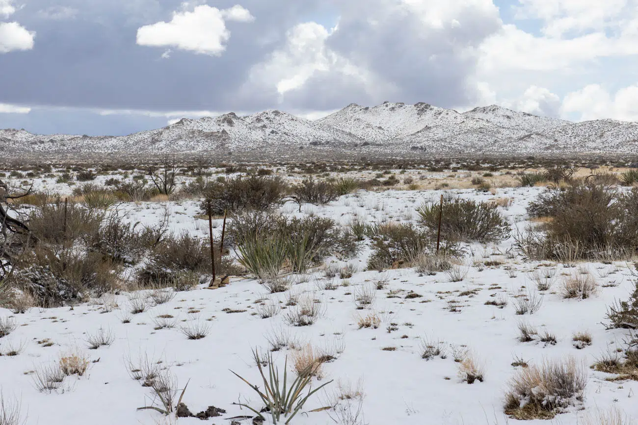
Mojave National Preserve in February
SPRING: In the spring, the high temperatures range from the upper 50’s to the low 70’s, getting warmer month by month. Rainfall is extremely low.
SUMMER: July tends to be the hottest month of the year, with the average high in the low 90’s. On unusually hot days, it can get well over 100°F and even as high as 120°F, at the lower elevations in the preserve. July and August are the wettest months of the year, getting about an inch of rain each month.
AUTUMN: The weather is almost identical to the spring months, with temperatures in the 70’s in early fall and getting down into the upper 50’s by late fall. Rainfall is low.
How to Get to Mojave National Preserve
The Mojave National Preserve is located in southeastern California, near the border with Nevada and Arizona. The closest major city is Las Vegas, which is about an hour drive from the northern part of Mojave Desert National Park.
Mojave National Preserve is bordered by I-15 to the north and I-40 to the south.
To get to Mojave National Preserve, you will need a car. There is no public transportation or shuttle service within the preserve.
Important Planning Information
Mojave National Preserve is open 24 hours a day, 7 days a week. There is no park entrance fee.
As you plan your trip and just before your visit, visit the National Park Service website for updates on road closures, trail closures, or other important information.
Frequently Asked Questions
How much time do you need at Mojave National Preserve?
In order to do everything on our top 10 list, you need a day and a half to two full days in Mojave National Preserve. The hikes are short and some things can be done very quickly, but because everything is so spread out, it takes some time to drive to each place.
Is Mojave National Preserve worth it?
On our visit, we were unexpectedly surprised at how many great things there are to do in the Mojave National Preserve. Hiking the Kelso Sand Dunes, seeing the Joshua Trees, hiking the Rings Trail at Hole-in-the-Wall, and visiting Zzyzx were some of our favorite experiences. These make a great addition to a southern California road trip, especially if you plan to visit nearby Joshua Tree National Park and/or Las Vegas.
What makes Mojave National Preserve special?
Sand dunes, lava tubes, cinder cones, a dry lake bed, short but fun hiking trails, and historical sights…the Mojave National Preserve is home to a surprisingly wide variety of landscapes. It is also home to the largest and densest population of Joshua Trees in the world.
If you have any questions about the best things to do in Mojave National Preserve, let us know in the comment section below.
Where Are You Going Next?
Read all of our articles about California in our California Travel Guide and the United States in our United States Travel Guide.
Comments 8