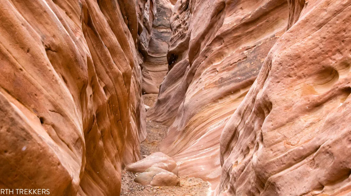
The hike along the Willis Creek Slot Canyon is so much fun! And to think that we almost skipped this hike.
After a long day of hiking and exploring both Bryce Canyon National Park and Kodachrome Basin State Park, we wondered if we should tack on Willis Creek to the end of our day. Would it be worth it?
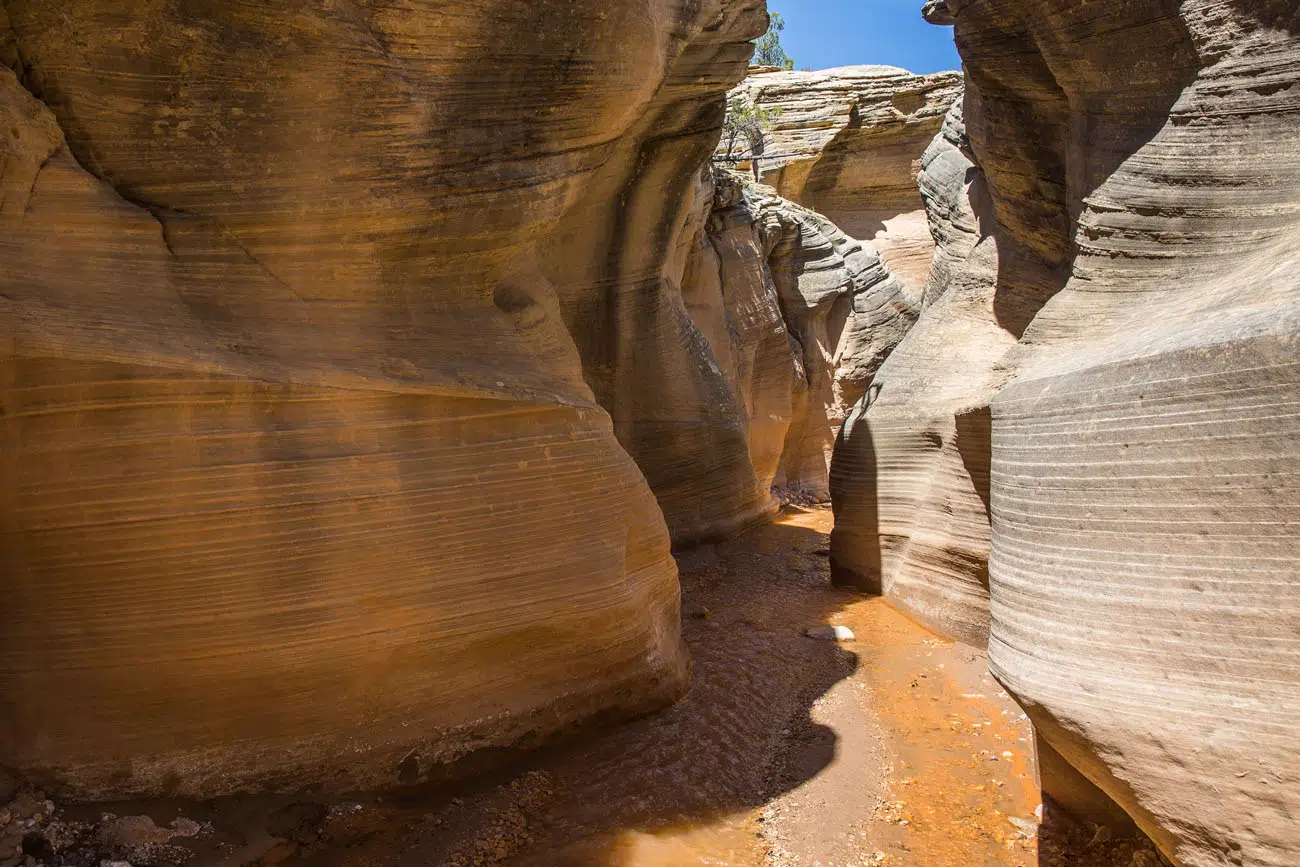
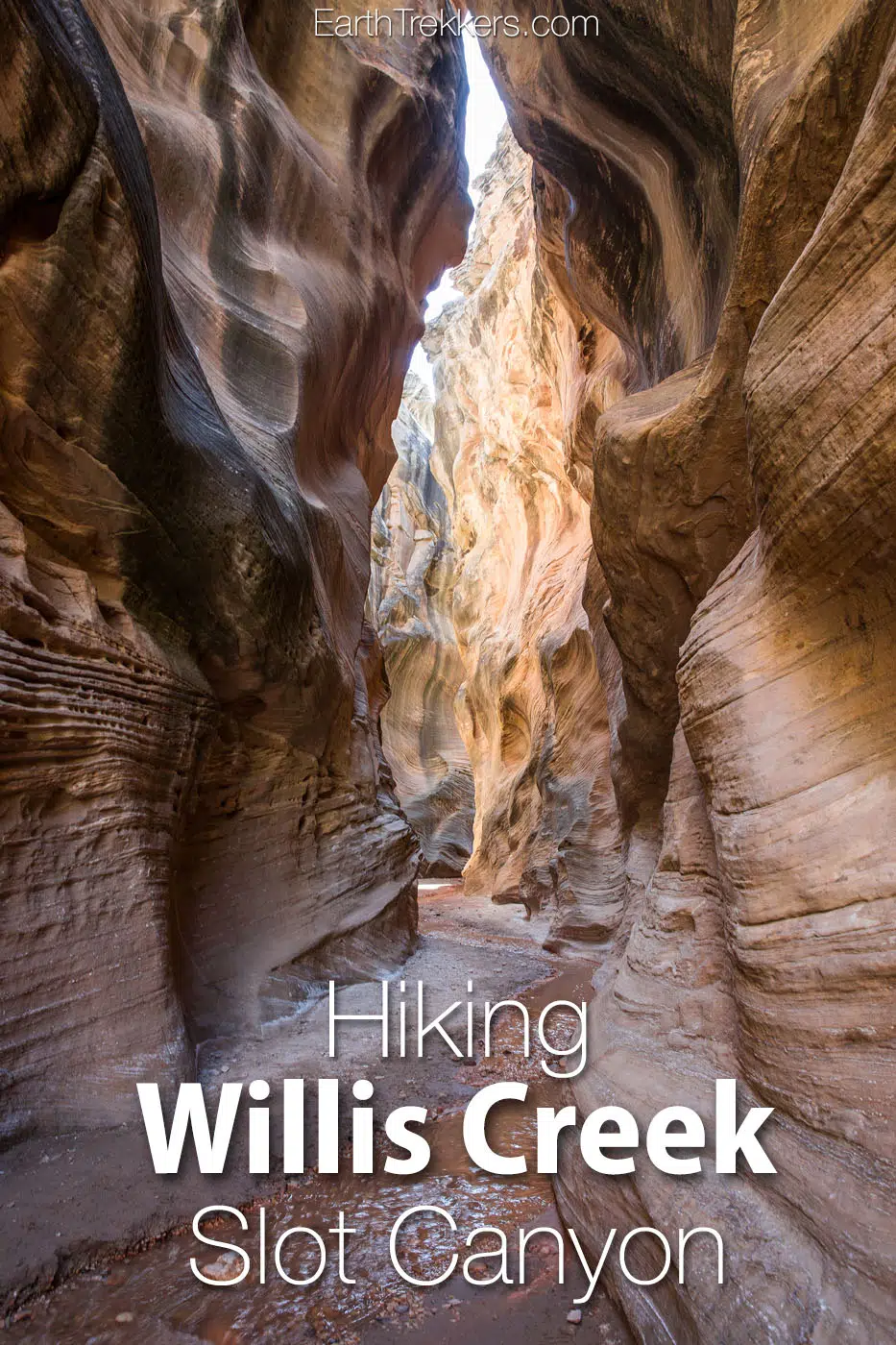
The answer is yes. Willis Creek was a blast to hike. Hiking within the narrow canyon, hopping and skipping over the creek, and watching as the canyon walls steadily grew higher and higher over us as we headed downstream was such a great experience.
Willis Creek is fun to explore. It’s easy, it’s great for all ability levels and ages, and with the creek and high canyon walls, you can stay cool (almost) even during the hotter summer months.
Willis Creek Hiking Stats
- Distance: 3+ miles (out and back)
- Elevation Gain: Minimal
- Difficulty: Easy
- Length of Time: 1.5 – 3 hours
- When to go: You can hike Willis Creek all year. The best time for this hike are during the spring and fall, when temperatures are mild. Expect very high temperatures midday during the summer. In the winter, it will be cold but crowds will be at their lowest.
Getting to the Willis Creek Trailhead
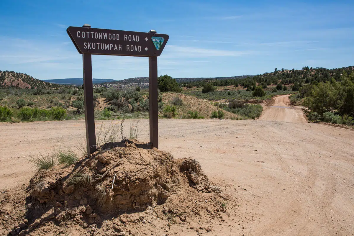
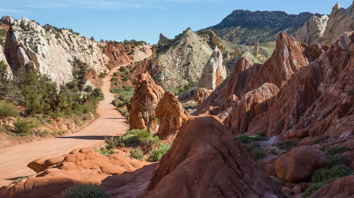
Willis Creek is located within Grand Staircase-Escalante National Monument. The closest town is Cannonville. From Cannonville, head south on Kodachrome Road, which becomes Cottonwood Canyon Road. Before arriving at Kodachrome Basin State Park (and before crossing over the Paria River), turn right on BLM 500, also named Skutumpah Road.
Skutumpah Road is a well groomed dirt road that takes you to the trailhead. Cars should be able to drive on this road, although a SUV or 4×4 is ideal. During wet, rainy weather, this road may be impassable, even if you have a 4×4.
Follow Skutumpah Road for 5.8 miles (about 20 minutes of driving) to a car park on the right hand side of the road.
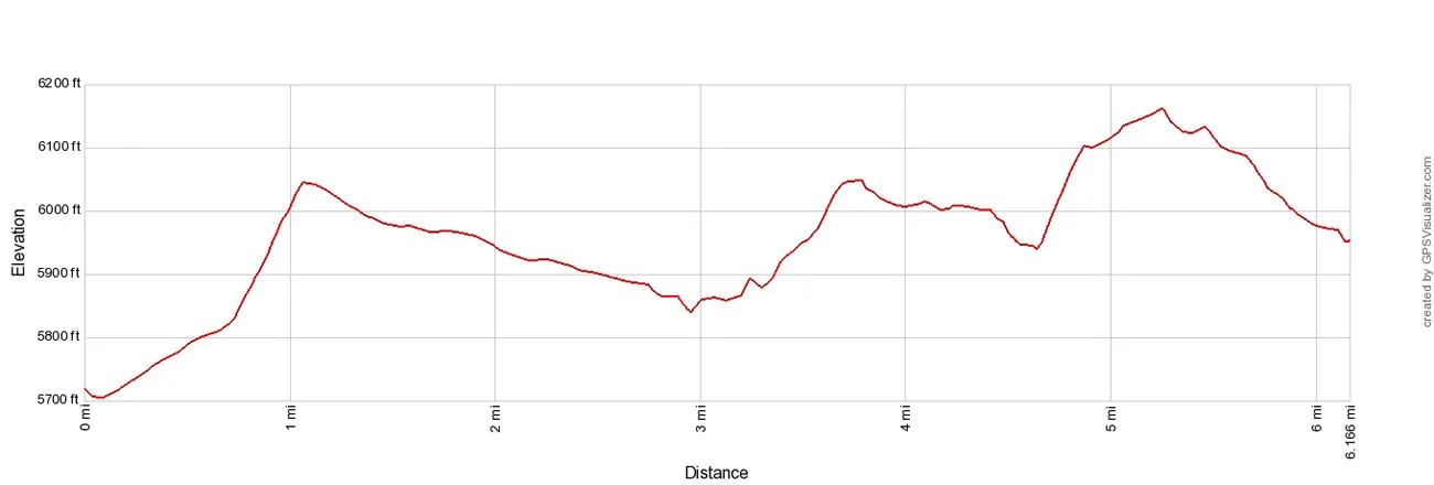
This is the elevation profile for the drive from the intersection of Cottonwood Canyon Road and Skutumpah Road to the parking lot at the trailhead (one-way). Some people report difficulties driving up the steeper sections of the road, and with this elevation profile, you can get an idea of what to expect. We do not have an elevation profile for the Willis Creek hike, since it is mostly flat.
Important Update: In recent months, we have heard numerous reports about the road conditions on Skutumpah Road. Make sure you read the comments below to get updated reports on the road conditions. And if you hike Willis Creek, feel free to write back in with your experience on the road and the trails, to help other hikers. Thanks!
The GPS coordinates for the trailhead are 37.483062, -112.096760.
From the car park, cross the road to get to the trailhead.
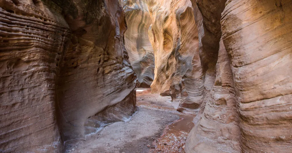
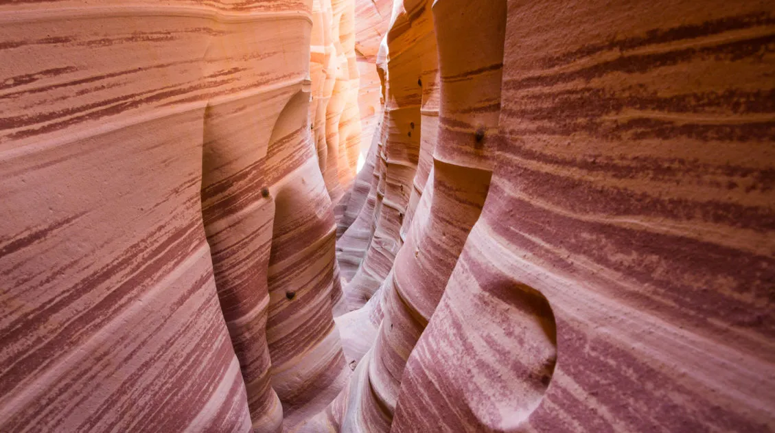
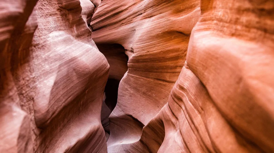
Hiking Willis Creek Slot Canyon
Step-By-Step Trail Guide
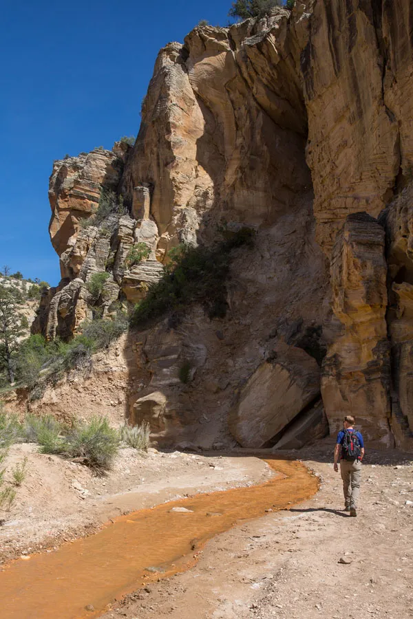
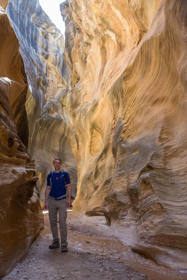
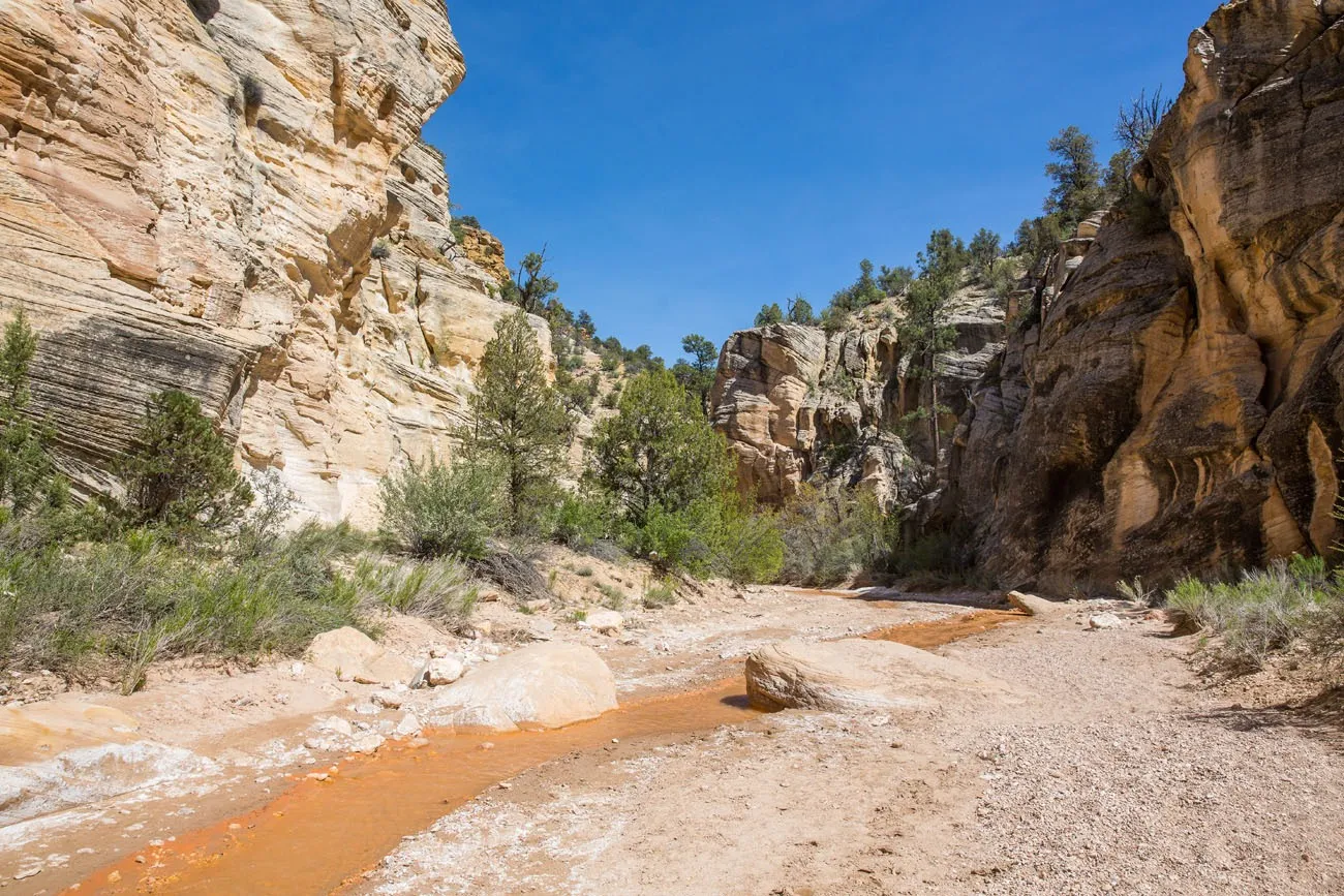
After following the trail for about 200 meters through brush and small trees, the trail dips down to Willis Creek. For the rest of the hike, you will be walking alongside or in Willis Creek.
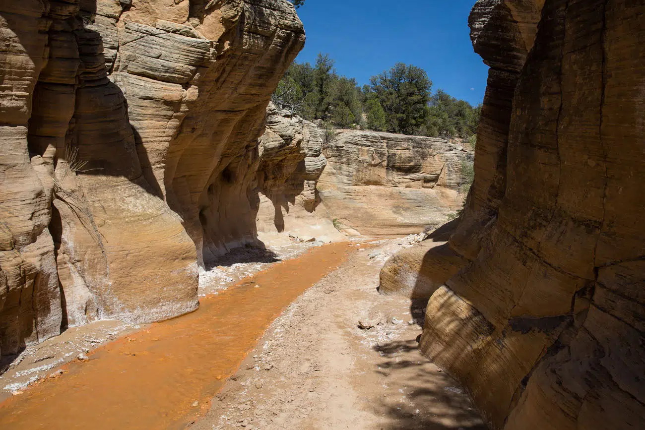
At first, the canyon walls are not very high, and the canyon is relatively wide. But this changes the further you hike.
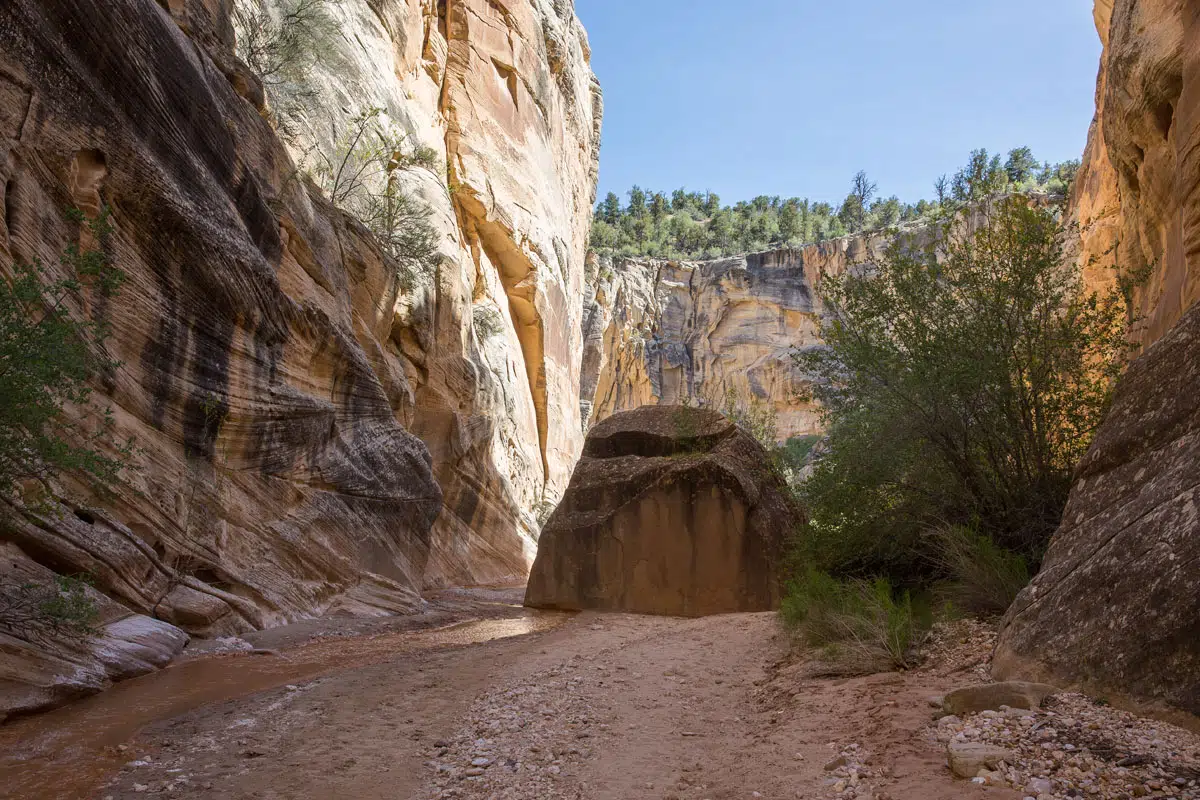
It does not take long for the canyon to get narrow. This is when it gets really fun! Tim and I tried our best to keep our feet dry, since we only had one pair of hiking shoes and several days of hiking to go. It kept things fun, hopping and skipping across the creek.
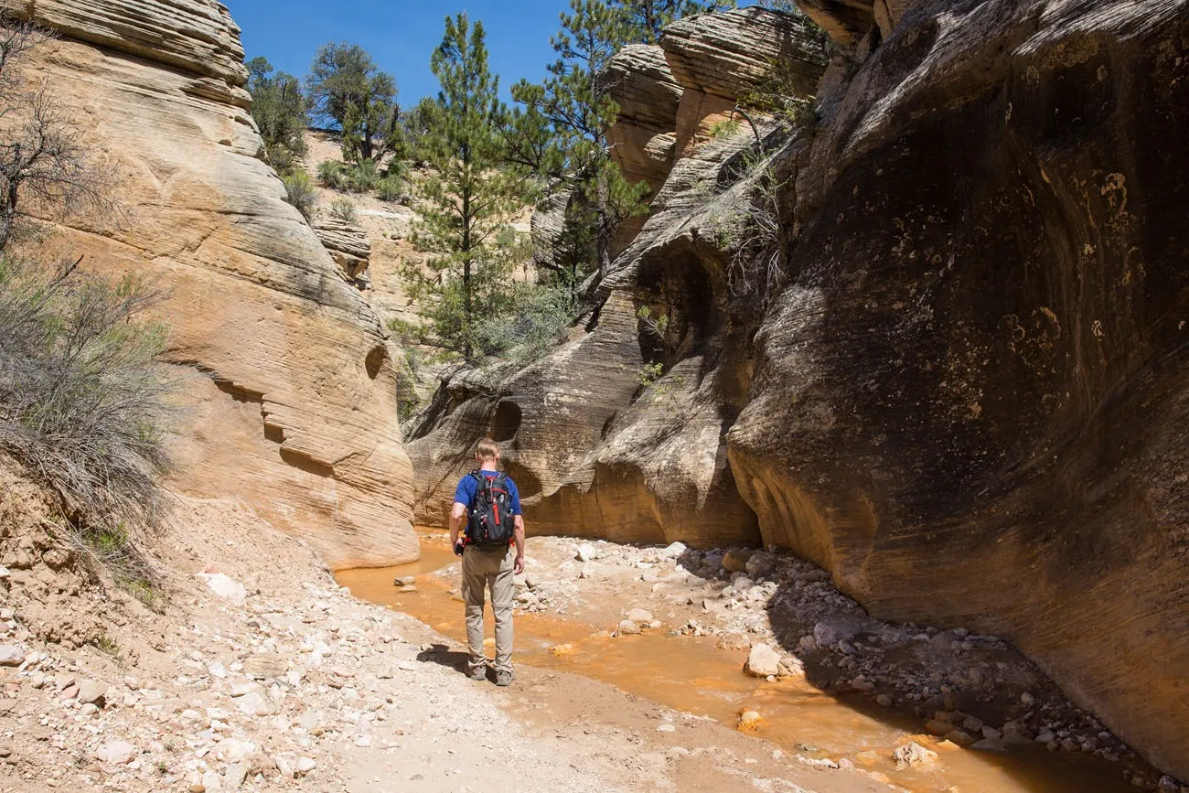
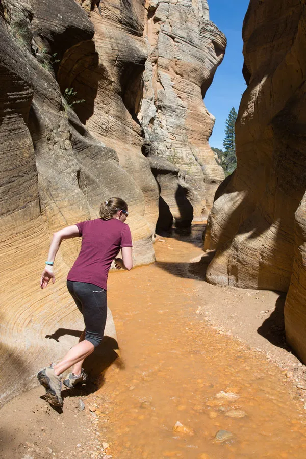
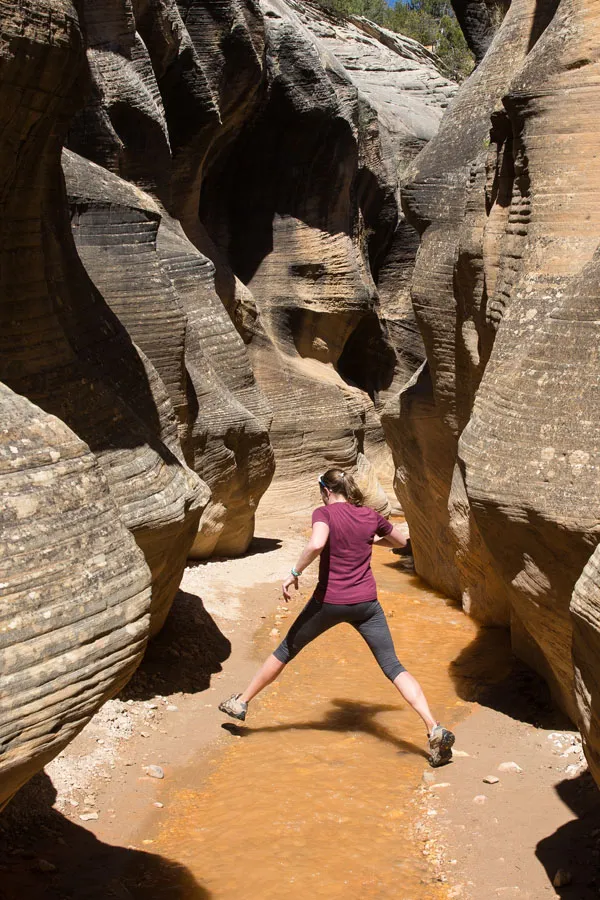
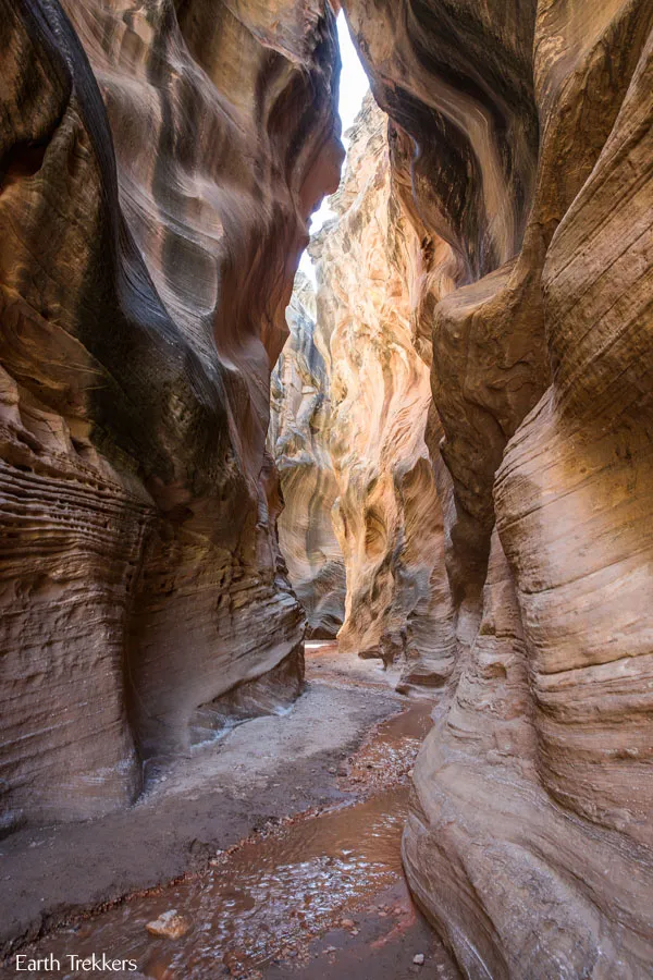
In some places, the canyon widens, which is nice, but the best parts of the hike are when the walls close in on you and make you feel so tiny. We felt like kids again, out exploring. During our hike, we only saw a handful of other people, making this an even better experience.
You have the option to hike all of the way to Sheep Creek. However, the slot canyon ends at 1.4 miles. Beyond this, the canyon widens and even though its scenic, it can get monotonous. If you do not have a GPS with you, once you get to this gigantic rock in the creek, the slot canyon portion of the hike is over. You can keep going or turn around here, the choice is yours.
About Our Experience
Willis Creek can be combined with other parks in the area.
We started our day at sunrise at Bryce Canyon. After spending six hours in Bryce, we drove out to Kodachrome Basin State Park where we did two hikes (Shakespeares Arch-Sentinel Trail and Angel’s Palace Trail). Later in the afternoon, around 4 pm, we started the Willis Creek hike. We almost did not do this hike, thinking it would be a bust after amazing Bryce Canyon and hiking in Kodachrome, but Willis Creek surprised us. This hike is pure fun and with very few people here, it was a great experience.
If you are wondering if Willis Creek is worth it, it really is! It’s fun, it’s easy, and it only takes a few hours. If you are traveling with kids, they are going to have a blast! Why not add it to your list if you are in the area?
Driving Times to Nearby Destinations:
- Bryce Canyon National Park: 24 miles, 50 minutes
- Kodachrome Basin State Park:10 miles, 30 minutes
- Zion National Park: 91 miles, 2 hours
- Escalante:43 miles, 1.25 hours
Important Things to Know Before You Go
Flash Floods. Since you are hiking through a slot canyon, flash floods are a danger. Make sure you check the weather forecast before you start the hike. Don’t hike if thunderstorms are in the area.
Shoes. There is a good chance you feet will get wet. You need to wear a sturdy pair of shoes, like hiking shoes, tennis shoes, or sandals designed for hiking (Keen sandals).
Bring lots of water. Bring several liters of water per person, especially during the summer months.
Sunscreen. Even though you are hiking through a canyon, you will still be exposed to the sun for most of the hike. Make sure you are wearing sunscreen.
Please practice the seven principles of Leave No Trace: plan ahead, stay on the trail, pack out what you bring to the hiking trail, leave areas as you found them, minimize campfire impacts, be considerate of other hikers, and do not approach or feed wildlife.
If you have any questions about hiking Willis Creek, or if you want to share your experience, either on the hiking trail or the road to get here, let us know in the comment section below.
More Information about Utah
Two Week American Southwest Road Trip: Grand Canyon & Utah’s Mighty 5
This is one of the best road trips in the USA. On this American Southwest road trip, you will visit Utah’s Mighty 5, the Grand Canyon, and a handful of wonderful state parks and national monuments. This is the itinerary I wish we had when we planned our first road trip to the American Southwest. […]
How to Hike Zebra Slot Canyon in Grand Staircase-Escalante
Zebra Slot Canyon is a very short slot canyon, named for its striped canyon walls. It’s a gorgeous spot, maybe not quite as pretty as Antelope Canyon in Arizona, but since you can explore this on your own without a guide or tour group, it’s more fun. Hiking Zebra Slot Canyon can be a little […]
What’s It Like to Drive Cottonwood Canyon Road?
Cottonwood Canyon Road is a scenic, unpaved road that travels through Grand Staircase-Escalante National Monument. It connects the town of Cannonville with Highway 89, just west of Big Water. Tim and I drove this road during our road trip through Arizona and Utah. Since we were traveling from Page, Arizona up to Escalante, Utah, Cottonwood Canyon […]
A Photojourney through Peek-A-Boo Gulch and Spooky Gulch
If you are looking for a super fun hike to do, put Peek-A-Boo Gulch and Spooky Gulch on your list. Just their names make this hike sound enticing. These slot canyons are located in Grand Staircase-Escalante National Monument on Hole-in-the-Rock Road. Getting here can be a mini-adventure, driving over 25 miles down a rough, dirt road […]
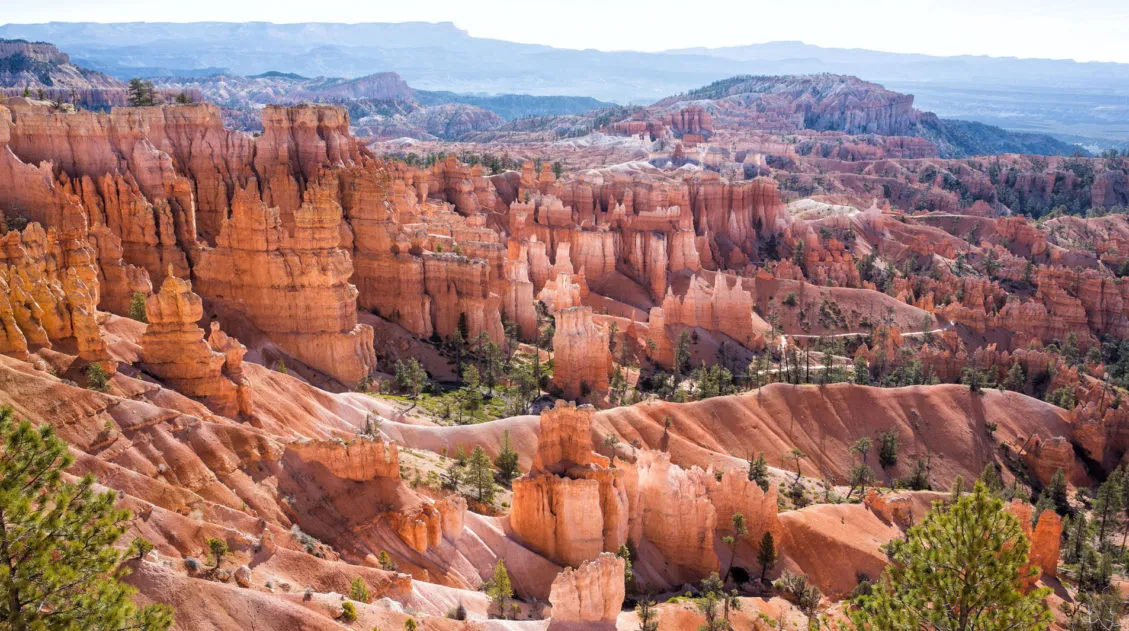
One Perfect Day in Bryce Canyon National Park
Bryce Canyon National Park…a fantasyland of hoodoos, bizarre rock formations, and sandstone pillars. This is a crazy beautiful place, and its unique landscape sets it apart from other national parks. Although Bryce may not have the same sweeping, expansive vistas as the Grand Canyon, it’s still a breathtaking experience the first time you see this […]
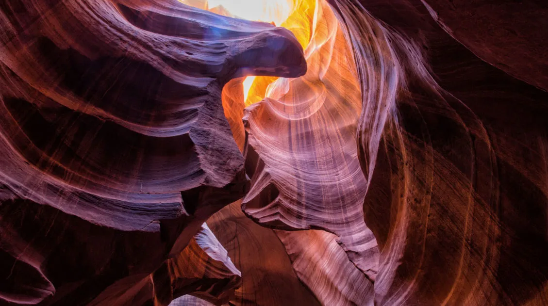
10 Amazing Slot Canyons to Explore in the American Southwest
The American Southwest is a playground for hikers, photographers, and adventurers. Fun to explore and extremely photogenic, slot canyons provide a unique hiking experience. We have assembled a short list of some of the best slot canyons in Utah, Arizona, and Nevada. This is not an all-inclusive list, because there are tons of slot canyons […]
Little Wild Horse Canyon – Bell Canyon Loop: A Step-By-Step Guide
Little Wild Horse Canyon is one of the most thrilling slot canyons in Utah. With tight passageways, curving, scalloped walls, and short sections of easy rock scrambling, this hike is fun for both kids and adults. You can hike the narrowest (and most fun) section of Little Wild Horse as a fast out-and-back hike, or […]
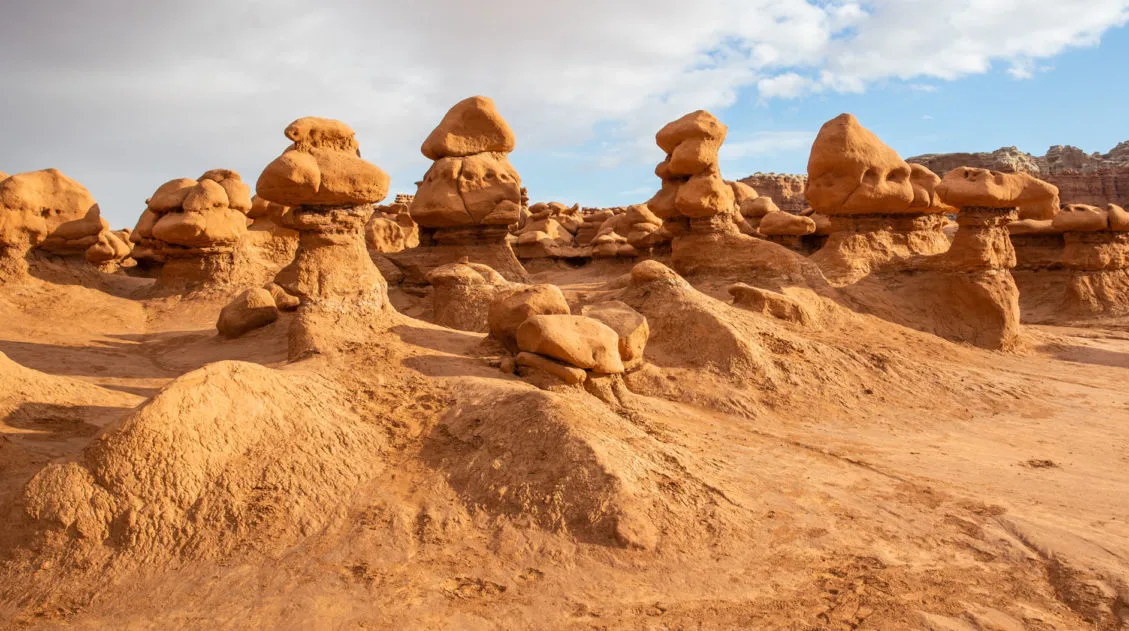
Goblin Valley State Park: Things to Do with Limited Time
Goblin Valley is an easy to visit state park that is located in southeastern Utah. With its hoodoos, toadstools, “goblins,” and short but sweet hiking trails, this park is pure fun to visit. Kids, and kids at heart, will LOVE this park!! The main section of hoodoos and goblins is free to explore…there is no […]
10 Great Hikes in Zion National Park: Which One Will Be Your Favorite?
Zion National Park is one of the best spots in the United States to go hiking. From the awe-inspiring hike up Angels Landing to the family friendly Riverside Walk to multi-day backpacking adventures, there is something here for everyone. Here are 10 of the best hikes in Zion National Park. This is not an all-inclusive […]
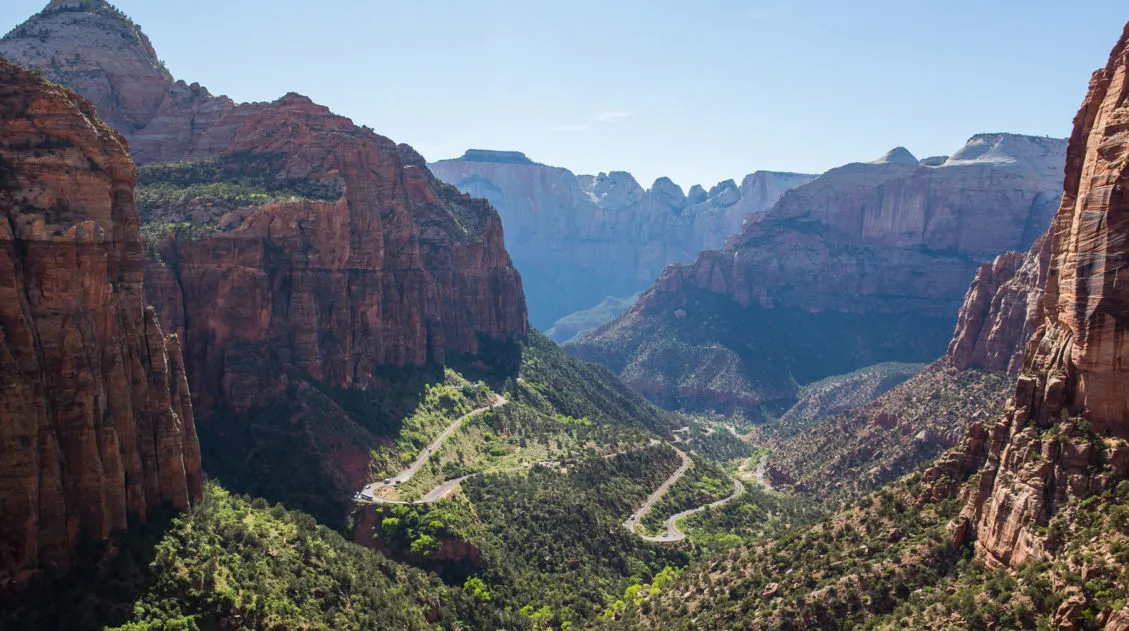
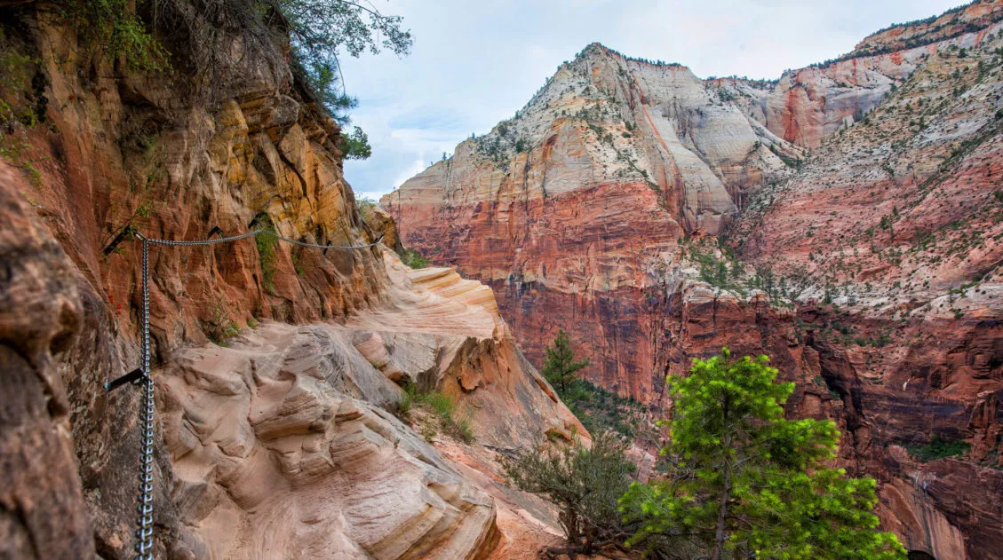
The Canyon Overlook Trail, One of Zion’s Essential Hikes
The Canyon Overlook Trail is a gem of a hike in Zion National Park. It’s short, it’s fun, and it takes you to an awesome viewpoint overlooking Zion Canyon. This is a hike that is perfect for all ages and ability levels. So if this is your first, or even your second time in Zion, […]
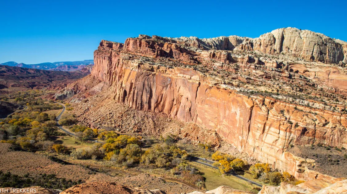
14 Amazing Things to Do in Capitol Reef National Park
Capitol Reef, often an overlooked national park, is full of many wonderful surprises. With an amazing scenic drive, hiking trails that rival those in Zion, rugged, remote areas to explore by 4×4, short, easy slot canyons, historical landmarks, and even delicious pie, this national park is absolutely amazing. In this post, learn about the best […]
The Ultimate Utah Travel Guide
Utah Travel Guide If you like rugged, desert landscapes, it is hard to beat the beauty of Utah. Visit the state’s five stunning National Parks, stand among iconic US monuments, kayak on the Great Salt Lake, and climb through photogenic slot canyons. This state is a great one for road trippers as there are many […]
United States Travel Guide: Places to Visit in the USA
Plan your visit to the United States. Learn about the best things to do, how to plan your time, road trip ideas, and sample itineraries.
Comments 71