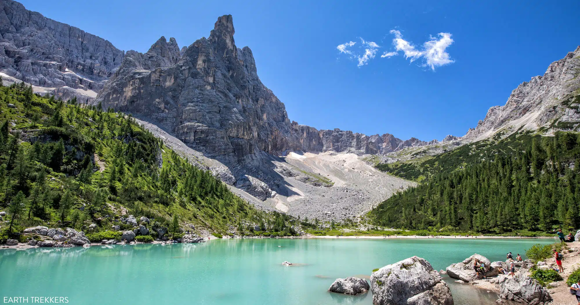

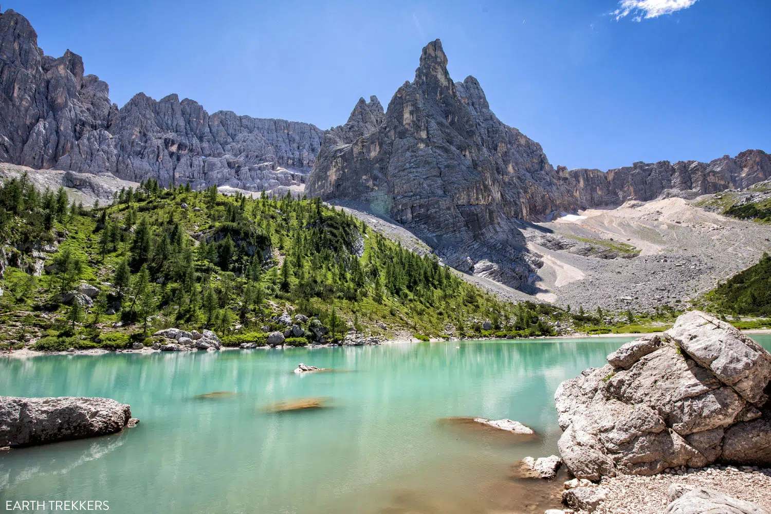
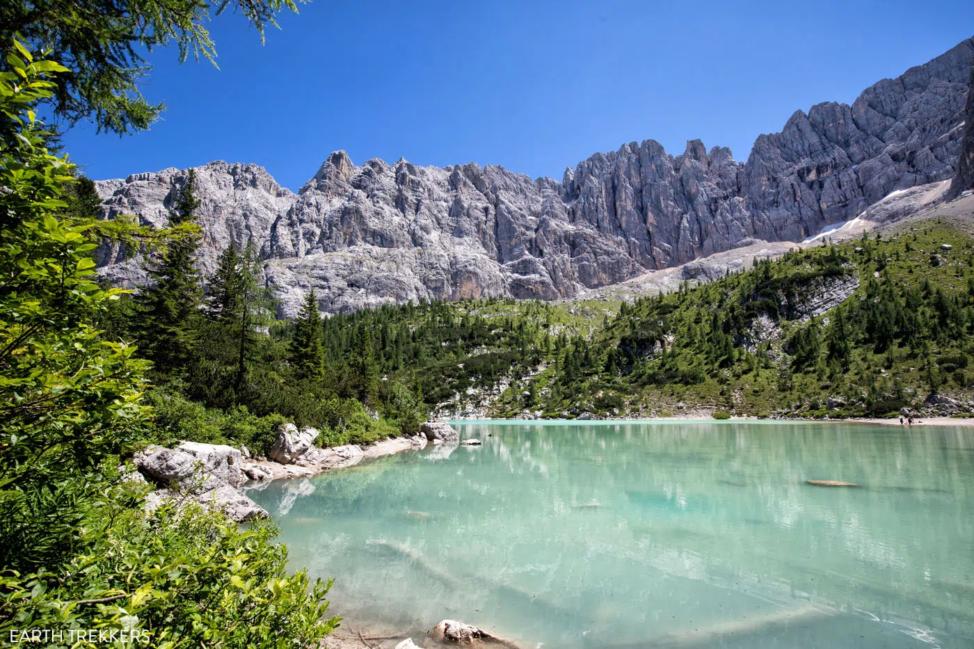
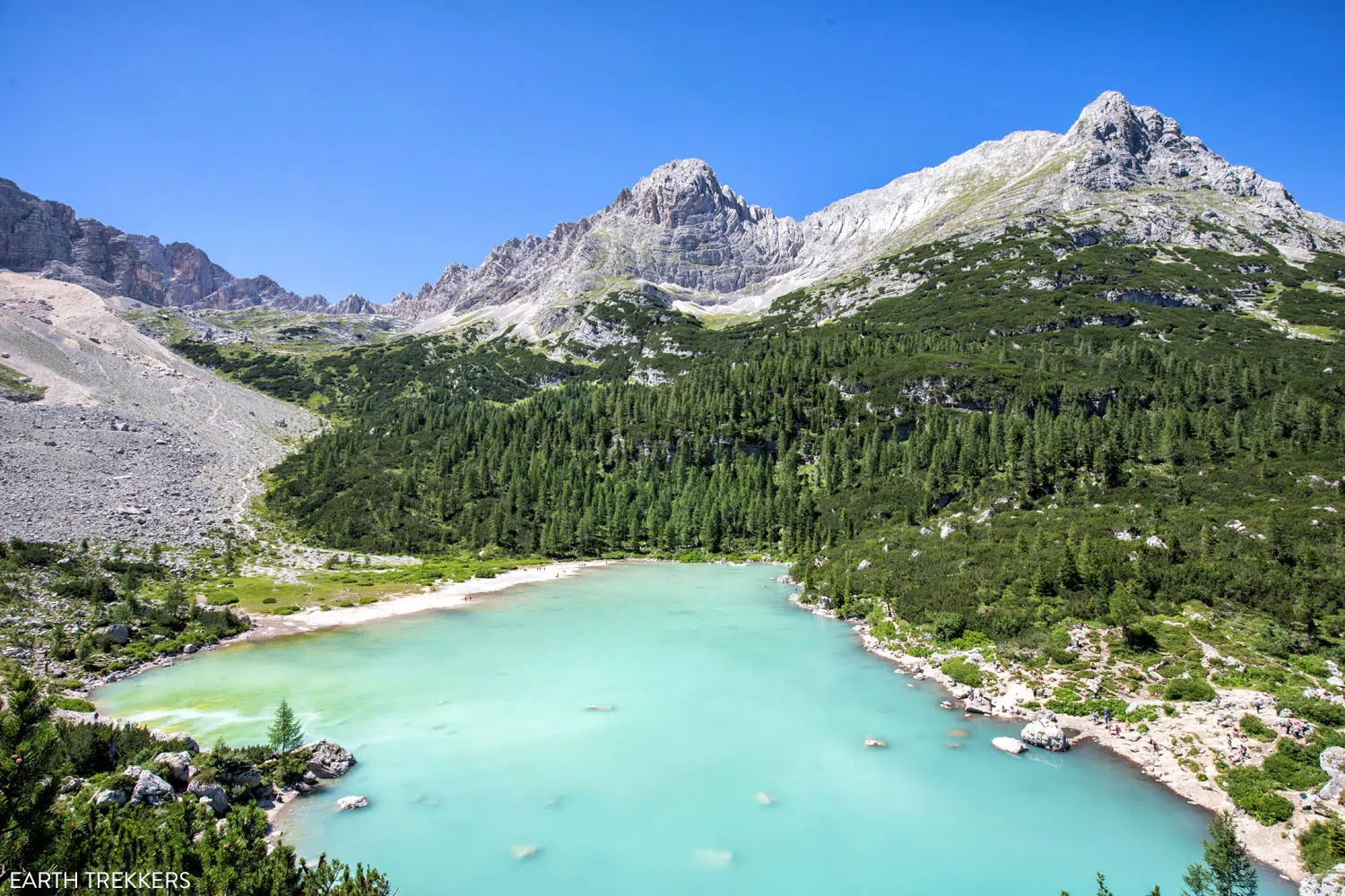
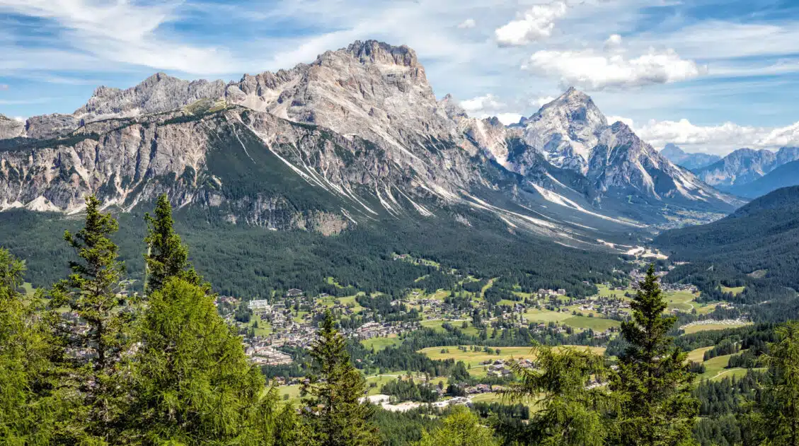
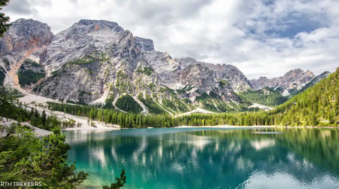
Lago di Sorapis (Lake Sorapis) is one of the most popular hikes in the Dolomites. Located just outside of Cortina d’Ampezzo, this aquamarine lake attracts hundreds of hikers every day during the summer months.
The vast majority of people hike out-and-back to Lago di Sorapis on the main trail. What many people don’t know is that you can turn this hike into a loop.
Doing it as a loop (Lago di Sorapis plus Forcella Marcoira) doesn’t add much in the way of extra distance, but it does add a hefty amount of elevation gain. However, your reward is unique views of Lago di Sorapis and panoramic views of the Dolomites.
When we did this hike, very little was written online about the alternative route, which is why most people probably hike to Lago di Sorapis out-and-back. We didn’t know what to expect…and then we were blown away by the views.
Yes, Lago di Sorapis is a beautiful spot to visit. But it was the views from the second half of the hike that really amazed us.
In this guide, we’ll let you know everything you need to know about how to hike to Lago di Sorapis, both out-and-back and as a loop.
The Essentials
WHAT IS IT | A stunning turquoise lake in the Italian Dolomites
WHERE | Near Cortina d’Ampezzo
OUT-AND-BACK ROUTE | An 11.6 km/7.2 mile moderate trail; the most popular way to hike Lago di Sorapis
THE LOOP HIKE | A more challenging 12.7 km/7.9 mile route that is done as a loop and adds on Forcella Marcoira; much less crowded return hike but the views are incredible
TIME OF DAY | Early morning is best to avoid the crowds
Lago di Sorapis Hiking Stats
Since this hike can be done several different ways, we list the hiking stats for the different routes below and then cover them in more detail later in this guide.
Lago di Sorapis Out-and-Back
These are the hiking stats for hiking out-and-back to Lago di Sorapis from the trailhead on SR48.
Distance: 11.6 km (7.2 miles)
Difficulty: Moderate
Total Ascent: 460 meters (1,520 feet)
Starting Elevation: 1,800 meters (5,900 feet)
Elevation at Lago Sorapis: 1,920 meters (6,300 feet)
Time: 3 to 5 hours
Lago di Sorapis as a Loop
If you hike to Lago di Sorapis as a loop, here are the stats.
Distance: 12.7 km (7.9 miles)
Difficulty: Strenuous
Total Ascent: 775 meters (2,550 feet)
Starting Elevation: 1,800 meters (5,900 feet)
Highest Elevation (Forcella Marcoira): 2,310 meters (7,575 feet)
Time: 5 to 7 hours
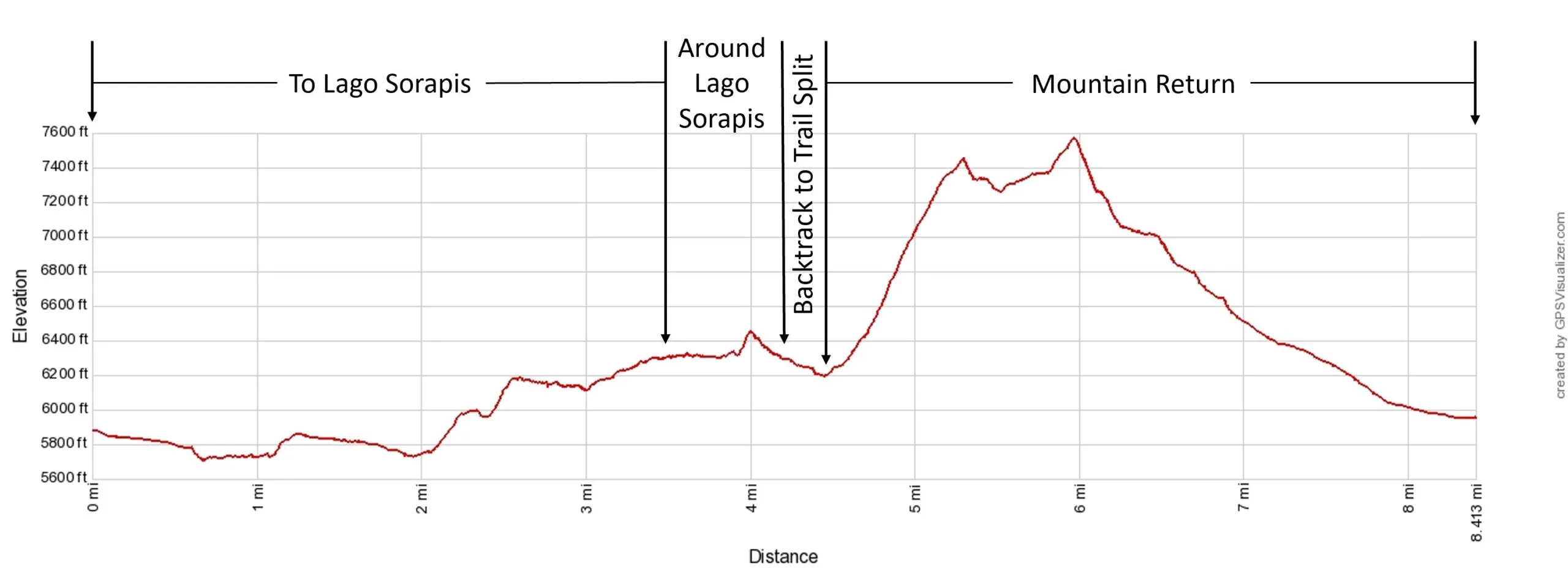
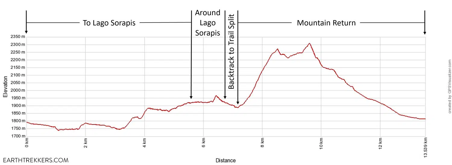
Lago di Sorapis Elevation Profile as a loop. This elevation profile also includes the extra distance for hiking around Lago di Sorapis.
Map of the Lago di Sorapis Hike
Below is a map of the Lago di Sorapis loop from my Garmin watch. The blue color is the lowest elevation along the trail and the orange and red colors are the highest elevations.
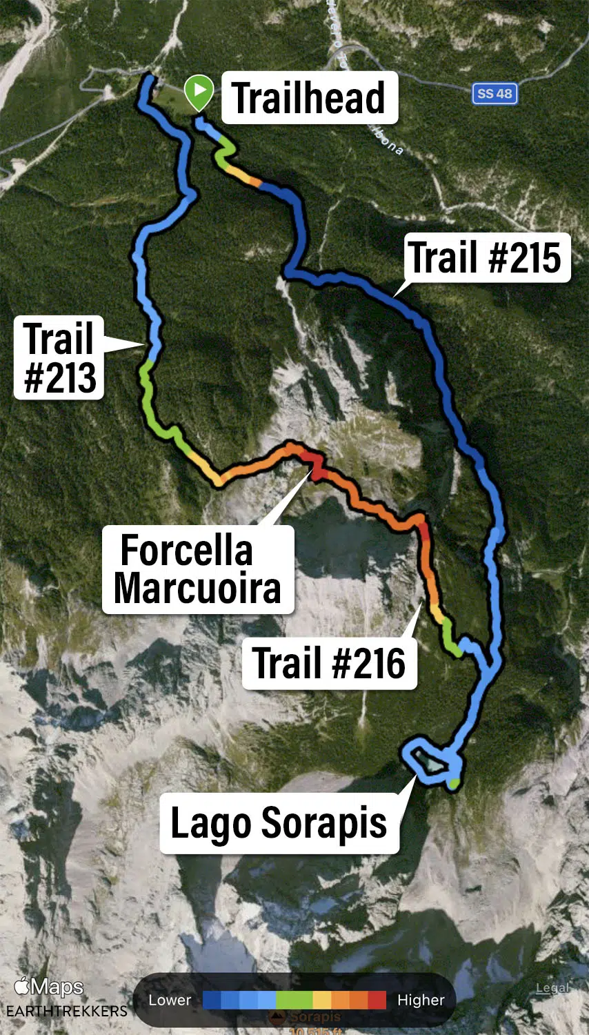
Lago di Sorapis Map
Detours and Add-Ons to the Main Trail
In addition to the two main hiking routes, there are two more add-ons to the hike.
Lago di Sorapis
If you hike around Lago di Sorapis, this adds 1.1 km (0.7 miles) and 70 meters (230 feet) of total ascent. Allow 30 to 45 minutes.
The total distance for the out-and-back hike is now 12.7 km (7.9 miles) and the total distance for the loop hike is now 13.8 km (8.6 miles).
Rifugio Vandelli
You can also add on Rifugio Vandelli. At this rifugio, you can use the bathrooms, refill your water bottles, and grab a bite to eat. The rifugio is located just off the main trail, about a 2 to 3-minute walk from Lago di Sorapis, so adding on the rifugio adds on a negligible amount of distance to the hike.
Additional Information & Helpful Tips
Best Time of Day to Hike to Lago di Sorapis: Morning (for good lighting for photos, lower crowds, and a closer parking spot to the trailhead)
Toilet: None at the trailhead; there is a toilet at Rifugio Vandelli, which is very close to Lago di Sorapis
Fear of Heights: If you have a fear of heights, there are some areas along the trail to Lago di Sorapis that run alongside of a cliff. And if you choose to hike the full loop, there will also be some exposed cliff edges as you approach Forcella Marcoira and there will be chains here to assist you.
Please practice the seven principles of Leave No Trace: plan ahead, stay on the trail, pack out what you bring to the hiking trail, leave areas as you found them, minimize campfire impacts, be considerate of other hikers, and do not approach or feed wildlife.
Is the Lago di Sorapis Hike Difficult?
If you follow the trail out-and-back to the lake, it is a moderately difficult hike. It’s an uphill hike to get to the lake, which does mean it’s easier on the return hike, but with 460 meters (1,520 feet) of elevation gain, this can feel challenging, especially for new hikers or those of low to average fitness.
If you choose to turn this hike into a loop, then it becomes much more challenging. The loop hike adds on a hefty climb up and over Forcella Marcoira, and it is not to be underestimated. We are very fit and this climb even had us pausing to catch our breath a few times (but you also get to enjoy those jaw-dropping views…). The descent on the other side isn’t much easier, on a slippery slope with loose gravel.
Most people will be able to handle the out-and-back hike to Lago di Sorapis. Rifugio Vandelli and the lake are the perfect places to recharge your batteries for the slightly easier hike back to the parking lot.
Where is Lago di Sorapis?
Lago di Sorapis is located in the Dolomites, near Cortina d’Ampezzo.
The trailhead is located on SR48. From Cortina d’Ampezzo, it is a 15-minute drive to get here.
Lago di Sorapis
Parking for the Lago di Sorapis Hike
The closest place to park is right along SR48, near the trailhead. Just be aware that you are parking along a busy road, not only with cars, but also with cyclists, so be careful when parking and then leaving later in the day.
The second closest place to park is just down the street at the parking lot next to B&B Hotel Passo Tre Croci Cortina.
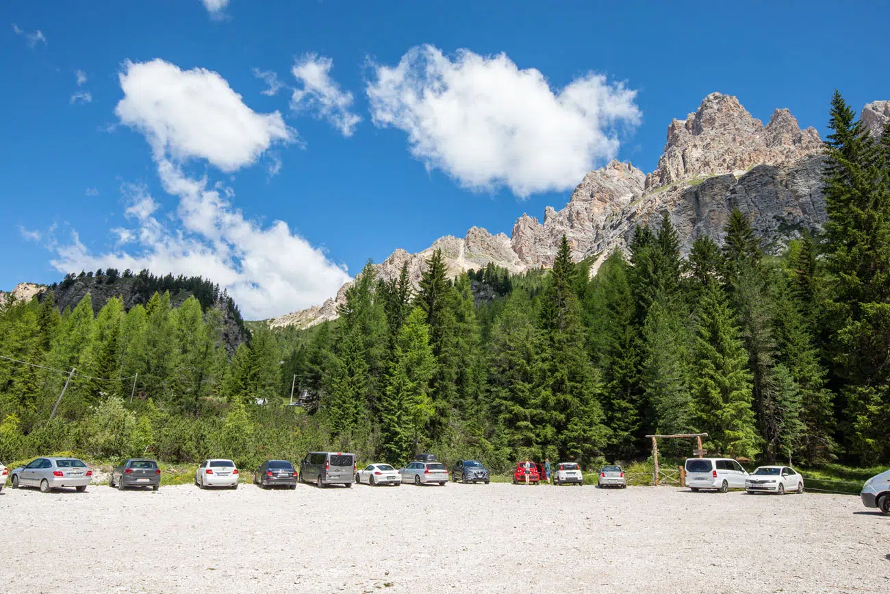
If that is filled, option #3 is at a gravel parking lot on SR48, west of the trailhead (photo below). It is labeled as Parcheggio per Sorapis on Google Maps. We parked here. The parking lot is enormous and even midday in July there were plenty of parking spaces. From the parking lot, it is a short but steep hike up a dirt trail in the woods. You come out of the woods next to Baita Son Zuogo and from here, walk about 5 minutes east along SR48 to the trailhead.
At the time that we did this, there was no fee for parking at these lots.
How to Hike to Lago di Sorapis
Step-By-Step Trail Guide
Next, I explain what to expect on the hike from the trailhead to Lago di Sorapis. Overall, it’s a very easy trail to follow, with one trail split not far from the lake. You do not need any special maps to hike this trail and if you plan to do this hike in the summer, there is a very good chance that you will be sharing the trail with many more hikers.
Trailhead to Lago di Sorapis
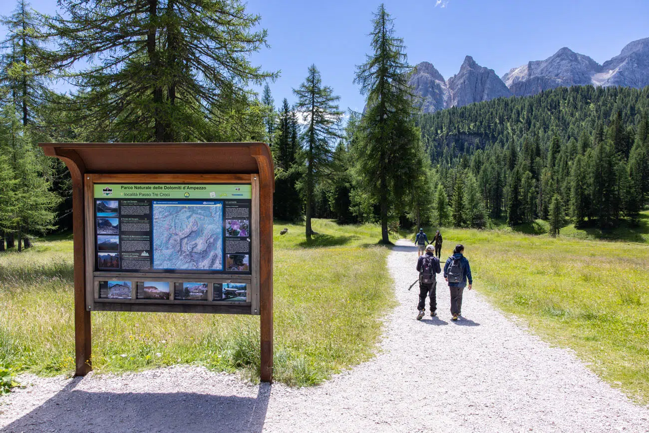
Lago di Sorapis Trailhead
To hike to Lago di Sorapis, it is a 5.8 km hike that takes about an hour and a half (one-way). You will take trail #215 from the trailhead to the lake (labeled Lake Sorapis Hike Trailhead on Google Maps).
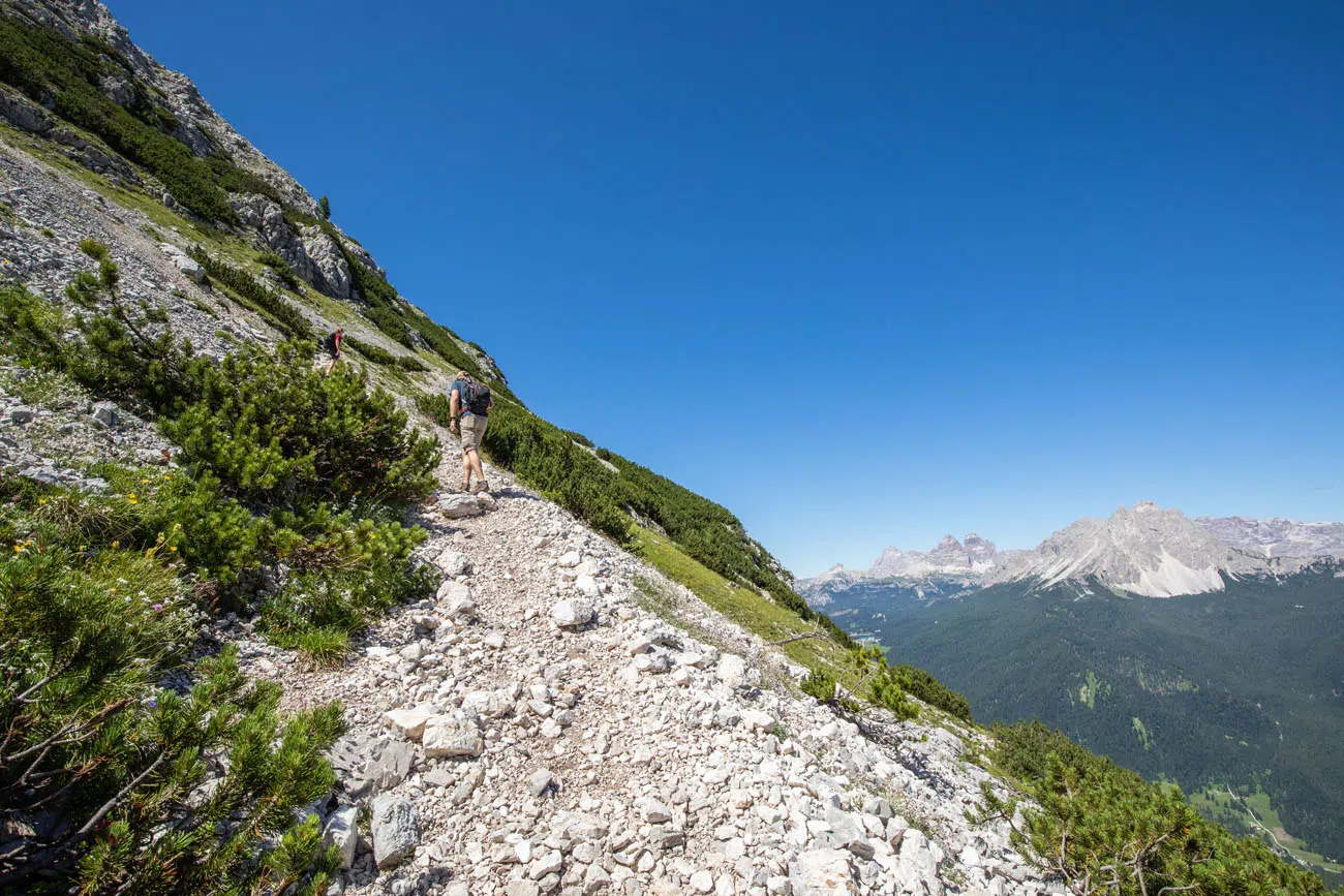
The trail starts off by slowly heading downhill into a forest. The trail is a wide, gravel path and very easy to hike.
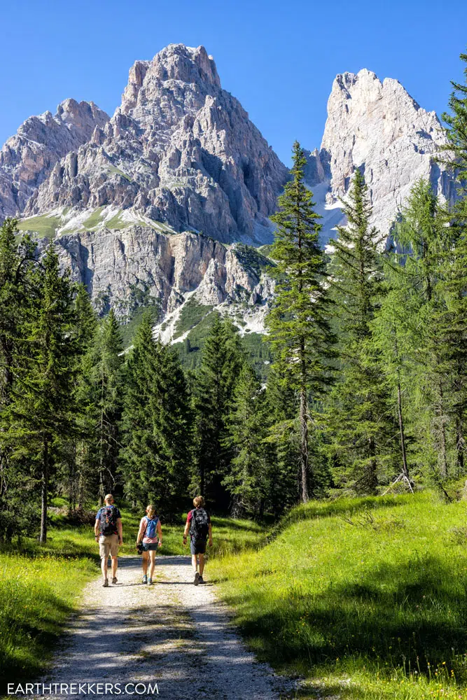
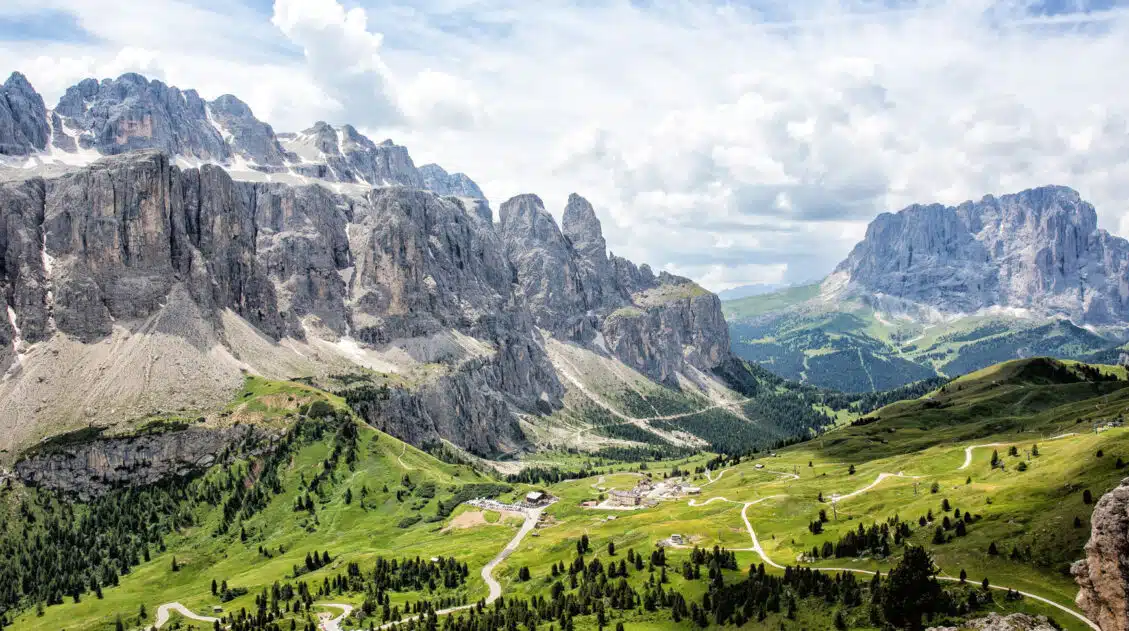
Just before the 2 km point, you have your first steep uphill climb. This is a good warm up for what is to come. At this point, the views open up and you get some beautiful views of the nearby mountains.
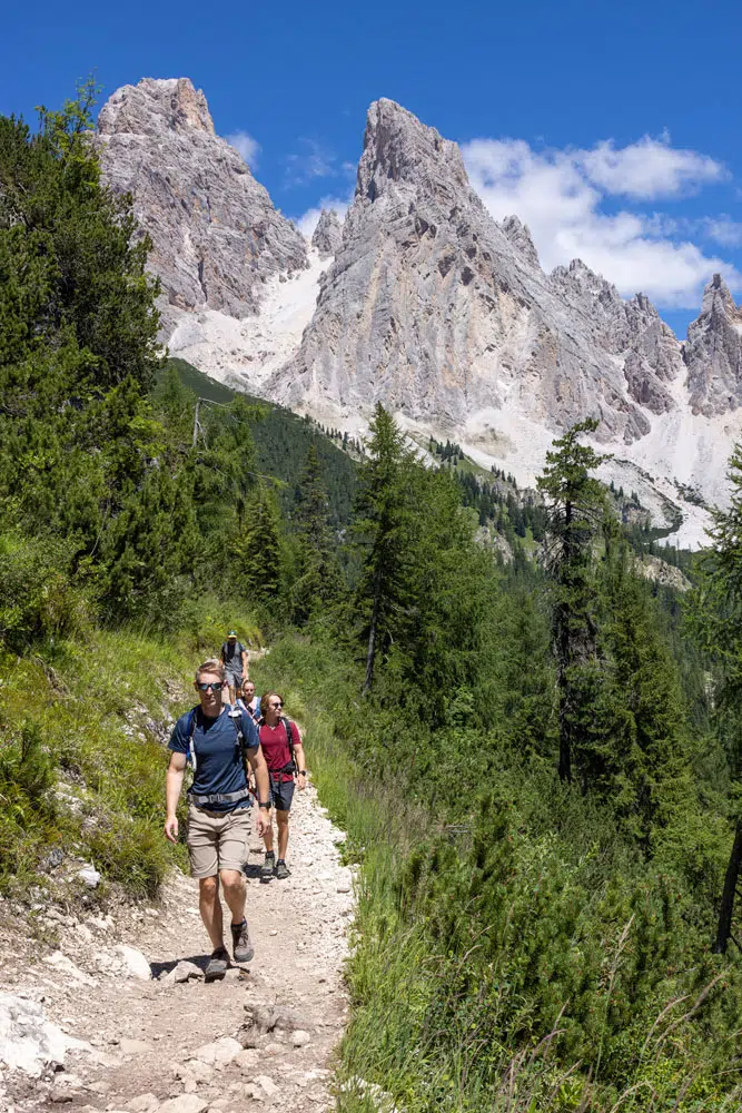
View along the trail
Another view along the trail
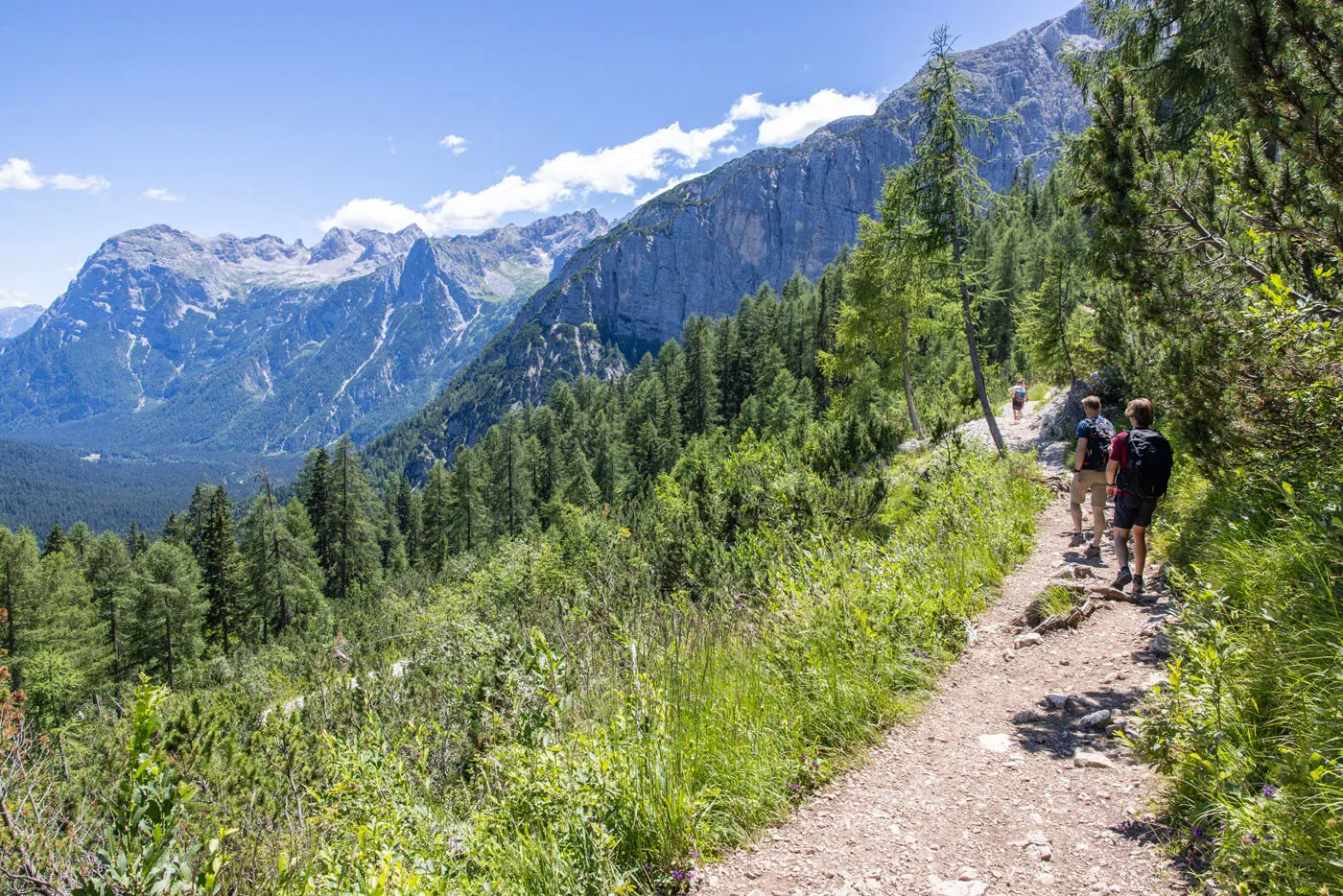
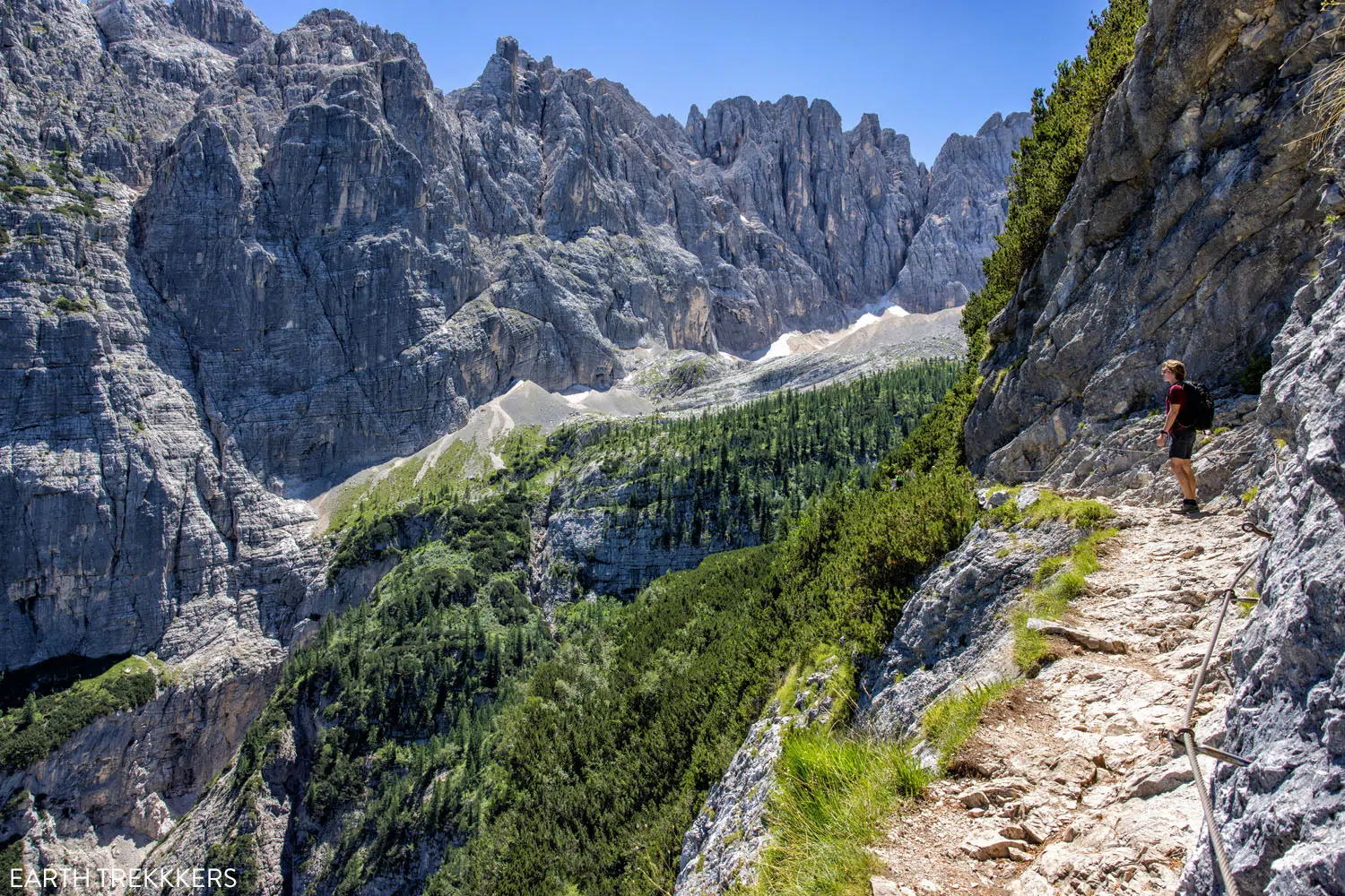
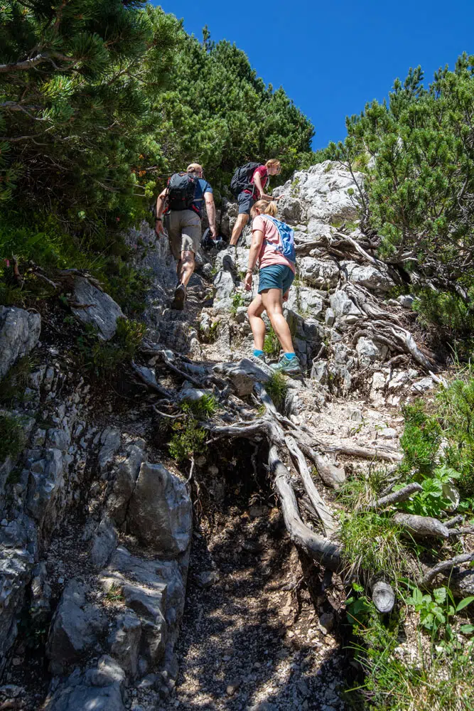
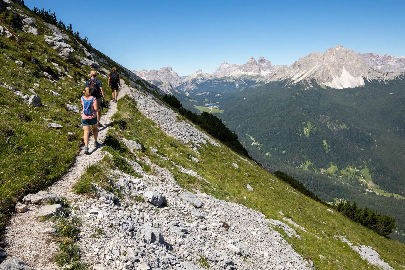
On the way out to the lake, the toughest section of the hike is between kilometers 3 and 4. The trail is narrower, there are a few short but steep sections, and at times, you will do some rock scrambling, climb short sections of metal steps, or hike up inclines with the aid of chains bolted into the rocks.
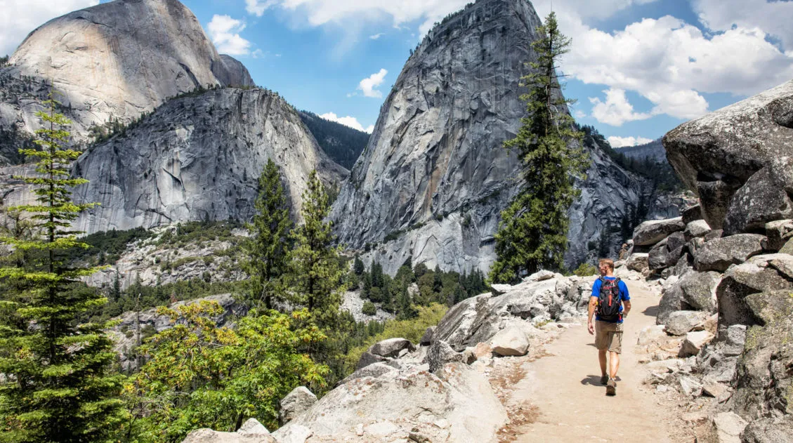
This is also a gorgeous part of the hike, with the wall of mountains off to your left.
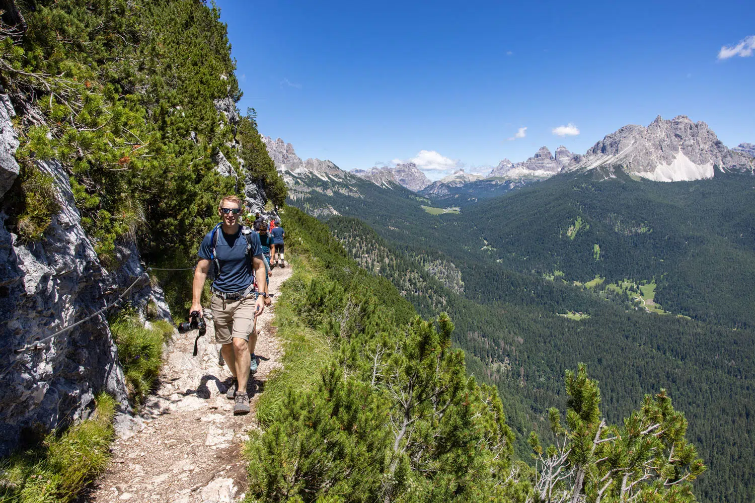
View of the trail. Off in the distance is Tre Cime di Lavaredo and Lago di Misurina.
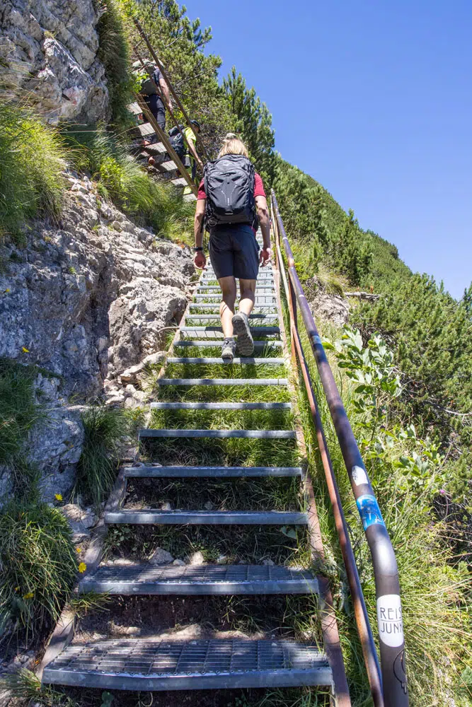
Stairs on the trail.
Trail to Lago di Sorapis
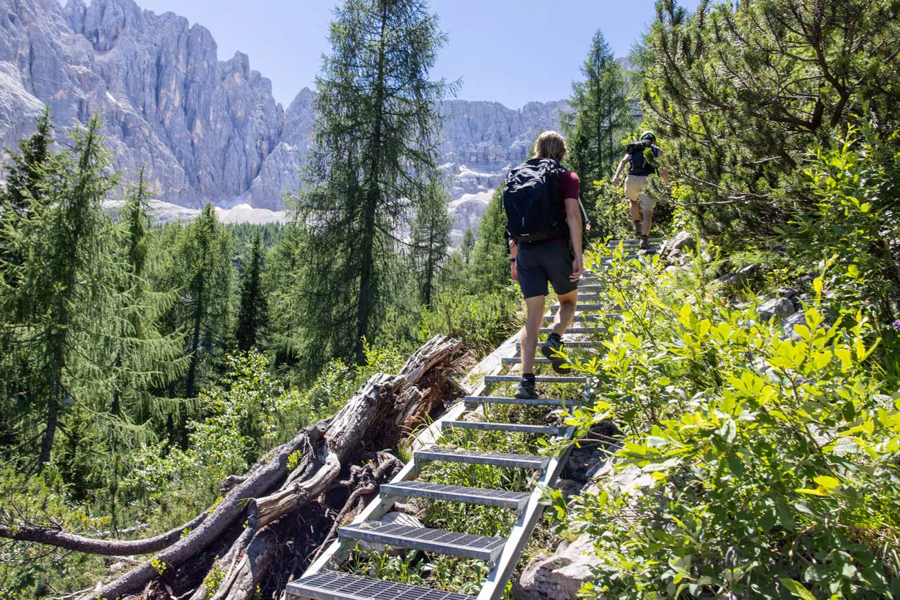
More stairs on the trail.
0.5 km (0.3 miles) before reaching Lago di Sorapis is a trail split. Stay left to continue to the lake. If you like the idea of turning this hike into a loop, you will take this trail to the right on the return hike (after visiting Lago di Sorapis).
Just before reaching the lake is another trail split. Go right to visit the lake. Go left to visit Rifugio Vandelli.
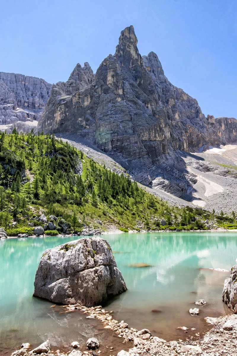
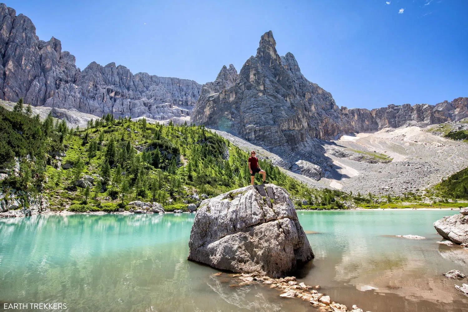
Lago di Sorapis
Once at Lago di Sorapis, you can find a spot to overlook the lake and have lunch or a snack.
There are two rocks which are popular photography locations. The one Tyler is standing on takes some good rock scrambling skills to get both on top of it, and back down, but it is a cool photo spot for those who can do it. Just to the right of this rock is a much smaller rock that is appropriate for hikers of all ages, so you can step right onto it.
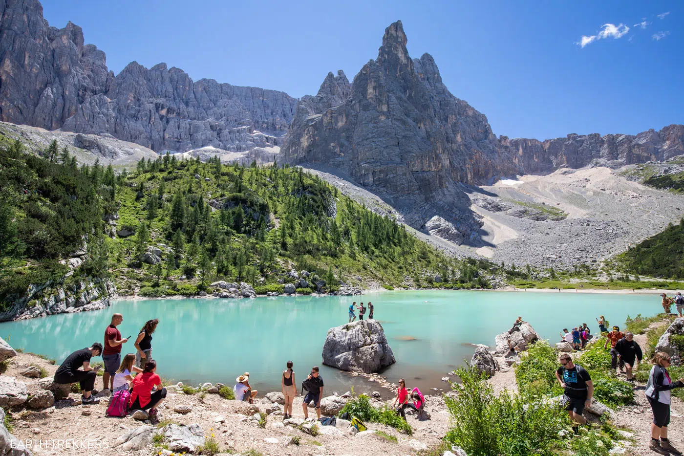
Lago di Sorapis in July
Hiking around Lago di Sorapis
You have the option to hike around Lago di Sorapis. If you choose to do this, it takes 30 to 45 minutes and adds 1.1 km (0.7 miles) onto the hike.
We did this and really thought it was worth it. You get fantastic views from all sides of the lake, since the lake is completely surrounded by the jagged peaks of the Dolomites.
We hiked around Lago di Sorapis in a counterclockwise direction. To get back to the starting point, you will hike up a short but very steep hill. It’s a challenging climb, but once on top of the hill, we had awesome views looking out over the lake which made it worth it.
So, if you’re up for the extra distance and time, and you want to see Lago di Sorapis from all angles, then add on the short hike around the lake.
Here are photos from going around the lake in the counterclockwise direction.
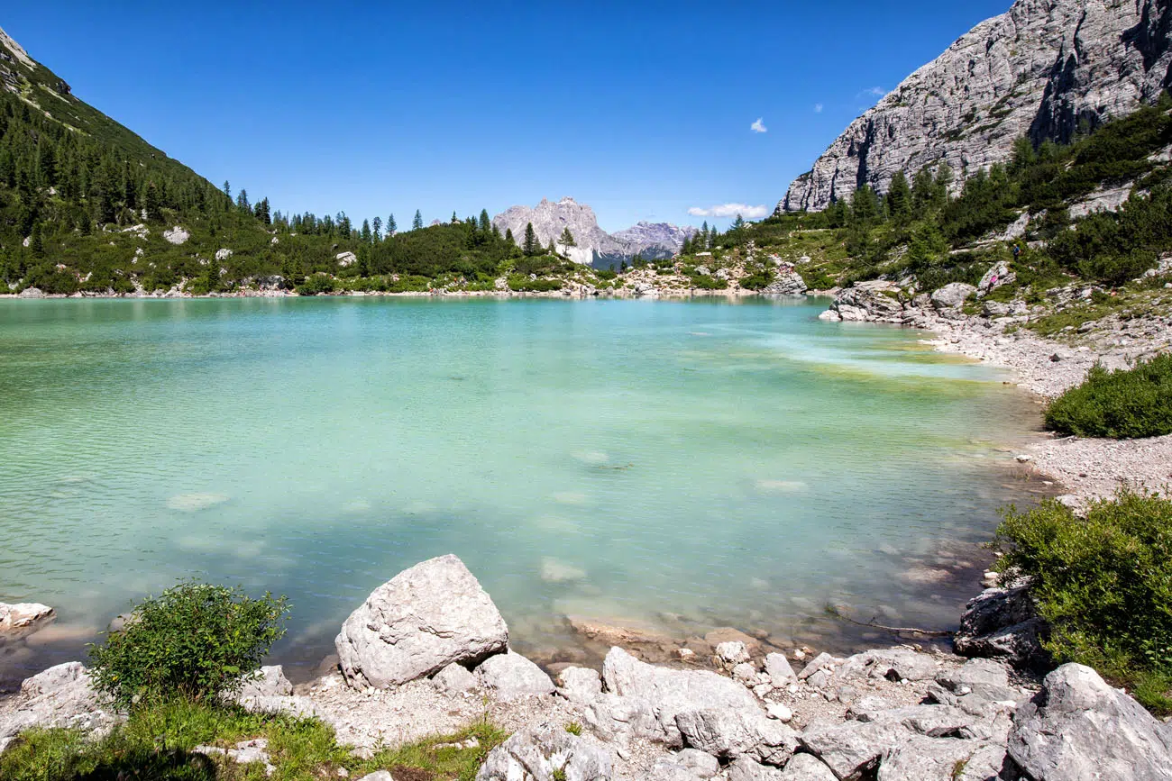
View from the far side of the lake.
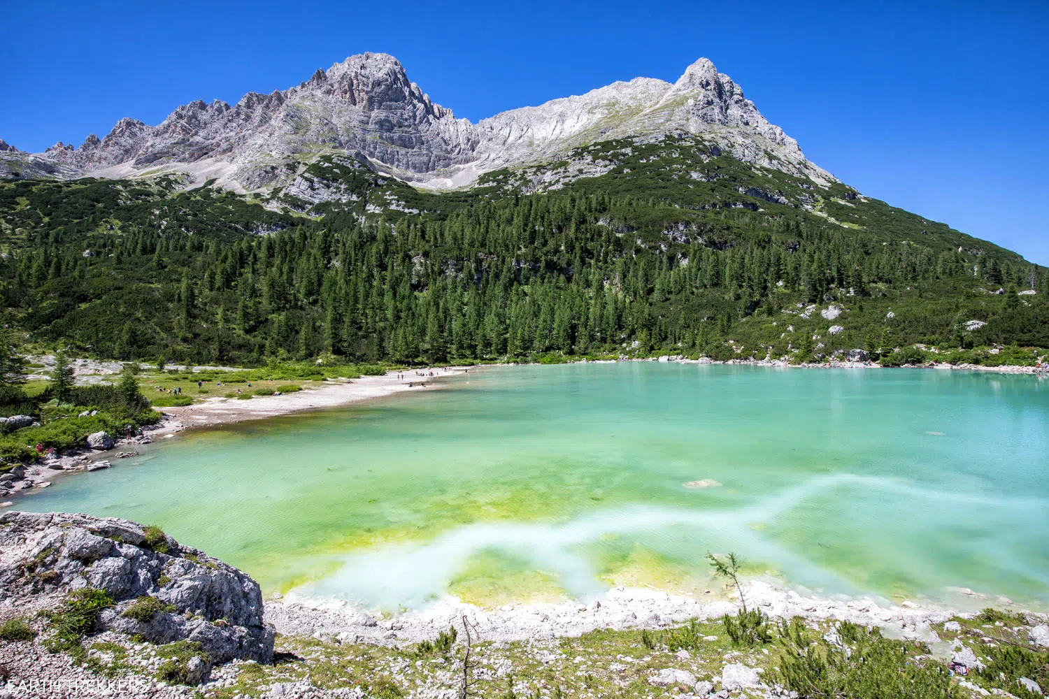
As you climb up the hill, you get a great view of the lake and its rainbow of colors.
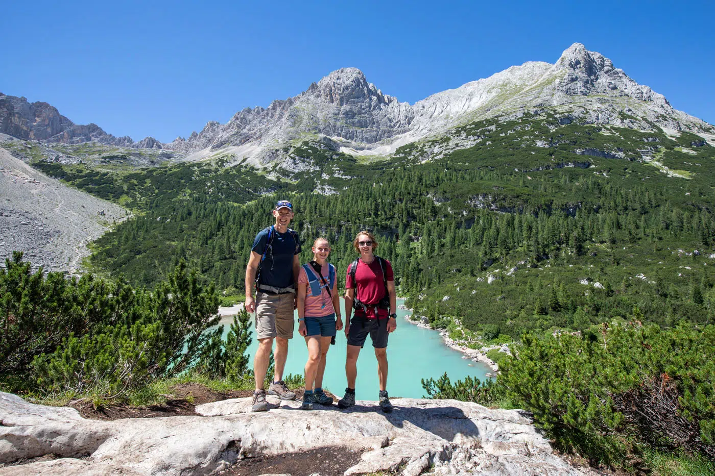
Photo spot on the highest viewpoint.
Overlooking Lago di Sorapis from the highest viewpoint on the loop.
Finishing the Hike
As stated earlier, there are two ways to finish this hike. You can either return the way you came, making this a 11.6 km (7.2 mile) hike.
But if you want BIG views of the Dolomites and still have plenty of energy left, and a challenging hill climb doesn’t deter you, consider doing the loop hike.
All four of us thought Lago di Sorapis was very nice to visit. But it was the views from the trail up and over Forcella Marcoira that really impressed us. It’s tough but it is a spectacular addition to Lago Sorapis.
How to Hike Lago di Sorapis as a Loop
Lago di Sorapis to Forcella Marcoira
From Lago di Sorapis, retrace your steps back along trail #215. 0.5 km (0.3 miles) from Lago Sorapis, at the trail split, take trail #216.
Immediately, you start climbing. At first it isn’t too bad. But the trail is very narrow, you’ll be brushing up against the small shrubs and pine trees along the edge of the trail, and at times you’ll have to do some rock scrambling. This trail gets far fewer hikers than trail #215 to the lake (another bonus for going this way!!), so it is a lot more rugged.
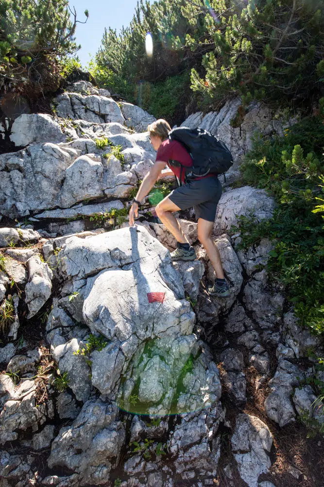
Rock scrambling on the first part of trail #216.
Another view of the first part of the trail.
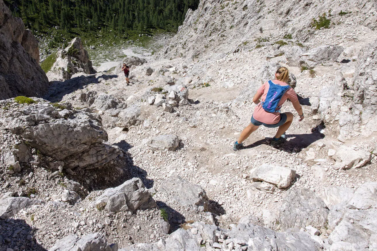
From the trail split, it is a 2.4 km uphill hike. For most of this distance, it is very steep. The trail is a mix of giant boulders and loose gravel, so at times you might slip a little. I’m not going to sugar coat it. This part of the hike is TOUGH. We hike pretty fast, but it was slow going for us on this part of the trail and we frequently had to stop to catch our breath.
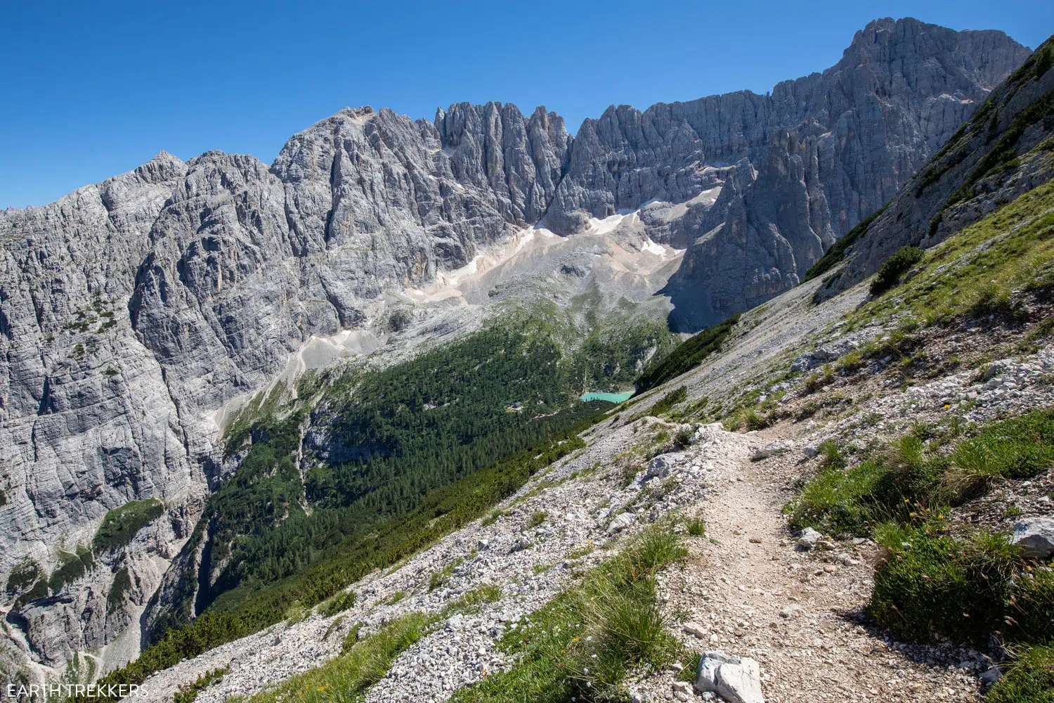
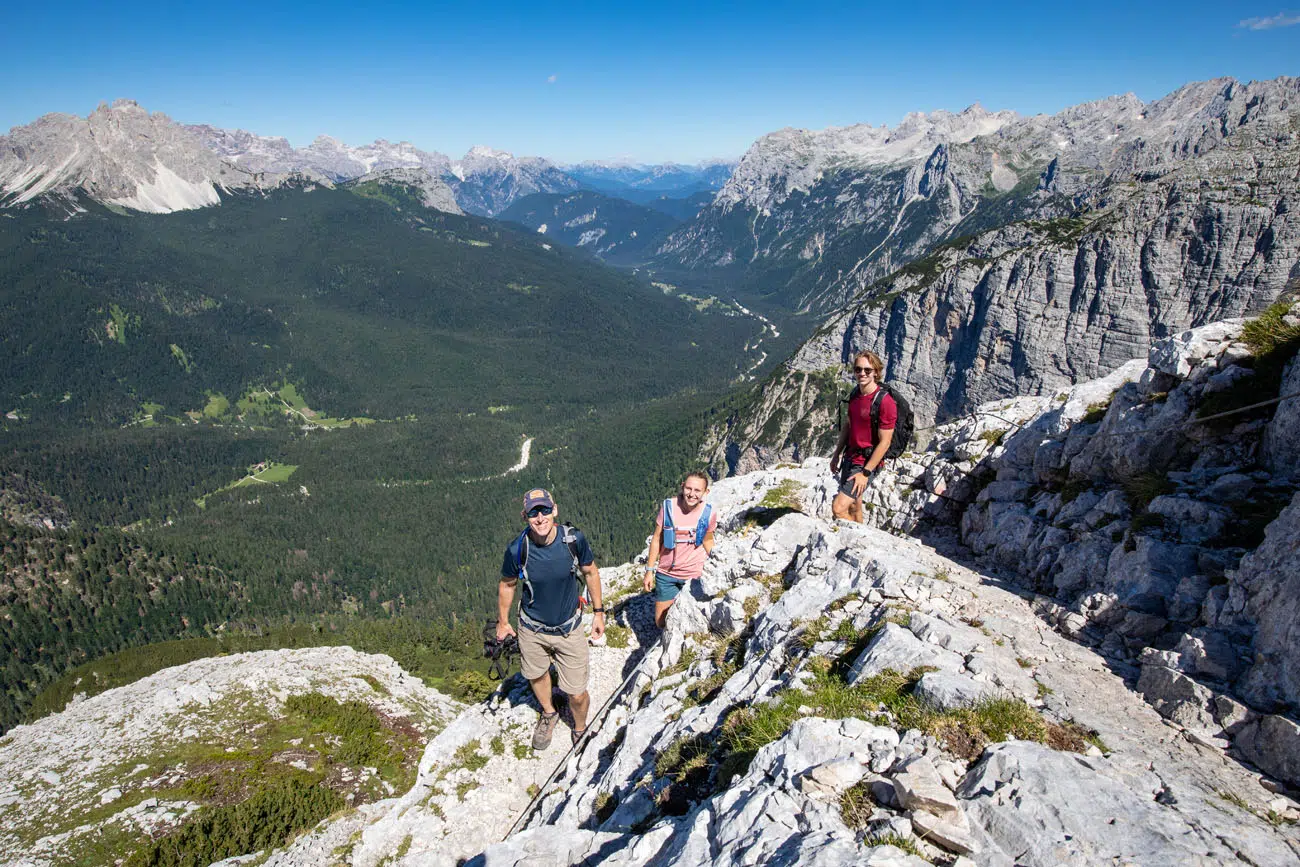
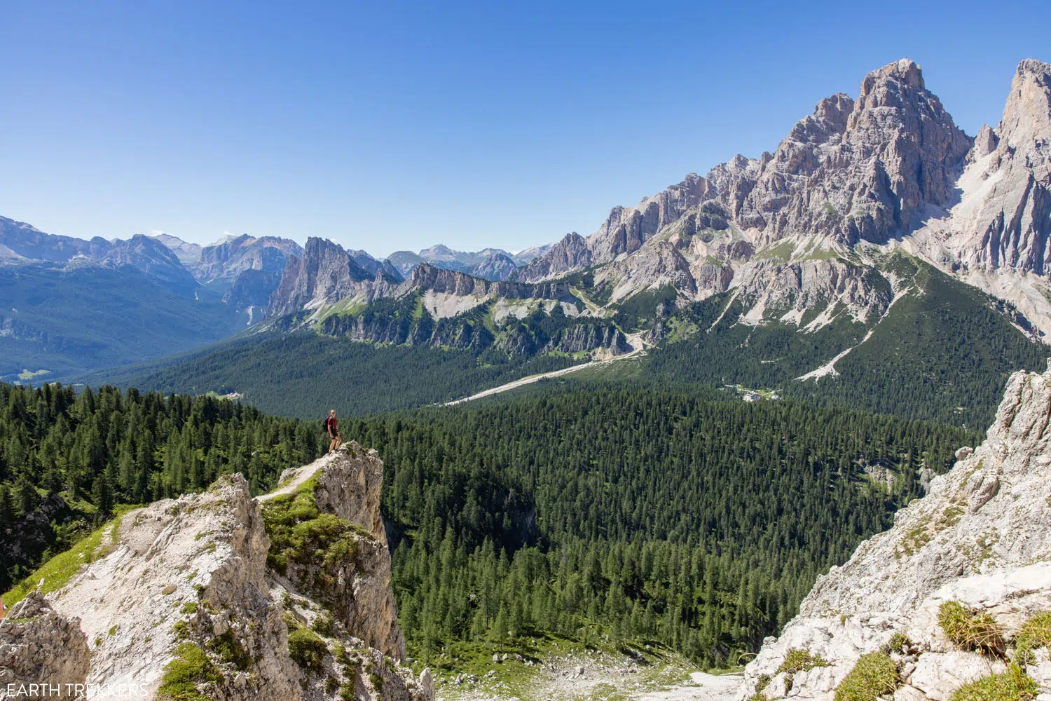
But it is worth it. The higher you go, the better the view. And it doesn’t take long until you can look back at Lago di Sorapis and Rifugio Vandelli, with the backdrop of the mountains, for one of the most unique views of this area.
Plus, the view is opening up in other directions as well. Even though are thighs were screaming at us, we could hardly believe our eyes.
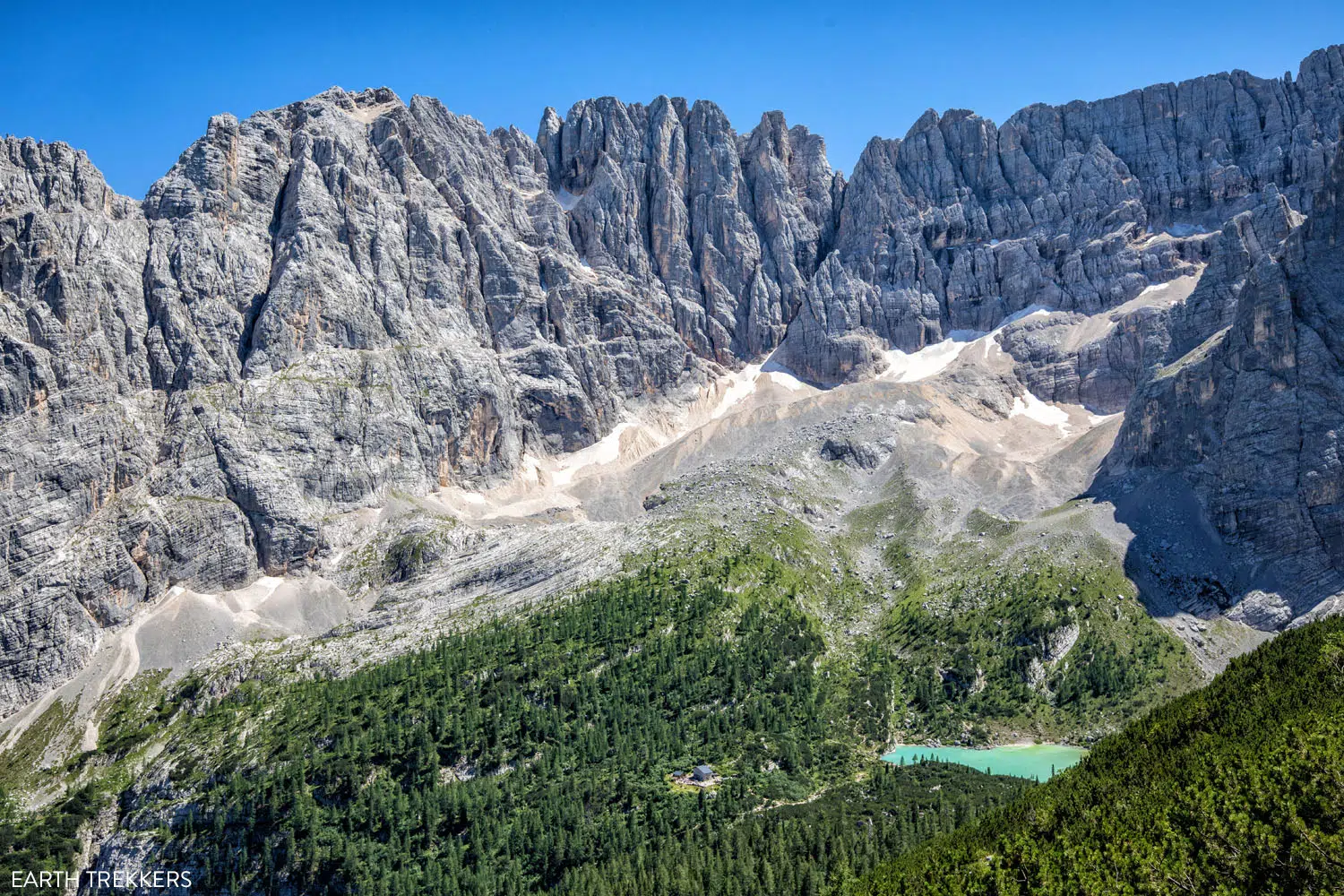
Overlooking Lago di Sorapis and Rifugio Vandelli from trail #216.
Trail #216
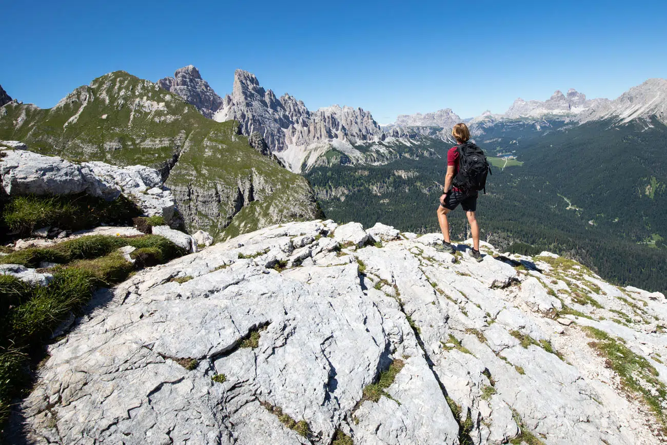
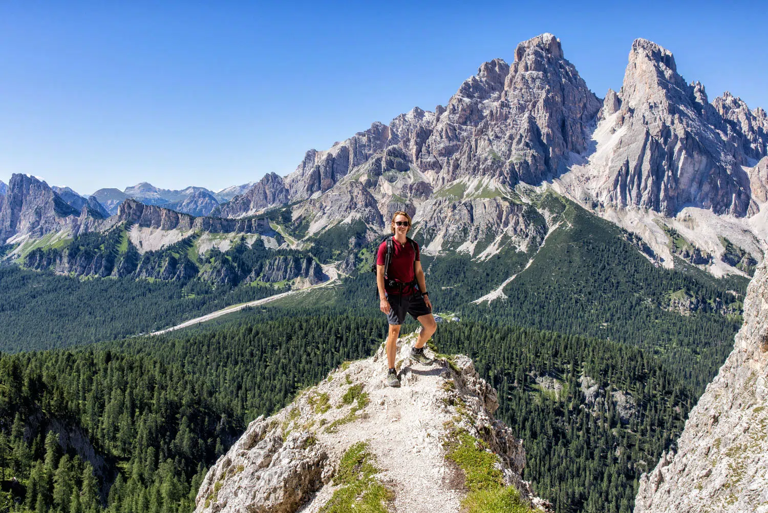
At the top of the pass, you get panoramic views across the Dolomites. From here, you can see Tre Cime di Lavaredo and Lago di Misurina.
Another view from trail #216.
And another view looking back down the trail.
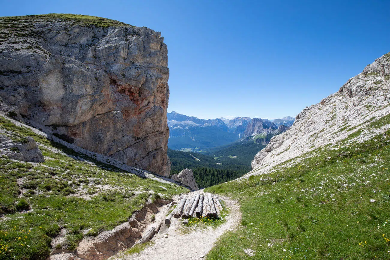
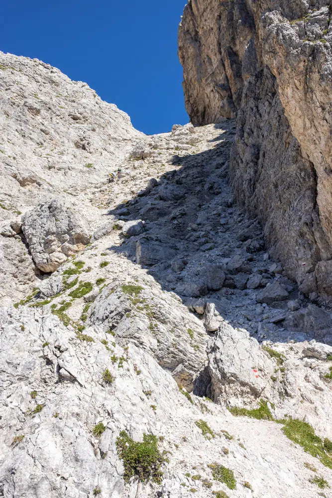
The trail briefly descends into a valley, and for a short distance here you are walking along a narrow trail with a drop off on one side. If you have a fear of heights, you might want to hike to Lago di Sorapis out-and-back. Here’s a photo of what to expect.
In this photo, you can see the photo zig zagging up to Forcella Marcoira.
Then it’s one final climb to Forcella Marcoira, as the trail passes between Cime Ciadin del Loudo and Cime di Marcoira. At this point, you are standing at 2,307 meters (7,600 feet). From here, continue on trail #216 towards Passo Tre Croci.
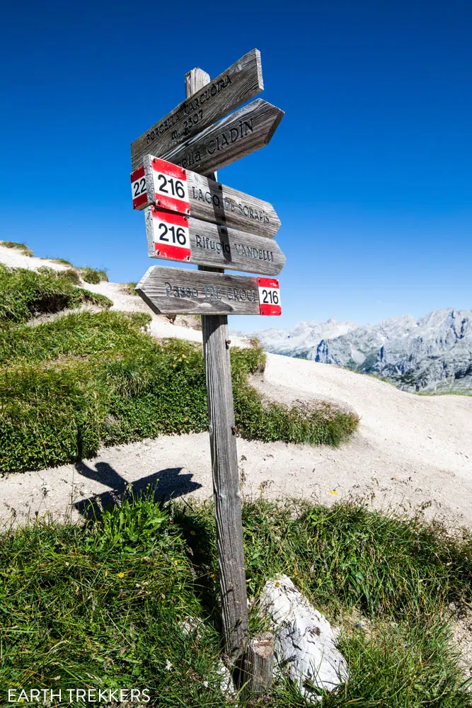
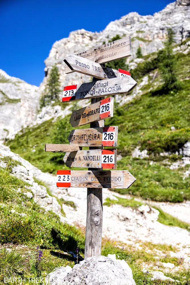
Trail sign at Forcella Marcoira
Forcella Marcoira to Passo Tre Croci
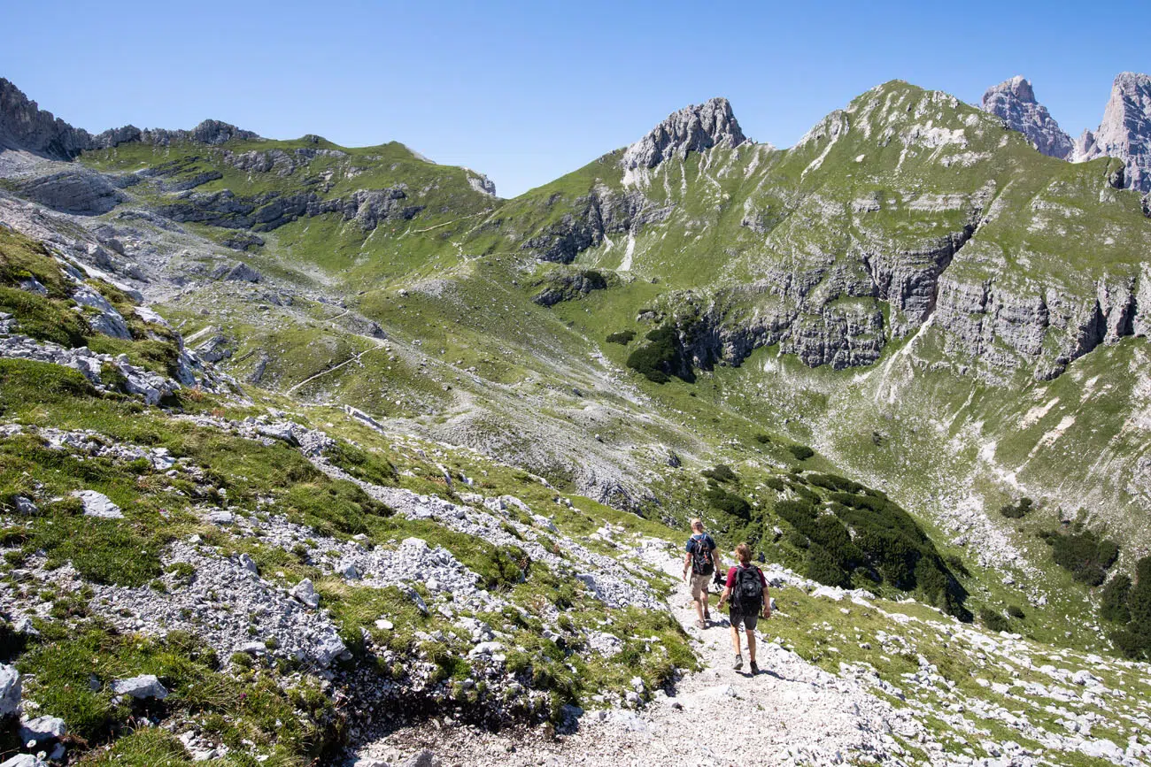
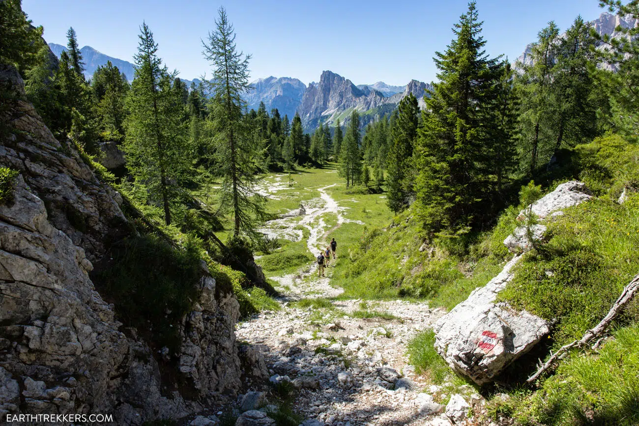
You will hike down an incredibly steep section of trail. It’s made even more treacherous with the loose gravel that covers the trail. Take your time here because it is very easy to slip and fall. If you knock loose some rock or boulders, call out “rock!” as a warning to those below you. Fortunately, when we did this, we were the only ones on this section of trail.
View of the trail from Forcella Marcoira.
Looking back up the trail.
Near the bottom of this steep descent is small hill you can climb which makes yet another great photo spot for the day.
At approximately 9.5 km, there is one final trail split. Turn right to take trail #213 to Passo Tre Croci.
From here, it’s a mostly easy, downhill walk the rest of the hike. There will be a few short, steep downhill sections, but for the most part, it’s an easy hike on wide gravel trail. Here are the last final kilometers of the hike in photos.
Trail #213, near Passo Tre Troci.

Who Should Do the Loop Hike?
Hiking to Lago Sorapis as a loop isn’t much farther than doing it out-and-back. But it’s the extra elevation gain that really makes this route challenging.
If you can handle it, the nice hike to Lago di Sorapis turns into an epic day of hiking in the Dolomites.
In order to do the hike as a loop, you need to have a high level of fitness. The climb is TOUGH and at times it feels as if it will never end.
If you have a fear of heights, there is one brief section (about 50 meters), where there is a lot of exposure on the trail, with a drop-off on one side. This occurs just before reaching Forcella Marcoira. And there are a few more brief spots along the trail where you will briefly be hiking along a short drop-off.
About Our Experience
We did this hike in early July. Earlier in the day, we drove from Venice to Cortina d’Ampezzo, so we didn’t start the hike until 12:00. We knew the trail would be crowded, but we had perfect weather and crystal-clear skies, so we were willing to brave the crowds in order to do this hike. But I do believe an earlier start would have made this a much better experience.
We liked the hike from start to finish. Yes, the trail was crowded. And so was the lake when we got there. But the trail is fun to hike and the views are wonderful along the entire trail so overall, it was a great experience.
But our favorite moments, by far, were on the return hike. We had no idea of what to expect, so when we had those incredible views of the Dolomites, we were blown away. And since very few people hike trails #216 and #213, we were on our own for most of the second half of the hike. It was magical.
What to Bring on the Hike to Lago di Sorapis
Hiking shoes. We recommend wearing hiking shoes for this hike. The trail is rough and uneven in a lot of places and you will rock scramble up and down smooth, granite rocks, which can be very slippery. The hiking shoes will give you added traction which will be very helpful on this hike.
Water. Bring at least 1.5 liters of water per person. You can refill you water bottle or hydration pack at Rifugio Vandelli.
Sunscreen, hat, and sunglasses. Parts of the trail is shaded, but you will be exposed to the sun on the second half of the trail and at Lago Sorapis. If you plan to do the hike as a loop, most of hiking trail is fully exposed to the sun.
Essential Hiking Gear: What Should You Bring on a Day Hike?
If you are new to hiking or are curious about what you should bring on a hike, check out our Hiking Gear Guide. Find out what we carry in our day packs and what we wear on the trails.Things to Do after the Lago di Sorapis Hike
After the hike, if you still have some energy left, you can visit Lago di Misurina, a beautiful lake that is a 10-minute drive from the trailhead. There are a few restaurants along the lake and we had very good pizza at Edelweiss Pizzeria.
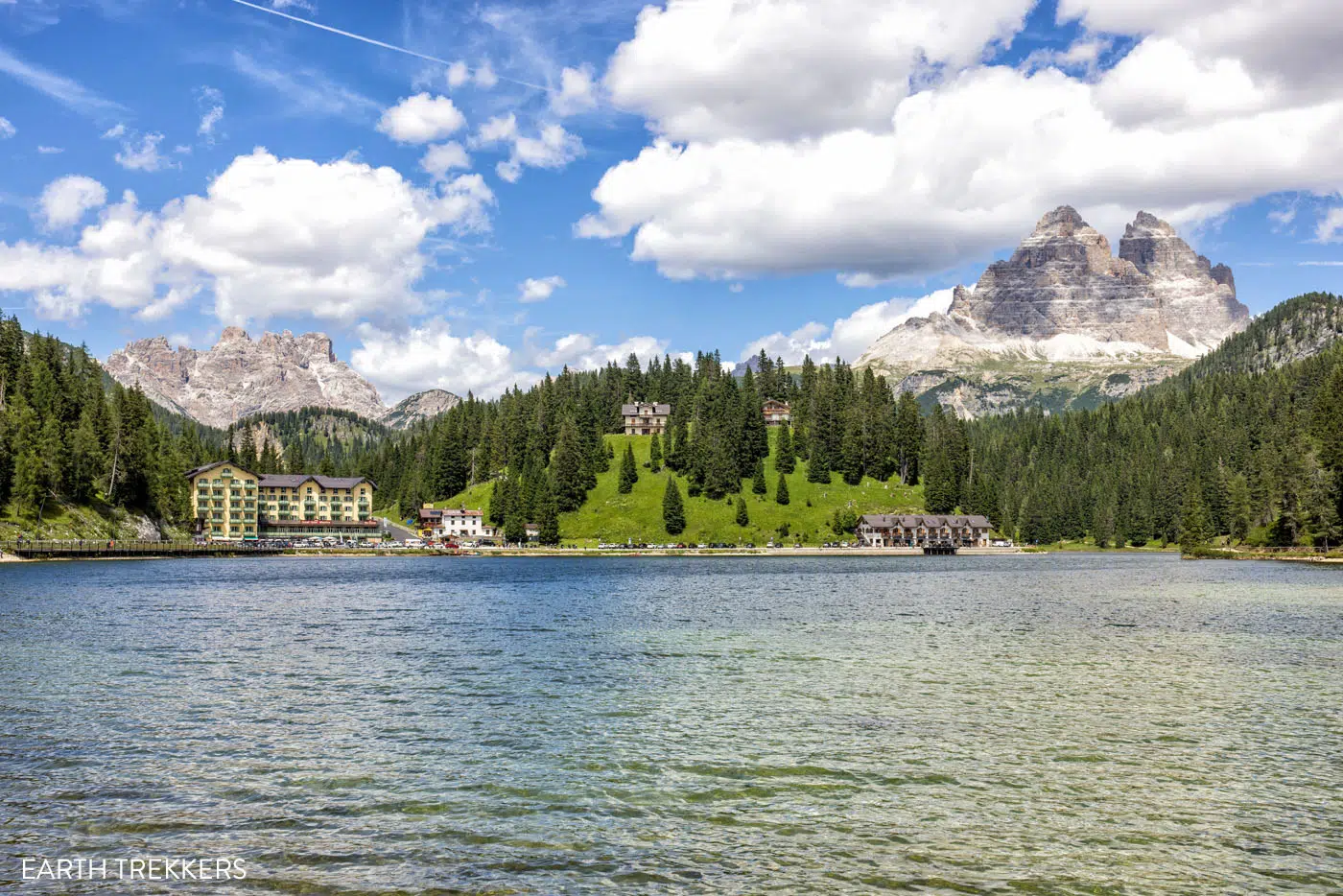
Lago di Misurina
We also loved the Freccia nel Cielo cable car to Tofana di Mezzo for jaw-dropping views of the Dolomites (the station is located in Cortina d’Ampezzo).
Frequently Asked Questions
When is the best time of day to hike to Lago di Sorapis?
The morning is the best time of day to hike to Lago di Sorapis. Crowds will be lower first thing in the morning and once you get to Lago Sorapis, the lighting will be perfect for photos of the lake.
What time of year can you hike Lago di Sorapis?
The best time of year to hike to Lago di Sorapis is the summer months (from June through September). The trail is open all year, but snow can cover the trail from October through May, so during this time, you should only hike to Lago di Sorapis if you have appropriate gear and experience hiking in the snow.
Can you swim in Lago di Sorapis?
No, swimming is not allowed in Lago di Sorapis.
If you have any questions about how to hike Lago Sorapis, or if you want to share your experience, let us know in the comment section below.
Plan Your Trip to Italy
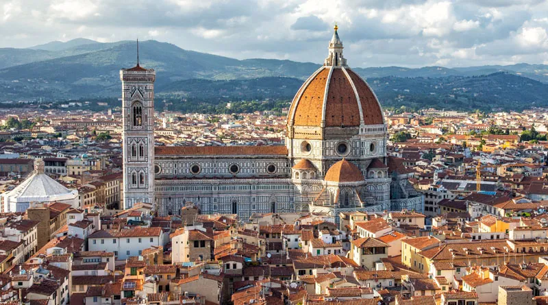
We have TONS more information about Italy in our Italy Travel Guide, including Rome, Florence, Venice, Tuscany, the Dolomites, the Amalfi Coast, the Cinque Terre, Basilicata, and Puglia.
15 Best Hikes in the Dolomites (Easy to Challenging)
The Dolomites are one of the best hiking destinations in Europe. In this guide, we rank the 15 best hikes in the Dolomites, from easy scenic trails to challenging alpine adventures, based on views, difficulty, and our firsthand experience hiking the region. Jagged limestone peaks, knife-edge ridgelines, and turquoise alpine lakes make the Dolomites one […]
Tre Cime di Lavaredo Hike: Step-By-Step Trail Guide, Parking & Map
The Tre Cime di Lavaredo trail is one of the most iconic hikes in the Italian Dolomites, featuring a scenic loop trail that circles three dramatic limestone peaks. We’ve hiked Tre Cime on multiple trips to the Dolomites, including peak summer season when parking restrictions were in place. The first time we did this hike, […]
Dolomites Travel Guide: How to Plan a Trip to the Dolomites
Dolomites Travel Guide The Dolomites are one of the most breathtaking mountain destinations in Europe. Jagged pinnacles of rock soar into the sky, mountain huts and cabins dot the green, rolling hills, cable cars whisk hikers and skiers to the highest mountain peaks, and hiking trails connect small hamlets and towns. We’ve spent 12 days […]
15 Surprising Things to Do in the Dolomites That Aren’t Hiking
We have traveled to the Dolomites twice, spending 12 days exploring alpine lakes, mountain passes, and hiking trails. This guide features the very best things to do in the Dolomites that require minimal or no hiking, based on our personal experiences. It’s no secret that the Dolomites are a great place to go hiking. But […]
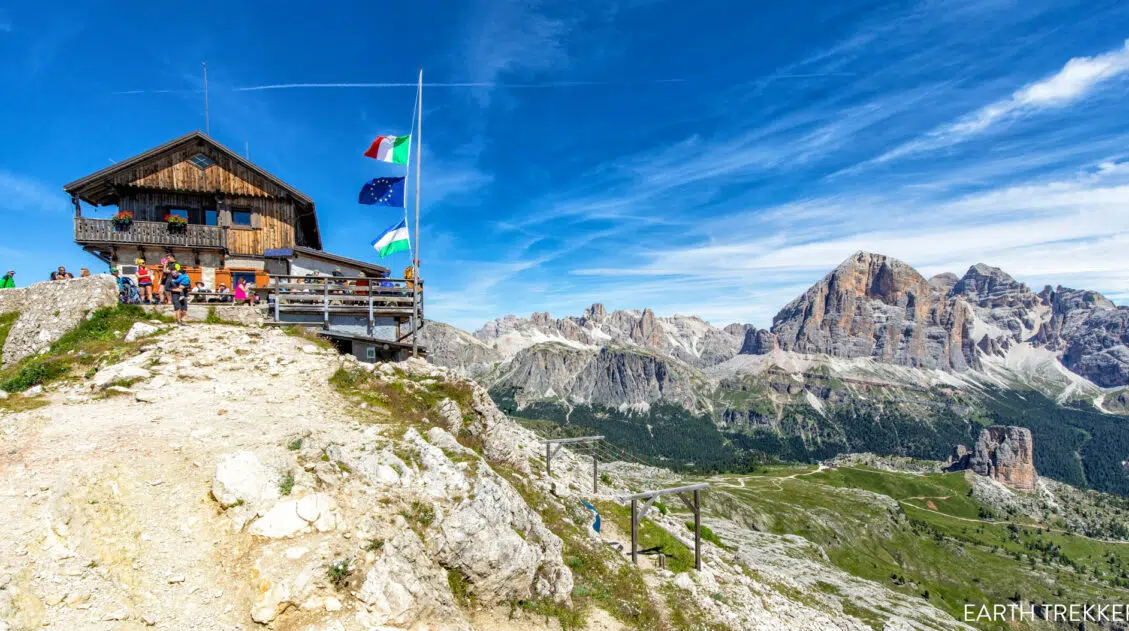
How to Hike Rifugios Averau & Nuvolau for Stunning Dolomites Views
Although we hadn’t intended to hike to Rifugio Averau or Rifugio Nuvolau, seeing them in the distance while hiking the Cinque Torri changed everything. The views from both huts were spectacular, turning a spontaneous decision into one of our most unforgettable experiences in the Dolomites. Rifugios Averau and Nuvolau are two of the most scenic, […]
Where to Stay in the Dolomites (2026 Guide to the Best Towns & Hotels)
Wondering where to stay in the Dolomites? It’s one of the most important decisions you’ll make when planning your trip. This region may look small on a map, but winding alpine roads and high mountain passes mean travel times are longer than expected. Stay in the wrong town and you could spend hours driving instead […]
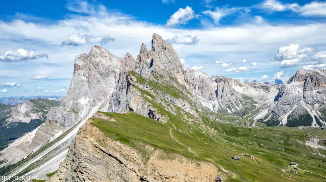
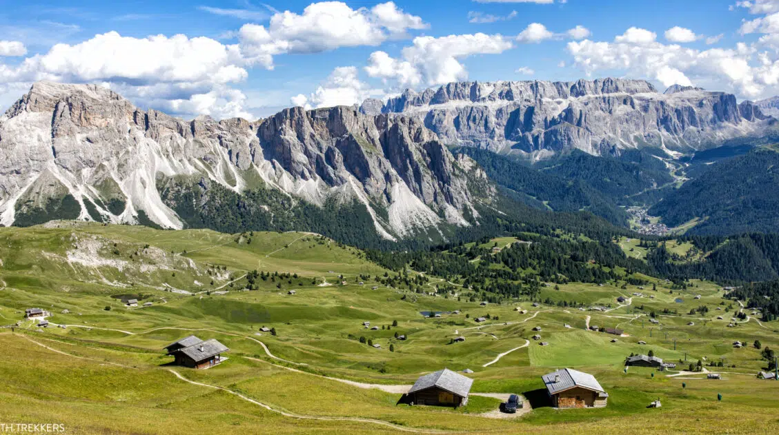
Best Way to Visit Seceda (with Little to No Hiking)
The ridgeline of Seceda looks almost unreal — a dramatic wall of jagged peaks rising above the green pastures of Val Gardena. It’s one of those views that stops you in your tracks, the kind you’ve seen in photos of the Dolomites and wondered, Is it really that beautiful in person? (Yes. It is.) And […]
Italy Travel Guide: How to Plan a Trip to Italy
Italy Travel Guide From the ruins of ancient Rome to the hiking trails of the Dolomites, the trulli of Puglia to the hilltop villages of Tuscany, Italy is a country that rewards every kind of traveler, and keeps pulling you back. We’ve traveled to Italy six times, exploring the country from the lakes and mountains […]
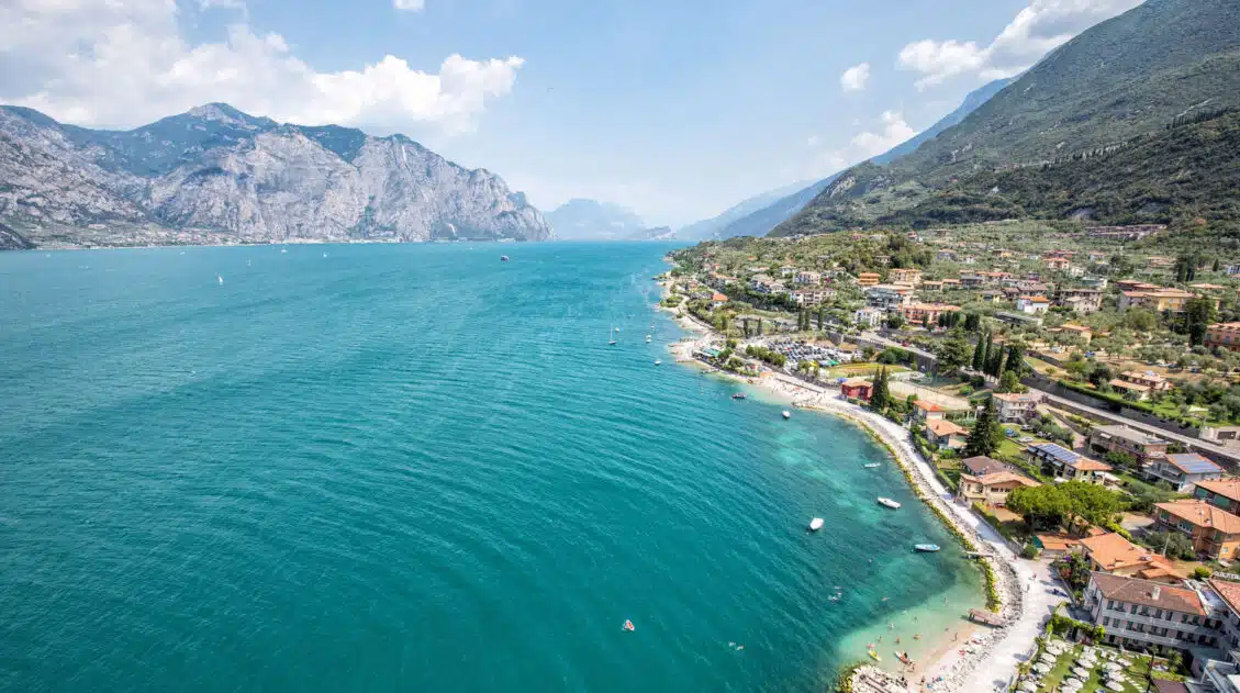
Lake Garda Itinerary: The Best Way to Spend 1 to 4 Days in Lake Garda
Lake Garda is Italy’s largest lake, spanning three provinces of Italy (Trentino, Verona, and Brescia). On a visit to Lake Garda, not only can you visit the long list of lovely towns that line the lake, but you can also cruise to Lake Garda’s islands, take your pick from hikes in the area, visit vineyards […]
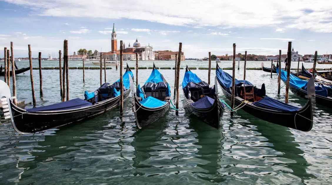
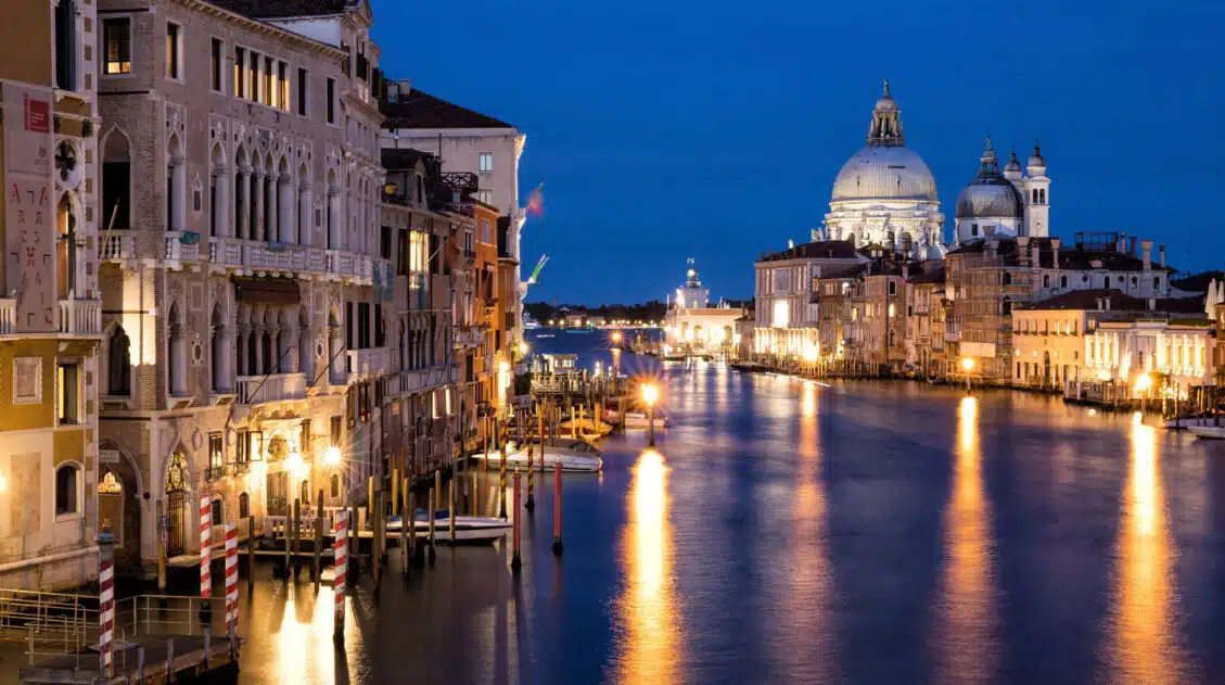
One Day in Venice: 3 Different Ways to Plan Your Itinerary
Visiting Venice for just one day? This guide gives you three proven one-day Venice itineraries, whether you want to see the must-do sights, avoid crowds, or explore at a slower pace. If you are planning to spend one day in Venice, there are several ways to do it. Do you want to spend the day […]

Milan Day Trip: One Day Itinerary from Florence, Venice & Cinque Terre
Milan makes a surprisingly easy and rewarding stop between Florence, Venice, and the Cinque Terre. With high-speed trains and compact sightseeing, you can see the Duomo, Leonardo da Vinci’s Last Supper, and stroll through the Galleria Vittorio Emanuele II, all in just a few hours. Milan also co-hosted the 2026 Winter Olympics, bringing the world […]
The Perfect 10 Day Northern Italy Itinerary (Dolomites, Venice & Lake Como)
This 10-day itinerary through Northern Italy features Venice, the Dolomites, Verona, Milan, and Lake Como, with hiking suggestions, hotel recommendations, and practical planning advice based on our numerous trips to Italy. We’ve visited Italy numerous times, exploring these destinations on separate trips over the years, hiking in the Dolomites, wandering the canals of Venice, strolling […]
Comments 26