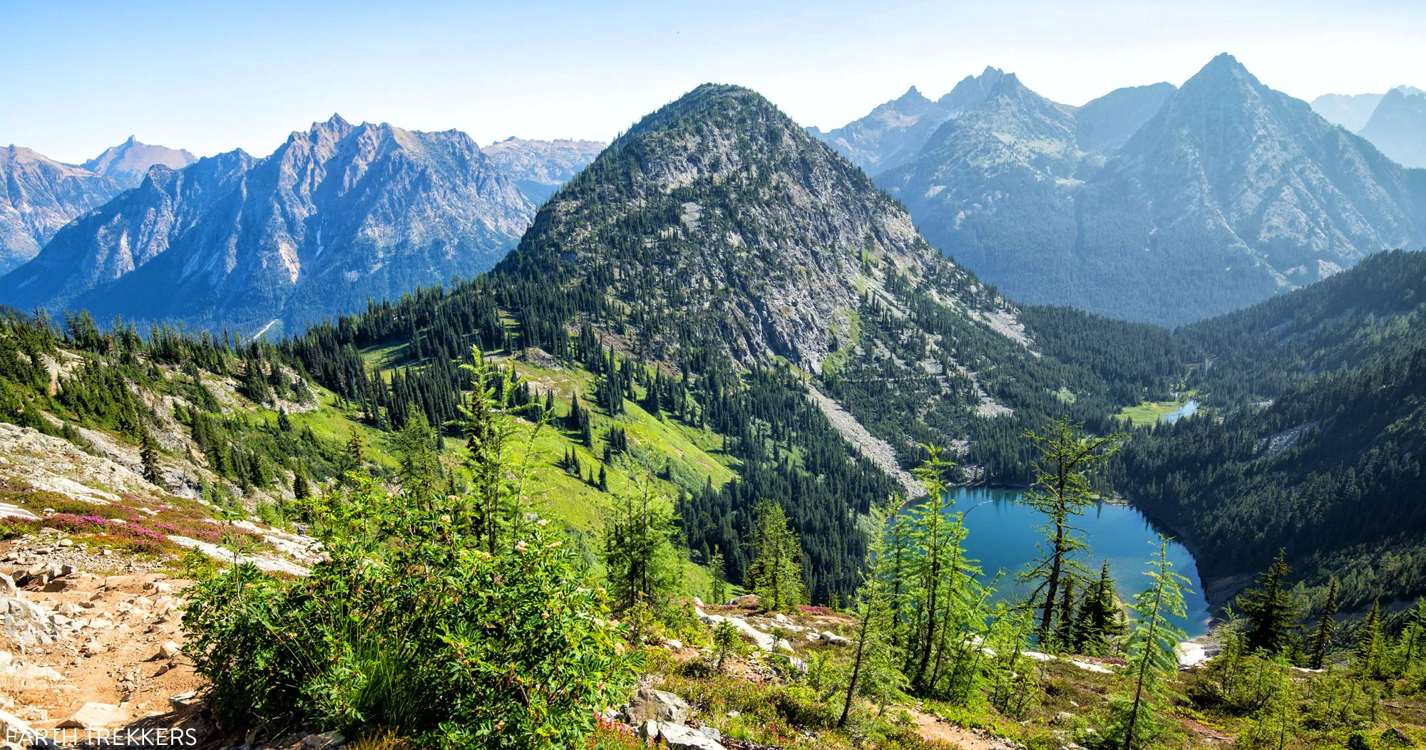
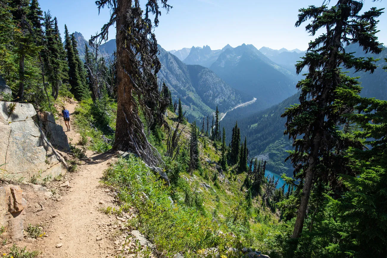
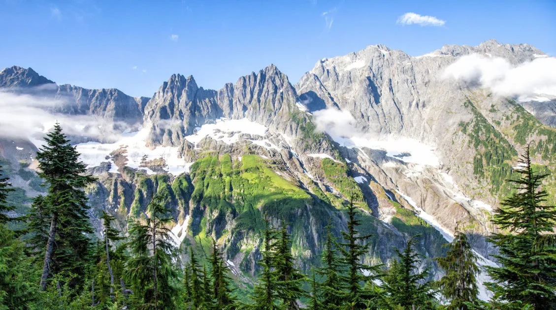
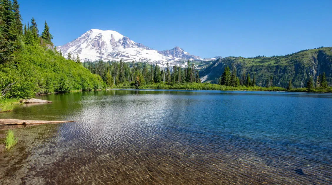
The Maple Pass Loop offers a little bit of everything…wildflowers, old growth forests, a visit to a lovely alpine lake, and (the best part) panoramic views of the North Cascades.
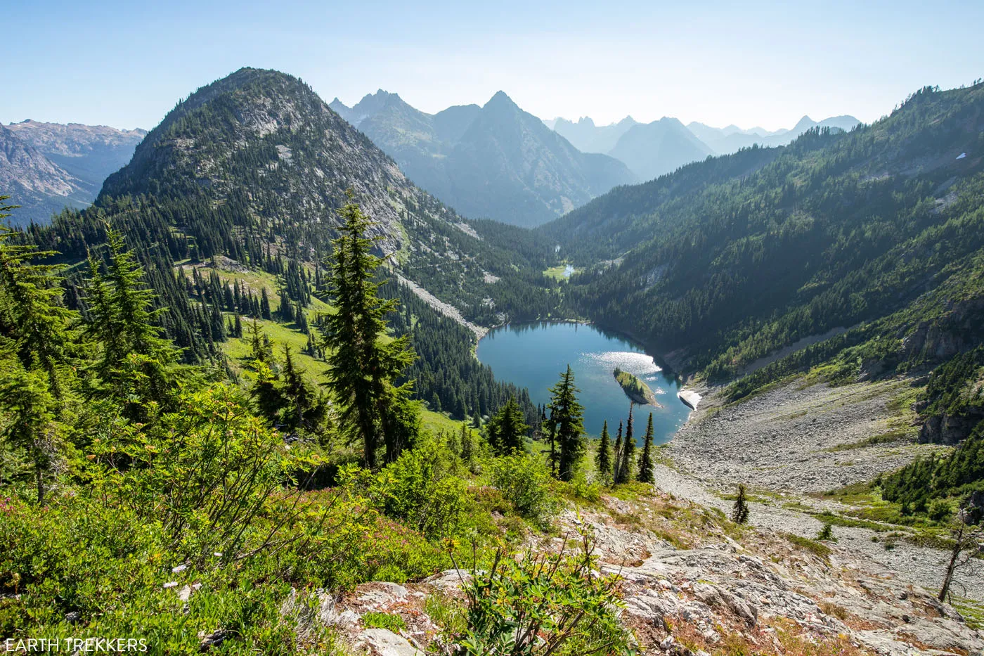
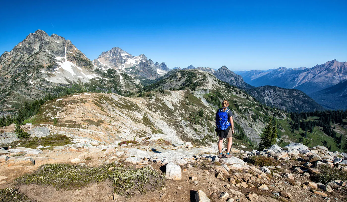
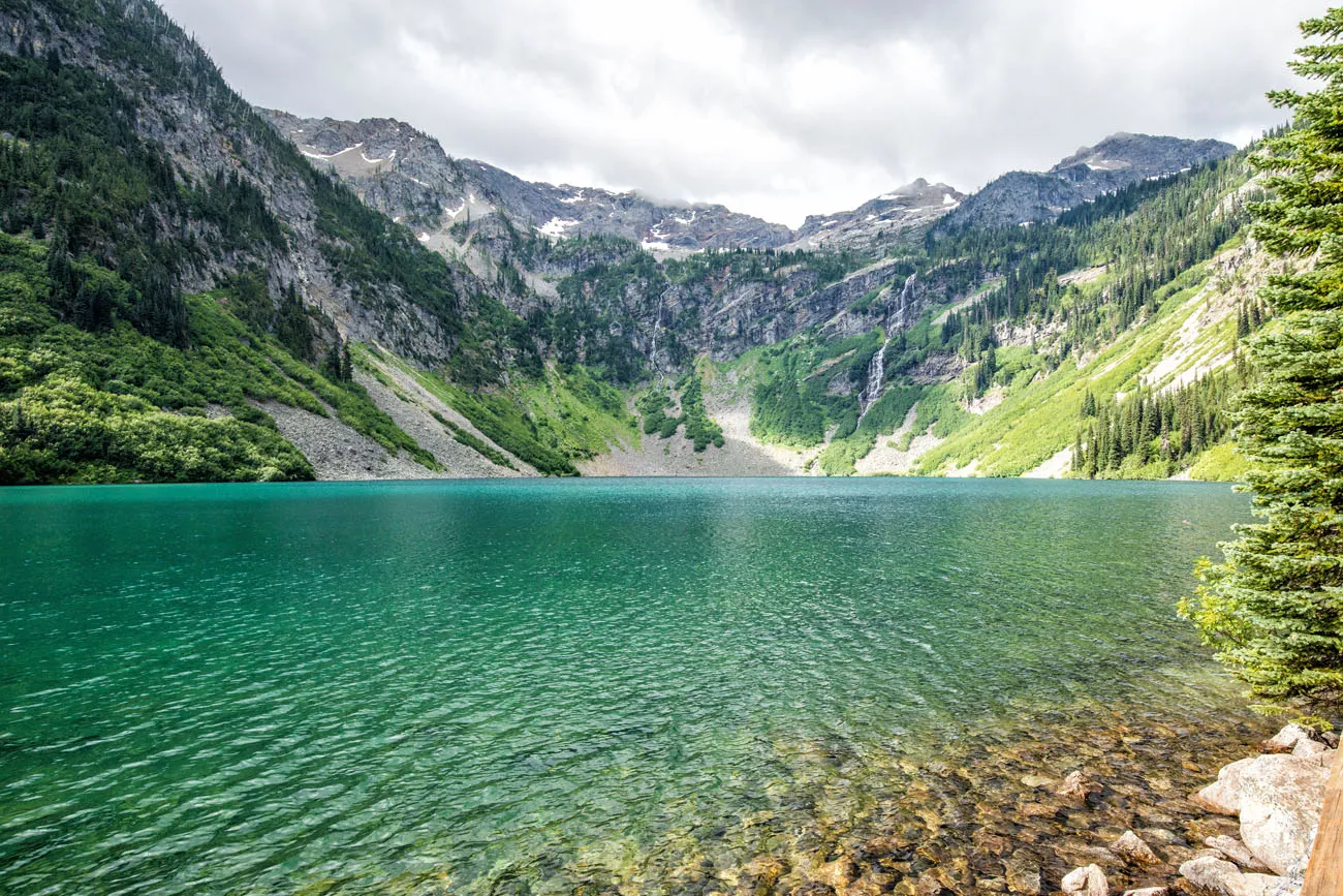
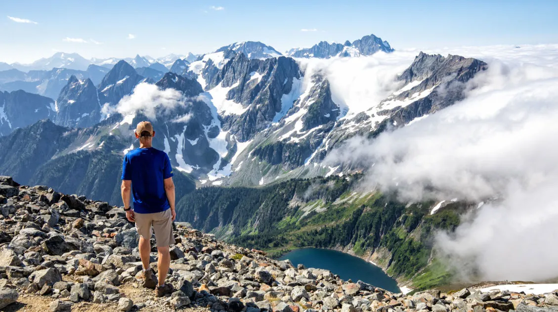
Although it is not located in North Cascades National Park, you bump right up against the park border. From the highest points along the trail, you will have spectacular views of the national park. The view over Ann Lake is lovely, but the whole reason for doing this hike, in my opinion, are for the high mountain views. They are truly breathtaking.
From this trail, you really get to appreciate just how vast and rugged and spectacular North Cascades National Park is.
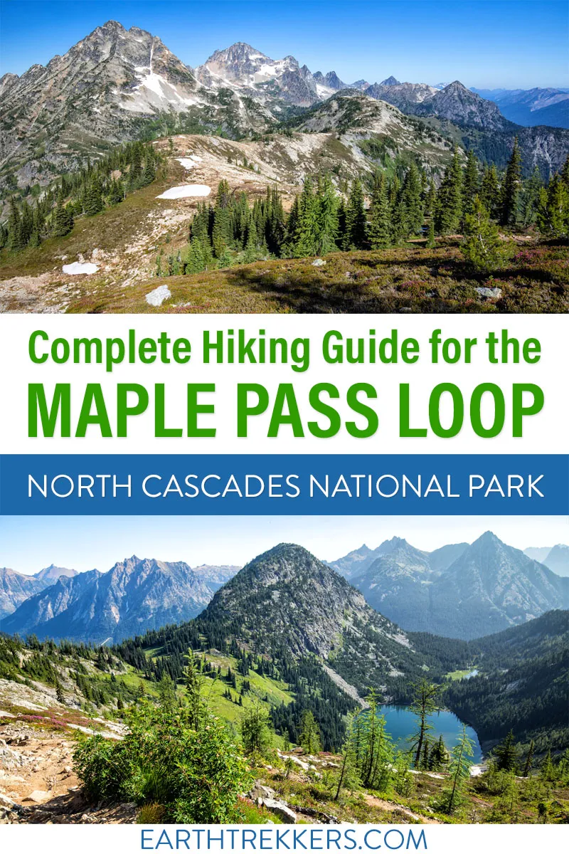
Maple Pass Loop Hiking Stats & Map
Distance: 7.2 miles
Difficulty: Strenuous
Total Elevation Gain: 2,200 feet
Trailhead Elevation: 4,900 feet
Highest Elevation (Maple Pass): 6,950 feet
Length of Time: 3 to 5 hours
When to Go: May through October, depending on the opening of Highway 20. Snow can linger on the trail through July. If you plan to do this hike before mid to late July, be prepared for lots of snow on the trail.
Note: These hiking statistics do not include the spur trail to Ann Lake. Adding Ann Lake onto the hike adds about 1 mile and 100 feet of elevation gain.
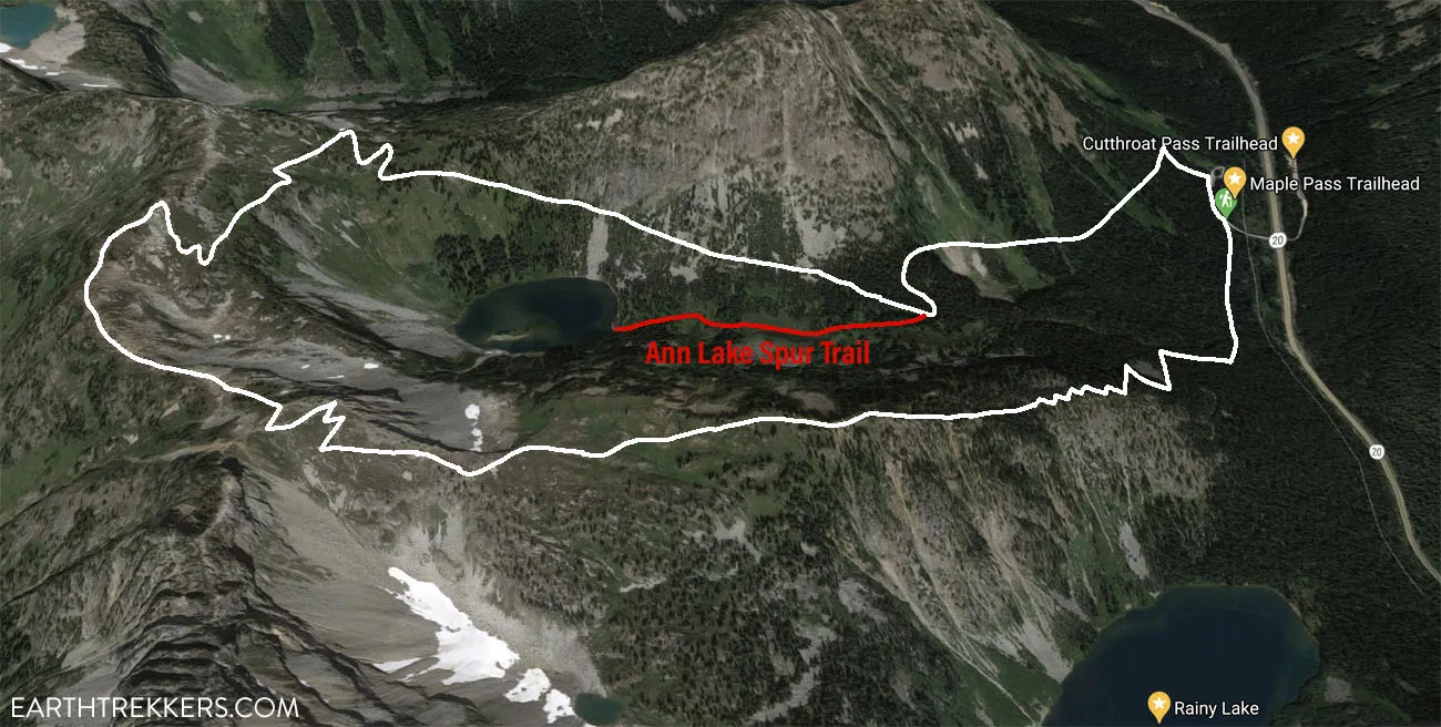
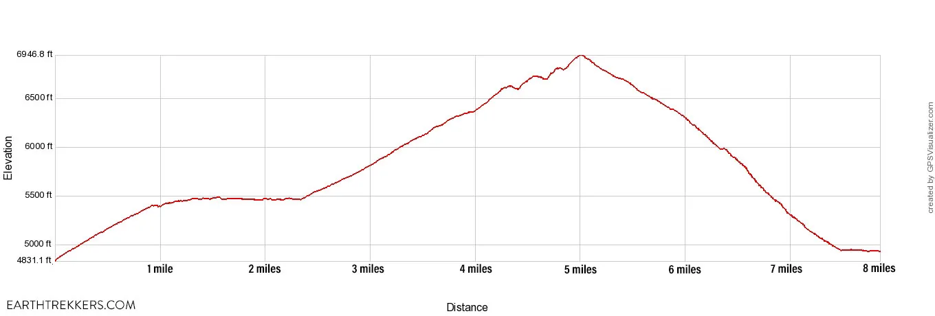
Elevation of the Maple Pass Loop in the counter-clockwise direction with the spur trail to Ann Lake.
Please practice the seven principles of Leave No Trace: plan ahead, stay on the trail, pack out what you bring to the hiking trail, leave areas as you found them, minimize campfire impacts, be considerate of other hikers, and do not approach or feed wildlife.
Clockwise or Counter-Clockwise?
The Maple Pass Trail is a loop and it can be hiked in either direction.
If you hike the Maple Pass Loop counter-clockwise, it is a gradual climb up to Maple Pass. For the entire climb, you have amazing views over Ann Lake and then out to the North Cascades. To get back to the parking lot, it’s a short but very steep descent through the woods that can be tough on the knees.
If you hike the Maple Pass Loop clockwise, you get the big climb over with early in the hike. The first 3 miles will be a steep trail mostly through the woods. The views will open up for the last half mile of the ascent. Then, as you hike the loop around the lake, you get to enjoy the views. It’s a gradual descent for most of the hike as you head back to the parking lot.
We chose to hike the Maple Pass Loop in the counter-clockwise direction. The amazing views over Ann Lake and the North Cascades took our minds off of the uphill climb. We stopped for a lot of breaks to take photos and then cruised down the downhill section in the woods. It worked great for us. But I also see the appeal in going the other direction.
If you like the idea of getting the hard part over with first, hike the loop in a clockwise direction.
Either way, it is a spectacular hike.
How to Hike the Maple Pass Loop
Step-By-Step Trail Guide
This trail description is for hiking the Maple Pass Loop in the counter-clockwise direction.
Getting to the Trailhead
The Maple Pass Loop starts at the Rainy Lake picnic area on Highway 20. This is a fairly large parking lot but it does tend to fill up by mid-morning. There are toilets here.
You will need a National Forest Pass. The cost is $5 per day. Fill out one of the day use passes (bring a pen!), insert your $5 cash, and deposit the envelope in the payment box. Display your pass on your dashboard. If you have an America the Beautiful Pass you do not need to purchase the National Forest Pass. Display your America the Beautiful pass on your dashboard.
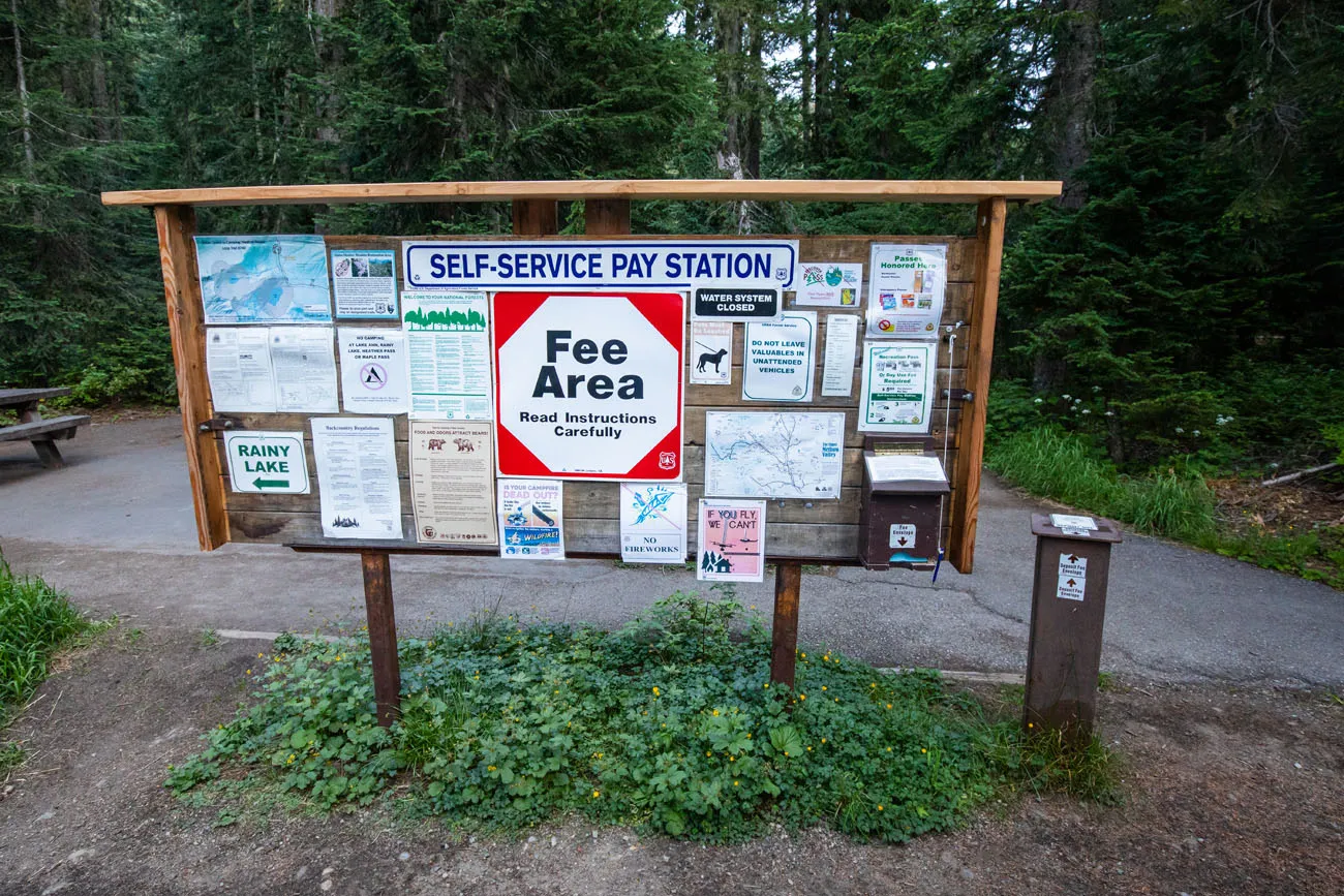
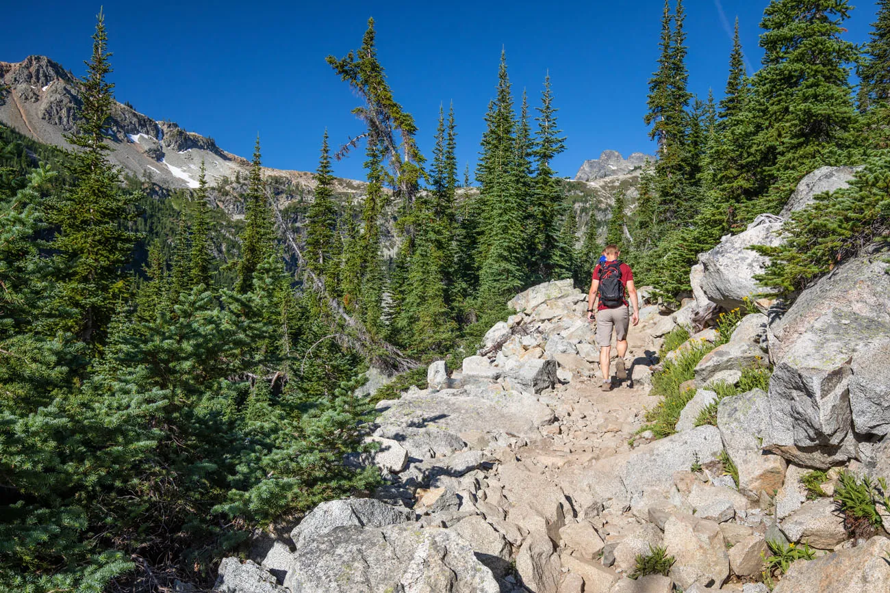
The trail starts on the west side of the parking lot. Look for signs directing you to Rainy Lake.
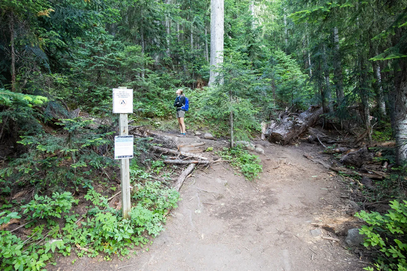
If you do this hike counter-clockwise, the trail starts right behind this trail sign, next to the start of the paved trail to Rainy Lake. Look for the dirt trail that wastes no time climbing up through the forest.
If you choose to hike the Maple Pass Loop clockwise, you will take the paved trail to Rainy Lake. At about 0.4 miles, look for the dirt trail that switchbacks up into the forest. There will be a small sign directing you to Maple Pass but it can be hard to miss.
Detour to Ann Lake
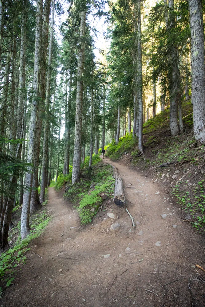
For the first 1.25 miles of the hike, it’s a gradual climb through a forest. It’s quiet, it’s shady, and it feels very peaceful.
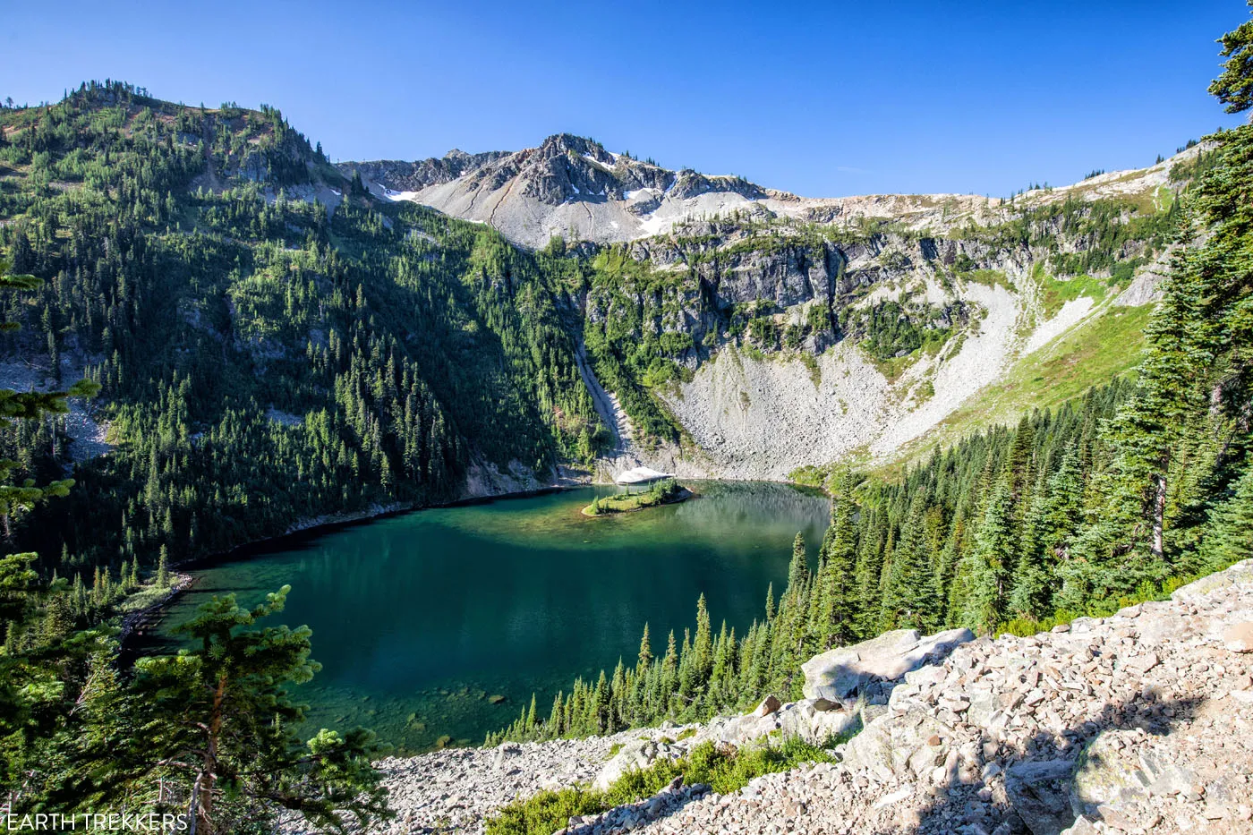
At the 1.25-mile point, you reach the spur trail to Ann Lake. You have the option to add on the short walk to Ann Lake.
Round trip, it is a 1-mile hike out-and-back to Ann Lake, adding roughly 100 feet of elevation to the entire hike. This is optional. From the lake, you do get a nice view of the ring of mountains that surround the lake and it gives you some perspective as to high how you will hike today.
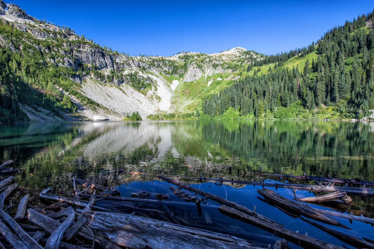
If you choose to hike to Ann Lake, make sure you bring mosquito repellent. There are lots of mosquitoes here!!
Heather Pass
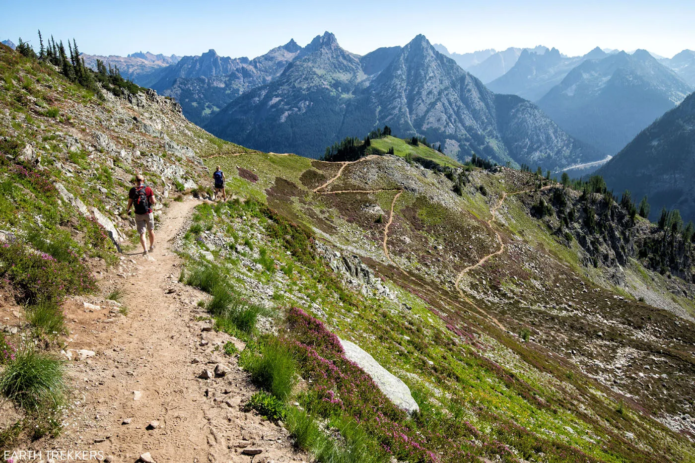
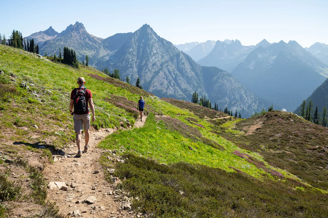
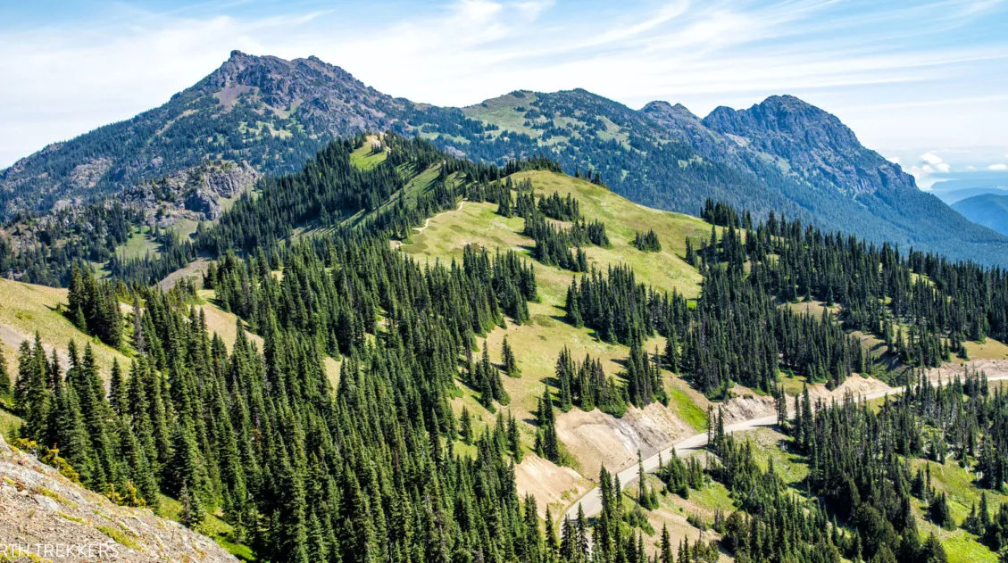
Past the Ann Lake detour, the trail continues to gain elevation. Once you clear the trees, you get to see the amazing views that makes this hike so popular.
At first, you get a wonderful view over Ann Lake and the trail that snakes along the ridgeline.
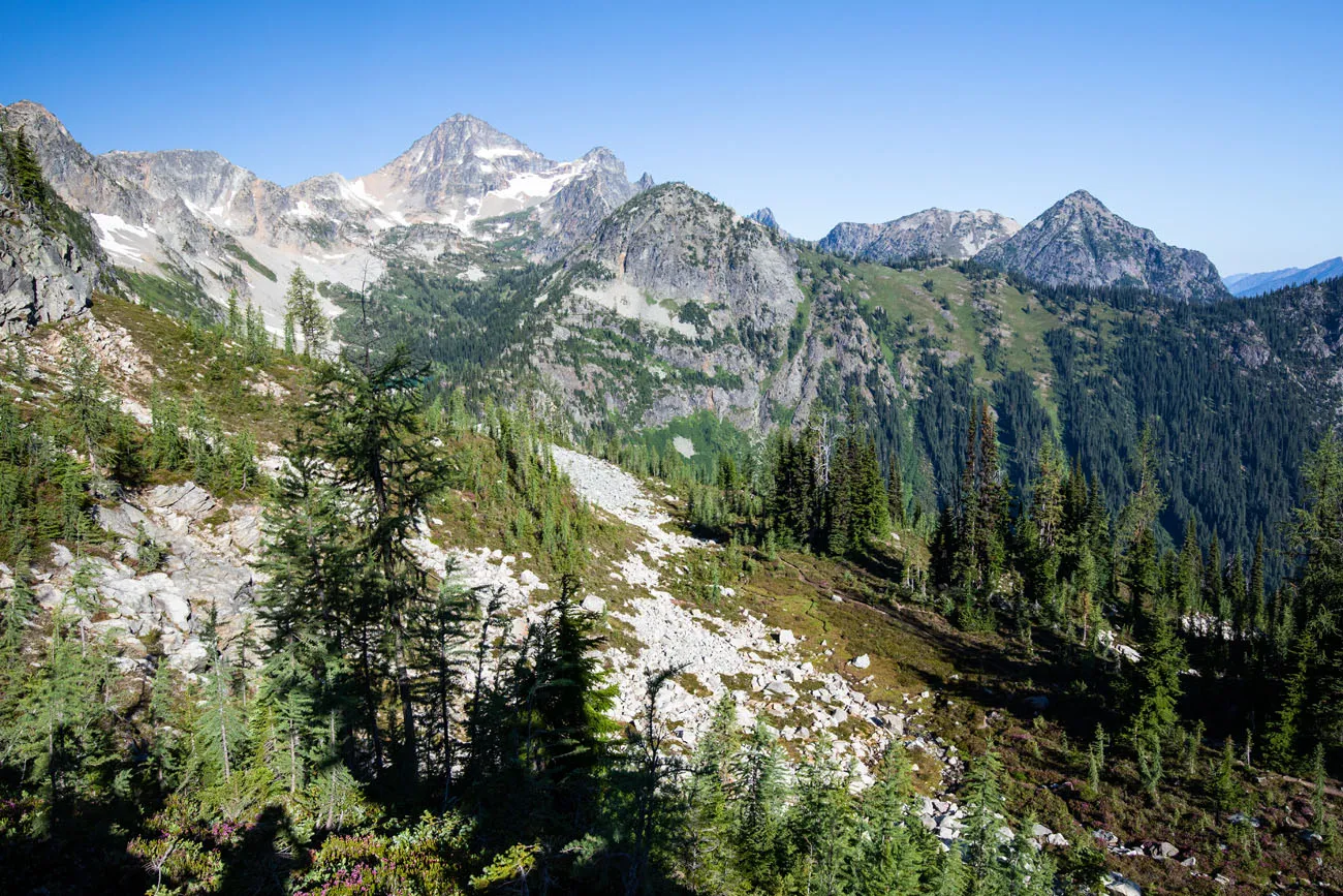
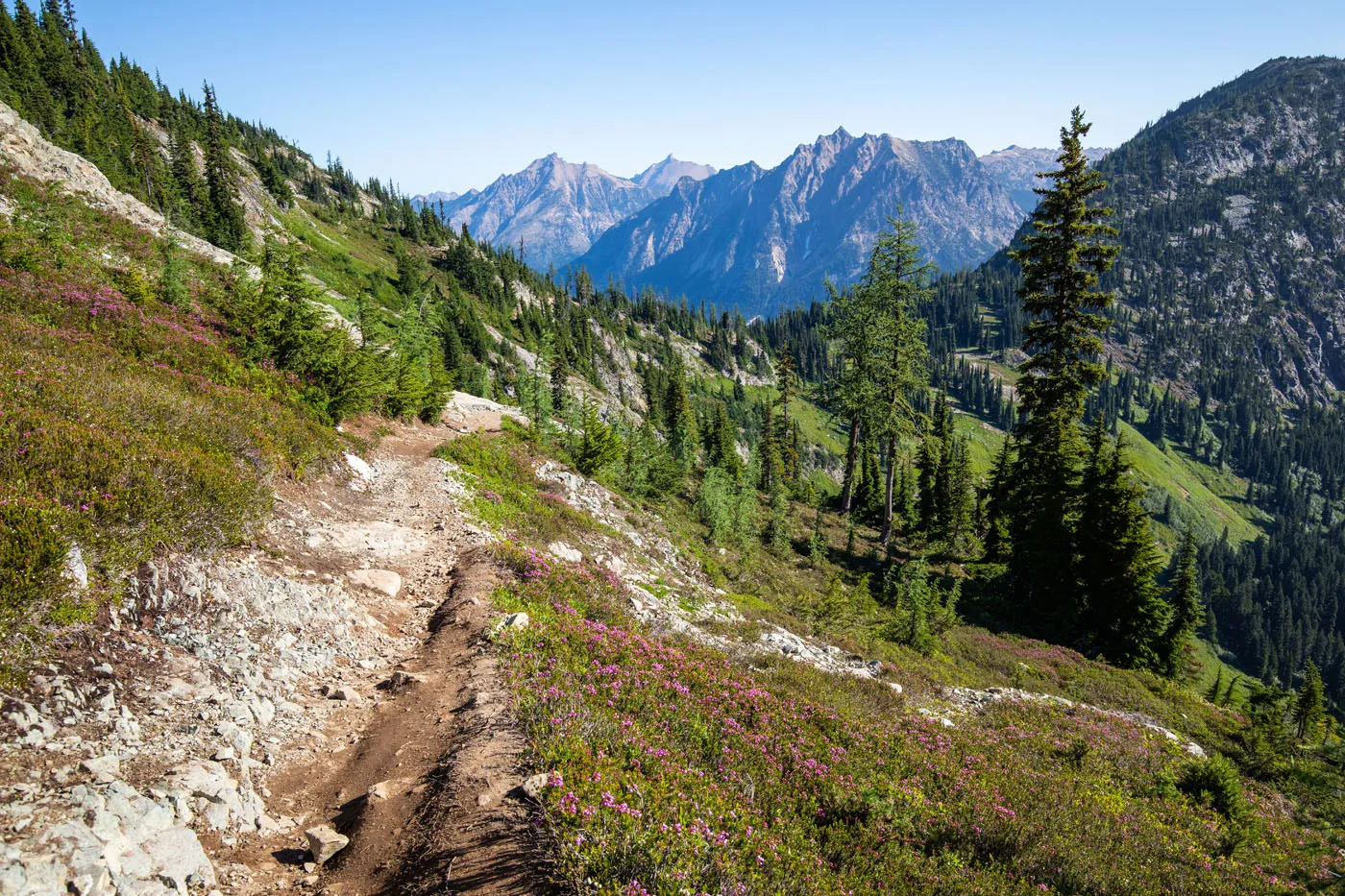
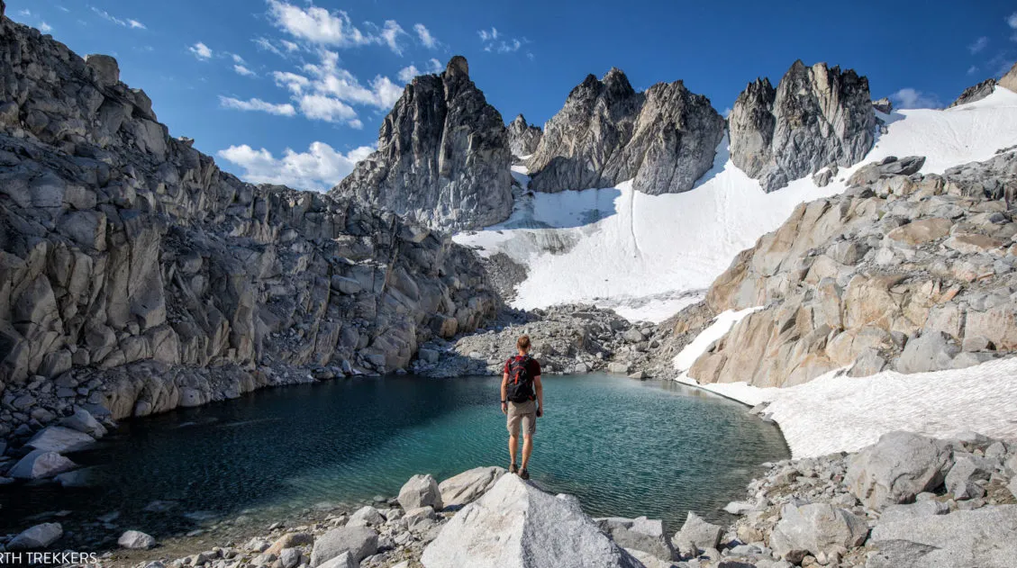
Then you come to Heather Pass, where fields of wildflowers color the hillsides.
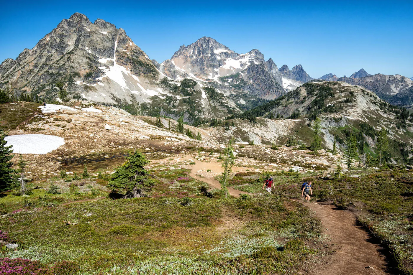
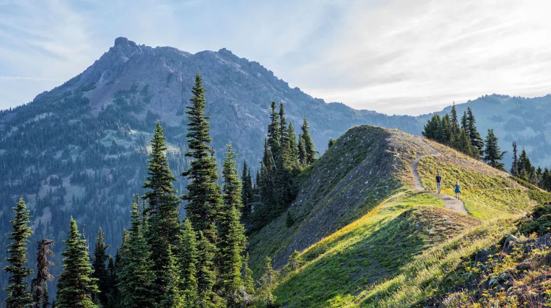
Maple Pass
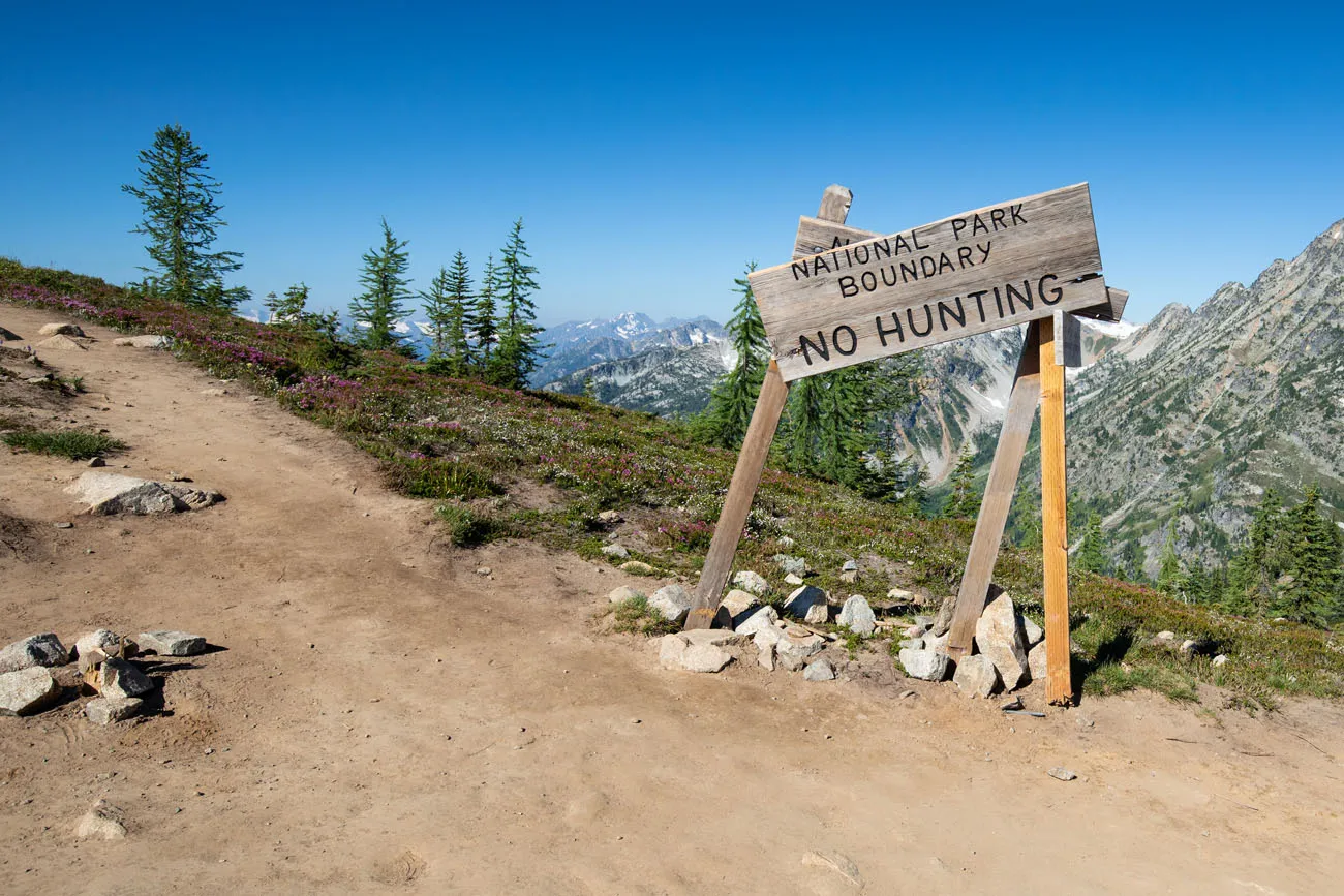
As you continue on the trail, you hike up to a ridgeline for one of the best views of the day. Now you are standing next to the North Cascades National Park boundary. Out to the west are layers and layers of jagged mountain peaks.
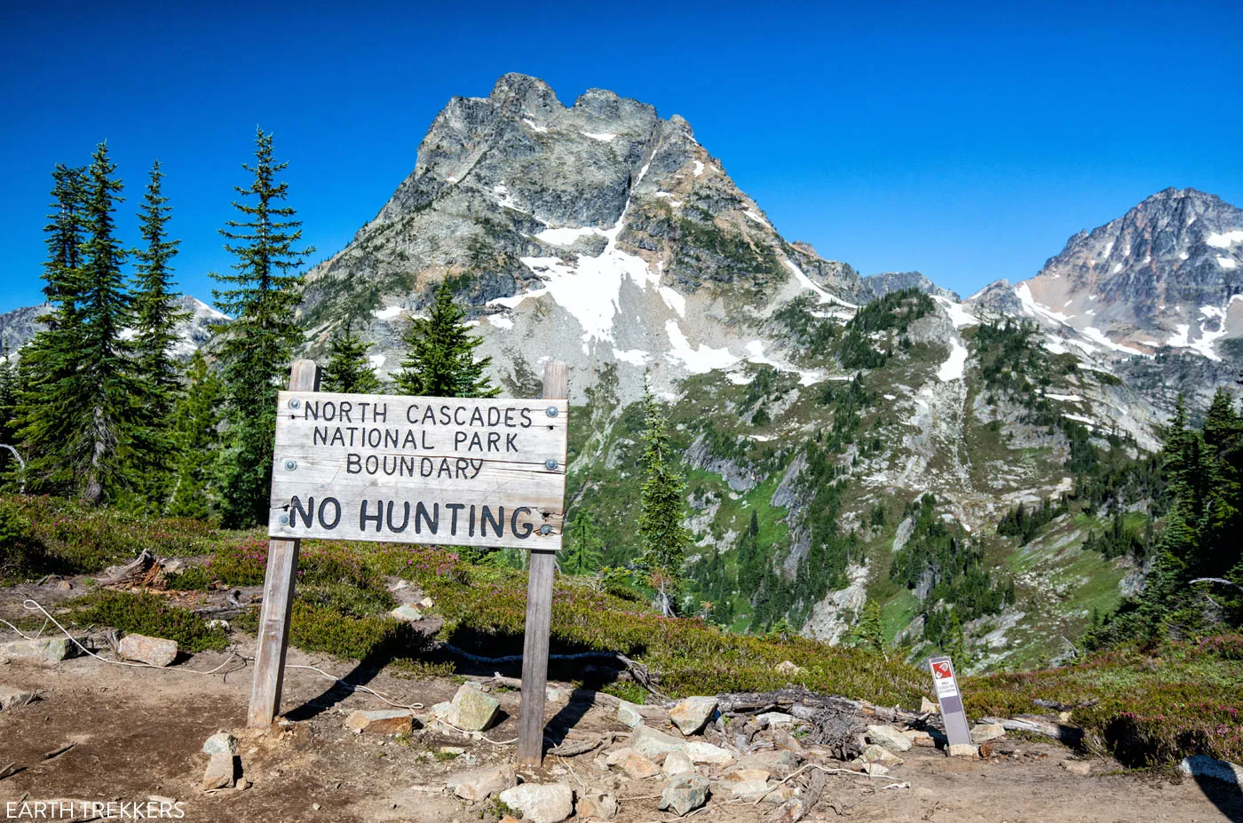
It is here that we realized that this is a park where you really need to hike, and hike high, to see the majesty of this national park. The drive along Highway 20 is beautiful, and the shorter hikes to other lakes are nice, but for views like these, you really have to hike high.
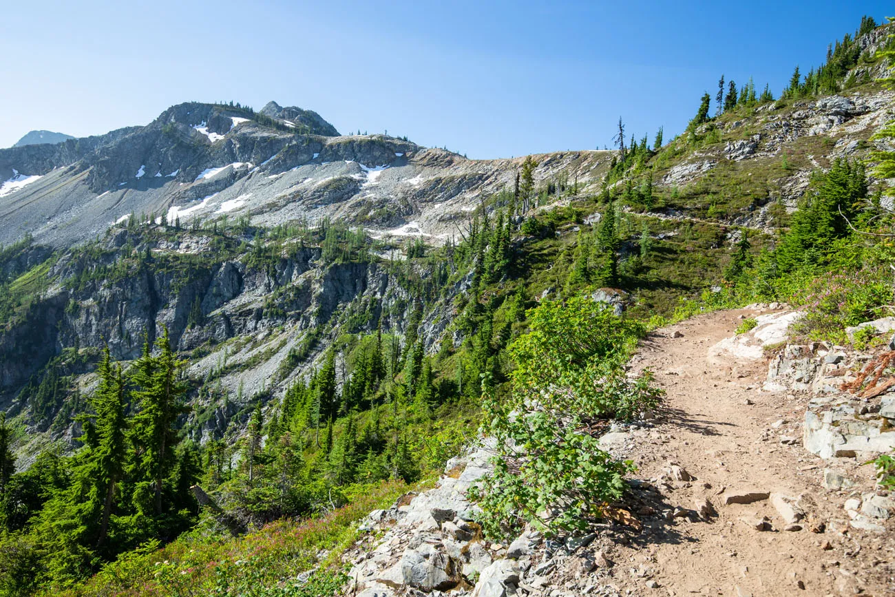
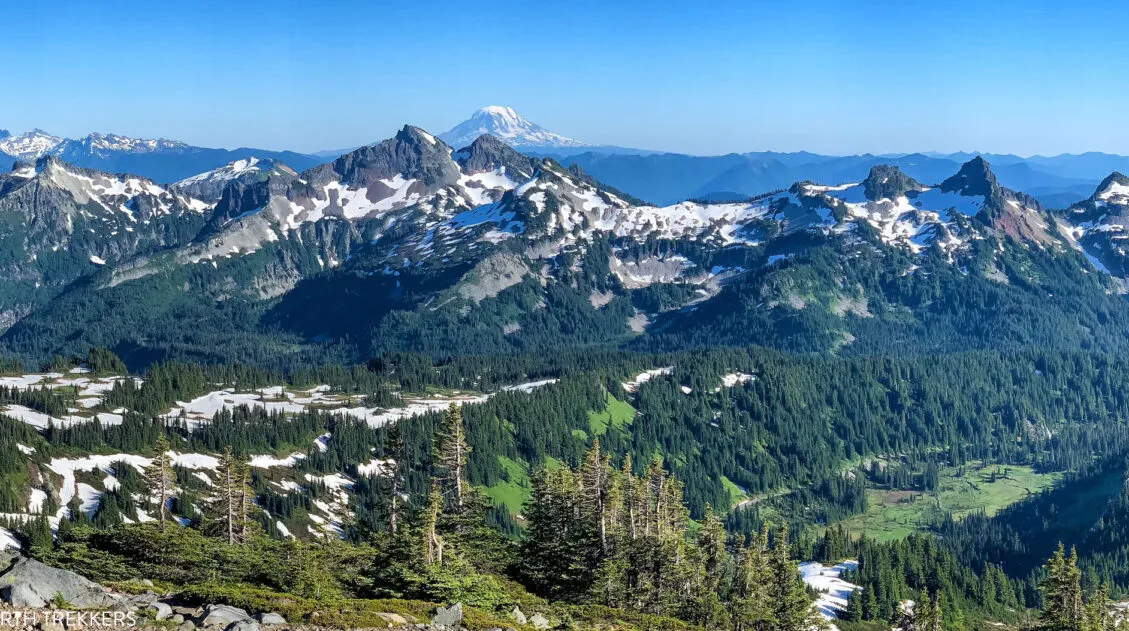
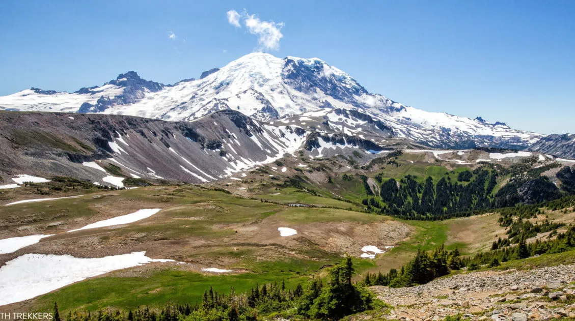
The trail tops out at Maple Pass. This upper part of the trail can still be snow-covered well into the summer, so be prepared to hike on the snow if you will be here in July. We did this in early August and there were still a few patches of snow lingering on the ground.
At the pass, take in one last view of the North Cascades. From here, it’s a massive descent back to the Rainy Lake picnic area.
Finishing the Hike
From Maple Pass, it is a 3-mile descent to get back to the Rainy Lake picnic area. At first, the trail switchbacks through fields of wildflowers.
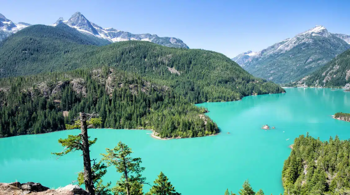
Once you enter the forest, you will hike down steep, rocky trails that can be hard on the knees. Through clearings of the trees, keep a lookout for a view over Rainy Lake to get a sense of how high you are right now (and how far down you still have to descend).
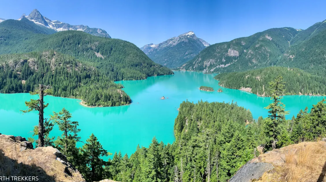
The dirt trail ends at the paved trail to Rainy Lake. Turn left to return to the parking lot. If you want to make the detour, turn right and it’s about a 0.6 mile walk one-way to the lake.
Rainy Lake
Tips to Have the Best Experience
Get updates on the road status and trail closures on the National Park Service website before you go.
Leave No Trace. When you are in the park, practice the seven principles of Leave no trace. This includes packing out what you bring into the park, be considerate of other hikers, stay on the trail, and do not remove anything from the park.
Do not expect your cell phone to work.We had zero cellular service on this hike. There is also no cellular service along most of Highway 20, which means you won’t get reception for most of the drive to the Rainy Lake picnic area. Don’t depend on your phone to call for help, talk to friends, or to send photos to friends and family.
What to Bring on the Hike
Hiking shoes. We recommend hiking shoes. When we did this hike in August, we hiked through patches of snow and large sections of muddy trail. You can get by with a sturdy pair of walking shoes, but I would leave the Converse sneakers and flip flops at home.
Water and snacks. At least 2 liters of water in the summer.
Sunscreen, hat, and sunglasses. For approximately half of the hike there is very little shade.
Camera. Even a smartphone will do.
Essential Hiking Gear: What Should You Bring on a Day Hike?
If you are new to hiking or are curious about what you should bring on a hike, check out our Hiking Gear Guide. Find out what we carry in our day packs and what we wear on the trails.If you have any questions about hiking the Maple Pass Loop, let us know in the comment section below. Happy hiking!!
More Information for Your Trip to North Cascades National Park
If this is part of a bigger road trip through the USA, visit our United States Travel Guide and our Washington Travel Guide for more inspiration and travel planning tips.
12 Great Hikes in North Cascades National Park
North Cascades National Park is not a place that easily reveals itself. Sure, the drive along Highway 20 is lovely. And the viewpoints over the lakes and mountain passes are gorgeous. But, to really see this park, you are going to have to invest some time on the hiking trails. If you only saw the […]
Hey there! This is an awesome write up! I’m about to be heading to North Cascades in a couple weeks to do the Maple Pass Loop and it seems like you did this hike around the same time we will be doing it. I was wondering how the mosquitoes were for you on this hike? I’ve heard they can be be pretty awful. Thank you!!
I don’t recall mosquitoes being an issue on this hike. I’d still bring repellent, just in case, but I don’t think we needed to use it (and I’m a mosquito magnet). Have a great hike! Cheers, Julie
Hello! I’m planning on driving up to the area in the evening and hiking the following morning. Do you have any advice on where I might be able to camp near the trailhead? Thank you 🙂
The closest campground that I know of is the Lone Fir campground. There are others located in NCNP as well but it would be a longer drive. Cheers, Julie
I could not be happier that I have stumbled across this the night before my first attempt at this loop! It is too late to wait for a reply but I am so unsure of which direction to take. My 20 y.o. daughter wants to take counter-clockwise as that is what is most recommended, however at 46 and dancing my entire life, my knees are nearly kaput! I worry that the descent would be OUCH! I am voting for clockwise. We shall see in the parking lot which we choose…. Thank you very much for the DETAIL and the photos!! I often worry about getting lost, online trail maps can be so sketchy…as can the ones at the trail heads…if they are there…and readable….I know that it will be STUNNING and I am so exited as this year I became an empty-nester (sob, sob) and this is the last big hoo-rah of the summer…
Your website is phenomenal and has been bookmarked! I am a fellow Terrapin, tho I attended the extension campus in Augsburg Germany, that has now closed…thank you so much again for sharing the love for adventure!!
Hello Katie. I recommend that you do this clockwise, because that last descent is hard on the knees. Tyler just started his first year at UMCP last week and I literally just watched Kara step onto the school bus to start her senior year in high school this morning. In one year, we will be empty nesters too. I miss Tyler like crazy but am excited about where they both are heading. Have fun in the North Cascades and wherever you are headed next! Cheers, Julie