Theodore Roosevelt National Park is made up of three separate units: the South Unit, the North Unit, and the Elkhorn Ranch Unit. The South Unit is the most commonly visited area of the national park, mainly due to its convenient location on Interstate 94.
In this guide, we cover the best things to do in the South Unit of Theodore Roosevelt National Park.
Overview of the South Unit of Theodore Roosevelt National Park
The South Unit of Theodore Roosevelt National Park is located along Interstate 94. It is the largest section of the park and is comprised of three distinct areas.
In the east is Painted Canyon. There is a Visitor Center, a rest stop for those traveling along Interstate 94, and several very good hiking trails.
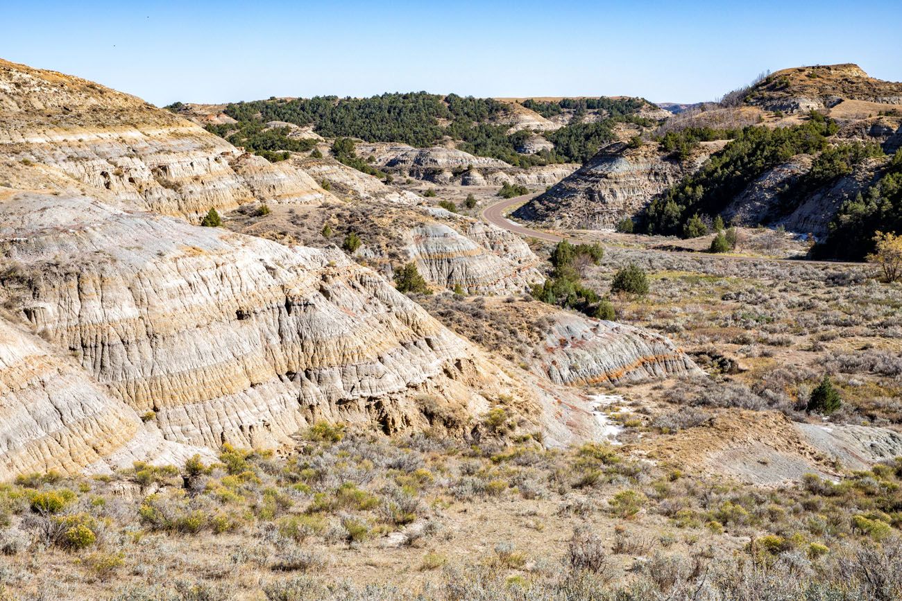
Dominating the central area of the South Unit is Scenic Loop Drive. This 36 mile long road leads to numerous hiking trails, overlooks, and campgrounds. Driving this loop is one of the best things to do in Theodore Roosevelt National Park.
Finally, out to the west, is the Petrified Forest. To get here, you will need to drive on a gravel road, but your reward is seeing ancient petrified logs and some of the best wildlife sightings in the park.
To visit all three of these areas, it will take you one to two days.
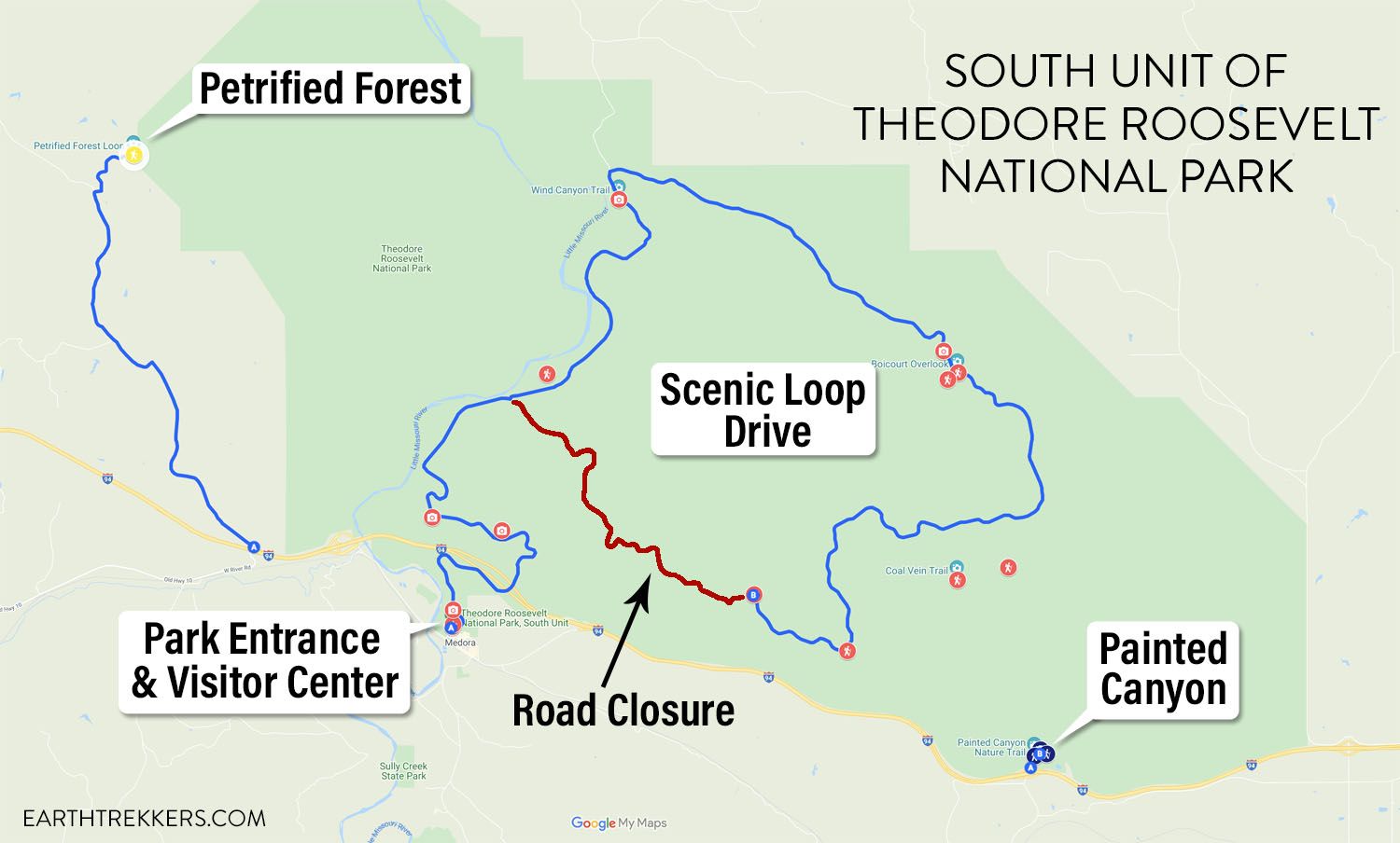
Map of the South Unit of Theodore Roosevelt National Park with the current road closure.
Things to Do in the South Unit of Theodore Roosevelt National Park
This list of things to do in the South Unit of Theodore Roosevelt National Park is organized by the three geographical areas listed above, starting in the east with Painted Canyon.
Things to Do in the Painted Canyon
All of the sights in the Painted Canyon are accessed from the parking lot/rest stop on Interstate 94. It is not uncommon to see tractor trailers in the parking lot, enjoying a break from the road, and minivans in the parking spaces, with families popping out to enjoy the view.
There is a Visitor Center here (open in the summer only) and restrooms.
There is no park entrance booth for this area of the South Unit. It is open 24 hours a day.
Painted Canyon Overlook
Located behind the Visitor Center, this overlook offers a panoramic view of the badlands and the colorful hills that give this area of the park its name.
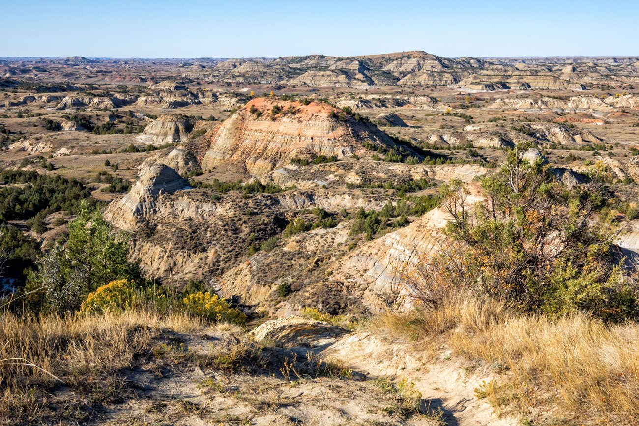
Painted Canyon Overlook
Painted Canyon Nature Trail
Distance: 0.9 mile loop | Difficulty: Moderate | Time: 30 to 45 minutes
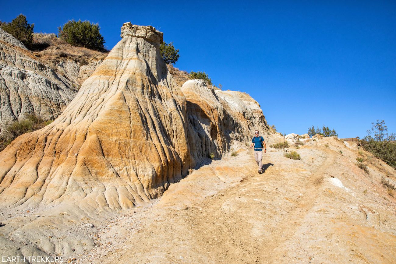
This short but moderately difficult trail leads down into the badlands and weaves its way through the hills. If you are looking for a short hike with nice views of the badlands, this is worth the effort. Just note that it will be a short but strenuous hike back up to the parking lot.
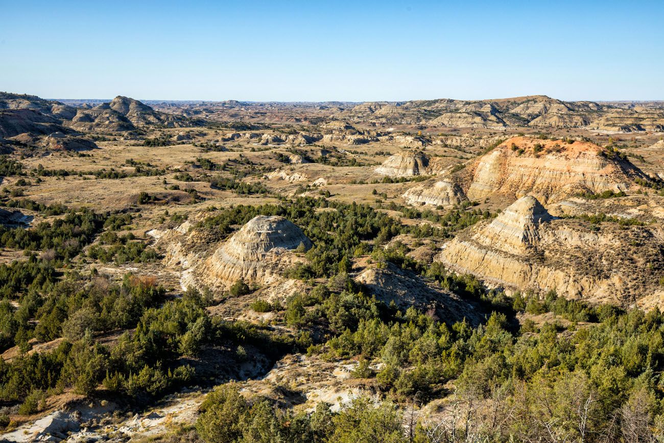
Painted Canyon Nature Trail
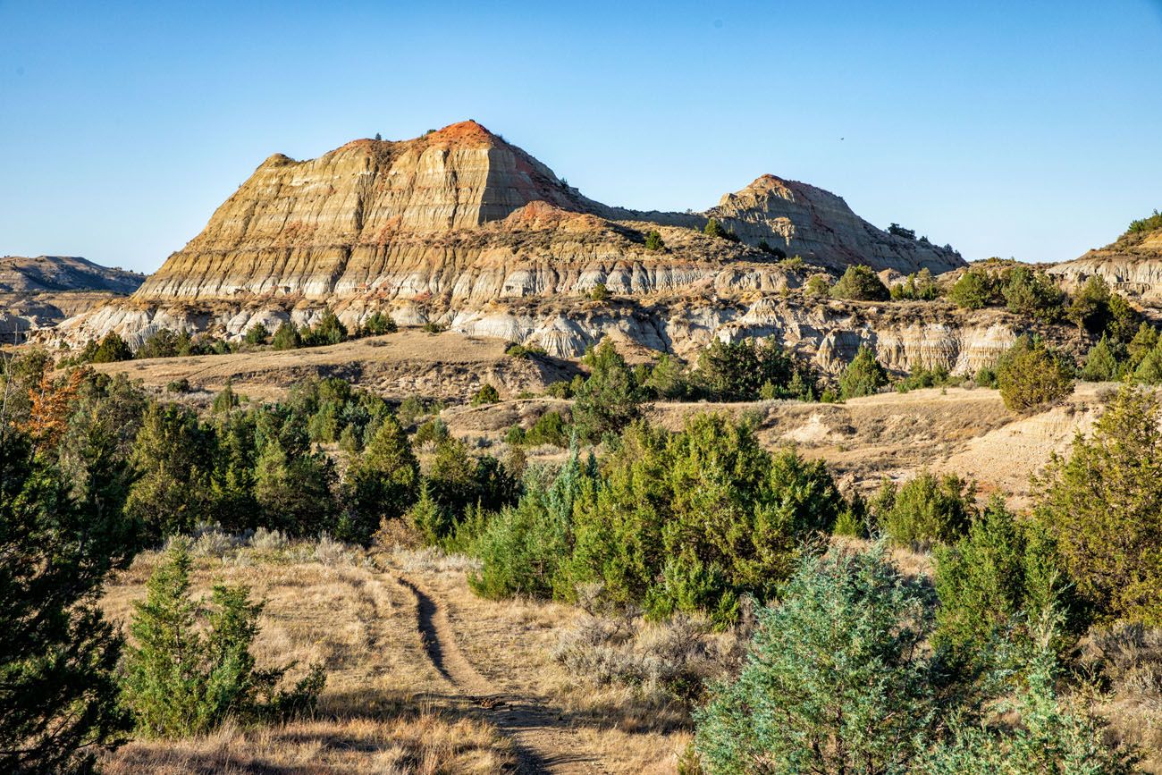
Painted Canyon Trail
Distance: 4.2 miles | Difficulty: Moderate | Time: 1.5 to 2.5 hours
This is a longer hike than the Nature Trail, but it is more interesting. The landscapes along the trail are more dramatic and since you head a bit deeper into the park (and away from the noisy, busy highway), wildlife sightings are more likely.
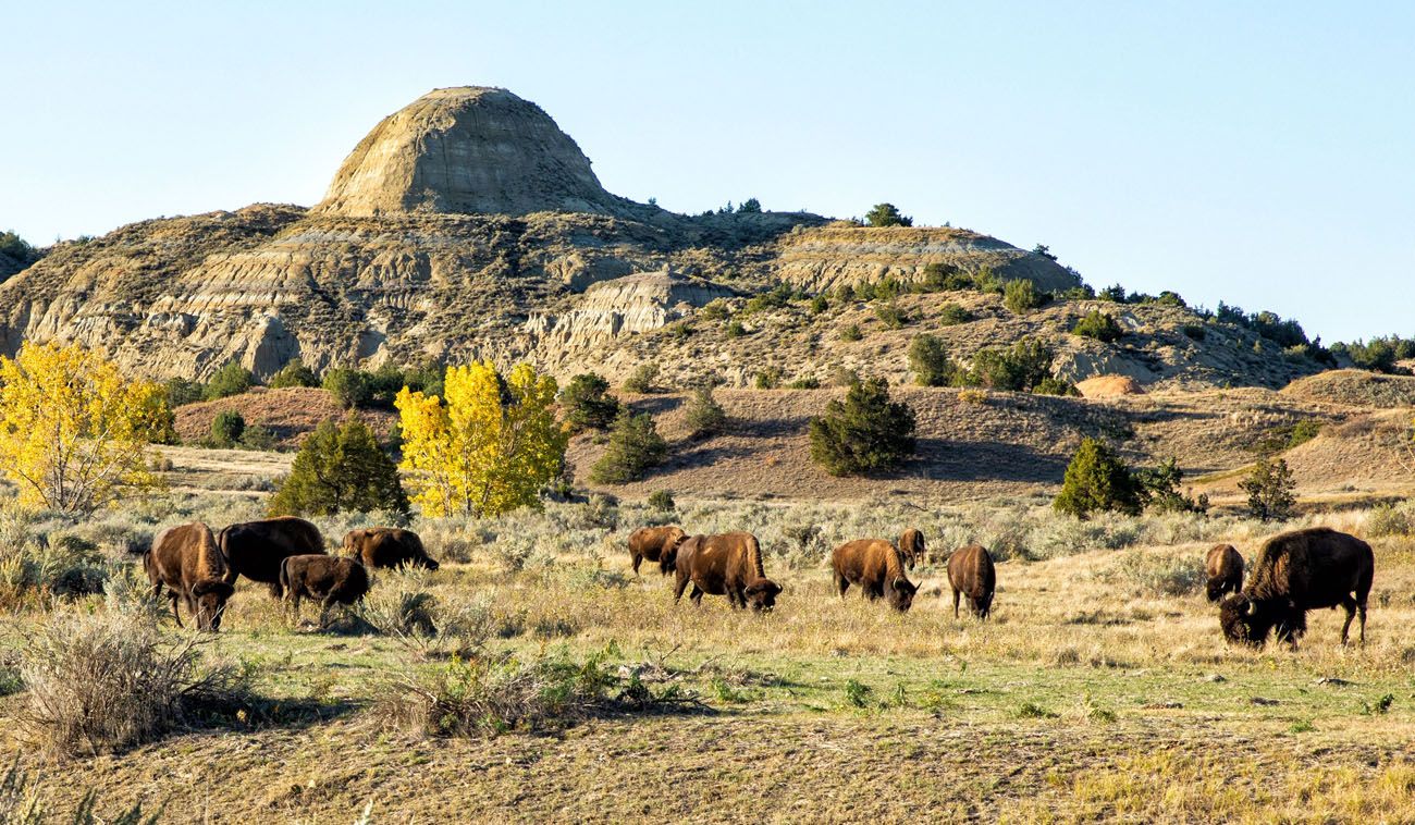
When we did this, there was a herd of bison grazing in the fields near the endpoint of this trail.
Planning Your Time
If you simply visit the Painted Canyon Overlook, a visit to this area takes about 15 minutes.
Adding on the Painted Canyon Nature Trail, the entire visit will take one hour.
If you visit the overlook and hike the Painted Canyon Trail, your visit will last 2 to 3 hours.
And if you do everything (the overlook and both hikes), plan on spending 3 to 4 hours at the Painted Canyon area of the South Unit.
Things to Do along Scenic Loop Drive
In order to drive Scenic Loop Drive, continue west along Interstate 94 to Medora. Just past this small western-style town is the main park entrance into the South Unit.
You will pass through the park entrance pay booth and then the Visitor Center will be immediately to the left. This is a great place to go first, to talk to park rangers about trail and road conditions, and to see the first sight on this scenic drive.
Note: Part of Scenic Loop Drive is closed (miles 24 to 28) due to road erosion. You can drive most of it, but due to the road closure, it cannot be driven as a loop. Instead, it can only be driven out-and-back. Learn more on the official National Park Service website.
Maltese Cross Cabin
This cabin was constructed for Theodore Roosevelt in the late 1800’s. He invested in the nearby Chimney Butte Ranch and this cabin was his temporary home.
For several decades, this cabin became a “mobile home.” It was moved to St. Louis, Missouri for the World’s Fair and then to Portland, Oregon for the Lewis and Clark Centennial Exposition. Later, it traveled back to North Dakota, spending time in both Fargo and Bismarck, and finally was placed back in its original location in Medora in 1959.
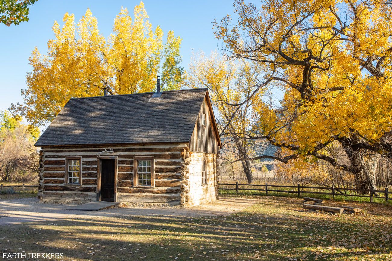
You can see the cabin right from the parking lot for the Visitor Center. For a closer view, enter the Visitor Center and walk out the back door, which puts you right in front of the cabin.
Medora Overlook
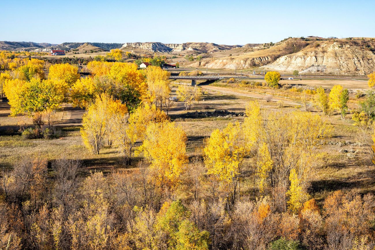
As you drive into the park, this is the first overlook along the road. From here, you have a nice view over Medora, Chimney Butte Ranch, and the Visitor Center.
Medora Overlook
Prairie Dog Town
The road climbs higher into the hills and then goes through an enormous prairie dog town. If you have not seen prairie dogs yet, it’s worth pulling over, getting out of your car, and spending a few minutes watching these noisy little guys. The closer prairie dogs will bark at you and zip down into their burrow if you get too close.
Skyline Vista
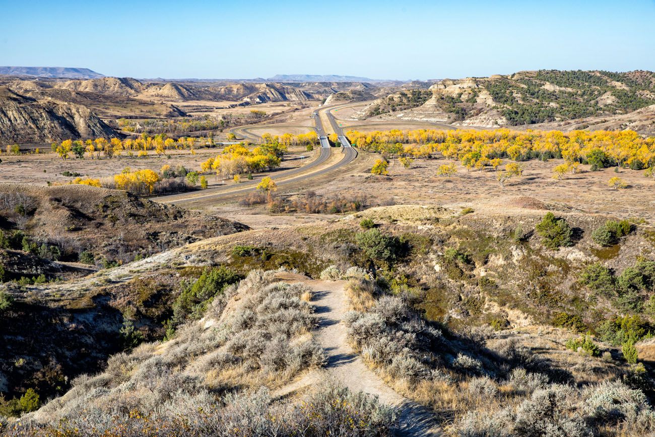
This viewpoint is quick to visit. It offers a similar view to the Medora Overlook but from here you have a higher vantage point, so the view is better.
A little distance past Skyline Vista, stay to the left to continue on Scenic Loop Drive.
The Little Missouri River + Ekblom Trail and Big Plateau Loop
From Scenic Loop Drive, turn left to go to Peaceful Valley Ranch. There is a small parking lot here.
From this location, you can do one of two things. #1: walk out to the Little Missouri River (worth it!). #2: hike the Ekblom + Big Plateau Loop (worth it if you want to do a longer hike with great views and the chance to spot wildlife).
If you only want to walk out to the Little Missouri River, it is a flat, 0.2 mile walk one-way. This is the quickest, easiest way to walk right to the river that I know of and it is a beautiful spot.
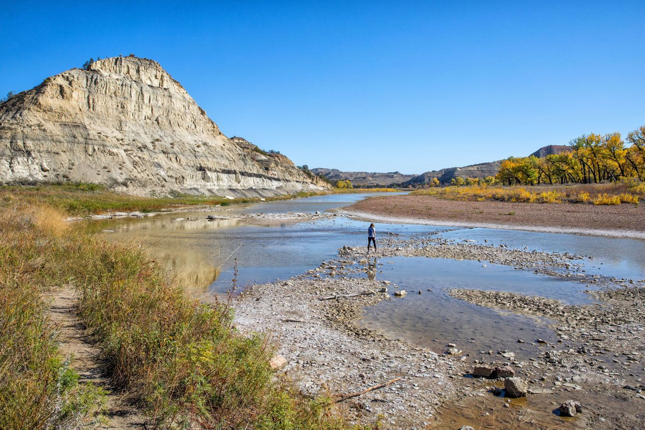
Little Missouri River
Continue across the river to hike the Ekblom and Big Plateau Loop. This 5 mile hike is moderately difficult and takes 2 to 3 hours. Along the way, you get 360° views of Theodore Roosevelt National Park. We saw prairie dogs, a feral horse, two coyote, and mule deer on this hike.
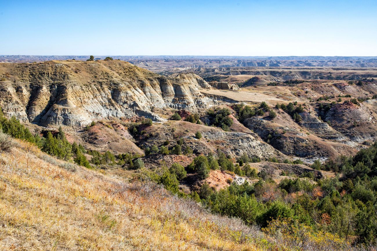
Wind Canyon Trail
Distance: 0.4 miles round-trip | Difficulty: Easy to moderate | Time: 20 minutes
From this trail, you get a spectacular view of the Little Missouri River. It’s a short hike with one steep climb but it is worth it for these big views.
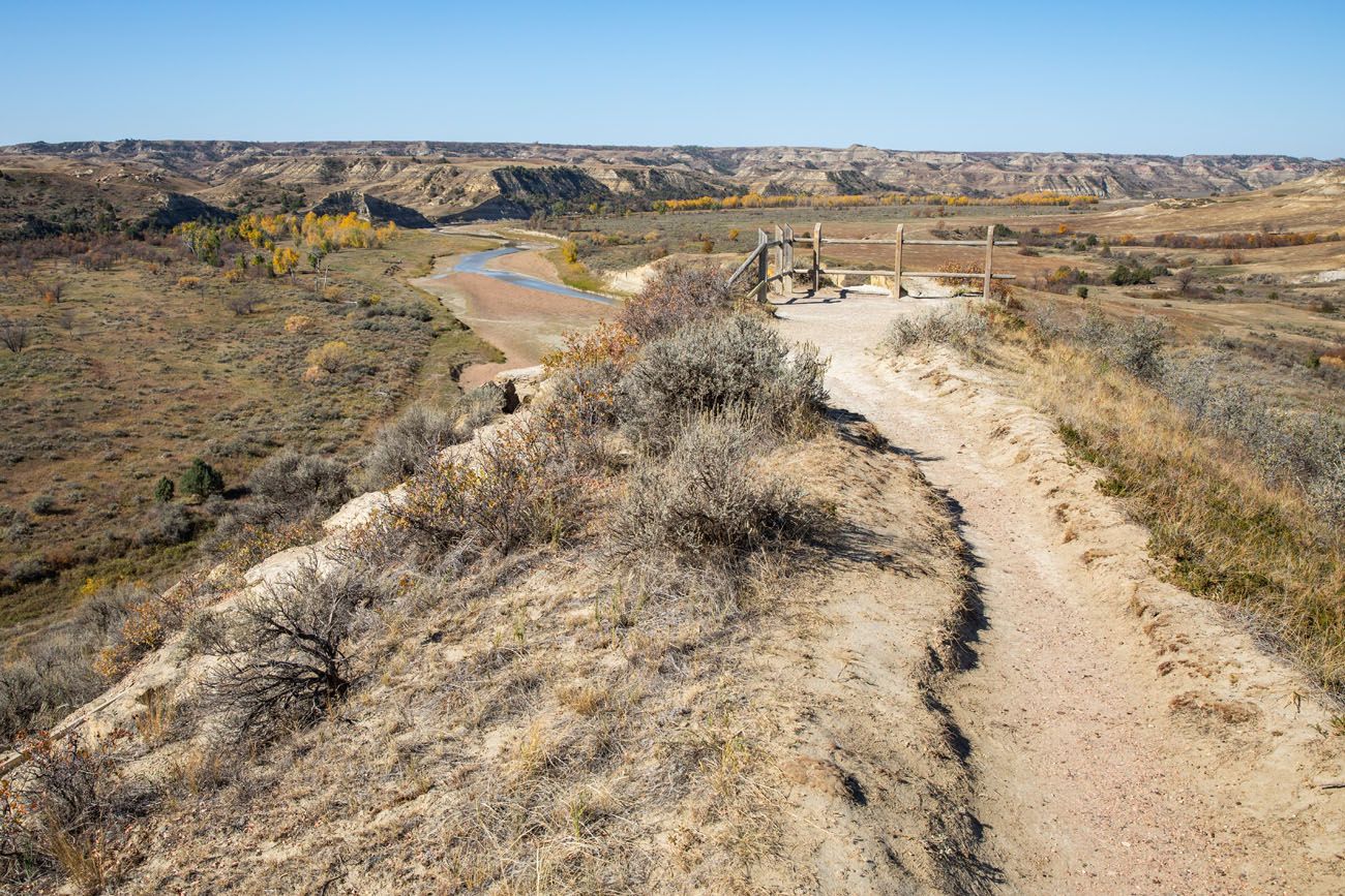
Wind Canyon Trail
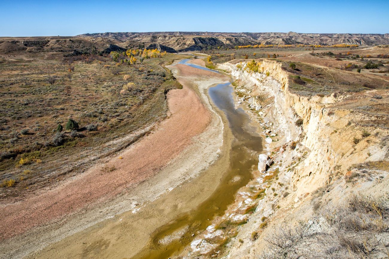
View of the Little Missouri River from the Wind Canyon Trail
Boicourt Overlook
From this overlook, you have a nice view south over the badlands in the South Unit.
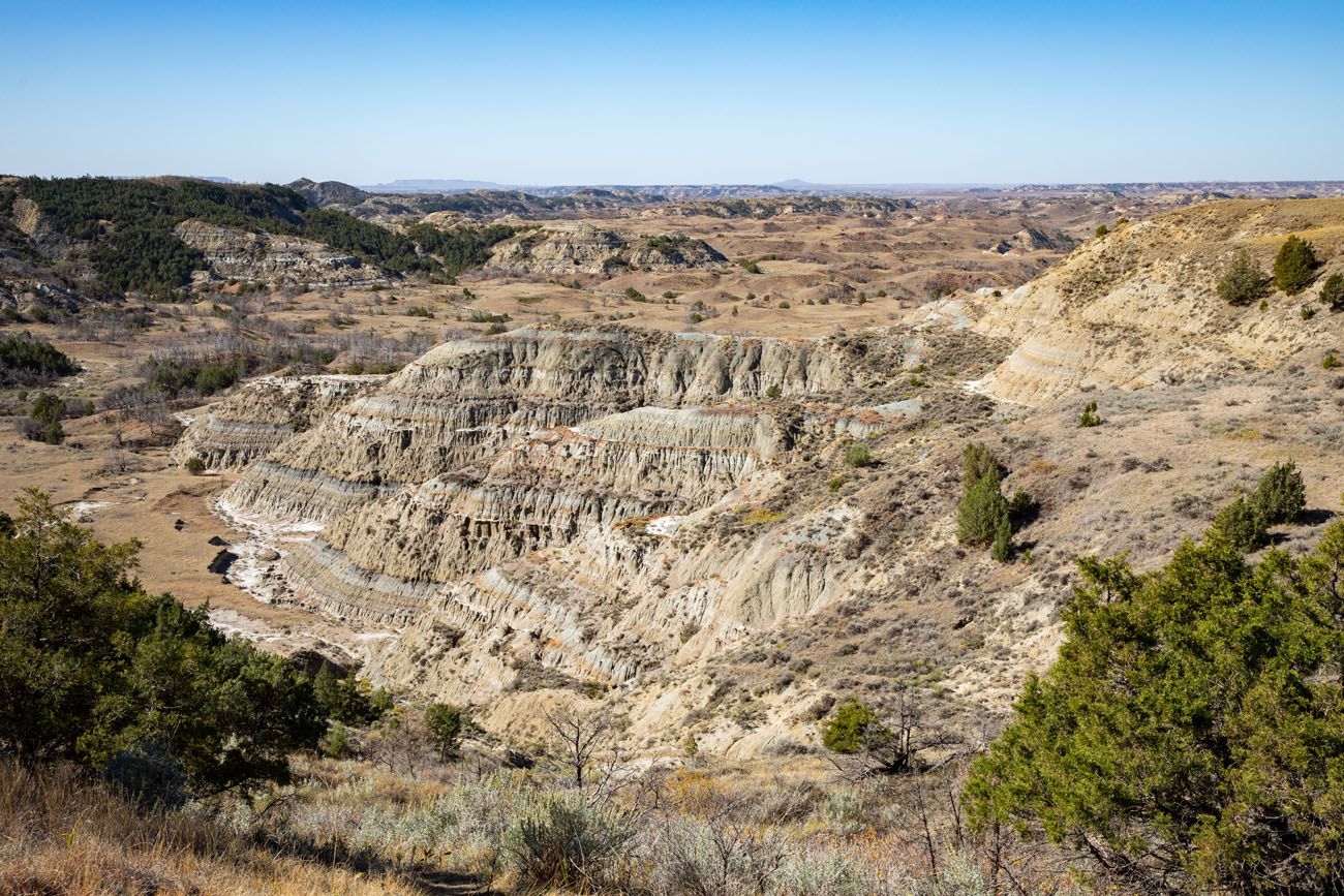
Boicourt Overlook
Boicourt Overlook Trail
Distance: 0.2 to 0.5 miles out-and-back | Difficulty: Easy | Time: 20 to 45 minutes
This trail, even though it shares the same name as the overlook above, is located at a different location on Scenic Loop Drive. From Boicourt Overlook, continue on Scenic Loop Drive for about one minute to get to the parking area for this trail.
This trail offers two viewpoints. The paved trail is 0.1 miles, one-way, and takes you to a decent overlook of the Badlands.
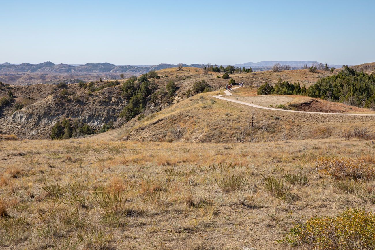
Boicourt Overlook Trail
For a better experience, continue along the unpaved trail. This leads out to an overlook with panoramic views that are wonderful and one of the best views of the day.
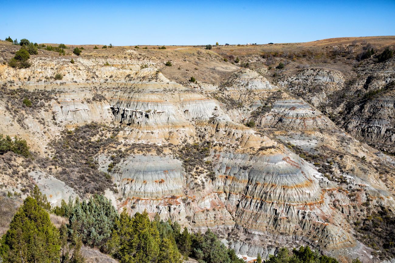
View from the Boicourt Overlook Trail
Buck Hill
Distance: 0.2 miles out-and-back | Difficulty: Easy | Time: 15 minutes
Buck Hill is the second highest point in the South Unit. From the parking lot, it’s a short but somewhat steep uphill walk to the viewpoint.
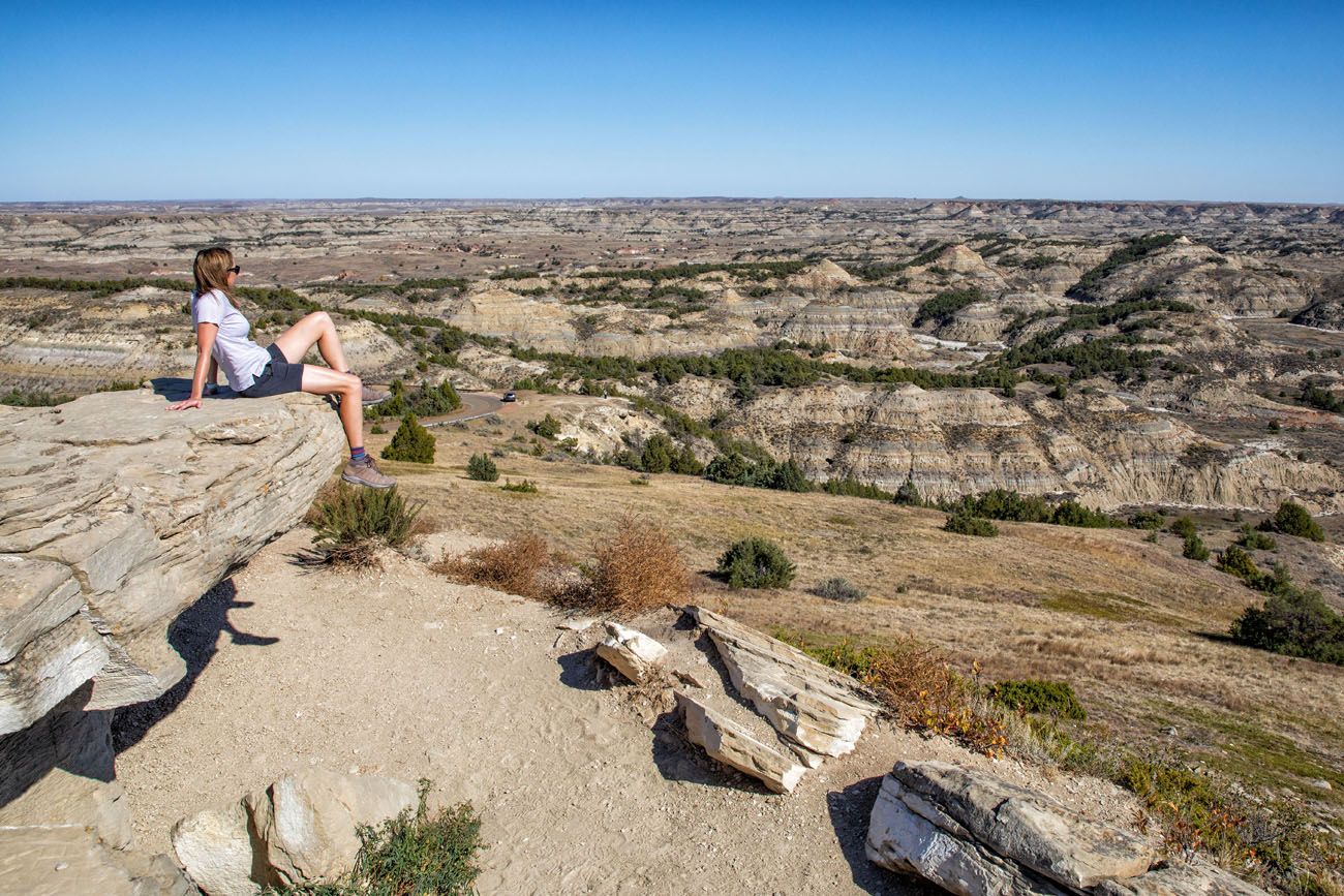
The trail keeps going. We hiked it and Tim and I both think that the views are better from the overlook, so we don’t think it is worth extending this hike any farther.
Coal Vein Trail
Distance: 0.6 mile loop | Difficulty: Easy to Moderate | Time: 30 to 45 minutes
I am listing this hike because you will hear about it from other sources as you research things to do in the South Unit. But it is a boring, uninteresting hike.
This trail loops through an area where at one time a coal vein was burning. This has long since ended but the trail remains. There is a guide that is available at the trailhead, but the information that it provides is also not that interesting, and some of the things that are mentioned can’t even be seen along this trail.
I recommend saving your time and skipping this hike. And to get here, you have to drive on a gravel road. It was well graded and suitable for standard cars when we did this, but if you don’t want to take your car on a gravel road, that’s yet another reason to skip this experience.
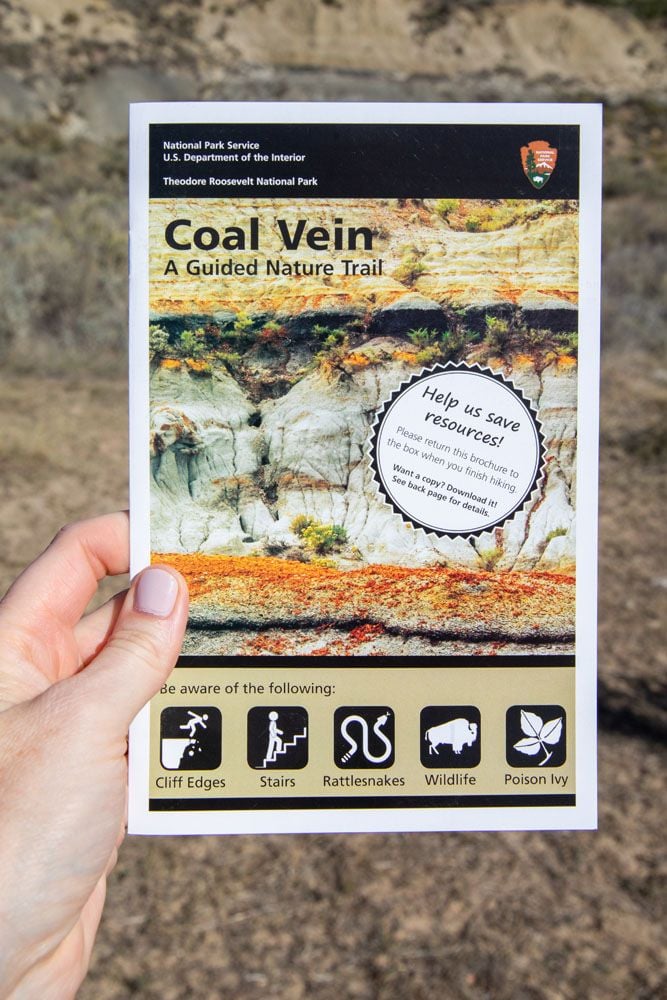
Old East Entrance Hike
Distance: 0.8 miles out-and-back | Difficulty: Easy | Time: 30 minutes
This trail takes you to the original entrance into the South Unit. It’s a flat, easy walk, but not that thrilling, unless you have an interest in history and want to see the original building. Even though the building dates back to 1938, it is in great condition! Vegetation is growing up around it but other than that, it looks like it will be here for many decades to come.
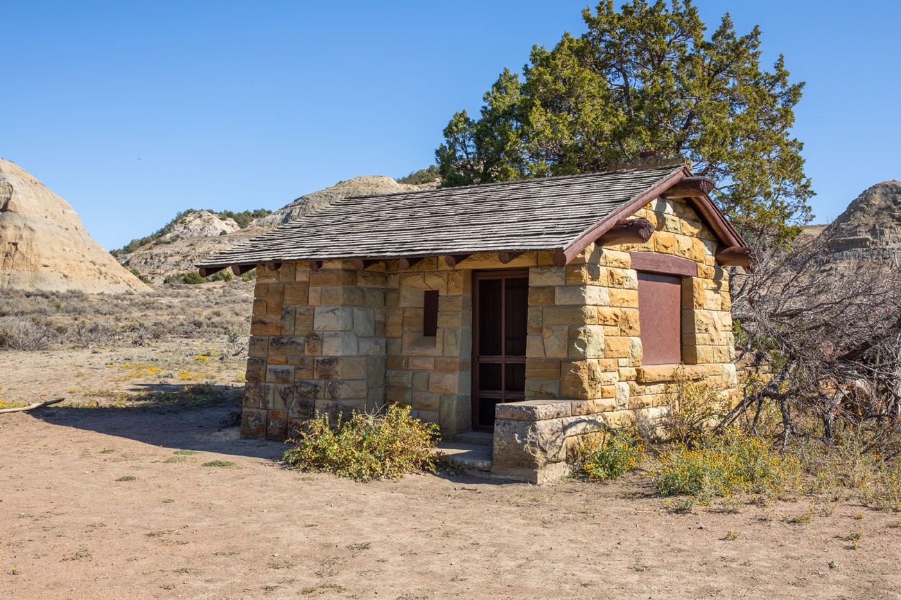
Old East Entrance
North Dakota Badlands Overlook
This is the final stop on Scenic Loop Drive before the road closure. From this overlook, you get a nice view of the Badlands.
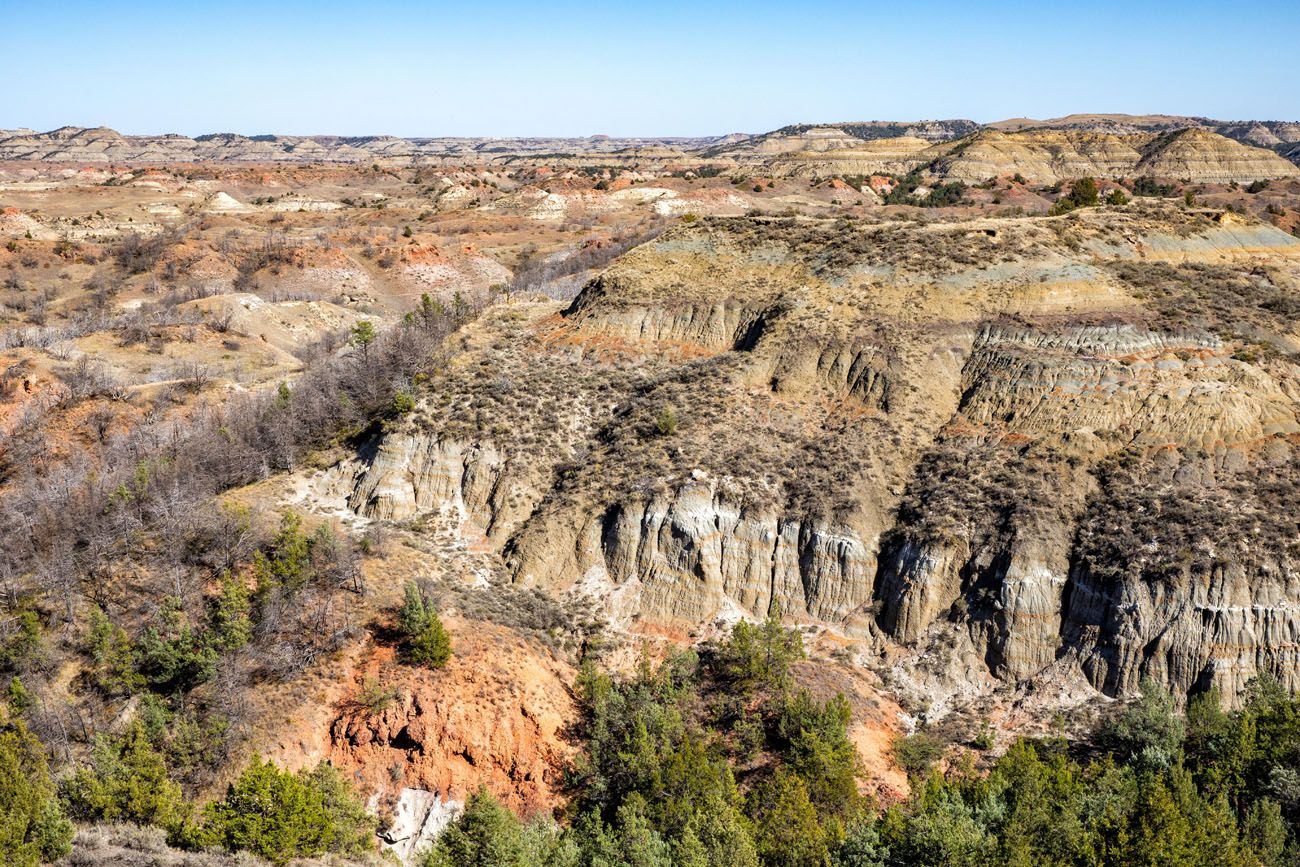
From here, you will have to turn around and drive back down Scenic Loop Drive to the park entrance. Without stops, it is 24 miles and takes just under one hour.
Planning Your Time
To drive Scenic Loop Drive and visit the overlooks and the short walks listed above, it will take 3 to 4 hours. Adding on the Ekblom Trail and Big Plateau Loop adds on an additional 2 to 3 hours.
There is nowhere in along Scenic Loop Drive to get food, so we recommend packing a picnic lunch. There are restrooms at the visitor center and several overlooks in the park. You can get food in Medora when you exit the park.
Petrified Forest
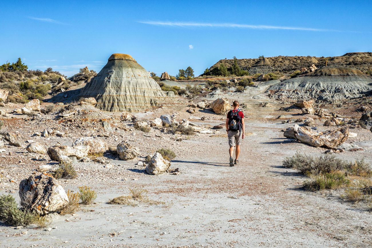
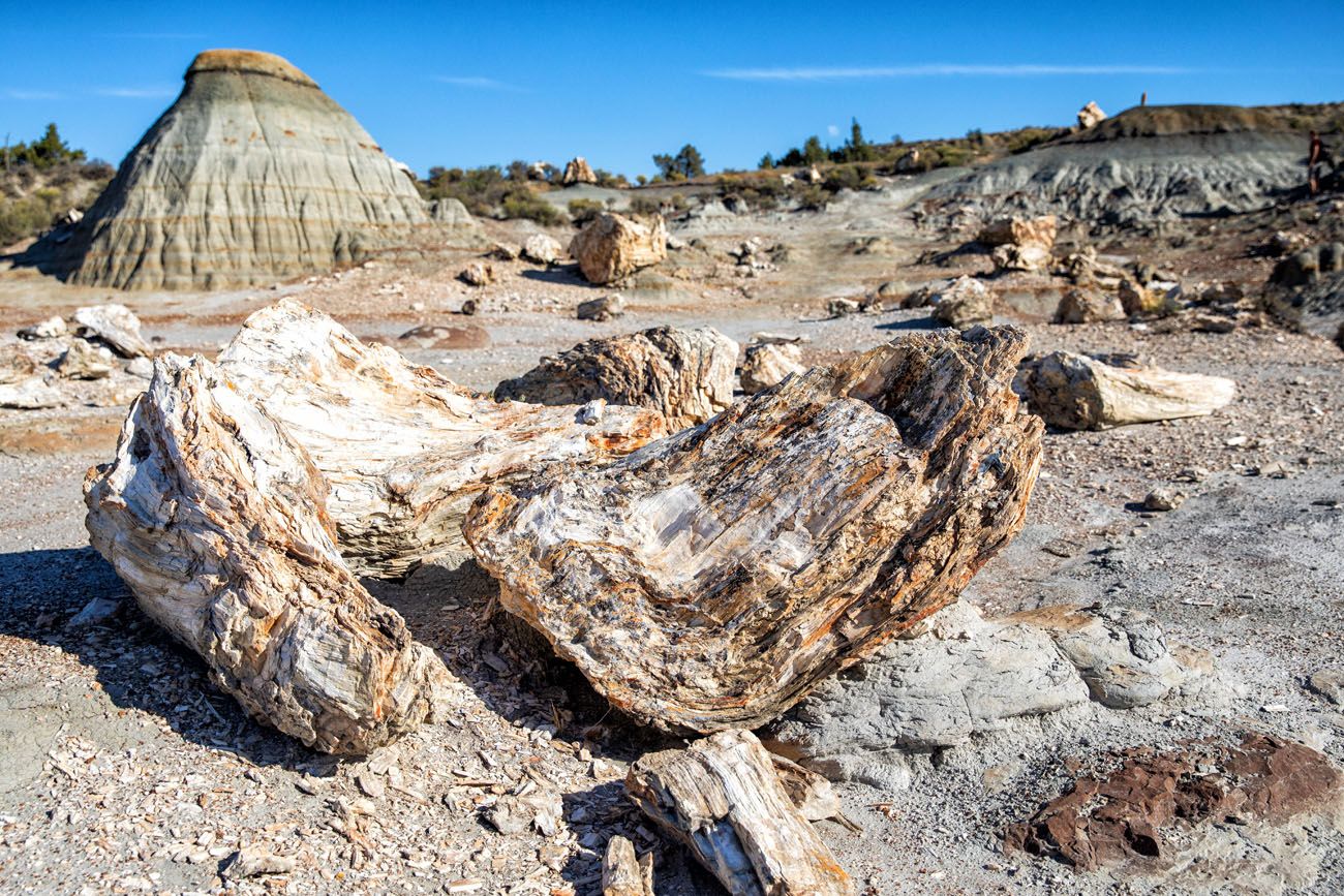
Millions of years ago, this part of North Dakota was once a swamp, much like the Everglades in Florida. The trees that lived here fell, were submerged under water, and over thousands of years, the organic material was replaced with minerals, forming petrified trees.
You can see these ancient trees in the Petrified Forest area of Theodore Roosevelt National Park. It’s not quite as impressive as what you would see in Petrified Forest National Park in Arizona, but it is still a worthwhile visit.
Getting Here
Petrified Forest is a separate area of the South Unit in the west. To get here, you will have to drive on gravel roads that go through private property in order to get to the trailhead.
The roads that lead to the Petrified Forest area lie outside of the national park boundary. It’s a 6 mile drive and takes about 20 minutes. The gravel road is suitable for standard vehicles just as long as it hasn’t recently rained.
Hiking to the Petrified Forest
There are two areas of petrified wood: a south area and a north area. You can hike to both as a gigantic loop (10.4 miles) or hike out-and-back to one or both areas. I recommend hiking out-and-back…it will save you a lot of time and most of the gigantic loop leads through monotonous grasslands.
On this hike, there is a good chance that you will see bison. A park ranger raved about the wildlife spottings here and we have to agree. We saw bison over and over again throughout this hike.
The north area was our favorite part of the Petrified Forest. It’s a slightly shorter walk to get here and amount and sizes of the petrified wood are more impressive. So, if you only have the time or energy for one section, we recommend the north area.
For full details on how to visit the Petrified Forest, read our Guide to the Petrified Forest.
Petrified Forest
Highlights of the South Unit
If you are short on time or only want to see the highlights, here are our top eight experiences in the South Unit of Theodore Roosevelt National Park:
- Drive Scenic Loop Drive
- Skyline Vista Overlook
- Wind Canyon Trail
- Ekblom Trail to the Little Missouri River (and do the full loop hike with the Big Plateau Trail if you like hiking)
- Painted Canyon Overlook
- Painted Canyon Nature Trail or the Painted Canyon Trail
- Boicourt Overlook Trail
- Buck Hill
Things to Do in the South Unit: On a Map
How to Use This Map: Click the tab in the top left hand corner of the map to view the layers (points of interest and the walking route). You can click the check marks to hide or show layers. If you click the icons on the map, you can get more information about each point of interest.
If you click the star next to the title of the map, this map will be added to your Google Maps account. To view it on your phone or computer, open Google Maps, click the menu button, go to “Your Places,” click Maps, and you will see this map on your list.
One Day in the South Unit
Start your day at the Painted Canyon area of the South Unit. Take your pick between the Painted Canyon Nature Trail (short and easier) or the Painted Canyon Trail (longer but more interesting).
Next, drive Scenic Loop Drive, visiting the overlooks along the way. If you like hiking, we also recommend doing the Ekblom Trail and Big Plateau Loop.
Following the drive on Scenic Loop, Medora is the closest place to get food.
If you still have the time and energy, you can visit the Petrified Forest area. This can add on 2 to 4 hours to the day, depending on how much hiking you want to do here.
How to Get to the South Unit of Theodore Roosevelt National Park
The South Unit of Theodore Roosevelt National Park is located on Interstate 94 in western North Dakota. There are several small towns located nearby, these being Medora, Belfield, and Dickinson.
Here are driving distances and times from nearby destinations:
- Bismarck, North Dakota: 135 miles, 2 hours
- North Unit of Theodore Roosevelt National Park: 70 miles, 1 hour
- Rapid City, South Dakota: 240 miles, 4 hours
- Billings, Montana: 280 miles, 4 hours
- Devils Tower, Wyoming: 222 miles, 3.5 hours
- Yellowstone National Park (Northeast Entrance): 410 miles, 6.5 hours
If you also plan to visit the North Unit of Theodore Roosevelt National Park, it takes one hour to drive between these two sections of the park.
Overlooking Scenic Loop Drive
Where to Stay
The closest place to stay is Medora, which is located next to the park entrance. This small, western-themed town has small shops and restaurants.
Belfield is the next closest town but doesn’t offer a lot in the way of hotels or restaurants.
We stayed in Dickinson, which is about 30 minutes east of the South Unit. There are numerous hotels to choose from, with popular chains such as TownePlace Suites by Marriott (this is where we stayed), La Quinta by Wyndham, Candlewood Suites, and Hampton Inn & Suites.
In Dickinson, we highly recommend the Brickhouse Grille (great steaks, salads, and seafood) or Phat Fish Brewing (brewery with beer flights and bar food) for dinner.
Plan Your Visit
Cost: $30 per private vehicle, valid for 7 days
Hours of Operation: The South Unit is open 24 hours a day all year. This includes all three areas of the South Unit. Visitor Center hours vary by season and you can get updated hours on the NPS website.
Before you go, check the National Park Service website for park conditions and updates on road closures and trail closures.
North Unit: For information about things to do and how to plan your time in the North Unit, check out our Guide to the North Unit of Theodore Roosevelt National Park.
If you have any questions about things to do in the South Unit of Theodore Roosevelt National Park, let us know in the comment section below.
Where Are You Going Next?
BEST OF THEODORE ROOSEVELT NP: Best Things to Do in Theodore Roosevelt National Park
SOUTH DAKOTA: Custer State Park: Best Hikes, Best Scenic Drives & Best Things to Do
SOUTH DAKOTA: How to Visit Mount Rushmore: 10 Things to Know Before You Go
WYOMING & SOUTH DAKOTA ROAD TRIP: Yellowstone, Devils Tower & Mount Rushmore: 10 Day Road Trip Itinerary
US NATIONAL PARKS: The Complete Guide to the US National Parks
US NATIONAL PARKS LIST: Ultimate US National Parks List (+Printable Checklist)
Read all of our articles about the United States in our United States Travel Guide.
Note: This post contains affiliate links. When you make a purchase using one of these affiliate links, we get paid a small commission at no extra cost to you.
All rights reserved © Earth Trekkers. Republishing this article and/or any of its contents (text, photography, etc.), in whole or in part, is strictly prohibited.

Comments 9